Castle Meadows

Downs, Moorland in Ayrshire

Scotland

Castle Meadows

South Boig Farm Viewed from Connel Park, looking in the Cumnock direction.
South Boig Farm Credit: Mary and Angus Hogg

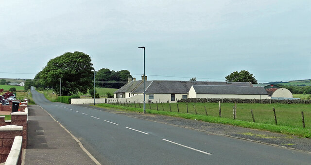
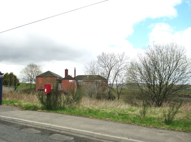
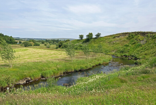
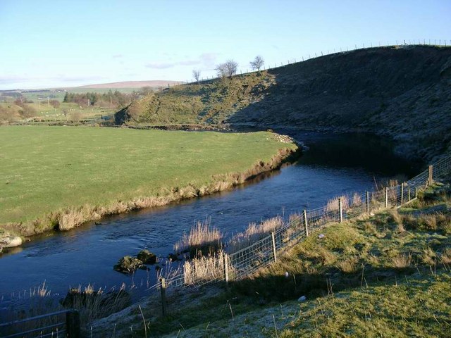
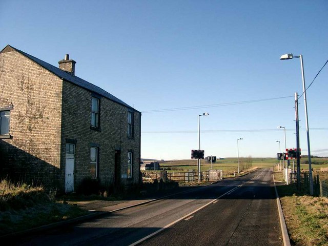
Castle Meadows is a picturesque and diverse natural landscape located in Ayrshire, Scotland. Spanning over a vast area, it encompasses downs, moorland, and other unique features. The meadows are situated near the historic Culzean Castle, adding to its allure and charm.

The downs in Castle Meadows are characterized by rolling hills and gentle slopes. These grassy areas provide a stunning panoramic view of the surrounding landscape. The lush greenery is dotted with vibrant wildflowers, creating a vibrant and colorful backdrop for visitors. The downs offer ample space for recreational activities such as picnics, horseback riding, and leisurely walks.

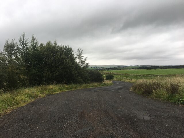
Moving towards the moorland, visitors are greeted with a different landscape altogether. The moorland in Castle Meadows is a haven for various species of flora and fauna. It is characterized by vast stretches of heather, creating a purple-hued carpet during the blooming season. The moorland is home to several bird species, including the iconic red grouse, making it an ideal spot for birdwatching enthusiasts.

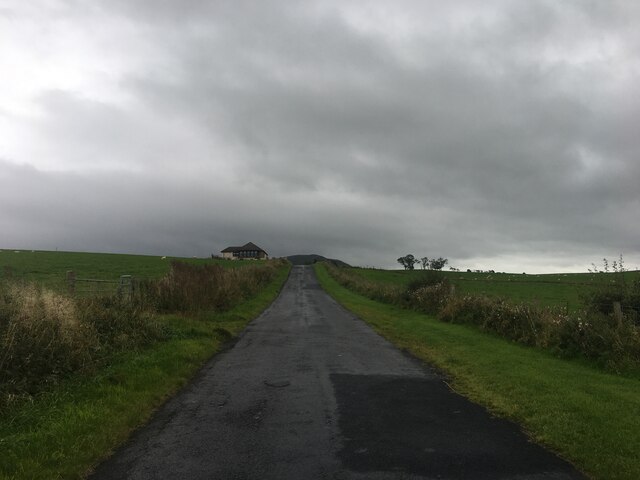
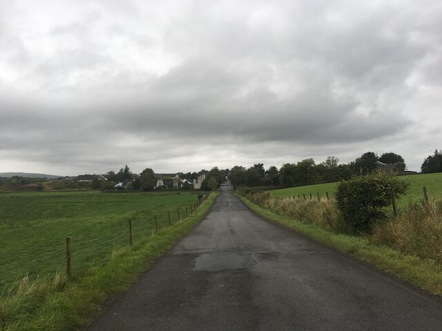
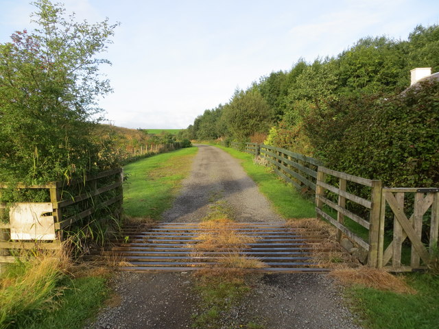
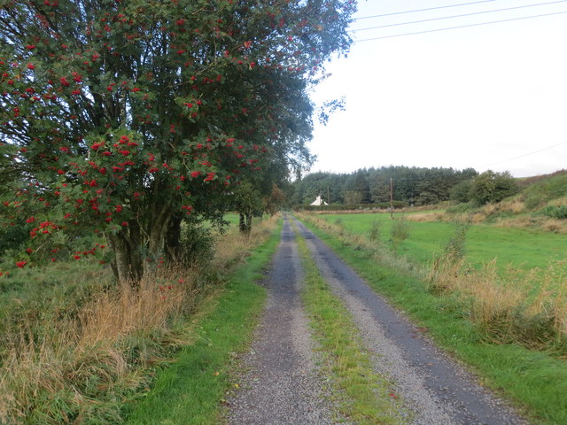
Castle Meadows also boasts a network of walking trails, allowing visitors to explore the rich biodiversity of the area. The trails are well-maintained and offer stunning views at every turn. Additionally, the meadows have designated areas for wildlife observation, providing a unique opportunity to see local wildlife, including rabbits, deer, and even the occasional hare.

Overall, Castle Meadows in Ayrshire is a natural gem that offers a diverse range of landscapes, from downs to moorland. Its stunning beauty and abundant wildlife make it a must-visit destination for nature lovers and outdoor enthusiasts alike.

If you have any feedback on the listing, please let us know in the comments section below.

Castle Meadows Images

Images are sourced within 2km of 55.395923/-4.1869968 or Grid Reference NS6113. Thanks to Geograph Open Source API. All images are credited.

South Boig Farm Viewed from Connel Park, looking in the Cumnock direction.
South Boig Farm
Viewed from Connel Park, looking in the Cumnock direction.
Coal from Knockshinnoch Washery 1997 A scanned slide from May 1997 shows the class 60 locomotive EWS 60002 hauling a load of coal from the old washery at Connel Park to join the main line on the west side of New Cumnock. It’s all part of history and memory now. See also <a href="https://www.geograph.org.uk/photo/7239867">NS5913 : At Boig Road Level Crossing</a>
Coal from Knockshinnoch Washery 1997
A scanned slide from May 1997 shows the class 60 locomotive EWS 60002 hauling a load of coal from the old washery at Connel Park to join the main line on the west side of New Cumnock. It’s all part of history and memory now. See also NS5913 : At Boig Road Level Crossing
Minor road near New Cumnock
Minor road near Mansfield
No through road near Pathhead
Bus stops on the B741 The road, on the left, is Glen Park.
Bus stops on the B741
The road, on the left, is Glen Park.
Post box on the B741 I am told that the buildings were once part of a colliery.
Post box on the B741
I am told that the buildings were once part of a colliery.
River Nith view Looking towards the land called Mote Knowe.
River Nith view
Looking towards the land called Mote Knowe.
At Boig Road Level Crossing The railway line was laid to serve the open-cast mining developments of the late 20th century. All traffic stopped when the open-cast industry collapsed. <a href="https://www.geograph.org.uk/photo/7239864">NS6014 : Coal from Knockshinnoch Washery 1997</a> shows rail traffic that was typical of the period on a nearby line.
At Boig Road Level Crossing
The railway line was laid to serve the open-cast mining developments of the late 20th century. All traffic stopped when the open-cast industry collapsed. NS6014 : Coal from Knockshinnoch Washery 1997 shows rail traffic that was typical of the period on a nearby line.
Boig Road Level Crossing The railway line was laid to serve the open-cast mining developments of the late 20th century. The track has lain idle since the collapse of the open-cast industry after a very short life-span. For a glimpse of past activity on a nearby line, see <a href="https://www.geograph.org.uk/photo/7239864">NS6014 : Coal from Knockshinnoch Washery 1997</a>
Boig Road Level Crossing
The railway line was laid to serve the open-cast mining developments of the late 20th century. The track has lain idle since the collapse of the open-cast industry after a very short life-span. For a glimpse of past activity on a nearby line, see NS6014 : Coal from Knockshinnoch Washery 1997
The River Nith at Meikle Creoch Heavy frost still on the north facing slopes on this brilliant winter's day.
The River Nith at Meikle Creoch
Heavy frost still on the north facing slopes on this brilliant winter's day.
Level crossing at Woodend This area is criss-crossed by railway lines used for removing the coal after open-cast extraction.
Level crossing at Woodend
This area is criss-crossed by railway lines used for removing the coal after open-cast extraction.
Track from Meikle Creoch Farm at Mote Cottage Looking westward.
Track from Meikle Creoch Farm at Mote Cottage
Looking westward.
Track from Meikle Creoch farm to Mote Knowe and road Looking westward.
Track from Meikle Creoch farm to Mote Knowe and road
Looking westward.
Road (B741) at Bankglen Looking north-eastward.
Road (B741) at Bankglen
Looking north-eastward.
Boig Road level crossing On the Knockshinnoch Washery Branch, a railway reopened to serve the huge open cast coal mines between Dalmellington and Cumnock. The rails are shiny and obviously still in use.
Boig Road level crossing
On the Knockshinnoch Washery Branch, a railway reopened to serve the huge open cast coal mines between Dalmellington and Cumnock. The rails are shiny and obviously still in use.
Knockshinnoch Washery Branch Mineral line, rebuilt and reopened to serve the open cast coal mines.
Knockshinnoch Washery Branch
Mineral line, rebuilt and reopened to serve the open cast coal mines.
Boig Road Level Crossing
Show me another place!

Castle Meadows is located at Grid Ref: NS6113 (Lat: 55.395923, Lng: -4.1869968)

Unitary Authority: East Ayrshire

Police Authority: Ayrshire

What 3 Words

///sleep.hairspray.unusable. Near New Cumnock, East Ayrshire

Related Wikis

New Cumnock Town Hall

New Cumnock Town Hall is a municipal building in Castle, New Cumnock, East Ayrshire, Scotland. The structure, which is used as a community events venue...

New Cumnock

New Cumnock is a town in East Ayrshire, Scotland. It expanded during the coal-mining era from the late 18th century, and mining remained its key industry...

River Afton

The River Afton (or Afton Water) is a small river in Ayrshire, Scotland, which flows north from Alwhat Hill in the Carsphairn and Scaur Hills, through...

Glenafton Athletic F.C.

Glenafton Athletic Football Club is a Scottish football club, based in New Cumnock, Ayrshire. Members of the Scottish Junior Football Association, they...

New Cumnock railway station

New Cumnock railway station is a railway station serving the town of New Cumnock, East Ayrshire, Scotland. The station is managed by ScotRail and is on...

Connel Burn

Connel Burn is a river in East Ayrshire, Scotland which rises at Enoch Hill in the Southern Uplands and flows northwards through Laglaf and Connel Park...

Mansfield, East Ayrshire

Mansfield is a village in East Ayrshire in Scotland. It is north of New Cumnock from which it is separated by the River Nith and the adjacent village of...

Knockshinnoch disaster

The Knockshinnoch disaster was a mining accident that occurred in September 1950 in the village of New Cumnock, Ayrshire, Scotland. A glaciated lake filled...

Nearby Amenities

Located within 500m of 55.395923,-4.1869968
New Cumnock
Place: town
Population: 2884
Wikidata: Q1011095
Wikipedia: en:New Cumnock
Lat/Long: 55.3941167/-4.1849737
Fuel
McKechnie's Garage
Lat/Long: 55.3992828/-4.1832862
Post Box
Brand: Royal Mail
Brand Wikidata: Q638098
Mapillary: 949247982850333
Operator: Royal Mail
Operator Wikidata: Q638098
Post Box Mounting: stone_wall
Post Box Type: wall
Survey Date: 2023-05-23
Lat/Long: 55.3947359/-4.1850499
Post Office
New Cumnock Post Office
Addr City: New Cumnock
Addr Housenumber: 2-3
Addr Postcode: KA18 4AW
Addr Street: Castle Arcade
Brand: Post Office
Brand Wikidata: Q1783168
Ref Pol Id: 128098
Source: OS OpenData StreetView
Lat/Long: 55.3975701/-4.1830917
Mini Roundabout
Direction: clockwise
Lat/Long: 55.3941214/-4.185019
Post Box
Post Box Type: lamp
Source: survey
Lat/Long: 55.393881/-4.1809487
Fire Station
New Cumnock Community Fire Station
Source: survey
Lat/Long: 55.3943378/-4.1808438
Power: pole
Lat/Long: 55.3919707/-4.1894709
Power: pole
Lat/Long: 55.3927202/-4.1902112
Power: pole
Lat/Long: 55.3927263/-4.1916542
Power: pole
Lat/Long: 55.3924681/-4.1916864
Fuel
Gulf
Brand: Gulf
Brand Wikidata: Q5617505
Brand Wikipedia: en:Gulf Oil LP
Operator: Gulf
Lat/Long: 55.3970179/-4.1836731
Pharmacy
Lloyds Pharmacy
Addr City: New Cumnock
Addr Housenumber: 22
Addr Postcode: KA18 4AH
Addr Street: Castle
Brand: Lloyds Pharmacy
Brand Wikidata: Q6662870
Brand Wikipedia: en:LloydsPharmacy
Dispensing: yes
Fhrs Id: 611022
Healthcare: pharmacy
Lat/Long: 55.3964057/-4.1838391
Crossing
Crossing: traffic_signals
Lat/Long: 55.3947245/-4.1848154
Crossing
Crossing: traffic_signals
Lat/Long: 55.3935469/-4.1811959
Historic: ruins
Lat/Long: 55.3982303/-4.1846634
Generator Method: photovoltaic
Generator Output Electricity: yes
Generator Source: solar
Generator Type: solar_photovoltaic_panel
Power: generator
Lat/Long: 55.398925/-4.185083
Defibrillator
Defibrillator Location: New Cumnock Primary School: left of notice board on external wall (facing Castle street)
Emergency: defibrillator
Indoor: no
Lat/Long: 55.3945264/-4.1846983
The data included in this document is from www.openstreetmap.org. The data is made available under ODbL.

Have you been to Castle Meadows?

Leave your review of Castle Meadows below (or comments, questions and feedback).