Gwesbyr

Settlement in Flintshire

Wales

Gwesbyr
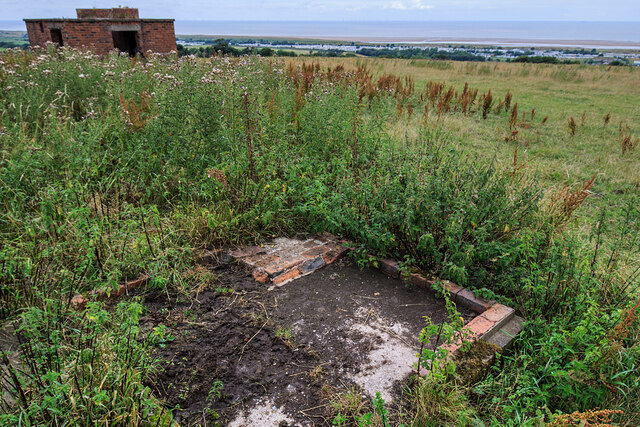
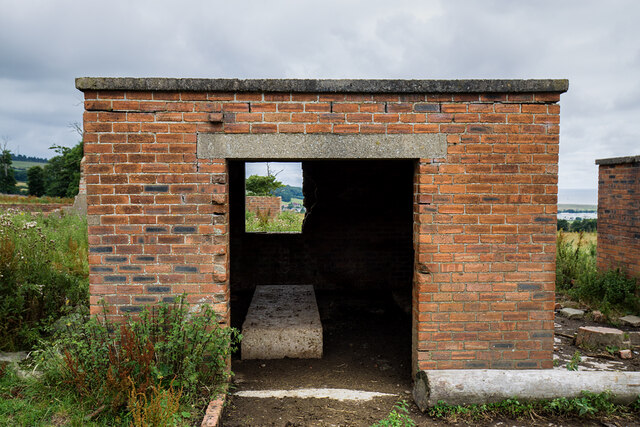
WWII defences of North Wales: Gwespyr Royal Naval Radar Station  (1) Overlooking the approaches to the mouths of the Dee and Mersey estuaries, the station was primarily used in a surface and coastal watching role, plotting ship movements, and keeping a close watch for enemy submarines. The station was one of only four other stations, all of which were in northern Scotland, and was only operational for a short time between December 1942 and October 1944. It was equipped with a type T273 Coastal Defence centimetric radar using a rotating parabolic dish antenna. Some of the buildings associated with the station still survive, albeit as ruins. The base of what was the guard picket post can be seen here in the foreground at the entrance to the site.

<a href="https://www.geograph.org.uk/photo/6943912">SJ1083 : WWII defences of North Wales: Gwespyr Royal Naval Radar Station  (2)</a>
WWII defences of North Wales: Gwespyr Royal Naval Radar Station (1) Credit: Mike Searle

The requested URL returned error: 429 Too Many Requests

If you have any feedback on the listing, please let us know in the comments section below.

Gwesbyr Images

Images are sourced within 2km of 53.334621/-3.334868 or Grid Reference SJ1182. Thanks to Geograph Open Source API. All images are credited.

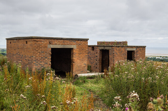
WWII defences of North Wales: Gwespyr Royal Naval Radar Station  (1) Overlooking the approaches to the mouths of the Dee and Mersey estuaries, the station was primarily used in a surface and coastal watching role, plotting ship movements, and keeping a close watch for enemy submarines. The station was one of only four other stations, all of which were in northern Scotland, and was only operational for a short time between December 1942 and October 1944. It was equipped with a type T273 Coastal Defence centimetric radar using a rotating parabolic dish antenna. Some of the buildings associated with the station still survive, albeit as ruins. The base of what was the guard picket post can be seen here in the foreground at the entrance to the site.

<a href="https://www.geograph.org.uk/photo/6943912">SJ1083 : WWII defences of North Wales: Gwespyr Royal Naval Radar Station  (2)</a>
WWII defences of North Wales: Gwespyr Royal Naval Radar Station (1)
Overlooking the approaches to the mouths of the Dee and Mersey estuaries, the station was primarily used in a surface and coastal watching role, plotting ship movements, and keeping a close watch for enemy submarines. The station was one of only four other stations, all of which were in northern Scotland, and was only operational for a short time between December 1942 and October 1944. It was equipped with a type T273 Coastal Defence centimetric radar using a rotating parabolic dish antenna. Some of the buildings associated with the station still survive, albeit as ruins. The base of what was the guard picket post can be seen here in the foreground at the entrance to the site. SJ1083 : WWII defences of North Wales: Gwespyr Royal Naval Radar Station (2)
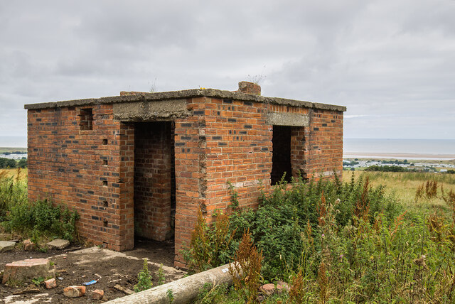
WWII defences of North Wales: Gwespyr Royal Naval Radar Station  (2) Two buildings, the one on the left housed the T273 naval CD transmitter/receiver equipment, and on the right, the radar plinth that contained turning gear for a rotating antenna on the roof within the circular brick parapet.

<a href="https://www.geograph.org.uk/photo/6943914">SJ1083 : WWII defences of North Wales: Gwespyr Royal Naval Radar Station  (3)</a>
WWII defences of North Wales: Gwespyr Royal Naval Radar Station (2)
Two buildings, the one on the left housed the T273 naval CD transmitter/receiver equipment, and on the right, the radar plinth that contained turning gear for a rotating antenna on the roof within the circular brick parapet. SJ1083 : WWII defences of North Wales: Gwespyr Royal Naval Radar Station (3)
WWII defences of North Wales: Gwespyr Royal Naval Radar Station  (3) The Tx/Rx building.

<a href="https://www.geograph.org.uk/photo/6943943">SJ1083 : WWII defences of North Wales: Gwespyr Royal Naval Radar Station  (4)</a>
WWII defences of North Wales: Gwespyr Royal Naval Radar Station (3)
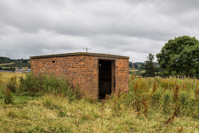
WWII defences of North Wales: Gwespyr Royal Naval Radar Station  (4) Radar plinth, the building that housed the turning gear for a roof mounted parabolic antenna.

<a href="https://www.geograph.org.uk/photo/6943957">SJ1083 : WWII defences of North Wales: Gwespyr Royal Naval Radar Station  (5)</a>
WWII defences of North Wales: Gwespyr Royal Naval Radar Station (4)
Radar plinth, the building that housed the turning gear for a roof mounted parabolic antenna. SJ1083 : WWII defences of North Wales: Gwespyr Royal Naval Radar Station (5)
WWII defences of North Wales: Gwespyr Royal Naval Radar Station  (5) Standby power generator building.

<a href="https://www.geograph.org.uk/photo/6943958">SJ1083 : WWII defences of North Wales: Gwespyr Royal Naval Radar Station  (6)</a>
WWII defences of North Wales: Gwespyr Royal Naval Radar Station (5)
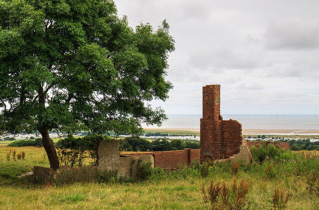
WWII defences of North Wales: Gwespyr Royal Naval Radar Station  (6) Remains of the Army guard accommodation.

START: <a href="https://www.geograph.org.uk/photo/6943910">SJ1083 : WWII defences of North Wales: Gwespyr Royal Naval Radar Station  (1)</a>
WWII defences of North Wales: Gwespyr Royal Naval Radar Station (6)
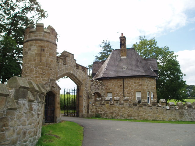
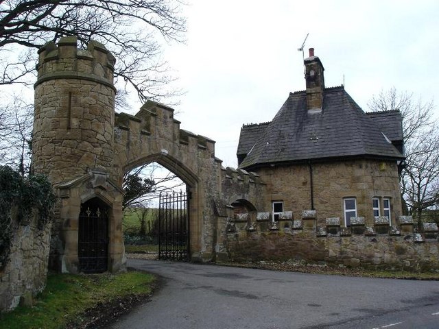
North Lodge, Gyrn Castle
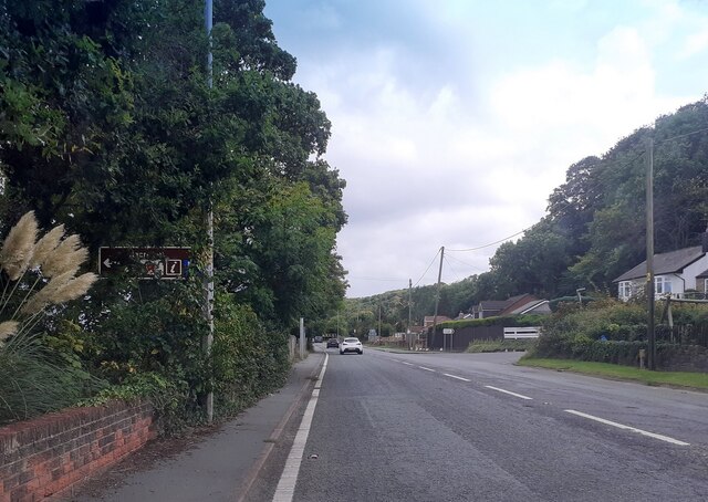
A548 north of Gwespyr
A548 at Tan Lan
A548 at Tan Lan
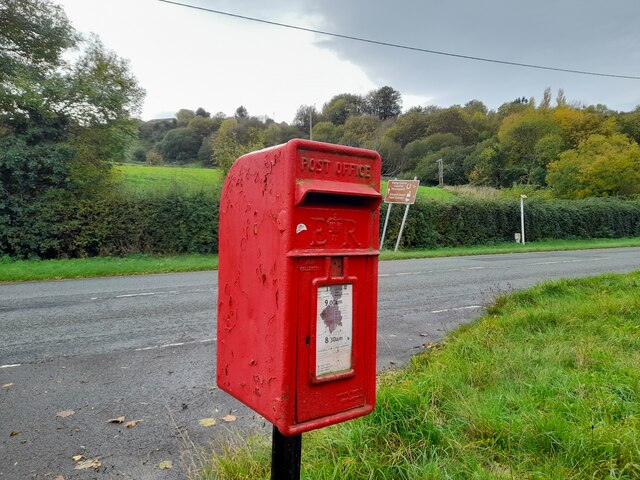
Postbox by the A548 CH8 29. Royal Mail list this box as 'Tan Y Coed'.
Postbox by the A548
CH8 29. Royal Mail list this box as 'Tan Y Coed'.
Point of Ayre Gas Terminal
A truck of nutty slack Mike Owens' sculpture of a coalminer and pit pony is pulling a real truck of nutty slack (presumably decent-sized lumps of coal would be too liable to theft). Unveiled in 1997, the work commemorates the last deep pit in the Flint and Denbigh coalfield, closed in 1996. I'm not convinced that the red bow tie is a wholly authentic bit of history - perhaps it has been added later by someone other than the original creator?
A truck of nutty slack
Mike Owens' sculpture of a coalminer and pit pony is pulling a real truck of nutty slack (presumably decent-sized lumps of coal would be too liable to theft). Unveiled in 1997, the work commemorates the last deep pit in the Flint and Denbigh coalfield, closed in 1996. I'm not convinced that the red bow tie is a wholly authentic bit of history - perhaps it has been added later by someone other than the original creator?
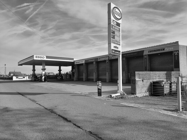
Study of a Gasoline Station Esso, Gwespyr.

 This photograph is part of a series taken in homage to the American artist Ed Ruscha's 1963 publication of 'Twentysix Gasoline Stations'.
 More properly known as filling stations in the UK, I am attempting to photograph as many as possible to mark the sixty year anniversary.
Study of a Gasoline Station
Esso, Gwespyr. This photograph is part of a series taken in homage to the American artist Ed Ruscha's 1963 publication of 'Twentysix Gasoline Stations'. More properly known as filling stations in the UK, I am attempting to photograph as many as possible to mark the sixty year anniversary.
Substantial locked steel gate Set in a strong fence tipped with sharp prongs, we had to scale this gate to escape from the industrial and scrapyard area behind. This is a new barrier, and has appeared in the last year or two. The area north of here used to be the derelict railway sidings of the old Point of Ayr Colliery.
Substantial locked steel gate
Set in a strong fence tipped with sharp prongs, we had to scale this gate to escape from the industrial and scrapyard area behind. This is a new barrier, and has appeared in the last year or two. The area north of here used to be the derelict railway sidings of the old Point of Ayr Colliery.
Entrance to Gronant Dunes SSSI Gronant Dunes SSSI is home to animals such as Natterjack Toads, sand lizards and Little Terns.

Gronant <span class="nowrap"><a title="http://www.deeestuary.co.uk/swshore.htm#gronant" rel="nofollow ugc noopener" href="http://www.deeestuary.co.uk/swshore.htm#gronant">Link</a><img style="margin-left:2px;" alt="External link" title="External link - shift click to open in new window" src="https://s1.geograph.org.uk/img/external.png" width="10" height="10"/></span>
Entrance to Gronant Dunes SSSI
Gronant Dunes SSSI is home to animals such as Natterjack Toads, sand lizards and Little Terns. Gronant LinkExternal link
Sand Lizard Sculpture at Gronant Dunes SSSI Wood sculpture of a sand lizard by Mike Owens.
Sand Lizard Sculpture at Gronant Dunes SSSI
Wood sculpture of a sand lizard by Mike Owens.
Presthaven Sands Holiday Park
Presthaven Sands Information Sign Sign in Presthaven Sands Holiday Park showing four steps to caravan ownership.
Presthaven Sands Information Sign
Sign in Presthaven Sands Holiday Park showing four steps to caravan ownership.
Show me another place!

Gwesbyr is located at Grid Ref: SJ1182 (Lat: 53.334621, Lng: -3.334868)

Unitary Authority: Flintshire

Police Authority: North Wales

Also known as: Gwespyr

What 3 Words

///soups.stocks.performs. Near Gronant, Flintshire

Nearby Locations

Llanasa Gwespyr Gwesbyr

Related Wikis

Gwespyr

Gwespyr is a village in Flintshire on the north coast of Wales in the community of Llanasa. Gwespyr had a population of 289 people in the United Kingdom...

Talacre railway station

Talacre railway station served the village of Talacre, near Prestatyn on the North Wales Coast Line. == History == The station was opened in 1903 by the...

Gyrn Castle

Gyrn Castle is a Grade II-listed castellated mansion in Llanasa in Flintshire. == History == It was built between 1817 and 1824 by John Douglas, who incorporated...

Llanasa

Llanasa is a village and community in the county of Flintshire, north-east Wales. Llanasa is described as one of the ancient parishes of Flintshire. It...

Nearby Amenities

Located within 500m of 53.334621,-3.334868
Pub
The Masons Arms
Addr Postcode: CH8 9LT
Fhrs Id: 902981
Source Addr Postcode: FHRS Open Data
Wikidata: Q80855293
Lat/Long: 53.3359708/-3.3367856
Gwespyr
Place: village
Wikidata: Q5623571
Lat/Long: 53.3378551/-3.3376751
Heritage: yes
Historic: memorial
Memorial: war_memorial
Wikidata: Q29502039
Lat/Long: 53.3360101/-3.3371871
Natural: spring
Lat/Long: 53.3327584/-3.3389594
Power: pole
Lat/Long: 53.3375426/-3.3293993
Power: pole
Lat/Long: 53.3376814/-3.3298867
Power: pole
Lat/Long: 53.3380601/-3.3306345
Power: pole
Lat/Long: 53.3381328/-3.3314607
Direction: SW
Generator Method: photovoltaic
Generator Output Electricity: yes
Generator Solar Modules: 12
Generator Source: solar
Generator Type: solar_photovoltaic_panel
Location: roof
Power: generator
Lat/Long: 53.3378451/-3.3365513
Direction: SW
Generator Method: photovoltaic
Generator Output Electricity: yes
Generator Solar Modules: 12
Generator Source: solar
Generator Type: solar_photovoltaic_panel
Location: roof
Power: generator
Lat/Long: 53.3377573/-3.336385
Direction: SW
Generator Method: photovoltaic
Generator Output Electricity: yes
Generator Solar Modules: 14
Generator Source: solar
Generator Type: solar_photovoltaic_panel
Location: roof
Power: generator
Lat/Long: 53.3374221/-3.3368277
Direction: SW
Generator Method: photovoltaic
Generator Output Electricity: yes
Generator Solar Modules: 14
Generator Source: solar
Generator Type: solar_photovoltaic_panel
Location: roof
Power: generator
Lat/Long: 53.3374765/-3.336935
Direction: SW
Generator Method: photovoltaic
Generator Output Electricity: yes
Generator Solar Modules: 16
Generator Source: solar
Generator Type: solar_photovoltaic_panel
Location: roof
Power: generator
Lat/Long: 53.3371754/-3.3364039
Direction: SW
Generator Method: photovoltaic
Generator Output Electricity: yes
Generator Solar Modules: 16
Generator Source: solar
Generator Type: solar_photovoltaic_panel
Location: roof
Power: generator
Lat/Long: 53.3371081/-3.3363154
Direction: SW
Generator Method: photovoltaic
Generator Output Electricity: yes
Generator Solar Modules: 16
Generator Source: solar
Generator Type: solar_photovoltaic_panel
Location: roof
Power: generator
Lat/Long: 53.3370457/-3.3362054
Direction: SW
Generator Method: photovoltaic
Generator Output Electricity: yes
Generator Solar Modules: 16
Generator Source: solar
Generator Type: solar_photovoltaic_panel
Location: roof
Power: generator
Lat/Long: 53.3369896/-3.3361223
Direction: SW
Generator Method: photovoltaic
Generator Output Electricity: yes
Generator Solar Modules: 15
Generator Source: solar
Generator Type: solar_photovoltaic_panel
Location: roof
Power: generator
Lat/Long: 53.3369096/-3.3359828
Direction: SW
Generator Method: photovoltaic
Generator Output Electricity: yes
Generator Solar Modules: 14
Generator Source: solar
Generator Type: solar_photovoltaic_panel
Location: roof
Power: generator
Lat/Long: 53.3375374/-3.3370342
Direction: SW
Generator Method: photovoltaic
Generator Output Electricity: yes
Generator Solar Modules: 12
Generator Source: solar
Generator Type: solar_photovoltaic_panel
Location: roof
Power: generator
Lat/Long: 53.3371177/-3.3351625
Direction: SW
Generator Method: photovoltaic
Generator Output Electricity: yes
Generator Solar Modules: 12
Generator Source: solar
Generator Type: solar_photovoltaic_panel
Location: roof
Power: generator
Lat/Long: 53.3372426/-3.3354121
Direction: SW
Generator Method: photovoltaic
Generator Output Electricity: yes
Generator Solar Modules: 12
Generator Source: solar
Generator Type: solar_photovoltaic_panel
Location: roof
Power: generator
Lat/Long: 53.3373705/-3.3356223
Direction: SW
Generator Method: photovoltaic
Generator Output Electricity: yes
Generator Solar Modules: 12
Generator Source: solar
Generator Type: solar_photovoltaic_panel
Location: roof
Power: generator
Lat/Long: 53.3372885/-3.3354808
Direction: SW
Generator Method: photovoltaic
Generator Output Electricity: yes
Generator Solar Modules: 12
Generator Source: solar
Generator Type: solar_photovoltaic_panel
Location: roof
Power: generator
Lat/Long: 53.3371609/-3.3352459
Direction: SW
Generator Method: photovoltaic
Generator Output Electricity: yes
Generator Solar Modules: 12
Generator Source: solar
Generator Type: solar_photovoltaic_panel
Location: roof
Power: generator
Lat/Long: 53.3374555/-3.3357858
Direction: SW
Generator Method: photovoltaic
Generator Output Electricity: yes
Generator Solar Modules: 12
Generator Source: solar
Generator Type: solar_photovoltaic_panel
Location: roof
Power: generator
Lat/Long: 53.3379658/-3.3368061
Direction: SW
Generator Method: photovoltaic
Generator Output Electricity: yes
Generator Solar Modules: 12
Generator Source: solar
Generator Type: solar_photovoltaic_panel
Location: roof
Power: generator
Lat/Long: 53.3379308/-3.3367212
Direction: SW
Generator Method: photovoltaic
Generator Output Electricity: yes
Generator Solar Modules: 12
Generator Source: solar
Generator Type: solar_photovoltaic_panel
Location: roof
Power: generator
Lat/Long: 53.3378825/-3.3366404
Direction: 215
Generator Method: photovoltaic
Generator Output Electricity: yes
Generator Solar Modules: 14
Generator Source: solar
Generator Type: solar_photovoltaic_panel
Location: roof
Power: generator
Lat/Long: 53.3365366/-3.3339965
The data included in this document is from www.openstreetmap.org. The data is made available under ODbL.

Have you been to Gwesbyr?

Leave your review of Gwesbyr below (or comments, questions and feedback).