Englishton Muir

Downs, Moorland in Inverness-shire

Scotland

Englishton Muir

Old road Old road through the forest
Old road Credit: david johnston

Englishton Muir is a picturesque area located in Inverness-shire, Scotland. Known for its stunning downs and moorland landscapes, it offers visitors a unique opportunity to experience the natural beauty of the Scottish Highlands.

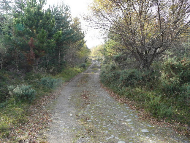
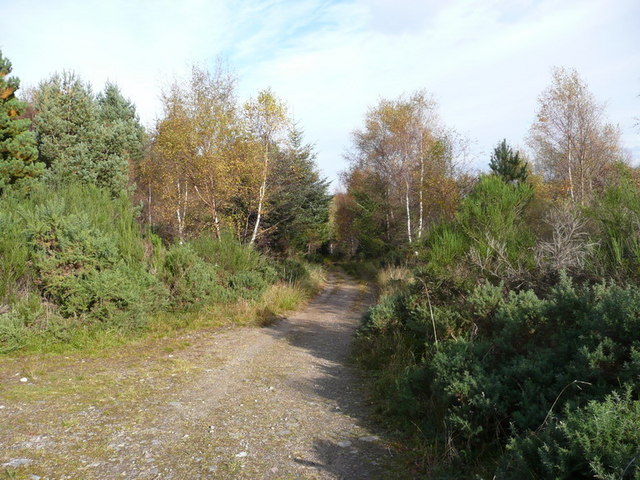
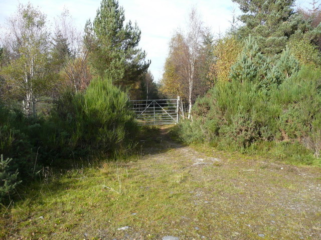
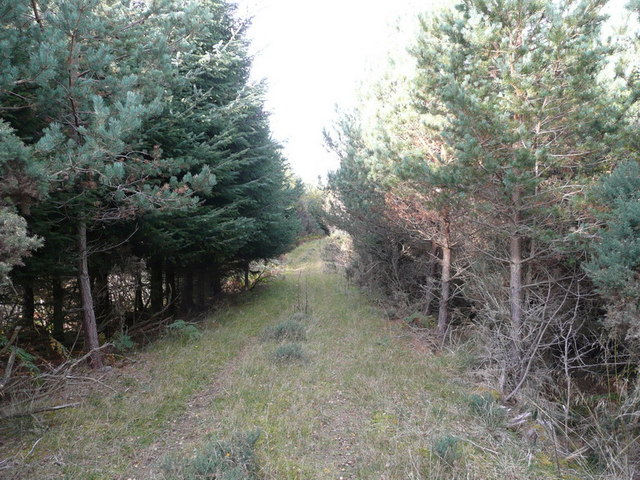
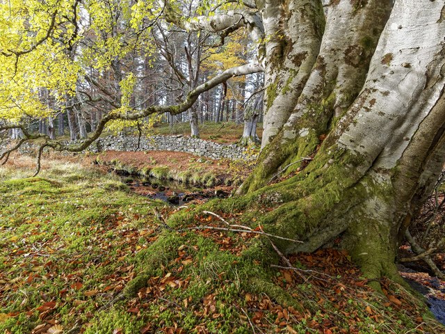
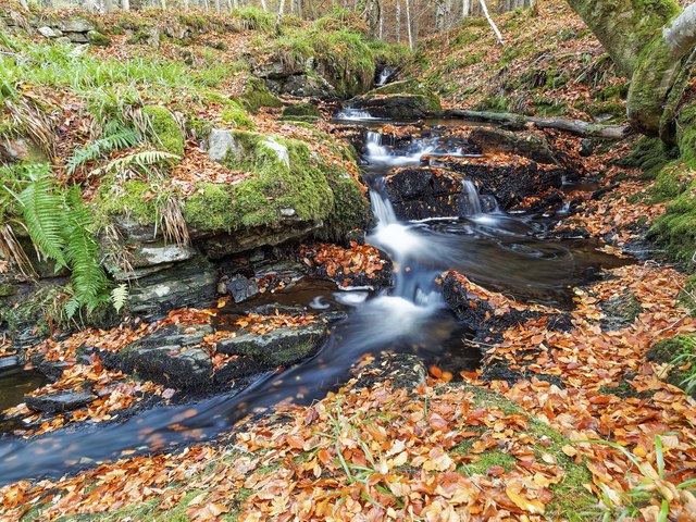
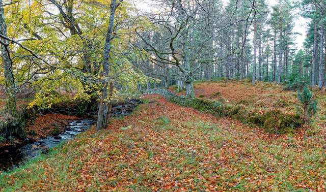
The downs of Englishton Muir are characterized by gently rolling hills covered in lush green grass, providing a perfect backdrop for outdoor activities such as hiking, picnicking, and birdwatching. Visitors can take leisurely walks along the well-maintained paths, enjoying panoramic views of the surrounding countryside. The downs are also home to a variety of wildlife, including deer, rabbits, and various bird species, making it a paradise for nature lovers.

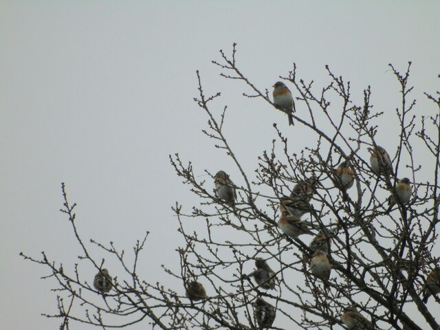
In contrast, the moorland of Englishton Muir offers a different kind of beauty. Stretching for miles, the moorland is dominated by heather and grasses, creating a vibrant purple and green tapestry. This unique landscape is a haven for botany enthusiasts, as it is home to a wide range of plant species, some of which are rare and endemic to the area. The moorland is also home to an array of wildlife, including red grouse, mountain hares, and even golden eagles.

Englishton Muir is a place of tranquility and natural beauty, offering a peaceful escape from the hustle and bustle of everyday life. Whether you are a keen hiker, a nature lover, or simply someone who appreciates stunning landscapes, Englishton Muir is a destination that should not be missed.

If you have any feedback on the listing, please let us know in the comments section below.

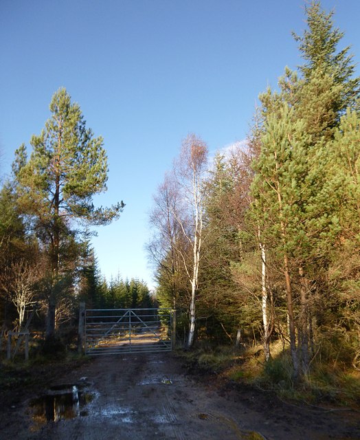
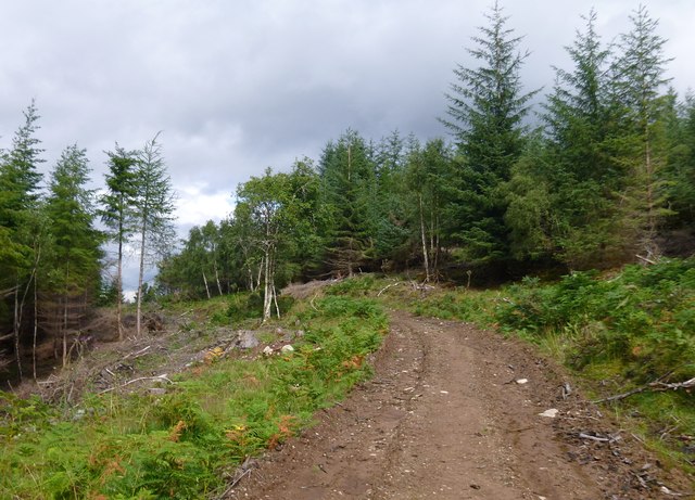
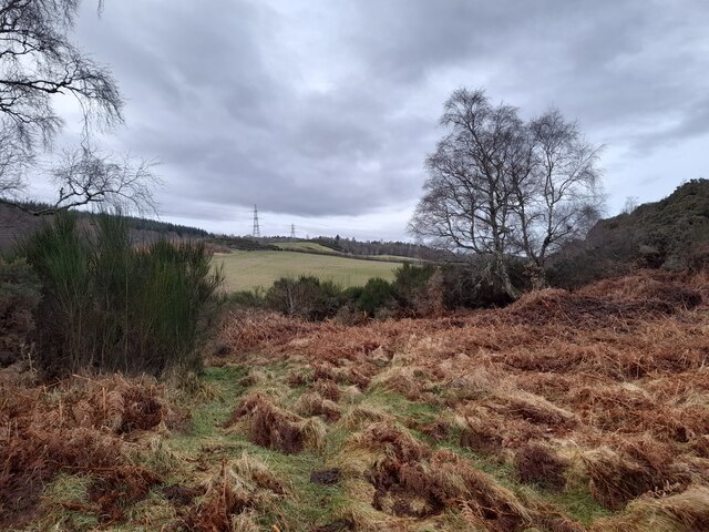
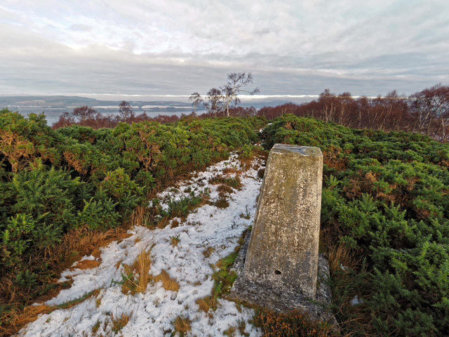
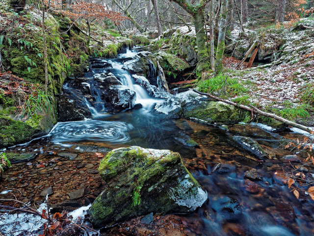
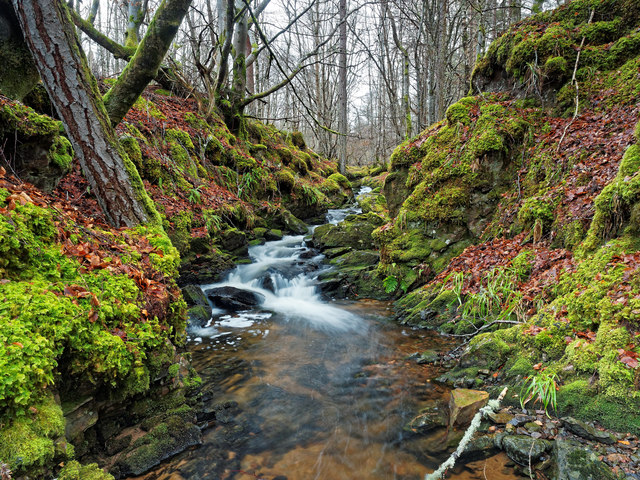
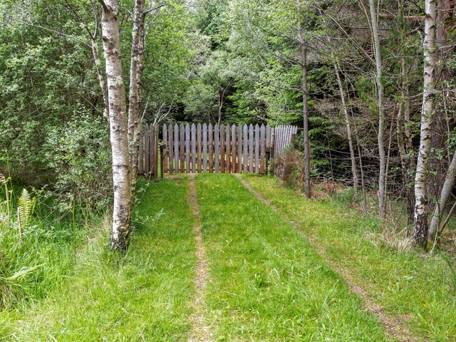
Englishton Muir Images

Images are sourced within 2km of 57.463351/-4.3221361 or Grid Reference NH6043. Thanks to Geograph Open Source API. All images are credited.

Old road Old road through the forest
Old road
Old road through the forest
Old road Old road through the forest
Old road
Old road through the forest
Gate across forest road Gate across forest road
Gate across forest road
Forestry road Forestry road
Forestry road
Forestry road
Gate on forest track, by Altnacardich This track branches off the main track, and heads towards Inchberry Hill. It is blocked by a high locked gate.
It looks like some of the track has been cleared/improved recently. It may have been used as access for working on the power line.

For a similar view from 2007, see <a href="https://www.geograph.org.uk/photo/584538">NH5943 : Gate across forest road</a>
Gate on forest track, by Altnacardich
This track branches off the main track, and heads towards Inchberry Hill. It is blocked by a high locked gate. It looks like some of the track has been cleared/improved recently. It may have been used as access for working on the power line. For a similar view from 2007, see NH5943 : Gate across forest road
Forest track, on Inchberry Hill It looks like this area is mostly conifer plantation. But there are a few other trees, including birch and rowan, plus bracken and gorse in the clearings beside the track.
Forest track, on Inchberry Hill
It looks like this area is mostly conifer plantation. But there are a few other trees, including birch and rowan, plus bracken and gorse in the clearings beside the track.
Between Hills View from the ridge that sits between Cnoc a Chinn and Inchberry Hill.
Between Hills
View from the ridge that sits between Cnoc a Chinn and Inchberry Hill.
A Flock of Brambling Part of a flock seen at Cnoc a Chinn.
A Flock of Brambling
Part of a flock seen at Cnoc a Chinn.
Trig Point - Cnoc a' Chinn The area surrounding the trig point is currently used to rear game birds; anyone considering a visit would be wise to check that there is not a shoot going on.
Trig Point - Cnoc a' Chinn
The area surrounding the trig point is currently used to rear game birds; anyone considering a visit would be wise to check that there is not a shoot going on.
The Allt na Ceardaich
Locked Gate This gate is firmly bolted shut, and enclosed by a deer fence. There is access over a stile further West at <a href="https://www.geograph.org.uk/gridref/NH591436">NH591436</a>.
Locked Gate
This gate is firmly bolted shut, and enclosed by a deer fence. There is access over a stile further West at NH591436.
Beech Tree Gnarled old beech tree on the bank of the Allt na Ceardaich
Beech Tree
Gnarled old beech tree on the bank of the Allt na Ceardaich
The Allt na Ceardaich The Allt na Ceardaich drops through a series of waterfalls surrounded by many beech trees
The Allt na Ceardaich
The Allt na Ceardaich drops through a series of waterfalls surrounded by many beech trees
The Allt na Ceardaich The Allt na Ceardaich is surrounded by deciduous trees, mainly beech and birch in a narrow strip with the commercial pine forest either side.
The Allt na Ceardaich
The Allt na Ceardaich is surrounded by deciduous trees, mainly beech and birch in a narrow strip with the commercial pine forest either side.
Cleared forest, by Altnacardich It appears most of this area has been felled recently.

On this hill is Blar nam Feinne. This is said to be the site of an 11th century battle between Malcolm III and Thorfinn, as well as a 15th century battle involving Clan Donald.
Cleared forest, by Altnacardich
It appears most of this area has been felled recently. On this hill is Blar nam Feinne. This is said to be the site of an 11th century battle between Malcolm III and Thorfinn, as well as a 15th century battle involving Clan Donald.
Trig point, Cnoc a' Chinn A trigpoint on the summit of this small hill. Much of it is surrounded by gorse bushes, with a rough path up the hill.
Trig point, Cnoc a' Chinn
A trigpoint on the summit of this small hill. Much of it is surrounded by gorse bushes, with a rough path up the hill.
Bracken and birch, Cnoc a' Chinn On the hill above Kirkton, plenty of birch trees and bracken, all turning orange. A rough path runs up the hill.
A view towards the Beauly Firth, the Kessock Bridge to the right.
Bracken and birch, Cnoc a' Chinn
On the hill above Kirkton, plenty of birch trees and bracken, all turning orange. A rough path runs up the hill. A view towards the Beauly Firth, the Kessock Bridge to the right.
Show me another place!

Englishton Muir is located at Grid Ref: NH6043 (Lat: 57.463351, Lng: -4.3221361)

Unitary Authority: Highland

Police Authority: Highlands and Islands

What 3 Words

///peach.pitchers.upper. Near Inverness, Highland

Related Wikis

Blar Nam Feinne

Blàr nam Fèinne (Battlefield of the Fingalians) on Cnoc na Moine (Hill of the Peat) in The Aird, to the west of Inverness, is the site of the 11th century...

Bunchrew railway station

Bunchrew railway station served the village of Bunchrew, Highland, Scotland from 1862 to 1964 on the Inverness and Ross-shire Railway. == History == The...

Bunchrew

Bunchrew (Scottish Gaelic: Bun Craobh, meaning "Near to the Tree") is a small village in the Highland council area of Scotland. It is around 3 miles (5...

Craig Dunain Hospital

Craig Dunain Hospital was a mental health facility near Inverness in Scotland. The former hospital is a Category B listed building. == History == The hospital...

Nearby Amenities

Located within 500m of 57.463351,-4.3221361
Power: tower
Lat/Long: 57.462084/-4.3242504
Power: tower
Lat/Long: 57.4610735/-4.3206975
Power: tower
Lat/Long: 57.4610763/-4.3185012
Power: tower
Lat/Long: 57.4637399/-4.3290071
Power: tower
Lat/Long: 57.4642279/-4.3273891
Power: pole
Lat/Long: 57.4663994/-4.3277205
Power: pole
Lat/Long: 57.4665846/-4.3258435
Power: pole
Lat/Long: 57.4661364/-4.325578
Power: pole
Lat/Long: 57.4657288/-4.3253327
Power: pole
Lat/Long: 57.4599211/-4.3262939
Power: pole
Lat/Long: 57.4598832/-4.3253697
Power: pole
Lat/Long: 57.459857/-4.3245379
Power: pole
Lat/Long: 57.4595614/-4.3241649
Power: pole
Lat/Long: 57.4593047/-4.3238338
Power: pole
Lat/Long: 57.4601887/-4.3238859
Power: pole
Lat/Long: 57.4605267/-4.3232457
Power: pole
Lat/Long: 57.4610817/-4.3216225
Power: pole
Lat/Long: 57.462103/-4.3196262
Power: pole
Lat/Long: 57.4624582/-4.319238
Power: pole
Lat/Long: 57.4628269/-4.3188633
Power: pole
Lat/Long: 57.4631893/-4.3185104
Power: pole
Lat/Long: 57.463587/-4.3181088
Power: pole
Lat/Long: 57.4639828/-4.3177039
Power: pole
Lat/Long: 57.4643814/-4.317272
Power: pole
Lat/Long: 57.4649643/-4.3166973
Power: pole
Lat/Long: 57.465521/-4.3161193
Power: pole
Lat/Long: 57.4659782/-4.3156085
Power: pole
Lat/Long: 57.4634397/-4.3191372
Power: pole
Lat/Long: 57.4636403/-4.319643
The data included in this document is from www.openstreetmap.org. The data is made available under ODbL.

Have you been to Englishton Muir?

Leave your review of Englishton Muir below (or comments, questions and feedback).