Ballikinrain Muir

Downs, Moorland in Stirlingshire

Scotland

Ballikinrain Muir

Crags, Coire of Balglass. The big vegetated crag at the back of Coire of Balglass. This is a refuge for the sort of plants that would be growing on the hill if it were not for the grazing.
Crags, Coire of Balglass. Credit: Richard Webb

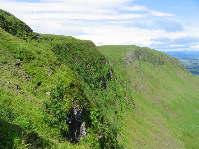
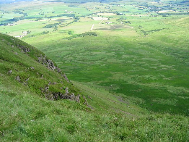
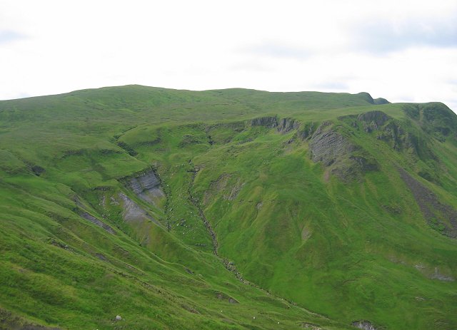
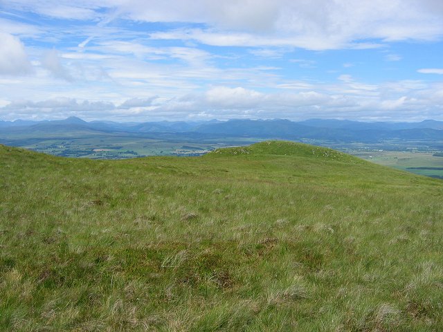
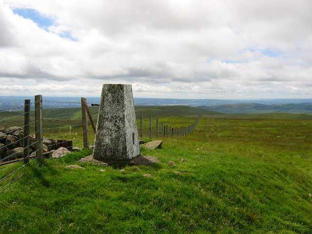
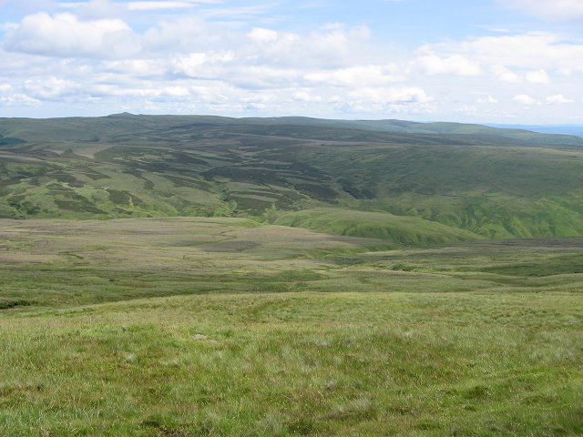
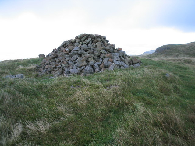
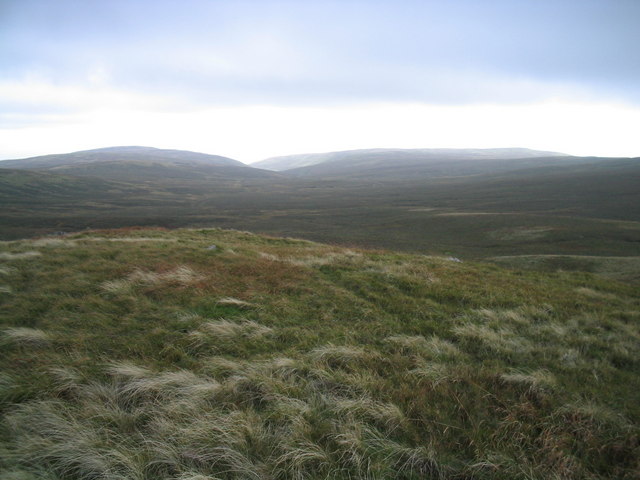
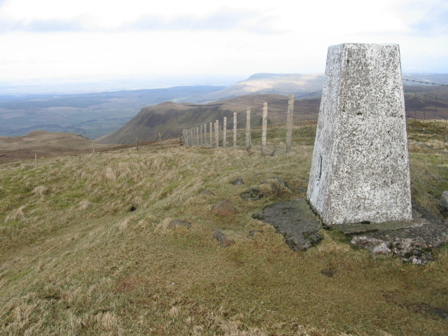
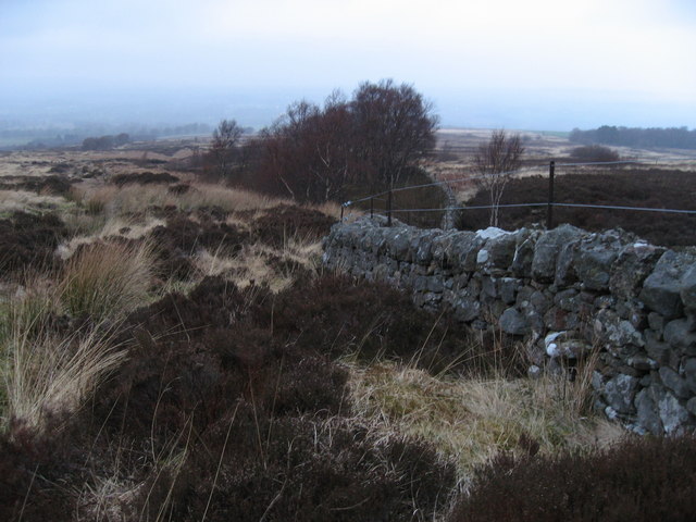
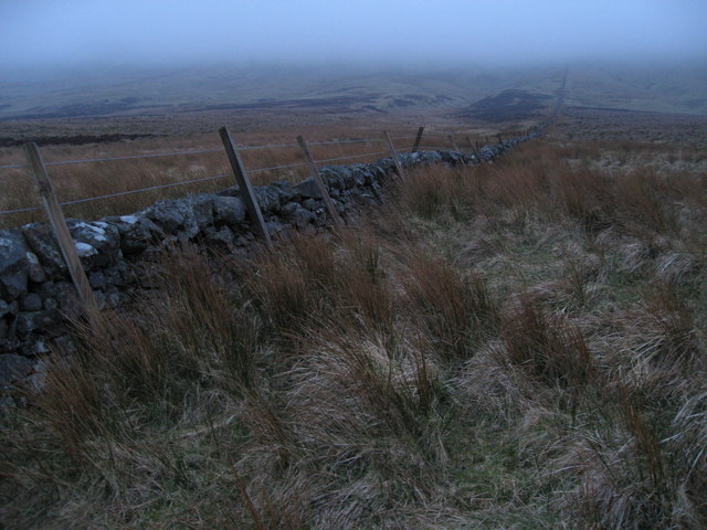
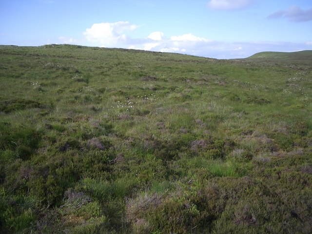
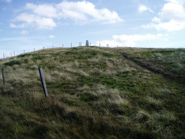
Ballikinrain Muir is a prominent natural feature located in Stirlingshire, Scotland. Situated in the central part of the country, specifically in the Ballikinrain area, this expansive moorland covers a vast expanse of roughly 2,000 acres. The muir is characterized by its undulating downs and sprawling moorland, offering visitors a picturesque and tranquil setting.

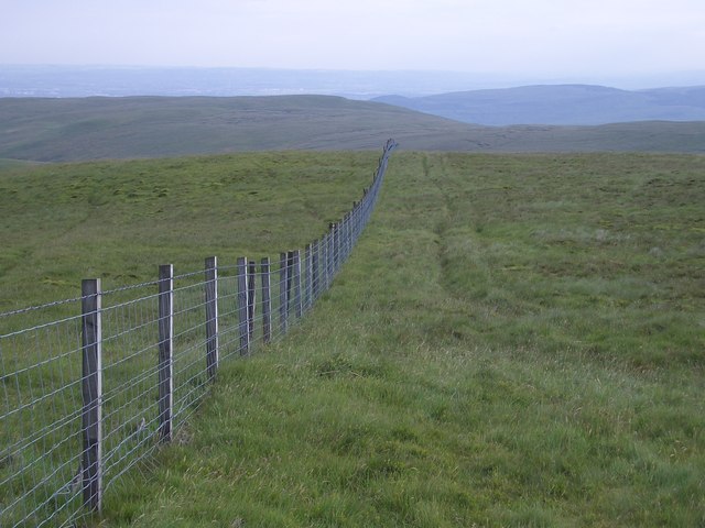
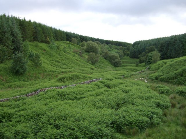
The terrain of Ballikinrain Muir is varied, with gently rolling hills and vast stretches of open space. The landscape is dominated by heather, grasses, and mosses, which create a vibrant and colorful display throughout the year. This diverse ecosystem supports a variety of wildlife species, including birds, mammals, and insects.

The muir is a popular destination for nature enthusiasts, hikers, and walkers, offering an extensive network of trails that crisscross the area. These paths provide visitors with the opportunity to explore the stunning natural surroundings and enjoy breathtaking views of the surrounding countryside.

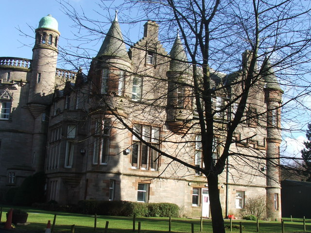
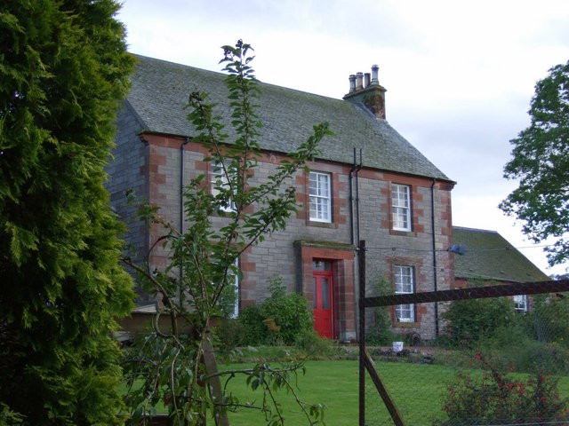
Additionally, Ballikinrain Muir holds historical significance, as it was once part of the larger Ballikinrain Estate, which dates back to the 18th century. The estate, which included a grand mansion and extensive gardens, played a notable role in the local community's history.

Overall, Ballikinrain Muir in Stirlingshire offers a captivating natural landscape, rich in biodiversity and history. Whether one seeks solitude, outdoor activities, or a chance to immerse themselves in the region's past, this downs and moorland area provides a unique and memorable experience for all who visit.

If you have any feedback on the listing, please let us know in the comments section below.

Ballikinrain Muir Images

Images are sourced within 2km of 56.041013/-4.2955473 or Grid Reference NS5785. Thanks to Geograph Open Source API. All images are credited.

Crags, Coire of Balglass. The big vegetated crag at the back of Coire of Balglass. This is a refuge for the sort of plants that would be growing on the hill if it were not for the grazing.
Crags, Coire of Balglass.
The big vegetated crag at the back of Coire of Balglass. This is a refuge for the sort of plants that would be growing on the hill if it were not for the grazing.
Corrie of Balglass The floor of the corrie takes up a fair chunk of this square. looking into the depths from the western rim.
Corrie of Balglass
The floor of the corrie takes up a fair chunk of this square. looking into the depths from the western rim.
Jocks Cairn. On the small sharp summit of Barniemore. View over the square showing the new forestry plantations below the scarp.
Jocks Cairn.
On the small sharp summit of Barniemore. View over the square showing the new forestry plantations below the scarp.
Little Corrie Another chunk bitten out of the north side of the Campsie Fells.  This is smaller than Balglass, but still a very scenic feature. The highest point of the skyline is Earl's Seat, the highest point in the Campsie Fells.
Little Corrie
Another chunk bitten out of the north side of the Campsie Fells. This is smaller than Balglass, but still a very scenic feature. The highest point of the skyline is Earl's Seat, the highest point in the Campsie Fells.
Moorland, Earl's Seat. The plateau, just below the summit of Earl's Seat, and before the plunge over the scap.
Moorland, Earl's Seat.
The plateau, just below the summit of Earl's Seat, and before the plunge over the scap.
Summit, Earl's Seat Highest point in the Campsie Fells and a fine view point overlooking Glasgow and Loch Lomond.
Summit, Earl's Seat
Highest point in the Campsie Fells and a fine view point overlooking Glasgow and Loch Lomond.
Campsie Plateau Eastward view from below the summit of Earl's seat showing the big undulating boggy plateau of the Campsie Fells.
Campsie Plateau
Eastward view from below the summit of Earl's seat showing the big undulating boggy plateau of the Campsie Fells.
Ballagan Tops cairn This cairn lies on the more westerly of the two Ballagan tops.
Ballagan Tops cairn
This cairn lies on the more westerly of the two Ballagan tops.
View from Ballagan Tops down Ballagan Burn View of the head of the valley formed by Ballagan Burn with typical tussocky moorland grass in the foreground.
View from Ballagan Tops down Ballagan Burn
View of the head of the valley formed by Ballagan Burn with typical tussocky moorland grass in the foreground.
Earl's Seat trig point S1622 towards Allanrowie
Ballikinrain
Ballikinrain
Wall at a stream crossing in rough moorland
Moorland wall A wall disappearing into the mist on the North edge of the Campsies
Moorland wall
A wall disappearing into the mist on the North edge of the Campsies
Campsie moorland The Campsie Fells are distinctive on their north side by their steep escarpments.  Stick to the top of the cliffs and the walking is generally easy going.  Away from the crags, it's often a different story with deep grass, heather and tufts.
Campsie moorland
The Campsie Fells are distinctive on their north side by their steep escarpments. Stick to the top of the cliffs and the walking is generally easy going. Away from the crags, it's often a different story with deep grass, heather and tufts.
Earl's Seat fence Looking south from the summit of Earl's Seat in the direction of Glasgow.
Earl's Seat fence
Looking south from the summit of Earl's Seat in the direction of Glasgow.
Mount Farmhouse
Mount Farmhouse
Secluded Valley of Balglass Burn Shallow valley full of bracken
Secluded Valley of Balglass Burn
Shallow valley full of bracken
Earls Seat Summit
Earls Seat Summit
Show me another place!

Ballikinrain Muir is located at Grid Ref: NS5785 (Lat: 56.041013, Lng: -4.2955473)

Unitary Authority: Stirling

Police Authority: Forth Valley

What 3 Words

///bicker.nicely.showed. Near Balfron, Stirling

Nearby Locations

Ballikinrain Muir

Related Wikis

Earl's Seat

Earl's Seat (578 m) is the highest hill of the Campsie Fells in Central Scotland. It lies on the border of Stirlingshire and East Dunbartonshire in central...

Ballikinrain

Ballikinrain is an independent residential school in Stirling, central Scotland. It is run by CrossReach, a social care outreach arm of the Church of Scotland...

Campsie Fells

The Campsie Fells (also known as the Campsies; Scottish Gaelic: Monadh Chamaisidh) are a range of hills in central Scotland, stretching east to west from...

Dumfoyn

Dumfoyn is a hill in the Campsie Fells of Scotland. It is a volcanic plug, and rises to 426 metres (1,398 ft). It sits beside another hill, Dumgoyne which...

Nearby Amenities

Located within 500m of 56.041013,-4.2955473
Man Made: grouse_butt
Lat/Long: 56.0427412/-4.3025571
Man Made: grouse_butt
Lat/Long: 56.042242/-4.3026191
The data included in this document is from www.openstreetmap.org. The data is made available under ODbL.

Have you been to Ballikinrain Muir?

Leave your review of Ballikinrain Muir below (or comments, questions and feedback).