Blood Moss
Downs, Moorland in Ayrshire
Scotland
Blood Moss

Blood Moss is a nature reserve located in Ayrshire, Scotland. It is situated on the Downs and Moorland area, offering a diverse and unique ecosystem. Covering an area of approximately 200 hectares, the reserve is known for its stunning landscapes and rich biodiversity.
The name "Blood Moss" originates from the vibrant red color that the moss takes on during the autumn months. This phenomenon occurs due to the high iron content in the soil, which gives the moss its distinct hue. Visitors to the reserve can witness this captivating sight as they explore the various trails and pathways that wind through the area.
The reserve is home to a wide range of plant and animal species. The moss itself provides a habitat for numerous insects and invertebrates, which in turn attract a variety of bird species such as the Eurasian curlew and the red grouse. Rare plants like the bog rosemary and the carnivorous sundew can also be found in the reserve.
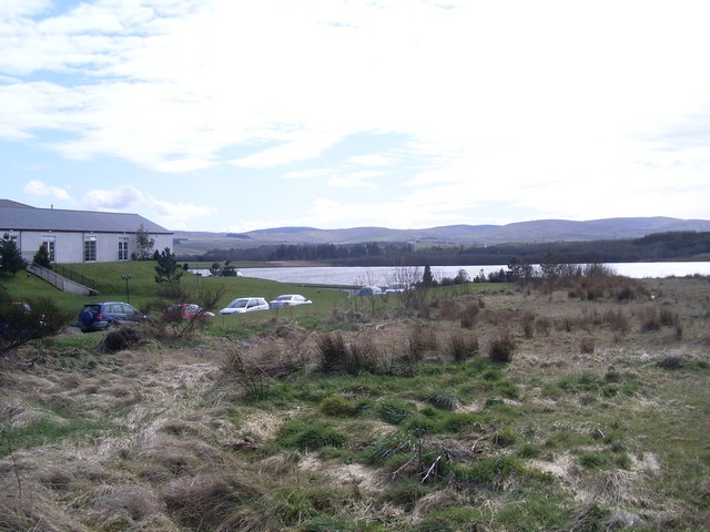
The landscape of Blood Moss is characterized by rolling hills, heather-covered moorlands, and peat bogs. This diverse terrain offers opportunities for activities such as hiking, birdwatching, and photography. The reserve is well-maintained, with designated paths and viewpoints for visitors to enjoy the natural beauty while minimizing their impact on the delicate ecosystem.
Overall, Blood Moss in Ayrshire is a captivating nature reserve that showcases the stunning landscapes and rich biodiversity of the Downs and Moorland area. Whether exploring the trails or simply taking in the vibrant red hues of the moss, visitors are sure to be enthralled by the unique beauty of this natural gem.
If you have any feedback on the listing, please let us know in the comments section below.
Blood Moss Images
Images are sourced within 2km of 55.358862/-4.2776925 or Grid Reference NS5509. Thanks to Geograph Open Source API. All images are credited.
Blood Moss is located at Grid Ref: NS5509 (Lat: 55.358862, Lng: -4.2776925)
Unitary Authority: East Ayrshire
Police Authority: Ayrshire
What 3 Words
///louder.glare.gurgling. Near New Cumnock, East Ayrshire
Nearby Locations
Related Wikis
Knockshinnoch disaster
The Knockshinnoch disaster was a mining accident that occurred in September 1950 in the village of New Cumnock, Ayrshire, Scotland. A glaciated lake filled...
Connel Burn
Connel Burn is a river in East Ayrshire, Scotland, which rises at Enoch Hill in the Southern Uplands and flows northwards through Laglaf and Connel Park...
Loch o' th' Lowes (New Cumnock)
Loch o' th' Lowes (NS 60183 14581), Lochside or Meikle Creoch Loch is a freshwater loch in the Parish of New Cumnock in the East Ayrshire Council Area...
Creoch Loch
Creoch Loch (NS 59259 15615), previously known as Little Creoch Loch, is a freshwater loch in the Parish of New Cumnock in the East Ayrshire Council Area...
Have you been to Blood Moss?
Leave your review of Blood Moss below (or comments, questions and feedback).


![A signpost and a bungalow beside the B741 The signpost points to a minor road and says "Cumnock 6 1/2 miles [minor road]". However, a sign at the start of the road has a "No Through Road" sign!](https://s2.geograph.org.uk/geophotos/03/50/49/3504990_21f5a52d.jpg)


