Backside Moss
Downs, Moorland in Ayrshire
Scotland
Backside Moss

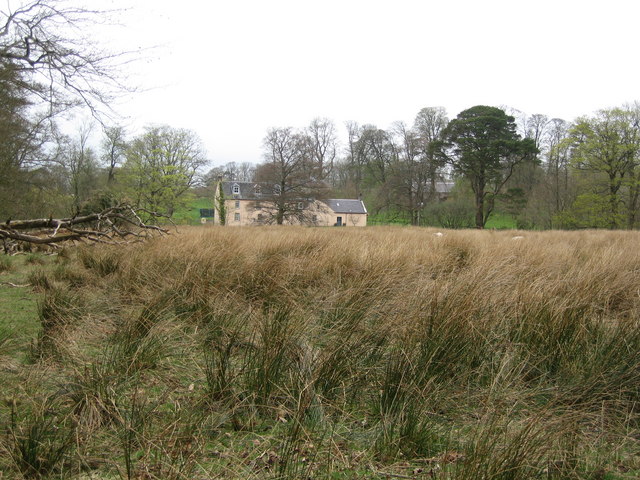
Backside Moss is a picturesque area located in Ayrshire, Scotland. Nestled amidst the breathtaking landscape of the Scottish countryside, it is well-known for its stunning downs and moorland. Spanning over a considerable area, Backside Moss offers a diverse range of natural features and wildlife.
The downs of Backside Moss are characterized by rolling hills covered in lush green grass. These gentle slopes provide a scenic backdrop, offering panoramic views of the surrounding countryside. The moorland, on the other hand, is marked by vast stretches of open land, covered in heather and other wildflowers. This unique ecosystem is home to various species of birds, including the elusive black grouse and the vibrant red grouse.
The area is renowned for its tranquility, making it an ideal spot for nature enthusiasts and outdoor activities. Visitors can explore the numerous walking trails and hiking routes that wind through the downs and moorland, immersing themselves in the untouched beauty of the Scottish landscape. Additionally, Backside Moss is a popular destination for birdwatching, with its diverse avian population attracting enthusiasts from all around.
Apart from its natural beauty, Backside Moss also boasts a rich history. The area has been inhabited for centuries, with traces of ancient settlements and historic landmarks dotting the landscape. Visitors can delve into the past by visiting sites such as old ruins and standing stones, gaining insight into the region's fascinating history.
In summary, Backside Moss is a captivating area in Ayrshire, Scotland, offering a blend of stunning downs and moorland. With its scenic beauty, diverse wildlife, and historical significance, it provides a memorable experience for those seeking a connection with nature and a glimpse into Scotland's past.
If you have any feedback on the listing, please let us know in the comments section below.
Backside Moss Images
Images are sourced within 2km of 55.547994/-4.2908422 or Grid Reference NS5530. Thanks to Geograph Open Source API. All images are credited.


Backside Moss is located at Grid Ref: NS5530 (Lat: 55.547994, Lng: -4.2908422)
Unitary Authority: East Ayrshire
Police Authority: Ayrshire
What 3 Words
///kilt.splice.deep. Near Catrine, East Ayrshire
Nearby Locations
Related Wikis
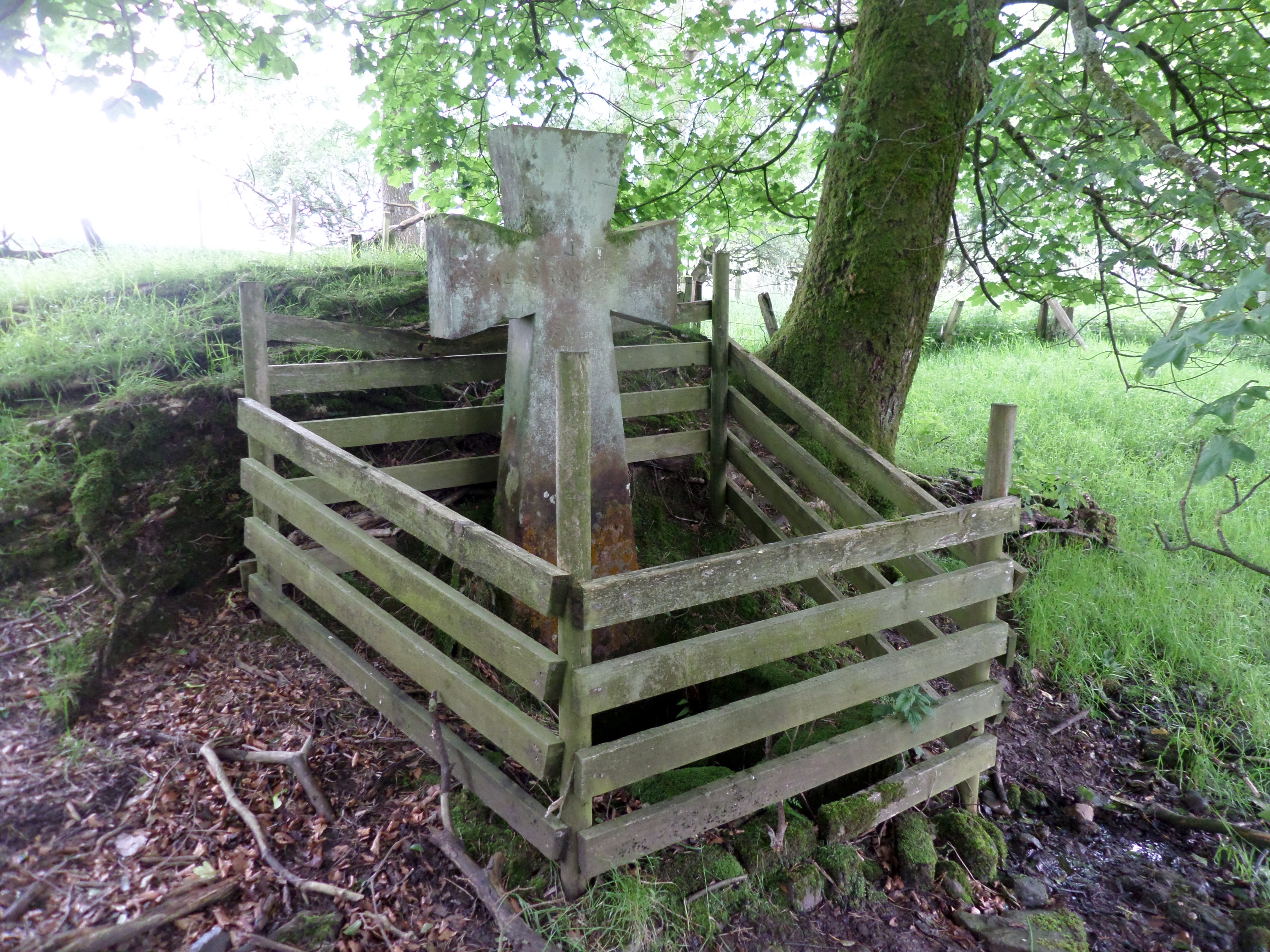
Lady's Well, Auchmannoch
The Lady's Well is a natural spring surmounted by a large cross that stands beside the Stra Burn Ford (NS254630) near Auchmannoch House in the Parish of...
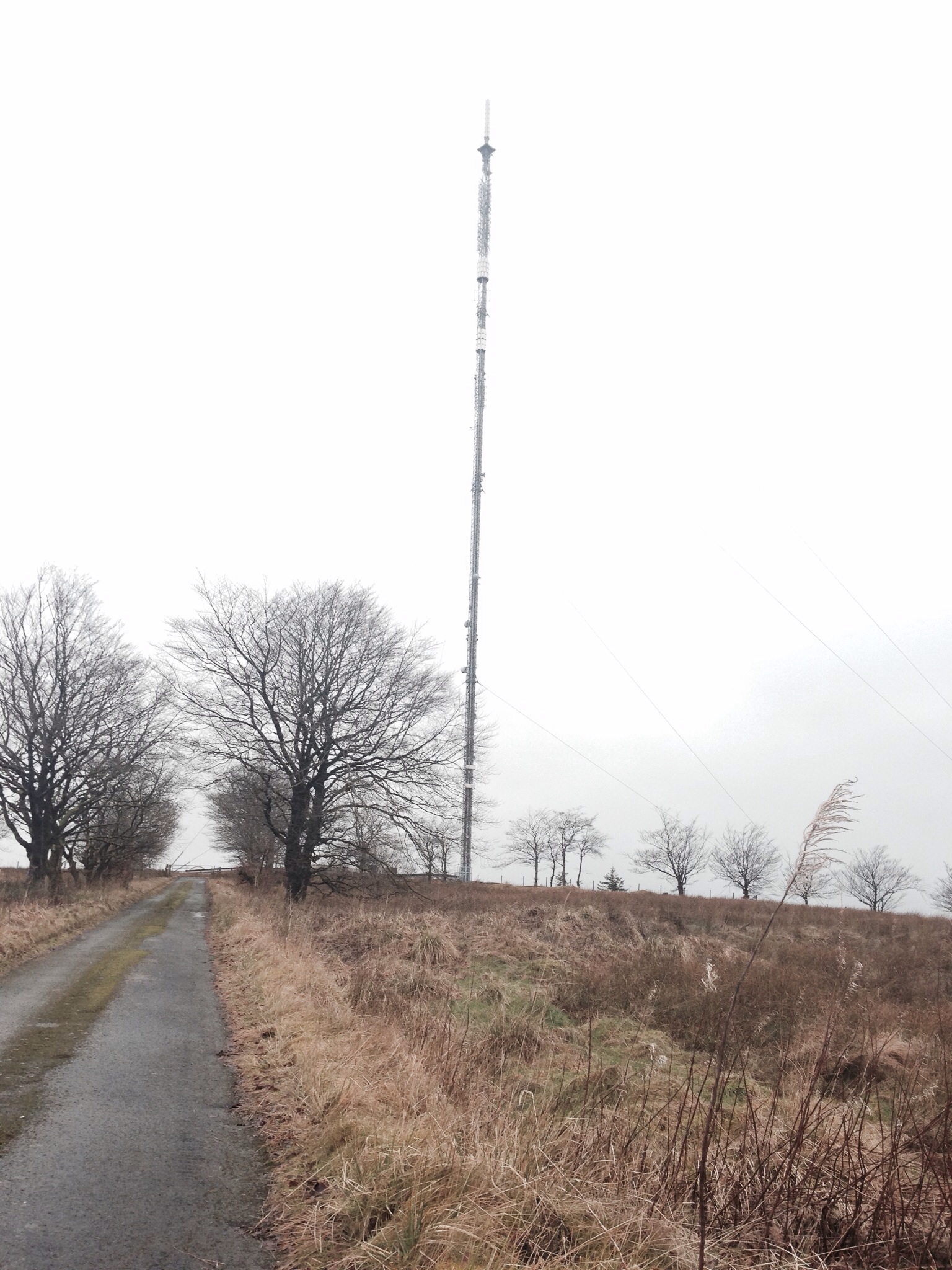
Darvel transmitting station
Darvel transmitting station is a broadcasting and telecommunications facility located near Darvel, East Ayrshire, Scotland (grid reference NS5567234132...

Sorn Castle
Sorn Castle is located by the River Ayr just outside the village of Sorn in East Ayrshire, Scotland. The castle comprises a medieval tower house, which...

Sorn, East Ayrshire
Sorn (Scottish Gaelic: Sorn, meaning a kiln) is a small village in East Ayrshire, Scotland. It is situated on the River Ayr. It has a population of roughly...
Nearby Amenities
Located within 500m of 55.547994,-4.2908422Have you been to Backside Moss?
Leave your review of Backside Moss below (or comments, questions and feedback).