Gwernaffield

Settlement in Flintshire

Wales

Gwernaffield

Dog on the Trail Waiting for his people to catch up and decide which way they are going.
Loggerheads Country Park.
Dog on the Trail Credit: Des Blenkinsopp

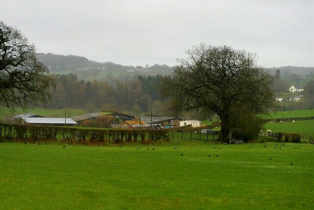
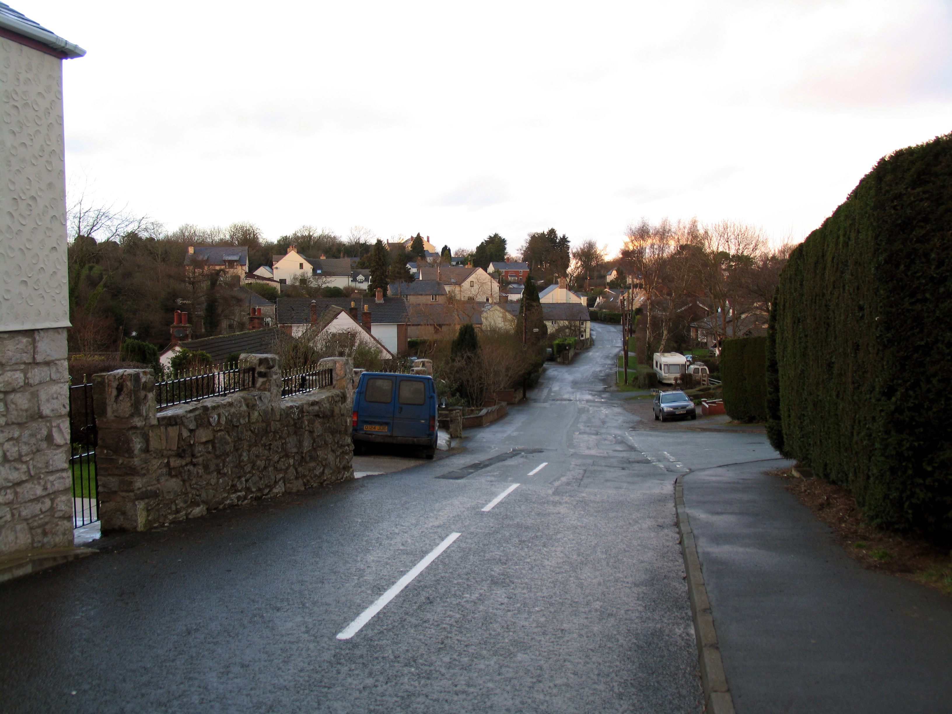
Gwernaffield is a small village located in Flintshire, Wales. Situated in the northeastern part of the county, it lies approximately 5 miles southwest of the town of Mold. The village is surrounded by picturesque countryside and offers a tranquil setting for its residents.

The history of Gwernaffield can be traced back to medieval times, with evidence of settlement in the area since at least the 13th century. Today, it retains its rural charm, with a mix of traditional stone cottages and modern houses dotting the landscape.

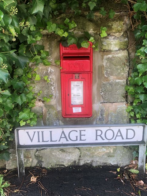
Despite its small size, Gwernaffield has a close-knit community that takes pride in their village. The village has a primary school, providing education to local children, and a village hall that serves as a social hub for various community events and gatherings. There is also a charming church, St. Mary's, which dates back to the 14th century and is worth a visit for its historic architecture.

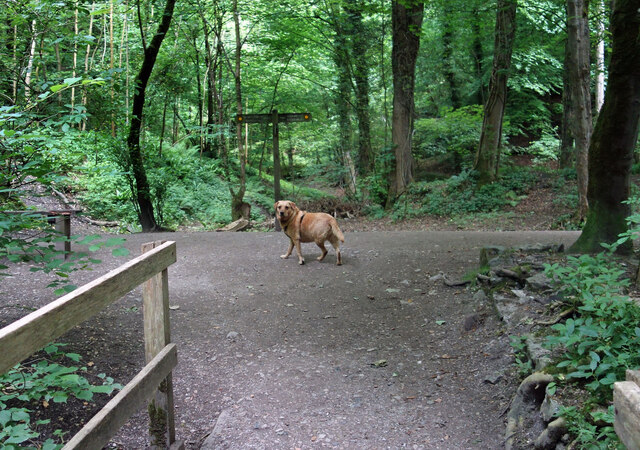
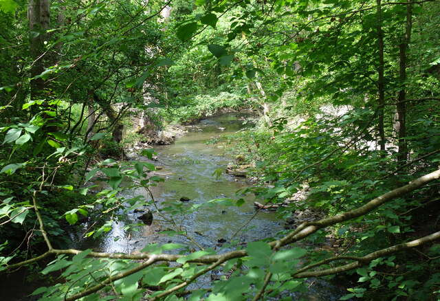
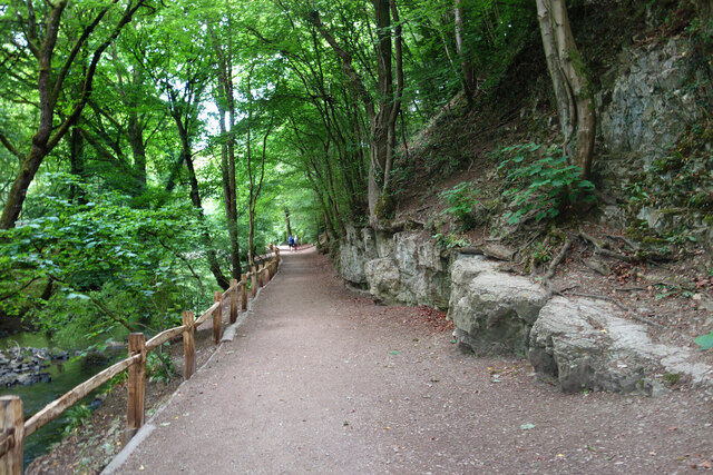
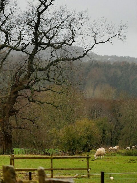
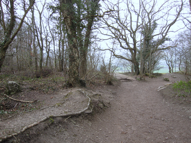
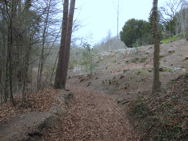
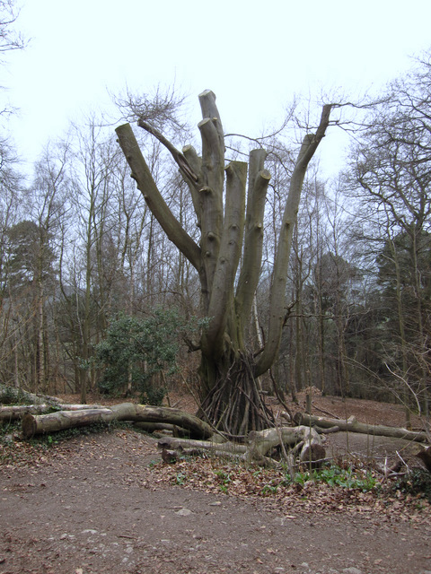
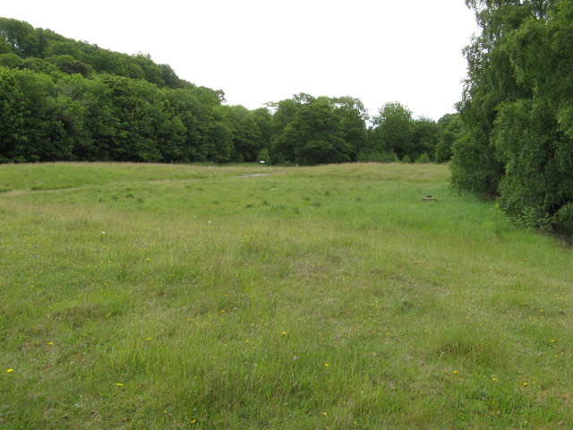
Nature lovers will appreciate the countryside surrounding Gwernaffield, as it offers ample opportunities for outdoor activities. The village is located near the edge of the Clwydian Range Area of Outstanding Natural Beauty, providing stunning views and numerous walking trails for residents and visitors to explore.

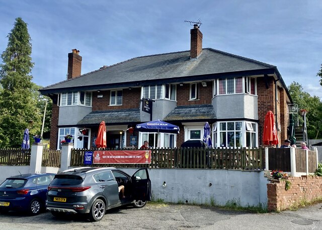
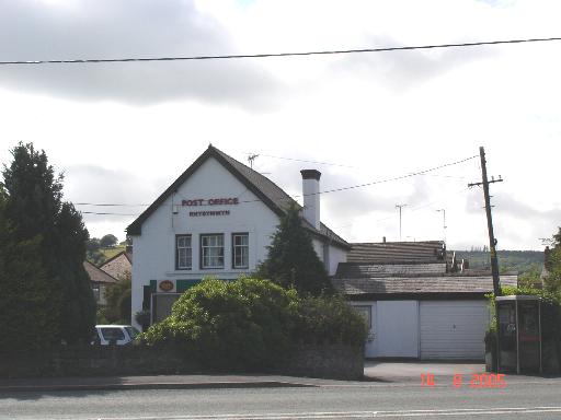
In terms of amenities, Gwernaffield is relatively limited, with a small shop and a pub providing essential services for the local population. However, for more extensive shopping and entertainment options, the nearby town of Mold offers a broader range of facilities just a short drive away.

Overall, Gwernaffield is a charming and peaceful village that offers a rural retreat for its residents, with its rich history, beautiful countryside, and strong community spirit.

If you have any feedback on the listing, please let us know in the comments section below.

Gwernaffield Images

Images are sourced within 2km of 53.171323/-3.1884995 or Grid Reference SJ2064. Thanks to Geograph Open Source API. All images are credited.

Dog on the Trail Waiting for his people to catch up and decide which way they are going.
Loggerheads Country Park.
Dog on the Trail
Waiting for his people to catch up and decide which way they are going. Loggerheads Country Park.
River Alyn in Loggerheads Park The river flows past limestone cliffs in a beautiful woodland setting.
River Alyn in Loggerheads Park
The river flows past limestone cliffs in a beautiful woodland setting.
Riverside Path, Loggerheads Park Sandwiched between the River Alyn on one side and steep limestone crags on the other.
Riverside Path, Loggerheads Park
Sandwiched between the River Alyn on one side and steep limestone crags on the other.
The Crown Inn, Pantymwyn
Farm near Mold
Farm near Mold
Sheep Grazing in a Field off the A541 near Mold Sheep grazing unperturbed by Storm Eunice.
Sheep Grazing in a Field off the A541 near Mold
Sheep grazing unperturbed by Storm Eunice.
Wall-mounted postbox at Cadole
Victorian letterbox in Church Lane, Gwernaffield, Flintshire A fine Victorian wall box with an enlarged opening set in a wall close to the Hand Inn, Gwernaffield.

Maker:-
W T Allen & Co London

Reference: CH7 20

Unfortunately 'Lost' between 2012 and 2016.
Victorian letterbox in Church Lane, Gwernaffield, Flintshire
A fine Victorian wall box with an enlarged opening set in a wall close to the Hand Inn, Gwernaffield. Maker:- W T Allen & Co London Reference: CH7 20 Unfortunately 'Lost' between 2012 and 2016.
'Mold' boundary stone and a rivet bench mark This old boundary stone has the name 'MOLD' on the dressed face, but the back of the stone is just rough cut. A rivet bench mark has been cut into the top edge of the stone and this is recorded on the 1878 O.S. map levelled at 804.8 feet. This stone is very close to the popular viewing area high above Loggerheads, but is about three metres off the track - see <a href="https://www.geograph.org.uk/photo/2331859">SJ1962 : Track to Loggerheads viewing point</a>. Another similar boundary stone, without a bench mark, is adjacent to the track, and is more obvious, about 50 metres east of this one.

Milestone Society National ID: FLT_MOLD03pb
'Mold' boundary stone and a rivet bench mark
This old boundary stone has the name 'MOLD' on the dressed face, but the back of the stone is just rough cut. A rivet bench mark has been cut into the top edge of the stone and this is recorded on the 1878 O.S. map levelled at 804.8 feet. This stone is very close to the popular viewing area high above Loggerheads, but is about three metres off the track - see SJ1962 : Track to Loggerheads viewing point. Another similar boundary stone, without a bench mark, is adjacent to the track, and is more obvious, about 50 metres east of this one. Milestone Society National ID: FLT_MOLD03pb
Track to Loggerheads viewing point Just ahead the track through the woods opens out onto an expansive viewing point on the limestone cliffs high above Loggerheads. On the far left of the photo is a 'MOLD' boundary stone, which has a rivet bench mark <a href="https://www.geograph.org.uk/photo/2331833">SJ1962 : 'Mold' boundary stone and a rivet bench mark</a>.
Track to Loggerheads viewing point
Just ahead the track through the woods opens out onto an expansive viewing point on the limestone cliffs high above Loggerheads. On the far left of the photo is a 'MOLD' boundary stone, which has a rivet bench mark SJ1962 : 'Mold' boundary stone and a rivet bench mark.
Parc Gwledig Loggerheads Country Park This track through Loggerheads Country Park is high above the River Alyn and links up with Cefn Bychan Road. The woodland in the park is managed and work is carried out between November and March. Cut timber is left to decay naturally providing habitat for all sorts of creatures.
Parc Gwledig Loggerheads Country Park
This track through Loggerheads Country Park is high above the River Alyn and links up with Cefn Bychan Road. The woodland in the park is managed and work is carried out between November and March. Cut timber is left to decay naturally providing habitat for all sorts of creatures.
Ancient beech in Loggerheads Country Park This old beech tree has been trimmed and the timber has been left around to provide a natural habitat for wildlife.
Ancient beech in Loggerheads Country Park
This old beech tree has been trimmed and the timber has been left around to provide a natural habitat for wildlife.
Viewing point in Loggerheads Country Park The high level track through the park passes this viewing and rest area high above the River Alyn.
Viewing point in Loggerheads Country Park
The high level track through the park passes this viewing and rest area high above the River Alyn.
Viewpoint in Loggerheads Country Park A smart new painting by Chris Hull <span class="nowrap"><a title="http://www.chrishulldesigns.co.uk/" rel="nofollow ugc noopener" href="http://www.chrishulldesigns.co.uk/">Link</a><img style="margin-left:2px;" alt="External link" title="External link - shift click to open in new window" src="https://s1.geograph.org.uk/img/external.png" width="10" height="10"/></span> graces this viewpoint high up in Loggerheads Country Park. The farm in the distance is Pwll-y-blawd. See also <a href="https://www.geograph.org.uk/photo/2333085">SJ1962 : Viewing point in Loggerheads Country Park</a>
Viewpoint in Loggerheads Country Park
A smart new painting by Chris Hull LinkExternal link graces this viewpoint high up in Loggerheads Country Park. The farm in the distance is Pwll-y-blawd. See also SJ1962 : Viewing point in Loggerheads Country Park
A Loggerheads boundary stone? This unassuming stone sits unnoticed amongst the limestone at the viewing point high on the cliffs above Loggerheads. I have visited this place many times but have only just noticed what seems to be an 'L' cut into the north face of this stone. The old O.S. maps indicate a number of boundary stones in this area although only the two impressive 'MOLD' ones are obvious today. If it is a boundary stone it is a much cruder version than the Mold ones, but then Mold is the county town. See also <a href="https://www.geograph.org.uk/photo/2333259">SJ1962 : Viewing area above Loggerheads - and a boundary stone?</a>
A Loggerheads boundary stone?
This unassuming stone sits unnoticed amongst the limestone at the viewing point high on the cliffs above Loggerheads. I have visited this place many times but have only just noticed what seems to be an 'L' cut into the north face of this stone. The old O.S. maps indicate a number of boundary stones in this area although only the two impressive 'MOLD' ones are obvious today. If it is a boundary stone it is a much cruder version than the Mold ones, but then Mold is the county town. See also SJ1962 : Viewing area above Loggerheads - and a boundary stone?
Viewing area above Loggerheads - and a boundary stone? This viewing point high above Loggerheads is a popular area to visit, especially on a sunny day, and the exposed rock shows that this is limestone country. After many years of visiting this place I have only just noticed that the dark-faced stone to the right of the photo seems to have an 'L' cut into it. The old O.S. maps indicate several boundary stones in this area, so I wonder if this could be one of those for Loggerheads? <a href="https://www.geograph.org.uk/photo/2333250">SJ1962 : A Loggerheads boundary stone?</a>
Viewing area above Loggerheads - and a boundary stone?
This viewing point high above Loggerheads is a popular area to visit, especially on a sunny day, and the exposed rock shows that this is limestone country. After many years of visiting this place I have only just noticed that the dark-faced stone to the right of the photo seems to have an 'L' cut into it. The old O.S. maps indicate several boundary stones in this area, so I wonder if this could be one of those for Loggerheads? SJ1962 : A Loggerheads boundary stone?
Wartime buildings Buildings remaining on the secret Rhydymwyn wartime manufacturing and supply depot which is now administered as a nature reserve.
Wartime buildings
Buildings remaining on the secret Rhydymwyn wartime manufacturing and supply depot which is now administered as a nature reserve.
Rhydymwyn nature reserve The site of the secret wartime facility has been kept free of interference for so long that it is now maintained as a nature reserve. The River Alyn used to meander across the site between the wooded slopes, but was taken into a culvert at the south-western edge and the floor of the valley levelled by taking the spoil from the creation of a series of huge underground storage levels. The suspicious contours remain from this time but grass has taken over the spoil.
Rhydymwyn nature reserve
The site of the secret wartime facility has been kept free of interference for so long that it is now maintained as a nature reserve. The River Alyn used to meander across the site between the wooded slopes, but was taken into a culvert at the south-western edge and the floor of the valley levelled by taking the spoil from the creation of a series of huge underground storage levels. The suspicious contours remain from this time but grass has taken over the spoil.
Show me another place!

Gwernaffield is located at Grid Ref: SJ2064 (Lat: 53.171323, Lng: -3.1884995)

Unitary Authority: Flintshire

Police Authority: North Wales

Also known as: Gwernaffield-y-Waun, Waen

What 3 Words

///suitcase.reissued.price. Near Mold, Flintshire

Related Wikis

Gwernaffield

Gwernaffield (Welsh: Y Waun), also known as Gwernaffield-y-Waun, is a village and electoral ward in Flintshire, Wales. It lies about three miles west of...

Gwernaffield with Pantymwyn

Gwernaffield with Pantymwyn is a community in Flintshire, Wales with a population of 1942 as of the 2011 UK census. It includes the villages of Gwernaffield...

Rhydymwyn

Rhydymwyn (Welsh for 'Ford of the Ore') is a village in Flintshire, Wales, located in the upper Alyn valley. Once a district of Mold, it was recognised...

Pantymwyn

Pantymwyn is a small village just outside Mold in Flintshire, Wales, in the community of Gwernaffield with Pantymwyn. The village is located within the...

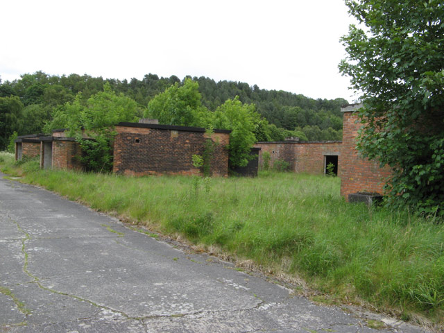
M. S. Factory, Valley

The M.S. (Ministry of Supply) Factory, Valley was a Second World War site in Rhydymwyn, Flintshire, Wales, that was used for the storage and production...

Cadole

Cadole is a village in Flintshire, Wales. It lies west of Gwernymynydd and Mold (Yr Wyddgrug), south of Gwernaffield and to the east of the Clwydian Range...

Ogof Hesp Alyn

Ogof Hesp Alyn (Welsh for: Dry Alyn Cave) was discovered by North Wales Caving Club in 1973 in the Alyn Gorge near Cilcain, Flintshire, Wales. Reaching...

Ogof Hen Ffynhonnau

Ogof Hen Ffynhonnau (sometimes known in English as Poacher's Cave) lies in the Alyn Gorge in Flintshire, Wales close to Ogof Hesp Alyn. It was discovered...

Nearby Amenities

Located within 500m of 53.171323,-3.1884995
Ref: 48
Lat/Long: 53.1713446/-3.1885081
Gwernaffield
Name Cy: Y Waun
Name En: Gwernaffield
Place: village
Wikidata: Q5623557
Wikipedia: en:Gwernaffield
Lat/Long: 53.1710616/-3.1889642
Bus Stop
Pantybuarth Crossroads
Lat/Long: 53.167586/-3.1887618
Pub
The Hand
Wikidata: Q80855396
Lat/Long: 53.1714625/-3.1887382
Place Of Worship
Holy Trinity Church
Denomination: anglican
Religion: christian
Lat/Long: 53.1715249/-3.1880859
Leisure: playground
Lat/Long: 53.1729369/-3.1890542
Power: pole
Lat/Long: 53.1672667/-3.1917295
Power: pole
Lat/Long: 53.1668969/-3.188763
Power: pole
Lat/Long: 53.1671043/-3.1903669
Power: pole
Lat/Long: 53.1738266/-3.1823981
Power: pole
Lat/Long: 53.1727108/-3.1823632
Power: pole
Lat/Long: 53.1715308/-3.1823713
Power: pole
Lat/Long: 53.1708105/-3.1823713
Power: pole
Lat/Long: 53.1702686/-3.1835353
Power: pole
Lat/Long: 53.1697236/-3.1847316
Power: pole
Lat/Long: 53.1692251/-3.1858581
Power: pole
Lat/Long: 53.1688875/-3.1866547
Power: pole
Lat/Long: 53.1682476/-3.1881219
Power: pole
Lat/Long: 53.167926/-3.1888837
Power: pole
Lat/Long: 53.1675964/-3.1896293
Power: pole
Lat/Long: 53.1673359/-3.1902677
Power: pole
Lat/Long: 53.1743988/-3.1930615
Power: pole
Lat/Long: 53.173857/-3.1935738
Power: pole
Lat/Long: 53.1732879/-3.1941022
Power: pole
Lat/Long: 53.1723257/-3.1950289
Power: pole
Lat/Long: 53.1719165/-3.1958215
Direction: 165
Generator Method: photovoltaic
Generator Output Electricity: yes
Generator Solar Modules: 13
Generator Source: solar
Generator Type: solar_photovoltaic_panel
Location: roof
Power: generator
Lat/Long: 53.1717493/-3.1950108
Power: pole
Lat/Long: 53.1725136/-3.194831
Power: pole
Lat/Long: 53.1750075/-3.1924928
Barrier: kissing_gate
Lat/Long: 53.1712928/-3.1879444
Barrier: stile
Foot: yes
Material: wood
Stile: stepover
Lat/Long: 53.1686378/-3.1845339
Barrier: stile
Foot: yes
Material: wood
Stile: stepover
Lat/Long: 53.1690692/-3.1859021
Barrier: stile
Foot: yes
Material: wood
Stile: stepover
Lat/Long: 53.1696181/-3.1869624
Barrier: stile
Foot: yes
Material: stone
Stile: stepover
Lat/Long: 53.1685957/-3.1834817
Direction: E
Generator Solar Modules: 14
Generator Source: solar
Location: roof
Power: generator
Lat/Long: 53.1717655/-3.1891382
Direction: S
Generator Solar Modules: 14
Generator Source: solar
Location: roof
Power: generator
Lat/Long: 53.1715571/-3.1888496
Direction: 165
Generator Method: photovoltaic
Generator Output Electricity: yes
Generator Solar Modules: 8
Generator Source: solar
Generator Type: solar_photovoltaic_panel
Location: roof
Power: generator
Lat/Long: 53.1719282/-3.1867102
Direction: E
Generator Solar Modules: 14
Generator Source: solar
Location: roof
Power: generator
Lat/Long: 53.1716683/-3.1891403
Direction: S
Generator Solar Modules: 14
Generator Source: solar
Location: roof
Power: generator
Lat/Long: 53.1715507/-3.1887133
Historic: memorial
Memorial: war_memorial
Lat/Long: 53.1714844/-3.1882316
Direction: E
Generator Solar Modules: 24
Generator Source: solar
Location: roof
Power: generator
Lat/Long: 53.1732729/-3.1896081
Direction: E
Generator Solar Modules: 14
Generator Source: solar
Location: roof
Power: generator
Lat/Long: 53.1715912/-3.1891564
Direction: E
Generator Solar Modules: 14
Generator Source: solar
Location: roof
Power: generator
Lat/Long: 53.1718356/-3.1891242
Direction: SSW
Generator Solar Modules: 8
Generator Source: solar
Location: roof
Power: generator
Lat/Long: 53.1739268/-3.1889966
Direction: S
Generator Solar Modules: 10
Generator Source: solar
Location: roof
Power: generator
Lat/Long: 53.1734587/-3.1896691
Direction: S
Generator Solar Modules: 14
Generator Source: solar
Location: roof
Power: generator
Lat/Long: 53.1717784/-3.1886886
Direction: S
Generator Solar Modules: 14
Generator Source: solar
Location: roof
Power: generator
Lat/Long: 53.1717854/-3.1888292
Direction: 275
Generator Method: photovoltaic
Generator Output Electricity: yes
Generator Solar Modules: 16
Generator Source: solar
Generator Type: solar_photovoltaic_panel
Location: roof
Power: generator
Lat/Long: 53.1698771/-3.1879073
Direction: 95
Generator Method: photovoltaic
Generator Output Electricity: yes
Generator Solar Modules: 17
Generator Source: solar
Generator Type: solar_photovoltaic_panel
Location: roof
Power: generator
Lat/Long: 53.1697477/-3.1883258
Direction: 95
Generator Method: photovoltaic
Generator Output Electricity: yes
Generator Solar Modules: 10
Generator Source: solar
Generator Type: solar_photovoltaic_panel
Location: roof
Power: generator
Lat/Long: 53.1708185/-3.1875184
Direction: 275
Generator Method: photovoltaic
Generator Output Electricity: yes
Generator Solar Modules: 10
Generator Source: solar
Generator Type: solar_photovoltaic_panel
Location: roof
Power: generator
Lat/Long: 53.1708185/-3.187566
Direction: E
Generator Method: photovoltaic
Generator Output Electricity: yes
Generator Solar Modules: 10
Generator Source: solar
Generator Type: solar_photovoltaic_panel
Location: roof
Power: generator
Lat/Long: 53.1710388/-3.1887093
Direction: E
Generator Method: photovoltaic
Generator Output Electricity: yes
Generator Solar Modules: 10
Generator Source: solar
Generator Type: solar_photovoltaic_panel
Location: roof
Power: generator
Lat/Long: 53.1709536/-3.1887169
Direction: E
Generator Method: photovoltaic
Generator Output Electricity: yes
Generator Solar Modules: 10
Generator Source: solar
Generator Type: solar_photovoltaic_panel
Location: roof
Power: generator
Lat/Long: 53.1708455/-3.1887265
Direction: E
Generator Method: photovoltaic
Generator Output Electricity: yes
Generator Solar Modules: 10
Generator Source: solar
Generator Type: solar_photovoltaic_panel
Location: roof
Power: generator
Lat/Long: 53.1707574/-3.1887344
Direction: E
Generator Method: photovoltaic
Generator Output Electricity: yes
Generator Solar Modules: 10
Generator Source: solar
Generator Type: solar_photovoltaic_panel
Location: roof
Power: generator
Lat/Long: 53.1706581/-3.1887432
Direction: E
Generator Method: photovoltaic
Generator Output Electricity: yes
Generator Solar Modules: 10
Generator Source: solar
Generator Type: solar_photovoltaic_panel
Location: roof
Power: generator
Lat/Long: 53.170587/-3.1887496
Direction: E
Generator Method: photovoltaic
Generator Output Electricity: yes
Generator Solar Modules: 10
Generator Source: solar
Generator Type: solar_photovoltaic_panel
Location: roof
Power: generator
Lat/Long: 53.1705162/-3.1900317
Direction: E
Generator Method: photovoltaic
Generator Output Electricity: yes
Generator Solar Modules: 10
Generator Source: solar
Generator Type: solar_photovoltaic_panel
Location: roof
Power: generator
Lat/Long: 53.170438/-3.1900426
Direction: E
Generator Method: photovoltaic
Generator Output Electricity: yes
Generator Solar Modules: 10
Generator Source: solar
Generator Type: solar_photovoltaic_panel
Location: roof
Power: generator
Lat/Long: 53.1703442/-3.1900558
Direction: S
Generator Method: photovoltaic
Generator Output Electricity: yes
Generator Solar Modules: 10
Generator Source: solar
Generator Type: solar_photovoltaic_panel
Location: roof
Power: generator
Lat/Long: 53.1702509/-3.1902918
Direction: S
Generator Method: photovoltaic
Generator Output Electricity: yes
Generator Solar Modules: 10
Generator Source: solar
Generator Type: solar_photovoltaic_panel
Location: roof
Power: generator
Lat/Long: 53.1702543/-3.1904525
Direction: S
Generator Method: photovoltaic
Generator Output Electricity: yes
Generator Solar Modules: 10
Generator Source: solar
Generator Type: solar_photovoltaic_panel
Location: roof
Power: generator
Lat/Long: 53.1702626/-3.1908526
Direction: S
Generator Method: photovoltaic
Generator Output Electricity: yes
Generator Solar Modules: 10
Generator Source: solar
Generator Type: solar_photovoltaic_panel
Location: roof
Power: generator
Lat/Long: 53.1702654/-3.1909892
Direction: E
Generator Method: photovoltaic
Generator Output Electricity: yes
Generator Solar Modules: 10
Generator Source: solar
Generator Type: solar_photovoltaic_panel
Location: roof
Power: generator
Lat/Long: 53.1703587/-3.1911716
Direction: E
Generator Method: photovoltaic
Generator Output Electricity: yes
Generator Solar Modules: 10
Generator Source: solar
Generator Type: solar_photovoltaic_panel
Location: roof
Power: generator
Lat/Long: 53.1704456/-3.1911604
Direction: E
Generator Method: photovoltaic
Generator Output Electricity: yes
Generator Solar Modules: 10
Generator Source: solar
Generator Type: solar_photovoltaic_panel
Location: roof
Power: generator
Lat/Long: 53.1705452/-3.1911475
Direction: E
Generator Method: photovoltaic
Generator Output Electricity: yes
Generator Solar Modules: 10
Generator Source: solar
Generator Type: solar_photovoltaic_panel
Location: roof
Power: generator
Lat/Long: 53.1706288/-3.1911367
Direction: S
Generator Method: photovoltaic
Generator Output Electricity: yes
Generator Solar Modules: 10
Generator Source: solar
Generator Type: solar_photovoltaic_panel
Location: roof
Power: generator
Lat/Long: 53.1706674/-3.1909946
Direction: S
Generator Method: photovoltaic
Generator Output Electricity: yes
Generator Solar Modules: 10
Generator Source: solar
Generator Type: solar_photovoltaic_panel
Location: roof
Power: generator
Lat/Long: 53.1706674/-3.1908578
Direction: S
Generator Method: photovoltaic
Generator Output Electricity: yes
Generator Solar Modules: 10
Generator Source: solar
Generator Type: solar_photovoltaic_panel
Location: roof
Power: generator
Lat/Long: 53.1706674/-3.1906673
Direction: E
Generator Method: photovoltaic
Generator Output Electricity: yes
Generator Solar Modules: 10
Generator Source: solar
Generator Type: solar_photovoltaic_panel
Location: roof
Power: generator
Lat/Long: 53.1707156/-3.1904554
Direction: S
Generator Method: photovoltaic
Generator Output Electricity: yes
Generator Solar Modules: 16
Generator Source: solar
Generator Type: solar_photovoltaic_panel
Location: roof
Power: generator
Lat/Long: 53.1704519/-3.1936768
Direction: SE
Generator Method: photovoltaic
Generator Output Electricity: yes
Generator Solar Modules: 12
Generator Source: solar
Generator Type: solar_photovoltaic_panel
Location: roof
Power: generator
Lat/Long: 53.1705613/-3.1925134
Direction: SE
Generator Method: photovoltaic
Generator Output Electricity: yes
Generator Solar Modules: 4
Generator Source: solar
Generator Type: solar_photovoltaic_panel
Location: roof
Power: generator
Lat/Long: 53.1706127/-3.1924463
Direction: 275
Generator Method: photovoltaic
Generator Output Electricity: yes
Generator Solar Modules: 16
Generator Source: solar
Generator Type: solar_photovoltaic_panel
Location: roof
Power: generator
Lat/Long: 53.1701561/-3.1928265
The data included in this document is from www.openstreetmap.org. The data is made available under ODbL.

Have you been to Gwernaffield?

Leave your review of Gwernaffield below (or comments, questions and feedback).