Blackmyre Moor

Downs, Moorland in Kirkcudbrightshire

Scotland

Blackmyre Moor

Sheds belonging to Bagbie Farm
Sheds belonging to Bagbie Farm Credit: Eirian Evans

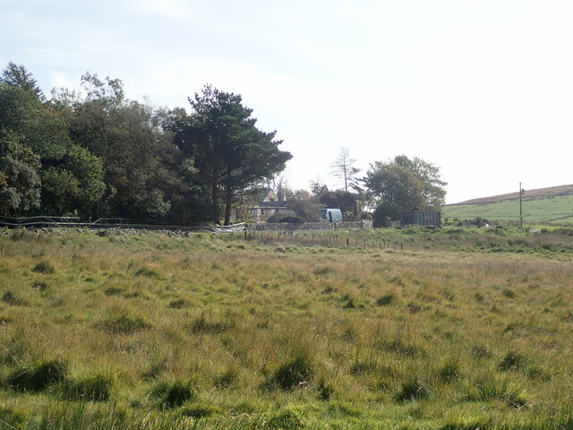
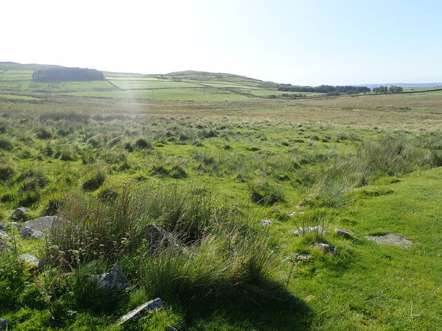
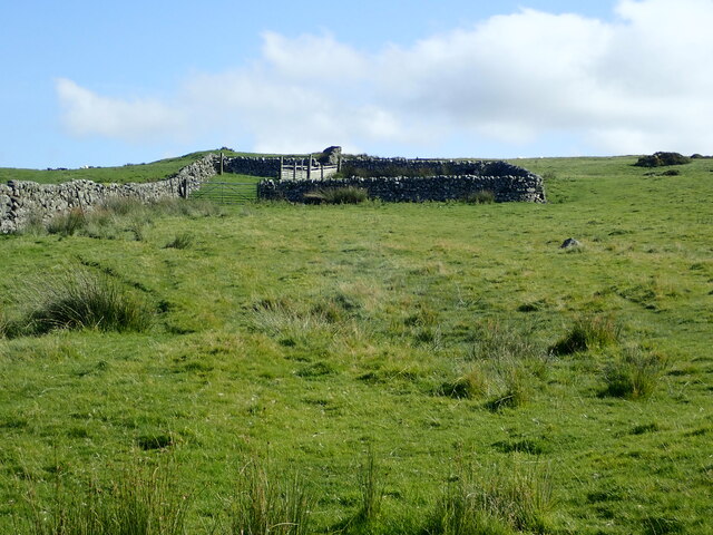
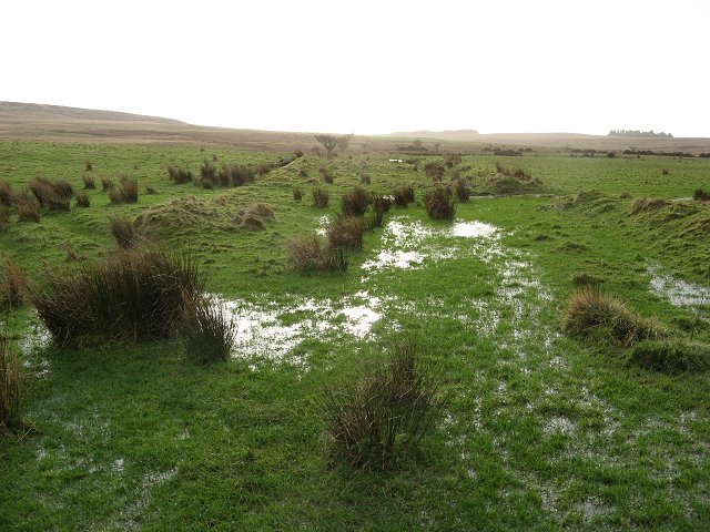
Blackmyre Moor is a vast expanse of moorland located in Kirkcudbrightshire, Scotland. This area is characterized by its rolling hills, sparse vegetation, and rugged terrain. The moorland is largely covered in heather, grasses, and patches of bracken, giving it a rich and varied landscape.

Blackmyre Moor is home to a variety of wildlife, including birds of prey such as buzzards and kestrels, as well as red and roe deer. The moorland provides an important habitat for these species, as well as a range of plant life that thrives in the acidic soil.

The area is popular with hikers and outdoor enthusiasts, who come to explore the expansive scenery and enjoy the peaceful surroundings. There are several walking trails that crisscross the moor, allowing visitors to take in the stunning views and experience the unique flora and fauna of the area.

Overall, Blackmyre Moor is a picturesque and diverse landscape that offers a glimpse into the natural beauty of Kirkcudbrightshire. Its remote location and unspoiled beauty make it a popular destination for those looking to escape the hustle and bustle of city life and immerse themselves in the tranquility of the Scottish countryside.

If you have any feedback on the listing, please let us know in the comments section below.

Blackmyre Moor Images

Images are sourced within 2km of 54.886204/-4.331283 or Grid Reference NX5057. Thanks to Geograph Open Source API. All images are credited.

Sheds belonging to Bagbie Farm
Moorland, Knock Gray View to distant Kirkdale Hill
Moorland, Knock Gray
View to distant Kirkdale Hill
Sheepfold on Blackmyre Moor
Forestry near Garrocher An open area obviously used as a loading area.
Forestry near Garrocher
An open area obviously used as a loading area.
Country road above Creetown With flourishing Bracken as part of the roadside vegetation.
Country road above Creetown
With flourishing Bracken as part of the roadside vegetation.
Rough grazing on Cambret Moor The TV station on Cambret Hill is on the left horizon.
Rough grazing on Cambret Moor
The TV station on Cambret Hill is on the left horizon.
Rough grassland on Cambret Moor Looking southwest over the shallow valley of the Englishman's Burn and, in the mist and drizzle in the distance, to two small plantations on Blackmyre Moor.
Rough grassland on Cambret Moor
Looking southwest over the shallow valley of the Englishman's Burn and, in the mist and drizzle in the distance, to two small plantations on Blackmyre Moor.
The Englishman's Burn Looking downstream from the Englishman's Bridge, on the Old Military Road over Cambret Moor.
The Englishman's Burn
Looking downstream from the Englishman's Bridge, on the Old Military Road over Cambret Moor.
Cambret Hill TV-Masts These towers belong to ntl. The tallest with the white cylinder is for Television when the other is for Mobile phone operators (Site share as we call it)
Cambret Hill TV-Masts
These towers belong to ntl. The tallest with the white cylinder is for Television when the other is for Mobile phone operators (Site share as we call it)
Garrocher Tree Farm Nursery and Christmas tree growers. Pibble Hill in the background.
Garrocher Tree Farm
Nursery and Christmas tree growers. Pibble Hill in the background.
Landscaped old sandpit A new pond dug out of an old sand and gravel pit. There is life here, a heron was hunting the margin. The banks are freshly dug, with new track marks on the road up to the pool.
Landscaped old sandpit
A new pond dug out of an old sand and gravel pit. There is life here, a heron was hunting the margin. The banks are freshly dug, with new track marks on the road up to the pool.
Billy Diamond's Bridge Narrow bridge over the Englishman's Burn. Cambret Hill on the skyline with the masts.
Billy Diamond's Bridge
Narrow bridge over the Englishman's Burn. Cambret Hill on the skyline with the masts.
Gullies on Cambret Hill Sheep grazing on moorland beside the Old Military Road. Gullies suggest that this was a route long before the military road was built.
Gullies on Cambret Hill
Sheep grazing on moorland beside the Old Military Road. Gullies suggest that this was a route long before the military road was built.
Cambret Hill Cambret Hill, topped by communication/TV masts as seen from the Old Military Road
Cambret Hill
Cambret Hill, topped by communication/TV masts as seen from the Old Military Road
Flooded ground The field drains are overloaded about where the improved land gives way to rough grazing.
Flooded ground
The field drains are overloaded about where the improved land gives way to rough grazing.
Old Military Road Military road built 1763- 1764 to facilitate rapid troop movements. Now a rough and little frequented backroad over the hills.
Old Military Road
Military road built 1763- 1764 to facilitate rapid troop movements. Now a rough and little frequented backroad over the hills.
Single track road leading to Cambret Cambret Hill Telecommunication Masts can just be seen at the top of the picture
Single track road leading to Cambret
Cambret Hill Telecommunication Masts can just be seen at the top of the picture
Blackmyre Moor With Cairnholy Hill in the distance
Blackmyre Moor
With Cairnholy Hill in the distance
Show me another place!

Blackmyre Moor is located at Grid Ref: NX5057 (Lat: 54.886204, Lng: -4.331283)

Unitary Authority: Dumfries and Galloway

Police Authority: Dumfries and Galloway

What 3 Words

///behalf.single.bronzer. Near Newton Stewart, Dumfries & Galloway

Nearby Locations

Blackmyre Moor

Related Wikis

Glenquicken stone circle

Glenquicken stone circle or Billy Diamond's Bridge stone circle (grid reference NX50965821) is an oval stone circle with a central pillar, two miles east...

Cairnholy

Cairnholy (or Cairn Holy) is the site of two Neolithic chambered tombs of the Clyde type. It is located 4 kilometres east of the village of Carsluith in...

Kirkmabreck

Kirkmabreck is a civil parish in the historic county of Kirkcudbrightshire in the Dumfries and Galloway council area, Scotland. Situated in the historic...

Creetown F.C.

Creetown Football Club are a football club based in Creetown in the Dumfries and Galloway area of Scotland. Formed in 1905 as Creetown Rifle Volunteers...

Have you been to Blackmyre Moor?

Leave your review of Blackmyre Moor below (or comments, questions and feedback).