Odham Moor

Downs, Moorland in Devon West Devon

England

Odham Moor

Highampton: sawmill Petrock Timber’s sawmill sits on the course of the North Devon & Cornwall Junction Light Railway. Looking east
Highampton: sawmill Credit: Martin Bodman

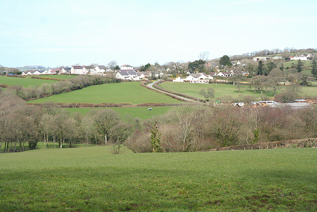
Odham Moor, located in Devon, England, is a vast expanse of downs and moorland, offering a picturesque and diverse landscape for visitors to explore. With an area spanning approximately 1,500 acres, it is a popular destination for outdoor enthusiasts, nature lovers, and those seeking a tranquil escape.

The moorland at Odham Moor boasts a rich variety of flora and fauna, making it an important habitat for many species. Visitors can expect to encounter heather, gorse, and bracken, which create a colorful tapestry across the landscape. The moorland is also home to a range of wildlife, including birds such as skylarks and meadow pipits, and small mammals like rabbits and voles.

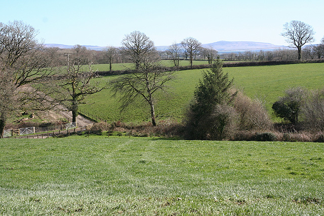
The downs at Odham Moor offer sweeping views of the surrounding countryside, with rolling hills and valleys as far as the eye can see. This area is perfect for leisurely walks and picnics, allowing visitors to soak in the beauty of the natural surroundings. The downs are also a popular spot for birdwatching, as they provide an ideal vantage point to observe various species in flight.

In addition to its natural beauty, Odham Moor has a rich cultural heritage. Ancient burial mounds and stone circles can be found scattered across the moorland, providing insight into its historical significance. Visitors interested in history and archaeology will find much to explore and learn about in this unique landscape.

Overall, Odham Moor is a captivating destination that offers a blend of natural beauty, biodiversity, and cultural heritage. Whether it's a leisurely stroll, birdwatching, or delving into the area's rich history, visitors to Odham Moor are sure to be captivated by its charm and tranquility.

If you have any feedback on the listing, please let us know in the comments section below.
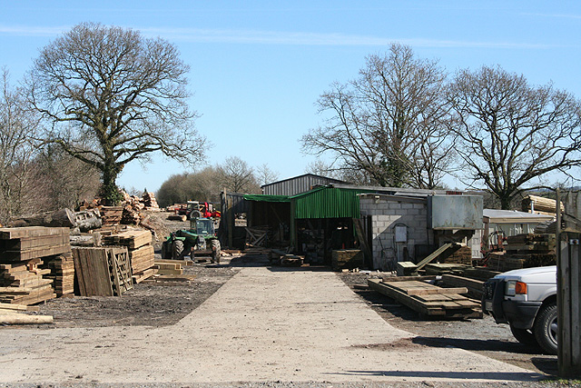
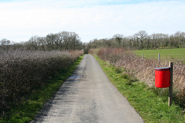
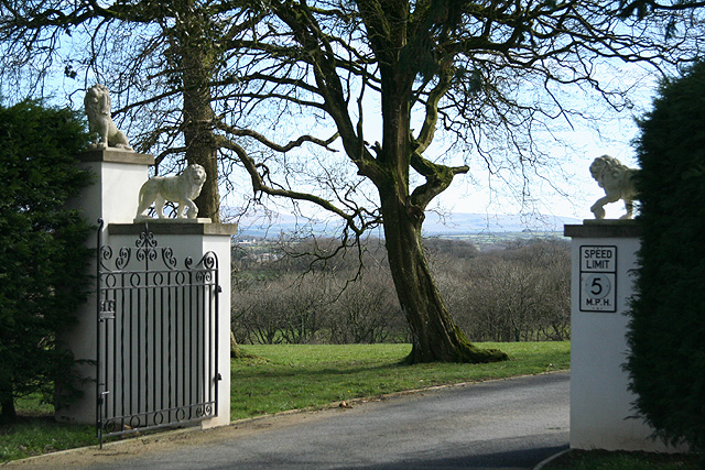
Odham Moor Images

Images are sourced within 2km of 50.798334/-4.1590024 or Grid Reference SS4702. Thanks to Geograph Open Source API. All images are credited.

Highampton: sawmill Petrock Timber’s sawmill sits on the course of the North Devon & Cornwall Junction Light Railway. Looking east
Highampton: sawmill
Petrock Timber’s sawmill sits on the course of the North Devon & Cornwall Junction Light Railway. Looking east
Highampton: chapel graveyard Looking south-south-east across gravestones belonging to the Bible Christian chapel at West Lydacott. The adjoining chapel is now a private house
Highampton: chapel graveyard
Looking south-south-east across gravestones belonging to the Bible Christian chapel at West Lydacott. The adjoining chapel is now a private house
Highampton: New Farm By the entrance to the farm which now operates as Oakwood Kennels and Cattery
Highampton: New Farm
By the entrance to the farm which now operates as Oakwood Kennels and Cattery
Highampton: near New Farm Looking north west towards a wood
Highampton: near New Farm
Looking north west towards a wood
Highampton: cycleway On the course of the North Devon & Cornwall Junction Light Railway. Looking west-north-west. The old trackbed now serves as a cycle route from Highampton to Black Torrington, avoiding the A3072 road
Highampton: cycleway
On the course of the North Devon & Cornwall Junction Light Railway. Looking west-north-west. The old trackbed now serves as a cycle route from Highampton to Black Torrington, avoiding the A3072 road
Highampton: by Odham Looking south east towards Stewdon Moor with Dartmoor on the horizon
Highampton: by Odham
Looking south east towards Stewdon Moor with Dartmoor on the horizon
Highampton: Burdon Grange The entrance to Burdon Grange with Dartmoor on the horizon. Looking south east
Highampton: Burdon Grange
The entrance to Burdon Grange with Dartmoor on the horizon. Looking south east
Highampton: towards the village The hedge running horizontally across the field below the village indicates the course of the Great Torrington - Halwill Junction Light Railway which has more recently become a cycle track linking Highampton with Black Torrington
Highampton: towards the village
The hedge running horizontally across the field below the village indicates the course of the Great Torrington - Halwill Junction Light Railway which has more recently become a cycle track linking Highampton with Black Torrington
Field boundary near Birchen What appears to be a wood is in fact a 25-metre-wide belt of trees, running between improved grassland such as this field, and unimproved pasture on Stewdon Moor.
Field boundary near Birchen
What appears to be a wood is in fact a 25-metre-wide belt of trees, running between improved grassland such as this field, and unimproved pasture on Stewdon Moor.
Hollow Moor Northlew Bridleway 25 crosses this large area of Culm grassland on the south side of Wagaford Water, but there is no access where shown on the map. This gate is at a possible access point near Wagaford Bridge.
Hollow Moor
Northlew Bridleway 25 crosses this large area of Culm grassland on the south side of Wagaford Water, but there is no access where shown on the map. This gate is at a possible access point near Wagaford Bridge.
Hollow Moor This is the heart of Hollow Moor, damp Culm grassland with scattered trees (mostly sallow and birch), some gorse, and much sedge. The trees on the right border Wagaford Water. Taken not very near the line of Northlew Bridleway 25.
Hollow Moor
This is the heart of Hollow Moor, damp Culm grassland with scattered trees (mostly sallow and birch), some gorse, and much sedge. The trees on the right border Wagaford Water. Taken not very near the line of Northlew Bridleway 25.
By Wagaford Water At the northern edge of Hollow Moor, the stream runs amongst trees and, here, not far upstream from Wagaford Bridge, past a delightful stretch of shady grass.
By Wagaford Water
At the northern edge of Hollow Moor, the stream runs amongst trees and, here, not far upstream from Wagaford Bridge, past a delightful stretch of shady grass.
Hollow Moor Birches and sallows grow on the left along the line of a drain.
Hollow Moor
Birches and sallows grow on the left along the line of a drain.
Lane past Hollow Moor The lane forms the eastern boundary of Hollow Moor. Somewhere along this straight stretch of road (from Holstock Cross to Highampton) there should be access to Northlew Bridleway 25, which heads across the moor to the left, but nothing is marked.
Lane past Hollow Moor
The lane forms the eastern boundary of Hollow Moor. Somewhere along this straight stretch of road (from Holstock Cross to Highampton) there should be access to Northlew Bridleway 25, which heads across the moor to the left, but nothing is marked.
Field access track The entrance to this track can be detected on the right in <a href="https://www.geograph.org.uk/photo/494759">SS4801 : Lane past Hollow Moor</a>, leading past a double line of trees to a field on the east side of Hollow Moor.
Field access track
The entrance to this track can be detected on the right in SS4801 : Lane past Hollow Moor, leading past a double line of trees to a field on the east side of Hollow Moor.
Wagaford Bridge The lane to Highampton crosses the Wagaford Water in heavy shade after crossing the edge of Hollow Moor and emerges into bright sunlight.
Wagaford Bridge
The lane to Highampton crosses the Wagaford Water in heavy shade after crossing the edge of Hollow Moor and emerges into bright sunlight.
Wagaford Water Looking downstream from <a href="https://www.geograph.org.uk/photo/494905">SS4801 : Wagaford Bridge</a>. Immediately below the bridge is a small weir and a fallen tree.
Wagaford Water
Looking downstream from SS4801 : Wagaford Bridge. Immediately below the bridge is a small weir and a fallen tree.
Trees alongside Stewdon Moor From the same spot as <a href="https://www.geograph.org.uk/photo/488963">SS4902 : Field boundary near Birchen</a>, this looks into the (shelter?) belt of trees that runs along the edge of the field.
Trees alongside Stewdon Moor
From the same spot as SS4902 : Field boundary near Birchen, this looks into the (shelter?) belt of trees that runs along the edge of the field.
Show me another place!

Odham Moor is located at Grid Ref: SS4702 (Lat: 50.798334, Lng: -4.1590024)

Administrative County: Devon

District: West Devon

Police Authority: Devon and Cornwall

What 3 Words

///suspends.steroids.closet. Near Hatherleigh, Devon

Nearby Locations

Odham Odham Moor

Related Wikis

Odham

Odham is a village in Devon, England.

Hole railway station

Hole Railway Station was a small halt on the North Devon and Cornwall Junction Light Railway in the U.K. between Torrington and Halwill Junction, serving...

Highampton

Highampton is a parish in Devon spread over approx. 4½ miles. It stands on a ridge with views of Dartmoor and Exmoor. Highampton is about 10 miles from...

Black Torrington

Black Torrington is a village and civil parish in Torridge, Devon, England, situated between the towns of Holsworthy and Hatherleigh. It is located on...

Have you been to Odham Moor?

Leave your review of Odham Moor below (or comments, questions and feedback).