Braes of Balquhidder

Downs, Moorland in Perthshire

Scotland

Braes of Balquhidder

Grass track that gives access to woodland and the slopes of Stob Coire an Lochain Looking north-westward,
Grass track that gives access to woodland and the slopes of Stob Coire an Lochain Credit: Peter Wood

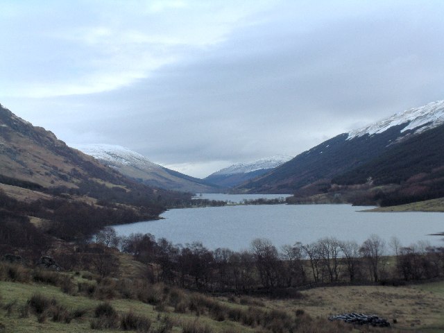
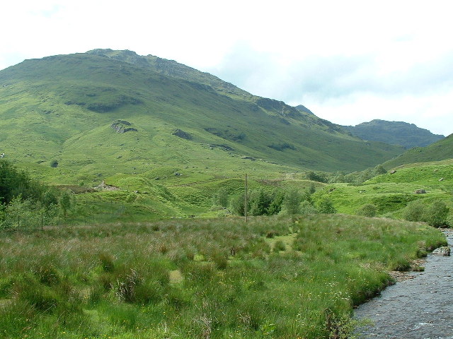
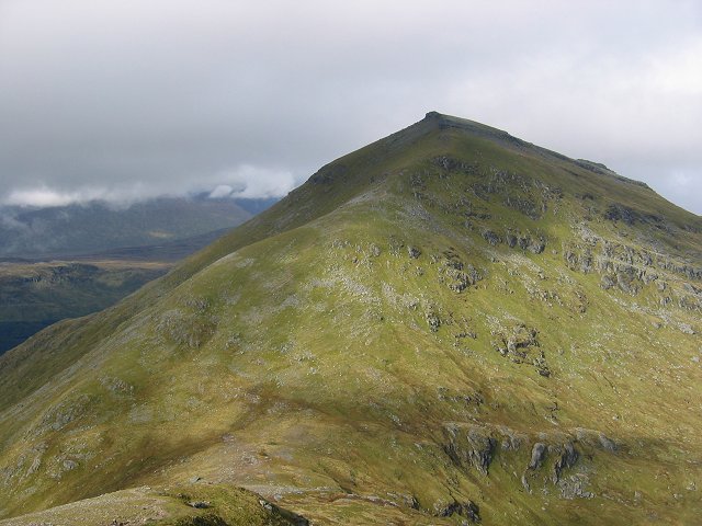
The Braes of Balquhidder is a picturesque region located in Perthshire, Scotland. Nestled within the stunning Scottish Highlands, it is a place of natural beauty and charm. The braes, or hills, of Balquhidder are known for their rugged and wild landscape, characterized by rolling moorlands and expansive downs.

Covered in heather and gorse, the moorlands of Balquhidder provide a rich and diverse habitat for a variety of wildlife. Visitors to this area can expect to see an array of bird species, such as red grouse and golden eagles, as well as deer and other mammals that roam freely across the downs. The landscape is dotted with lochs and rivers, adding to the scenic beauty of the region.

Aside from its natural wonders, the Braes of Balquhidder is also steeped in history. It is famously associated with the legendary outlaw, Rob Roy MacGregor, who was born and buried in the nearby village of Balquhidder. The area is dotted with historical sites and landmarks, including Balquhidder Church, which dates back to the 17th century and is the final resting place of Rob Roy.

For outdoor enthusiasts, the Braes of Balquhidder offers ample opportunities for hiking, cycling, and wildlife spotting. There are numerous trails and paths that wind through the moorlands, providing breathtaking views of the surrounding mountains and valleys. Whether it's exploring the historical sites, immersing oneself in nature, or simply enjoying the tranquility of the Scottish countryside, the Braes of Balquhidder is a destination that captivates the hearts of all who visit.

If you have any feedback on the listing, please let us know in the comments section below.

Braes of Balquhidder Images

Images are sourced within 2km of 56.342194/-4.509837 or Grid Reference NN4419. Thanks to Geograph Open Source API. All images are credited.

Grass track that gives access to woodland and the slopes of Stob Coire an Lochain Looking north-westward,
Grass track that gives access to woodland and the slopes of Stob Coire an Lochain
Looking north-westward,
Allt Carnaig heading into Loch Doine Looking south-eastward from the road bridge at Imirriabhach.
Allt Carnaig heading into Loch Doine
Looking south-eastward from the road bridge at Imirriabhach.
End of the public road at Inverlochlairg Looking westward.
End of the public road at Inverlochlairg
Looking westward.
Rough pastureland beside the River Larig Looking south-eastward towards Invernenty.
Rough pastureland beside the River Larig
Looking south-eastward towards Invernenty.
Estate track near Inverlochlarig The lower slopes of Beinn Tulaichean can be seen in the background.
Estate track near Inverlochlarig
The lower slopes of Beinn Tulaichean can be seen in the background.
Burial Ground west of Loch Doine The small, disused burial ground is walled and described by the Canmore website as being at Imirriabhach. The same source states that only one gravestone is visible there:
<span class="nowrap"><a title="https://canmore.org.uk/site/23937/loch-doine-imirriabhach-burial-ground" rel="nofollow ugc noopener" href="https://canmore.org.uk/site/23937/loch-doine-imirriabhach-burial-ground">Link</a><img style="margin-left:2px;" alt="External link" title="External link - shift click to open in new window" src="https://s1.geograph.org.uk/img/external.png" width="10" height="10"/></span> .
Burial Ground west of Loch Doine
The small, disused burial ground is walled and described by the Canmore website as being at Imirriabhach. The same source states that only one gravestone is visible there: LinkExternal link .
Trees along course of River Larig The River Larig drains the upper glen in which Balquhidder is located, its water running into Loch Doine. The trees along the valley flatness appear to be still leafless in this image from early April, 1996.
Stob a' Choin is the snowy mountain, its summit being on the farthest ridge.
Trees along course of River Larig
The River Larig drains the upper glen in which Balquhidder is located, its water running into Loch Doine. The trees along the valley flatness appear to be still leafless in this image from early April, 1996. Stob a' Choin is the snowy mountain, its summit being on the farthest ridge.
 View across Loch Doine towards Stob Breac and Stob a' Choin A moment to relax after giving up a hill walk up Ben More.
View across Loch Doine towards Stob Breac and Stob a' Choin
A moment to relax after giving up a hill walk up Ben More.
Climb up Stob Invercarnaig The River Larig runs into Loch Doine
Climb up Stob Invercarnaig
The River Larig runs into Loch Doine
Above Creag Artair Looking up Na Staidhrichean
Above Creag Artair
Looking up Na Staidhrichean
View from the summit of Meall Monachyle The peaks from left to right are:  Stob Coire an Lochan, Stob Binnein and on the right of the image, Meall na Dige
View from the summit of Meall Monachyle
The peaks from left to right are: Stob Coire an Lochan, Stob Binnein and on the right of the image, Meall na Dige
Inverlochlarig Glen Looking west from near Inverlochlarig Farm.
Inverlochlarig Glen
Looking west from near Inverlochlarig Farm.
Allt Sgionie Burn flowing down Glen Sgionie, south of Inverlochlarig Farm.
Allt Sgionie
Burn flowing down Glen Sgionie, south of Inverlochlarig Farm.
Inverlochlarig Glen Looking north from Inverlochlarig Farm.
Inverlochlarig Glen
Looking north from Inverlochlarig Farm.
Private road to Inverlochlarig Farm With an erratic boulder by the roadside.
Private road to Inverlochlarig Farm
With an erratic boulder by the roadside.
Bridge at Inverlochlarig
Boulders near Loch Doine Looking down the glen. Loch Voil is beyond Loch Doine.
Boulders near Loch Doine
Looking down the glen. Loch Voil is beyond Loch Doine.
Stile, Inverlochlarig An alternative approach to the Munros of Stob Binnein and Ben More.
Stile, Inverlochlarig
An alternative approach to the Munros of Stob Binnein and Ben More.
Show me another place!

Braes of Balquhidder is located at Grid Ref: NN4419 (Lat: 56.342194, Lng: -4.509837)

Unitary Authority: Stirling

Police Authority: Forth Valley

What 3 Words

///active.busters.grasp. Near Tyndrum, Stirling

Nearby Locations

Braes of Balquhidder

Related Wikis

Loch Doine

Loch Doine is a small freshwater loch that lies to the west of Balquhidder in the Trossachs and Teith ward within Stirling council area of Scotland. It...
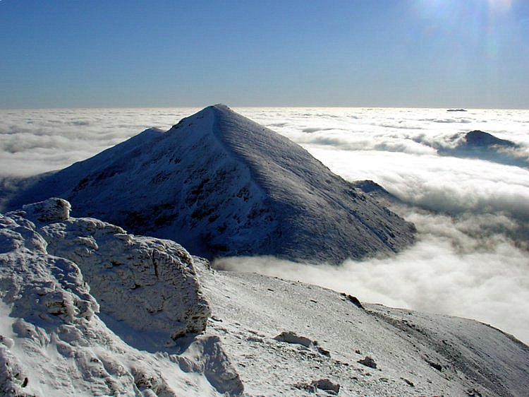
Crianlarich Hills

The Crianlarich Hills are a large group of mountains in Scotland, running east of Crianlarich and Loch Lomond, south of Strath Fillan and north of Loch...
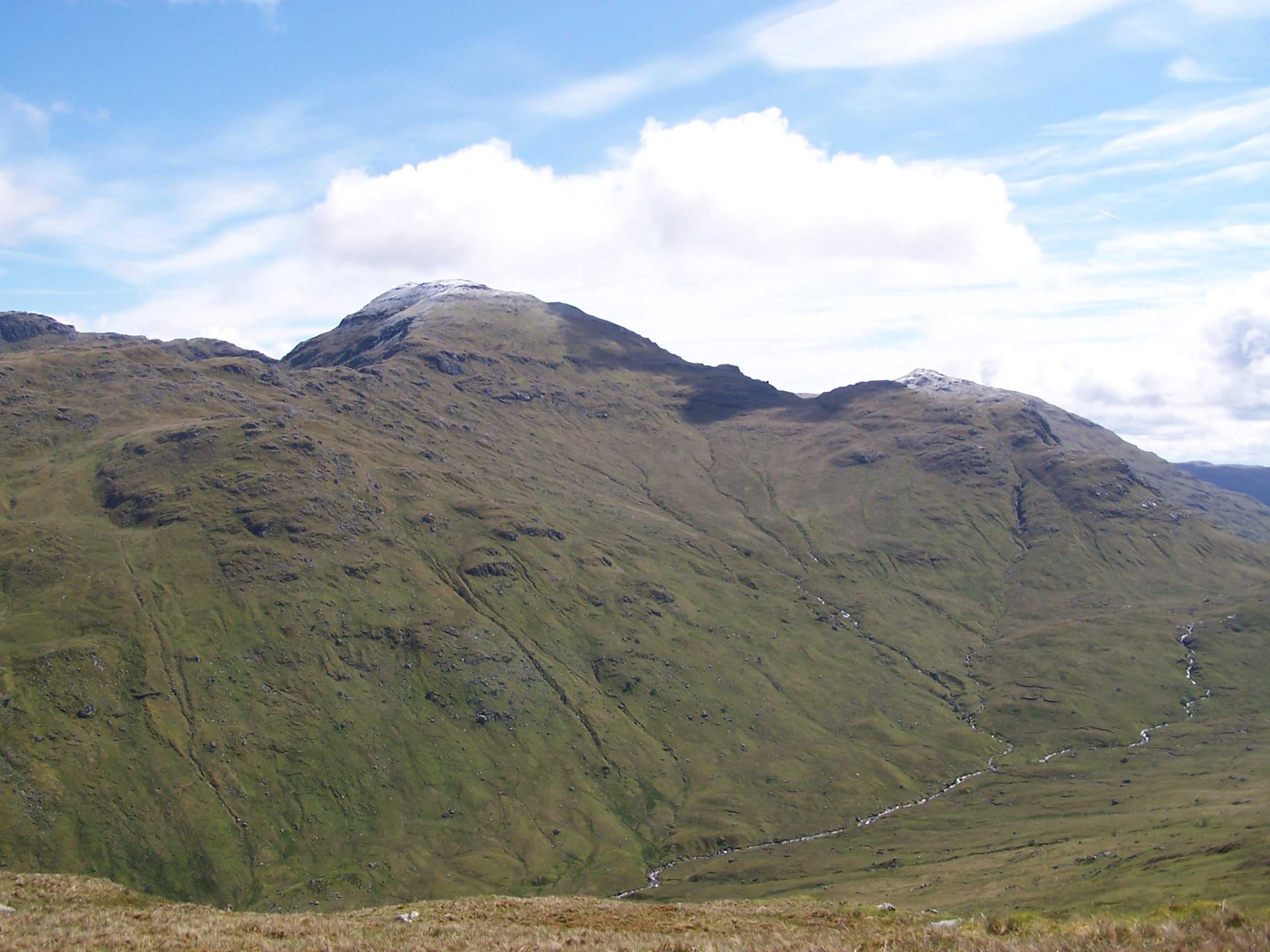
Beinn Tulaichean

Beinn Tulaichean is a Scottish mountain. It is not much more than the southern top of Cruach Ardrain, with a descent of only 120m before the ascent to...

Stob Binnein

Stob Binnein is a mountain in the southern Highlands of Scotland, near Crianlarich. It forms a twin-peak with Ben More 3,852 ft (1,174 m), from which it...

Cruach Ardrain

Cruach Ardrain is a Munro mountain in the Breadalbane region of the Scottish Highlands, with a height of 1,046 metres (3,432 feet). It is five kilometres...

Stob Garbh

Stob Garbh is a mountain in the Scottish Highlands. It is a Munro top located in the Breadalbane area of Loch Lomond and the Trossachs National Park.

Stob a' Choin

Stob a'Choin (869 m) is a mountain in the Grampian Mountains, Scotland, north of Loch Katrine in the Loch Lomond and The Trossachs National Park. The nearest...

Ben More (Crianlarich)

Ben More (Scottish Gaelic: Beinn Mhòr, "the great mountain") is a mountain in the Breadalbane region of the southern Scottish Highlands, near Crianlarich...

Have you been to Braes of Balquhidder?

Leave your review of Braes of Balquhidder below (or comments, questions and feedback).