Borrow Moss

Downs, Moorland in Wigtownshire

Scotland

Borrow Moss

Tractor on the horizon North of Wigtown
Tractor on the horizon Credit: Eirian Evans

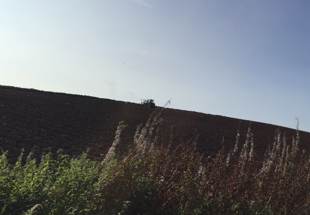
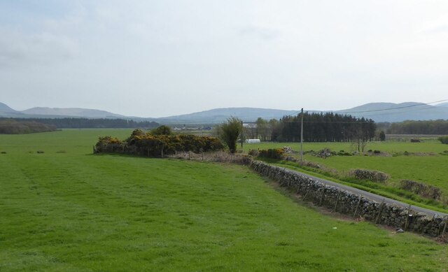
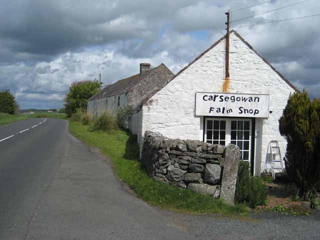
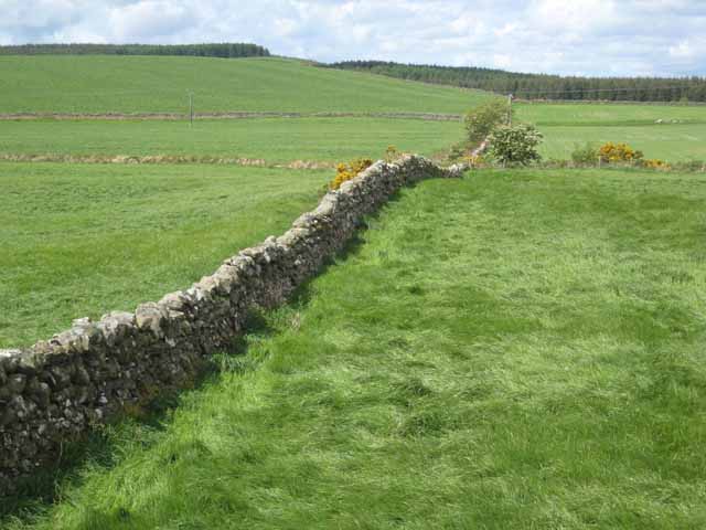
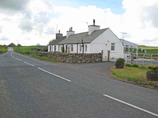
Borrow Moss is a vast expanse of downs and moorland located in Wigtownshire, Scotland. This area covers several square miles and is known for its unique and diverse ecological features. The moss is characterized by a combination of wetlands, peat bogs, and heathland, making it an important habitat for a variety of wildlife and plant species.

The moss is primarily composed of peat, which has been formed over thousands of years due to the accumulation of decomposing plant material. This peatland acts as a natural carbon sink, playing a crucial role in mitigating climate change by capturing and storing carbon dioxide from the atmosphere.

The landscape of Borrow Moss is characterized by rolling hills and open expanses, providing panoramic views of the surrounding countryside. The area is dotted with small lochs and ponds, creating a mosaic of habitats that support a rich biodiversity. Birdwatchers frequent the moss, as it is home to a number of rare and elusive species, including hen harriers, merlins, and short-eared owls.

Access to Borrow Moss is limited, as it is largely an untouched and protected area. However, there are designated paths and trails for visitors to explore the moss while minimizing their impact on the environment. The moss is also a popular destination for outdoor enthusiasts, offering opportunities for hiking, birdwatching, and photography.

In conclusion, Borrow Moss in Wigtownshire is a unique and ecologically important area, characterized by its diverse landscape and rich biodiversity. It serves as a natural carbon sink and provides a sanctuary for a variety of wildlife species, making it a valuable asset to both the local community and the environment.

If you have any feedback on the listing, please let us know in the comments section below.

Borrow Moss Images

Images are sourced within 2km of 54.891185/-4.4468308 or Grid Reference NX4357. Thanks to Geograph Open Source API. All images are credited.

Tractor on the horizon North of Wigtown
Tractor on the horizon
North of Wigtown
Road to Carslae Crossing The crossing was over the Portpatrick and Wigtownshire Joint Railway here heading to Newton Stewart.
Road to Carslae Crossing
The crossing was over the Portpatrick and Wigtownshire Joint Railway here heading to Newton Stewart.
Moss of Cree, Barsalloch
Road, Moss of Cree Passing Barsalloch with Wigtown in the distance.
Road, Moss of Cree
Passing Barsalloch with Wigtown in the distance.
Bishop Burn Upstream from Bishop Bridge.
Bishop Burn
Upstream from Bishop Bridge.
Bishop Burn A tidal creek amongst the saltmarshes of the Cree estuary.
Bishop Burn
A tidal creek amongst the saltmarshes of the Cree estuary.
Borrowmoss
Borrowmoss
Sheep, Borrowmoss
Sheep, Borrowmoss
South from Borrowmoss Bridge Borrowmoss Bridge once crossed the Wigtownshire Railway which served the Machars and a ferry to the Isle of Man. The trackbed has been erased in the field but can be seen as the line of trees in the distance.
South from Borrowmoss Bridge
Borrowmoss Bridge once crossed the Wigtownshire Railway which served the Machars and a ferry to the Isle of Man. The trackbed has been erased in the field but can be seen as the line of trees in the distance.
Crossing Borrowmoss Bridge
Wigtownshire Railway trackbed North of Borrowmoss Bridge.
Wigtownshire Railway trackbed
North of Borrowmoss Bridge.
Borrow Moss Carse land near Wigtown.
Borrow Moss
Carse land near Wigtown.
Old milestone 4 miles from Newton Stewart, 3 to Wigtown, another of the quadrant shaped milestones on this route.
Old milestone
4 miles from Newton Stewart, 3 to Wigtown, another of the quadrant shaped milestones on this route.
Old milestone This milestone is so close to the road edge and it looks as if vehicles have almost caught it.  Lorries, delivery vans, camper vans and caravans all travel along this quite narrow, busy road.  2 miles to Wigtown but the 1 mile milestone has not been found.  Nice plants in the garden.
Old milestone
This milestone is so close to the road edge and it looks as if vehicles have almost caught it. Lorries, delivery vans, camper vans and caravans all travel along this quite narrow, busy road. 2 miles to Wigtown but the 1 mile milestone has not been found. Nice plants in the garden.
Borrowmoss Burn nr Wigtown from Borrowmoss Bridge The burn joins up with the Bishops Burn where it's canalised until it runs into the River Cree
Borrowmoss Burn nr Wigtown from Borrowmoss Bridge
The burn joins up with the Bishops Burn where it's canalised until it runs into the River Cree
Carsegowan On the A714 Newton Stewart to Wigtown road. Once a farm shop, but obviously no longer trading.
Carsegowan
On the A714 Newton Stewart to Wigtown road. Once a farm shop, but obviously no longer trading.
Wall near Carsegowan Seen from the A714 Newton Stewart to Wigtown road. The Wood of Auchleand can be seen in the background.
Wall near Carsegowan
Seen from the A714 Newton Stewart to Wigtown road. The Wood of Auchleand can be seen in the background.
Culquhirk A couple of cottages on the B7005 which is effectively a by-pass for Wigtown. Located at the junction with the main A714 which goes into Wigtown before continuing on to Whithorn.
Culquhirk
A couple of cottages on the B7005 which is effectively a by-pass for Wigtown. Located at the junction with the main A714 which goes into Wigtown before continuing on to Whithorn.
Show me another place!

Borrow Moss is located at Grid Ref: NX4357 (Lat: 54.891185, Lng: -4.4468308)

Unitary Authority: Dumfries and Galloway

Police Authority: Dumfries and Galloway

What 3 Words

///throat.bearings.panoramic. Near Newton Stewart, Dumfries & Galloway

Nearby Locations

Borrow Moss

Related Wikis

Causeway End railway station

Causeway End (NX 42047 59602) or Causwayend was a railway station on the Wigtownshire Railway branch line, from Newton Stewart to Whithorn, of the Portpatrick...

Wigtown

Wigtown ( (both used locally); Scottish Gaelic: Baile na h-Ùige) is a town and former royal burgh in Wigtownshire, of which it is the county town, within...

Wigtown County Buildings

Wigtown County Buildings, also known as Wigtown County Buildings and Town Hall, is a municipal building in The Square, Wigtown, Scotland. The structure...

Blackfriars, Wigtown

The Church of the Friars Preachers of the Annunciation of the Blessed Virgin Mary at Wigtown, commonly called Blackfriars, was a mendicant friary of the...

Wigtown & Bladnoch F.C.

Wigtown & Bladnoch Football Club are a football club from the town of Wigtown in the Dumfries and Galloway area of Scotland, who play in the South of Scotland...

Wigtown Castle

Wigtown Castle was a royal castle that was located on the banks of the River Bladnoch, south of Wigtown in Dumfries and Galloway, Scotland.A castle was...

Wigtown railway station

Wigtown was a railway station on the Wigtownshire Railway branch line, from Newton Stewart to Whithorn, of the Portpatrick and Wigtownshire Joint Railway...

Bladnoch, Wigtownshire

Bladnoch (Scottish Gaelic: Blaidneach) is a small village on the River Bladnoch in Wigtownshire, Scotland, located just outside the county town of Wigtown...

Nearby Amenities

Located within 500m of 54.891185,-4.4468308
Power: pole
Lat/Long: 54.889002/-4.4400154
Power: pole
Lat/Long: 54.8926865/-4.4396953
Power: pole
Lat/Long: 54.8894918/-4.4534395
Power: pole
Lat/Long: 54.8892106/-4.4523045
Power: pole
Lat/Long: 54.8889305/-4.4511889
Power: pole
Lat/Long: 54.8886493/-4.4500714
Power: pole
Lat/Long: 54.8883636/-4.4489461
Power: pole
Lat/Long: 54.8880802/-4.4478188
Power: pole
Lat/Long: 54.8874039/-4.4471068
Power: pole
Lat/Long: 54.8867276/-4.446418
Power: pole
Lat/Long: 54.8945555/-4.4516235
Power: pole
Lat/Long: 54.8947853/-4.4503216
Power: pole
Lat/Long: 54.8949951/-4.4490625
Power: pole
Lat/Long: 54.8952026/-4.4478285
Power: pole
Lat/Long: 54.8954235/-4.4465693
Power: pole
Lat/Long: 54.8909226/-4.4393835
Power: pole
Lat/Long: 54.8899605/-4.4397
Power: pole
Lat/Long: 54.8917818/-4.4395353
The data included in this document is from www.openstreetmap.org. The data is made available under ODbL.

Have you been to Borrow Moss?

Leave your review of Borrow Moss below (or comments, questions and feedback).