Bad na Buige

Downs, Moorland in Perthshire

Scotland

Bad na Buige

Cairn and summit plateau on Beinn Sheasgarnaich
Cairn and summit plateau on Beinn Sheasgarnaich Credit: Steven Brown

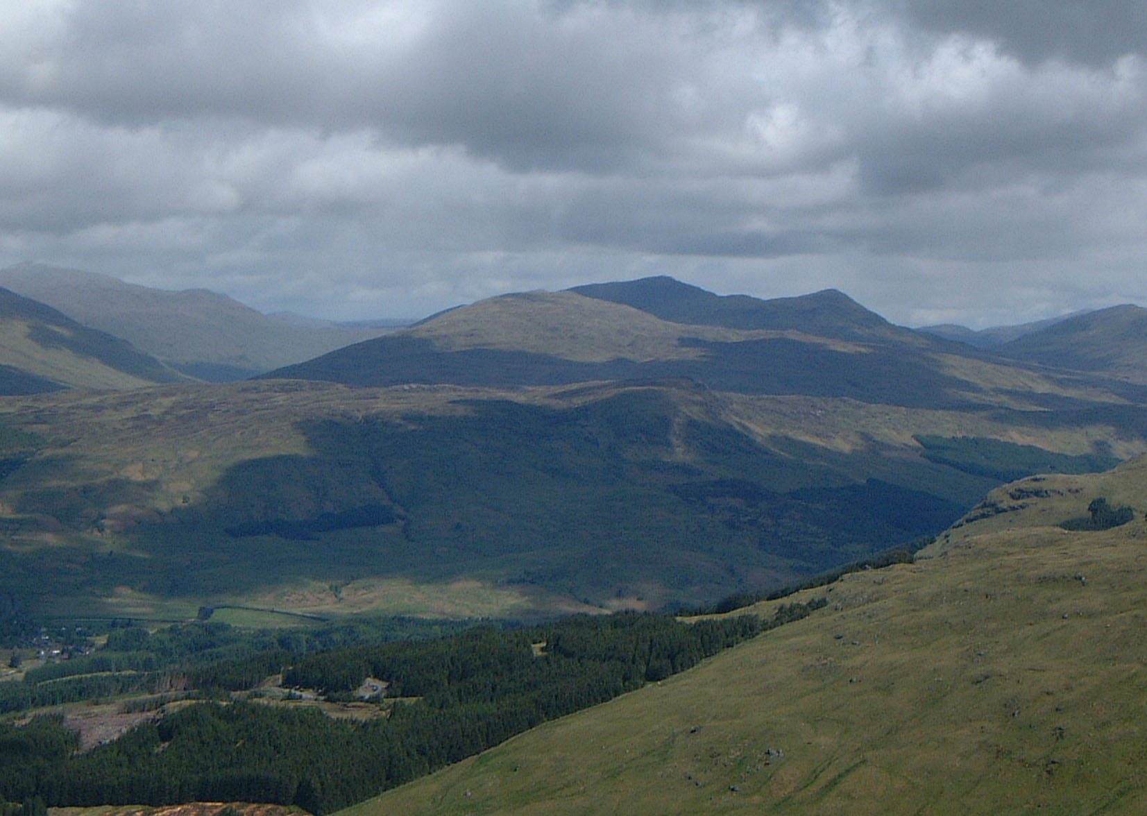
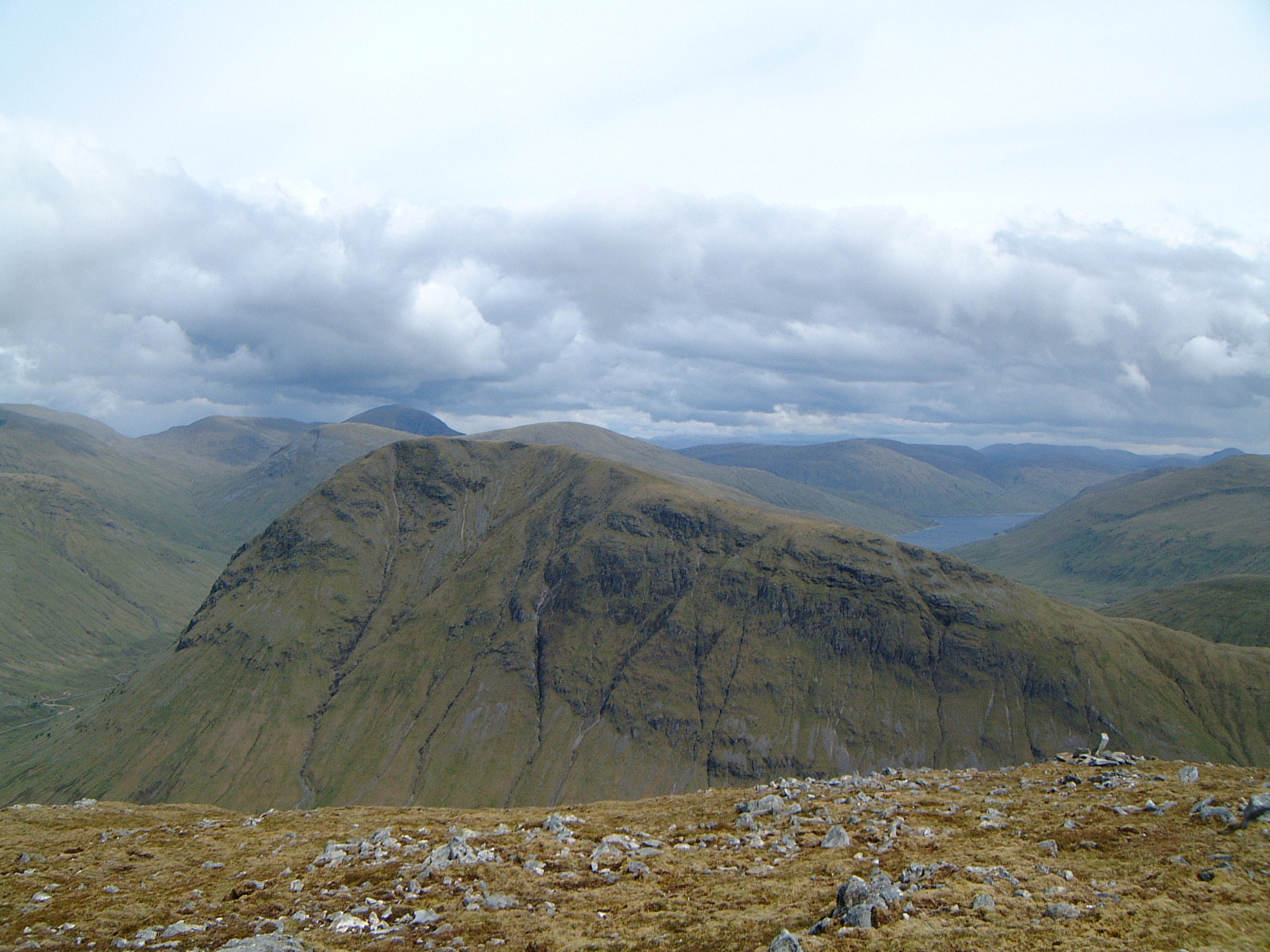
Bad na Buige is a scenic area located in Perthshire, Scotland, known for its stunning downs and moorland landscapes. Situated amidst the picturesque countryside, it attracts visitors with its natural beauty and tranquil atmosphere.

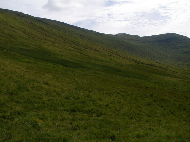
The downs of Bad na Buige are characterized by gently rolling hills and open grasslands, offering breathtaking panoramic views of the surrounding countryside. This serene setting is ideal for outdoor enthusiasts, providing ample opportunities for walking, hiking, and picnicking. The downs are also home to a variety of wildlife, including birds, deer, and rabbits, making it a popular spot for nature lovers and birdwatchers.

Adjacent to the downs, the moorland of Bad na Buige offers a rugged and wild environment. Covered in heather and grasses, the moorland offers a unique and dramatic landscape. Visitors can explore the moors on foot, immersing themselves in the peaceful solitude of this remote area. The moorland is also home to various species of plants and animals, including the iconic Scottish Highland cattle.

Bad na Buige is easily accessible, located just a short drive from the town of Perth. Its proximity to urban areas makes it a popular destination for day trips and weekend getaways. Visitors can enjoy a leisurely stroll along the downs, taking in the sweeping vistas, or venture into the moorland for a more adventurous experience.

In summary, Bad na Buige in Perthshire is a captivating destination known for its downs and moorland landscapes. With its natural beauty and tranquility, it offers a perfect escape from the hustle and bustle of everyday life.

If you have any feedback on the listing, please let us know in the comments section below.
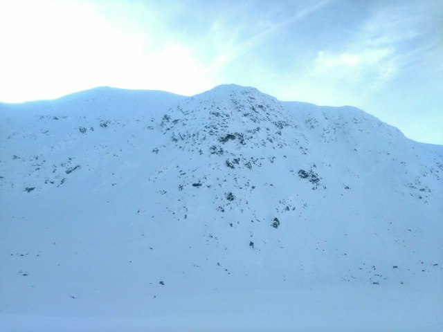
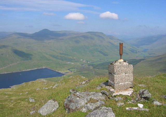
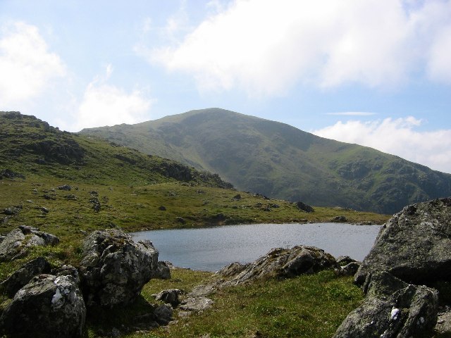
Bad na Buige Images

Images are sourced within 2km of 56.522156/-4.5731257 or Grid Reference NN4139. Thanks to Geograph Open Source API. All images are credited.

Cairn and summit plateau on Beinn Sheasgarnaich
Approaching the summit cairn on Beinn Heasgarnich
On Beinn Heasgarnich - snowfields on eastern slopes
Headwall Coire Sheasgarnaich Headwall of Coire Sheasgarnaich from the north.
Headwall Coire Sheasgarnaich
Headwall of Coire Sheasgarnaich from the north.
Ski track down into Coire Sheasgarnaich My ski tracks down into Coire Sheasgarnaich, looking back up to ridge and 949m point. Lots of snow!
Ski track down into Coire Sheasgarnaich
My ski tracks down into Coire Sheasgarnaich, looking back up to ridge and 949m point. Lots of snow!
Allt Tarsuinn below Creag na h-Achlarich The Allt Tarsuinn drains the eastern side of the Munro, Beinn Sheasgarnaich, previously named on maps as Beinn Heasgarnaich. The broken ground of Creag na h-Achlarich rises to the left, mainly out of the image.
Allt Tarsuinn below Creag na h-Achlarich
The Allt Tarsuinn drains the eastern side of the Munro, Beinn Sheasgarnaich, previously named on maps as Beinn Heasgarnaich. The broken ground of Creag na h-Achlarich rises to the left, mainly out of the image.
The lower slopes of Stob Garbh-Leachtir
Beinn Heasgarnich Also spelt Beinn Sheasgarnich, although the initial S rarely appears in the hill literature.  A view of the bulky hill from Creag Mhòr. The usual connecting route is across the bog and up the long Sròn Tairbh ridge (centre of the photograph).
Beinn Heasgarnich
Also spelt Beinn Sheasgarnich, although the initial S rarely appears in the hill literature. A view of the bulky hill from Creag Mhòr. The usual connecting route is across the bog and up the long Sròn Tairbh ridge (centre of the photograph).
Beinn Sheasgarnaich (Beinn Heasgarnaich) 1078m/579m hill of great bulk, but with a fine looking northern corrie, Coire Sheasgarnaich
Beinn Sheasgarnaich (Beinn Heasgarnaich)
1078m/579m hill of great bulk, but with a fine looking northern corrie, Coire Sheasgarnaich
Heavy snow cover, Beinn Sheasgarnaich The frequent Atlantic storms which have brought heavy rain and flooding to low ground this winter have brought frequent blizzards and large snow accumulations to the Scottish mountains.

Beinn Sheasgarnaich's Coire Bàn Mòr is often the last site in Perthshire to hold snow each year, with the last snowdrift remnants usually melting in early to mid summer.

Beinn Sheasgarnaich ('peaceful or sheltering mountain') is usually known as Beinn Heasgarnich, but the Ordnance Survey has recently altered the name on the map to the apparently more correct Gaelic.
Heavy snow cover, Beinn Sheasgarnaich
The frequent Atlantic storms which have brought heavy rain and flooding to low ground this winter have brought frequent blizzards and large snow accumulations to the Scottish mountains. Beinn Sheasgarnaich's Coire Bàn Mòr is often the last site in Perthshire to hold snow each year, with the last snowdrift remnants usually melting in early to mid summer. Beinn Sheasgarnaich ('peaceful or sheltering mountain') is usually known as Beinn Heasgarnich, but the Ordnance Survey has recently altered the name on the map to the apparently more correct Gaelic.
Creag na h-Achlarich Crags on Beinn Heasgarnich covered in glazed snow.
Creag na h-Achlarich
Crags on Beinn Heasgarnich covered in glazed snow.
Moine Achlarich A boggy plateau on Beinn Heasgarnich
Moine Achlarich
A boggy plateau on Beinn Heasgarnich
On Meall a'Chail The pillar was used to survey the construction of the Lyon dam below. View down to Loch Lyon, Pubil, and Stuichd an Lochain.
On Meall a'Chail
The pillar was used to survey the construction of the Lyon dam below. View down to Loch Lyon, Pubil, and Stuichd an Lochain.
Lochside Track This photo is looking west over Loch Lyon from the track on the south side of the loch. The hill on the right is Beinn Chreachain. On the left Beinn Mhanach. The distant notch in the centre of the skyline is the north face of Beinn An Dothaidh.
  Of note for anyone visiting this area is that despite not being shown on current maps there is now a track all the way round Loch Lyon. The track on the south side is excellent and suitable for cycling.
Lochside Track
This photo is looking west over Loch Lyon from the track on the south side of the loch. The hill on the right is Beinn Chreachain. On the left Beinn Mhanach. The distant notch in the centre of the skyline is the north face of Beinn An Dothaidh. Of note for anyone visiting this area is that despite not being shown on current maps there is now a track all the way round Loch Lyon. The track on the south side is excellent and suitable for cycling.
Around Loch Lyon on a misty day This is typical of the grassy hills surrounding Loch Lyon.
Around Loch Lyon on a misty day
This is typical of the grassy hills surrounding Loch Lyon.
Southern reaches of Loch Lyon The rounded hill is Beinn nam Fhuaran (806m) with Beinn Dorain (1076m) beyond.
Southern reaches of Loch Lyon
The rounded hill is Beinn nam Fhuaran (806m) with Beinn Dorain (1076m) beyond.
Open gates on the estate track above Loch Lyon
Allt Sheasgarnaich
Allt Sheasgarnaich
Show me another place!

Bad na Buige is located at Grid Ref: NN4139 (Lat: 56.522156, Lng: -4.5731257)

Unitary Authority: Perth and Kinross

Police Authority: Tayside

What 3 Words

///scouting.book.printouts. Near Pubil, Perth & Kinross

Related Wikis

Beinn Heasgarnich

Beinn Heasgarnich (Scottish Gaelic: Beinn Sheasgarnaich) is a mountain in the Breadalbane region of the Scottish Highlands. It lies about 2 km south of...

Loch Lyon

Loch Lyon (Scottish Gaelic, Loch Lìobhann) is a freshwater loch in Glen Lyon, located in Perthshire, Scotland, which feeds the River Lyon, a tributary...

Beinn Mhanach

Beinn Mhanach (Scottish Gaelic for 'monks' mountain'), also anglicized Ben Vannoch, is a mountain in the Breadalbane region of the Scottish Highlands....

Creag Mhòr

Creag Mhòr is a mountain in the Breadalbane region of the Scottish Highlands. It is in the Forest of Mamlorn, ten kilometres northeast of Tyndrum, and...

Meall Buidhe (Corbett)

Meall Buidhe is a Corbett situated in the southern highlands of Scotland. It forms part of the ridge line separating Glen Daimh, an offshoot of Glen Lyon...

Beinn a' Chreachain

Beinn a' Chreachain (lit. "Mountain of Scallops") is a Scottish mountain, with a conical top, to the north-west of Loch Lyon. == References == The Munros...

Meall Glas

Meall Glas is a mountain situated in the southern highlands of Scotland. It stands on the northern border of the Loch Lomond and the Trossachs National...

Beinn a' Chaisteil

Beinn a' Chaisteil is a mountain in the southern Highlands of Scotland, it is located 6.25 km north of Tyndrum on the border of Perth and Kinross and Argyll...

Have you been to Bad na Buige?

Leave your review of Bad na Buige below (or comments, questions and feedback).