Gwaunysgor

Settlement in Flintshire

Wales

Gwaunysgor
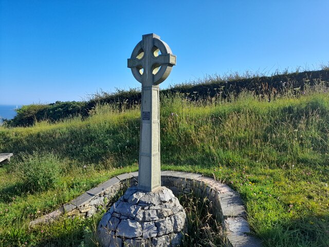
Celtic Style Cross on Gwaenysgor By the viewpoint car park.
Celtic Style Cross on Gwaenysgor Credit: David Bremner

The requested URL returned error: 429 Too Many Requests

If you have any feedback on the listing, please let us know in the comments section below.

Gwaunysgor Images

Images are sourced within 2km of 53.320497/-3.389345 or Grid Reference SJ0781. Thanks to Geograph Open Source API. All images are credited.
Celtic Style Cross on Gwaenysgor By the viewpoint car park.
Celtic Style Cross on Gwaenysgor
By the viewpoint car park.
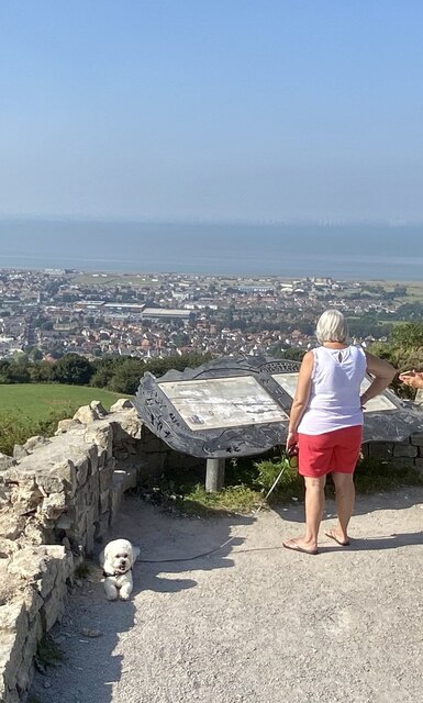
Viewpoint at Gwaenysgor Prestatyn and the Irish Sea in the distance.
Viewpoint at Gwaenysgor
Prestatyn and the Irish Sea in the distance.
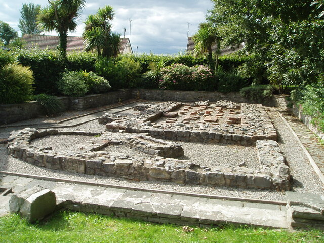
Remains of Roman Baths, Prestatyn Current thinking associates this with activities associated with the nearby lead mines.
Remains of Roman Baths, Prestatyn
Current thinking associates this with activities associated with the nearby lead mines.
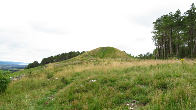
Approaching Gop Hill Cairn from the east Gop Hill is the second largest pre-historic man made mound in the United Kingdom after Silbury Hill in Wiltshire.
Approaching Gop Hill Cairn from the east
Gop Hill is the second largest pre-historic man made mound in the United Kingdom after Silbury Hill in Wiltshire.
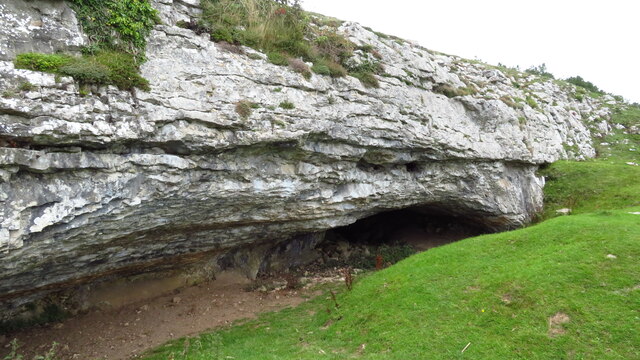
Gop Cave above Trelawnyd
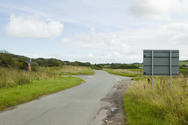
Crossroads near Gwaenysgor A reverse view of the first Geograph for this square: <a href="https://www.geograph.org.uk/photo/31116">SJ0780 : Gwaenysgor crossroads</a>
Crossroads near Gwaenysgor
A reverse view of the first Geograph for this square: SJ0780 : Gwaenysgor crossroads
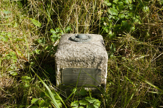
Fundamental Bench Mark, Bryniau Bench Mark Database: <span class="nowrap"><a title="https://www.bench-marks.org.uk/bm1054" rel="nofollow ugc noopener" href="https://www.bench-marks.org.uk/bm1054">Link</a><img style="margin-left:2px;" alt="External link" title="External link - shift click to open in new window" src="https://s1.geograph.org.uk/img/external.png" width="10" height="10"/></span>
Fundamental Bench Mark, Bryniau
Bench Mark Database: LinkExternal link
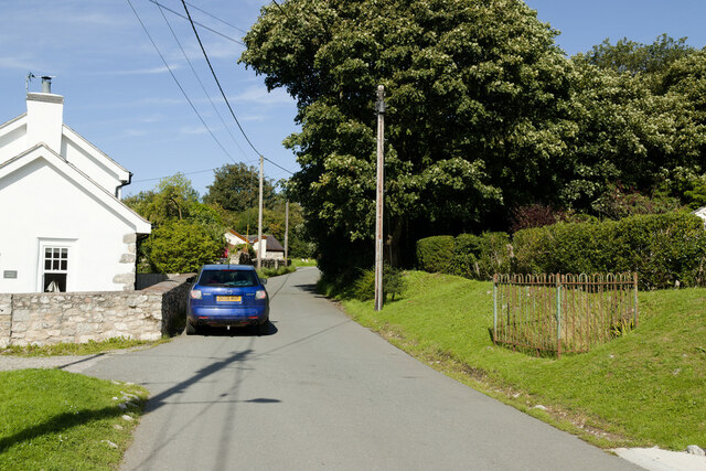
Lane in Bryniau Castle House is on the left. There is a fundamental bench mark behind the railings to the right of the photograph and a closer view can be seen here: <a href="https://www.geograph.org.uk/photo/7574290">SJ0680 : Fundamental Bench Mark, Bryniau</a>.
Lane in Bryniau
Castle House is on the left. There is a fundamental bench mark behind the railings to the right of the photograph and a closer view can be seen here: SJ0680 : Fundamental Bench Mark, Bryniau.
Lane near Gop Farm
Lane near Gop Farm
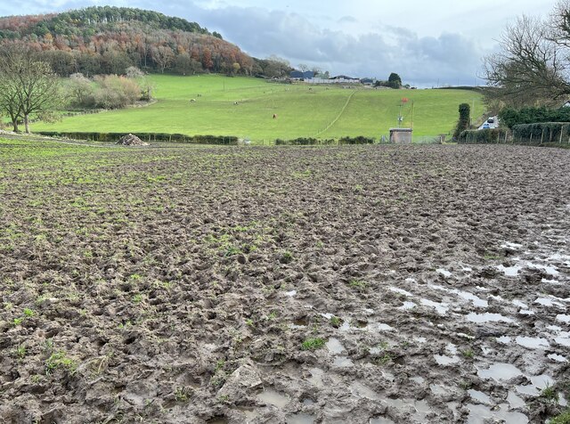
Impassable footpath through field An alternative route is required!
Impassable footpath through field
An alternative route is required!
Gop Farm & Moel Hiraddug from Gop Hill Cairn
Lane approaching Newmarket Road
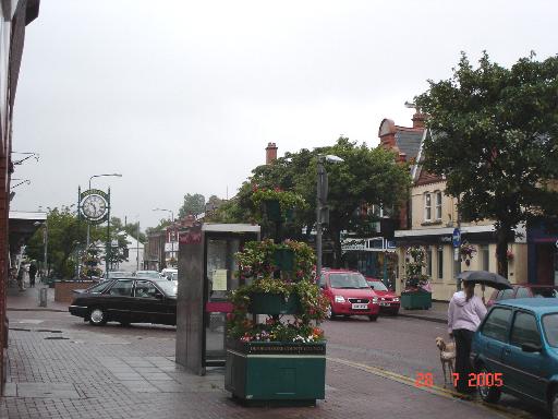
Prestatyn High  Street On a rainy July summer's day - Prestatyn High Street
Prestatyn High Street
On a rainy July summer's day - Prestatyn High Street
Red Lion and St. Melyd's hall at Meliden Pub and hall at the centre of the village of Meliden
Red Lion and St. Melyd's hall at Meliden
Pub and hall at the centre of the village of Meliden
Disused railway line at Meliden Disused railway bridge at Meliden
Disused railway line at Meliden
Disused railway bridge at Meliden
Gwaenysgor crossroads Crossroads midway between Gwaenysgor and Trelawnyd
Gwaenysgor crossroads
Crossroads midway between Gwaenysgor and Trelawnyd
Roadsigns at Prestatyn Hillside Viewpoint This panoramic viewpoint point gives spectacular views as far as the Isle of Man and Cumbria on a very clear day.
Roadsigns at Prestatyn Hillside Viewpoint
This panoramic viewpoint point gives spectacular views as far as the Isle of Man and Cumbria on a very clear day.
Quality housing in Upper Prestatyn The better quality housing in Prestatyn is found higher up the hill.
Quality housing in Upper Prestatyn
The better quality housing in Prestatyn is found higher up the hill.
Show me another place!

Gwaunysgor is located at Grid Ref: SJ0781 (Lat: 53.320497, Lng: -3.389345)

Unitary Authority: Flintshire

Police Authority: North Wales

Also known as: Gwaenysgor

What 3 Words

///serenade.intruders.jumpy. Near Prestatyn, Denbighshire

Related Wikis

Gwaenysgor

Gwaenysgor is a small village in Flintshire, Wales. Located near Prestatyn in north Wales, it lies at an elevation of 600 feet, 183 metres. There is one...

RAF Prestatyn

Royal Air Force Prestatyn or more simply RAF Prestatyn is a former Royal Air Force radar post situated near Prestatyn, in Denbighshire, north-east Wales...

St. Melyd Golf Links railway station

St. Melyd Golf Links railway station was a stop on Dyserth branch line (now a footpath). Passengers would have to access from the Gwaenysgor facing side...

Prestatyn Community Hospital

Prestatyn Community Hospital (Welsh: Ysbyty Cymunedol Prestatyn) was a community hospital in Prestatyn, Wales. It was managed by Betsi Cadwaladr University...

Nearby Amenities

Located within 500m of 53.320497,-3.389345
Barrier: stile
Foot: yes
Lat/Long: 53.3168088/-3.3925632
Barrier: stile
Foot: yes
Lat/Long: 53.3178581/-3.3908316
Barrier: kissing_gate
Foot: yes
Lat/Long: 53.3172688/-3.3910045
Barrier: kissing_gate
Foot: yes
Lat/Long: 53.3176726/-3.3910185
Bench
Lat/Long: 53.3180134/-3.3905047
Gwaenysgor
Place: village
Wikidata: Q20598745
Lat/Long: 53.3183456/-3.390403
Historic: village_pump
Lat/Long: 53.3184637/-3.3896291
Telephone
Defibrillator
Books: yes
Booth: K6
Covered: booth
Defibrillator Location: inside red phone box, in Gwaenysgor
Emergency: defibrillator
Man Made: telephone_box
Service Bicycle Pump: yes
Tourism: information
Lat/Long: 53.3186936/-3.3896993
Post Box
Post Box Type: wall
Royal Cypher: GVIR
Royal Cypher Wikidata: Q33102169
Lat/Long: 53.318664/-3.3899004
Bench
Lat/Long: 53.3222342/-3.3830531
Henry Judd survey marker stone
Historic: boundary_stone
Lat/Long: 53.3205174/-3.3920457
Man Made: mast
Tower Type: communication
Lat/Long: 53.3244805/-3.3860585
Power: pole
Lat/Long: 53.3166686/-3.3866016
Power: pole
Lat/Long: 53.3172662/-3.3861427
Power: pole
Lat/Long: 53.3178514/-3.3857102
Power: pole
Lat/Long: 53.3192024/-3.3846572
Power: pole
Lat/Long: 53.3203507/-3.383816
Power: pole
Lat/Long: 53.3218596/-3.3826581
Power: pole
Lat/Long: 53.3211125/-3.3832361
Power: pole
Lat/Long: 53.3197735/-3.3842077
Power: pole
Lat/Long: 53.3185955/-3.3851459
Tumulus
Archaeological Site: tumulus
Ele: 211
Historic: archaeological_site
Lat/Long: 53.3218711/-3.3959218
Ty-Uchaf Barrow
Archaeological Site: tumulus
Historic: archaeological_site
Historic Civilization: prehistoric
Lat/Long: 53.3174561/-3.3845347
War Memorial
Historic: memorial
Lat/Long: 53.3182424/-3.3895057
Power: pole
Lat/Long: 53.3244761/-3.3882006
Power: pole
Lat/Long: 53.3179404/-3.3877106
Power: pole
Lat/Long: 53.3183195/-3.3866292
Power: pole
Lat/Long: 53.3186195/-3.3857418
Archaeological Site: tumulus
Historic: archaeological_site
Historic Civilization: prehistoric
Tumulus: round_barrow
Lat/Long: 53.3191489/-3.389111
Power: pole
Lat/Long: 53.3209204/-3.3884838
Power: pole
Lat/Long: 53.3205058/-3.3873233
Power: pole
Lat/Long: 53.3201525/-3.3865323
Power: pole
Lat/Long: 53.3197649/-3.3855453
Power: pole
Lat/Long: 53.3214397/-3.3828366
Power: pole
Lat/Long: 53.3216256/-3.3823926
Power: pole
Lat/Long: 53.3211866/-3.383444
Power: pole
Lat/Long: 53.32093/-3.3839798
Power: pole
Lat/Long: 53.3206952/-3.3844501
Power: pole
Lat/Long: 53.3204114/-3.3849264
Power: pole
Lat/Long: 53.3207383/-3.3853695
Power: pole
Lat/Long: 53.3210551/-3.3857858
Power: pole
Lat/Long: 53.319229/-3.3880672
Power: pole
Lat/Long: 53.3194787/-3.3874056
Power: pole
Lat/Long: 53.3197175/-3.3867601
Barrier: stile
Lat/Long: 53.3185374/-3.3926171
Barrier: stile
Lat/Long: 53.3175961/-3.3911194
Information: board
Tourism: information
Lat/Long: 53.318666/-3.3898836
Direction: 75
Generator Method: photovoltaic
Generator Output Electricity: yes
Generator Solar Modules: 3
Generator Source: solar
Generator Type: solar_photovoltaic_panel
Location: roof
Power: generator
Lat/Long: 53.320871/-3.3891441
Direction: 235
Generator Method: photovoltaic
Generator Output Electricity: yes
Generator Solar Modules: 16
Generator Source: solar
Generator Type: solar_photovoltaic_panel
Location: roof
Power: generator
Lat/Long: 53.3177218/-3.3887646
Direction: 145
Generator Method: photovoltaic
Generator Output Electricity: yes
Generator Solar Modules: 15
Generator Source: solar
Generator Type: solar_photovoltaic_panel
Location: roof
Power: generator
Lat/Long: 53.3187553/-3.3888799
Direction: ESE
Generator Method: photovoltaic
Generator Output Electricity: yes
Generator Solar Modules: 14
Generator Source: solar
Generator Type: solar_photovoltaic_panel
Location: roof
Power: generator
Lat/Long: 53.3203927/-3.3881691
Direction: ESE
Generator Method: photovoltaic
Generator Output Electricity: yes
Generator Solar Modules: 16
Generator Source: solar
Generator Type: solar_photovoltaic_panel
Location: roof
Power: generator
Lat/Long: 53.3204664/-3.3881101
Direction: ESE
Generator Method: photovoltaic
Generator Output Electricity: yes
Generator Solar Modules: 16
Generator Source: solar
Generator Type: solar_photovoltaic_panel
Location: roof
Power: generator
Lat/Long: 53.3205225/-3.387925
Direction: ESE
Generator Method: photovoltaic
Generator Output Electricity: yes
Generator Solar Modules: 16
Generator Source: solar
Generator Type: solar_photovoltaic_panel
Location: roof
Power: generator
Lat/Long: 53.3205802/-3.387866
Direction: SSW
Generator Method: photovoltaic
Generator Output Electricity: yes
Generator Solar Modules: 14
Generator Source: solar
Generator Type: solar_photovoltaic_panel
Location: roof
Power: generator
Lat/Long: 53.3206411/-3.388153
Direction: SSW
Generator Method: photovoltaic
Generator Output Electricity: yes
Generator Solar Modules: 14
Generator Source: solar
Generator Type: solar_photovoltaic_panel
Location: roof
Power: generator
Lat/Long: 53.3206811/-3.3882764
Direction: SSW
Generator Method: photovoltaic
Generator Output Electricity: yes
Generator Solar Modules: 14
Generator Source: solar
Generator Type: solar_photovoltaic_panel
Location: roof
Power: generator
Lat/Long: 53.3207228/-3.3883944
Direction: SSW
Generator Method: photovoltaic
Generator Output Electricity: yes
Generator Solar Modules: 14
Generator Source: solar
Generator Type: solar_photovoltaic_panel
Location: roof
Power: generator
Lat/Long: 53.3207628/-3.3885124
Direction: 75
Generator Method: photovoltaic
Generator Output Electricity: yes
Generator Solar Modules: 3
Generator Source: solar
Generator Type: solar_photovoltaic_panel
Location: roof
Power: generator
Lat/Long: 53.3209996/-3.3892152
Direction: 345
Generator Method: photovoltaic
Generator Output Electricity: yes
Generator Solar Modules: 11
Generator Source: solar
Generator Type: solar_photovoltaic_panel
Location: roof
Power: generator
Lat/Long: 53.3210144/-3.3892869
Direction: 165
Generator Method: photovoltaic
Generator Output Electricity: yes
Generator Solar Modules: 11
Generator Source: solar
Generator Type: solar_photovoltaic_panel
Location: roof
Power: generator
Lat/Long: 53.3208414/-3.3892071
Direction: 345
Generator Method: photovoltaic
Generator Output Electricity: yes
Generator Solar Modules: 7
Generator Source: solar
Generator Type: solar_photovoltaic_panel
Location: roof
Power: generator
Lat/Long: 53.3205001/-3.3886771
Direction: 165
Generator Method: photovoltaic
Generator Output Electricity: yes
Generator Solar Modules: 7
Generator Source: solar
Generator Type: solar_photovoltaic_panel
Location: roof
Power: generator
Lat/Long: 53.3204504/-3.3886472
Direction: 165
Generator Method: photovoltaic
Generator Output Electricity: yes
Generator Solar Modules: 5
Generator Source: solar
Generator Type: solar_photovoltaic_panel
Location: roof
Power: generator
Lat/Long: 53.3204362/-3.3887203
Direction: 255
Generator Method: photovoltaic
Generator Output Electricity: yes
Generator Solar Modules: 6
Generator Source: solar
Generator Type: solar_photovoltaic_panel
Location: roof
Power: generator
Lat/Long: 53.3204584/-3.3887887
Direction: ESE
Generator Method: photovoltaic
Generator Output Electricity: yes
Generator Solar Modules: 6
Generator Source: solar
Generator Type: solar_photovoltaic_panel
Location: roof
Power: generator
Lat/Long: 53.320411/-3.3889704
Direction: 165
Generator Method: photovoltaic
Generator Output Electricity: yes
Generator Solar Modules: 6
Generator Source: solar
Generator Type: solar_photovoltaic_panel
Location: roof
Power: generator
Lat/Long: 53.3203607/-3.389014
Neolithic Settlement
Archaeological Site: settlement
Historic: archaeological_site
Historic Civilization: neolithic
Lat/Long: 53.3213114/-3.3937019
Bryn Llwyn
Natural: peak
Lat/Long: 53.3219014/-3.395951
Barrier: stile
Lat/Long: 53.3184695/-3.3938899
The data included in this document is from www.openstreetmap.org. The data is made available under ODbL.

Have you been to Gwaunysgor?

Leave your review of Gwaunysgor below (or comments, questions and feedback).