Guthram Gowt

Settlement in Lincolnshire South Kesteven

England

Guthram Gowt

Flax stubble burning on Pinchbeck South Fen near Guthram Gowt: aerial 2021 At least I think it was a flax/linseed crop, since a similar fate befell what I know was a flax field nearby. Ironical that the stems of this plant should be discarded whereas flax and hemp were once valued for their fibre in our Lincolnshire fields - see <a href="https://www.geograph.org.uk/photo/6860356">SK8395 : Site of retting pits NW of Blyton: aerial 2021 (5)</a>, <a href="https://www.geograph.org.uk/photo/6957236">TF2021 : Flax stubble burning on Pinchbeck Common SW of Pode Hole: aerial 2021 (2)</a> and <a href="https://www.geograph.org.uk/photo/6957235">TF2021 : Flax stubble burning on Pinchbeck Common SW of Pode Hole: aerial 2021 (1)</a>.
Flax stubble burning on Pinchbeck South Fen near Guthram Gowt: aerial 2021 Credit: Chris

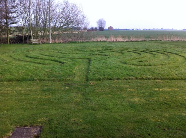
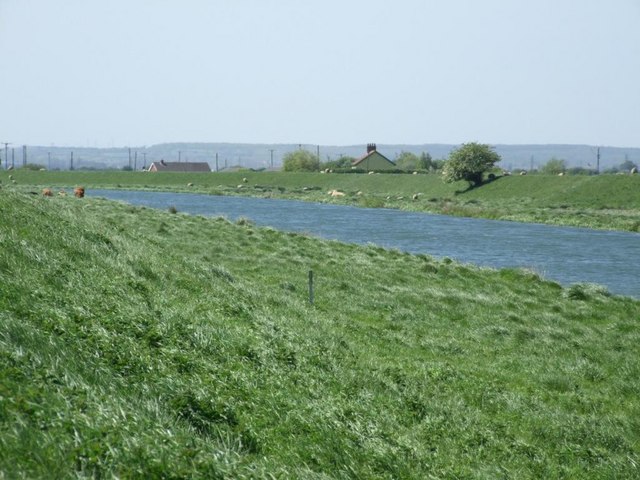
Guthram Gowt is a small village located in the South Holland district of Lincolnshire, England. Situated on the banks of the River Welland, it is approximately 4 miles east of the town of Spalding. The village is known for its picturesque countryside, with rolling fields and meadows surrounding the area.

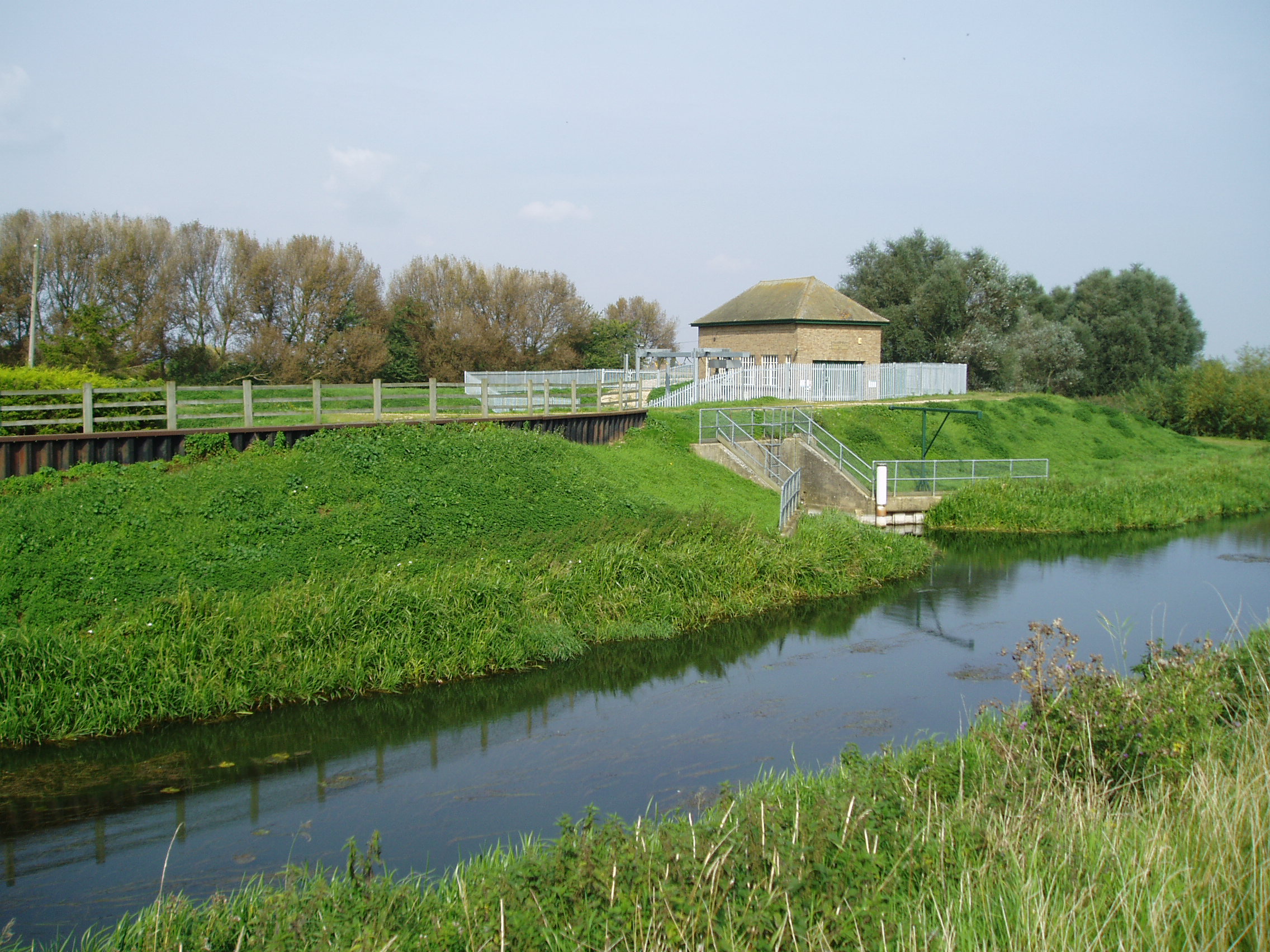
The origins of Guthram Gowt can be traced back to medieval times when it was a vital crossing point on the River Welland. The village takes its name from Guthram, a Danish leader who once controlled this strategic location. Gowt refers to the sluice gate or drainage channel that was constructed to regulate water levels in the area.

Despite its small size, Guthram Gowt boasts a few notable landmarks. One such landmark is the Grade II listed Guthram Gowt Bridge, an elegant stone bridge that spans the River Welland. The bridge dates back to the 18th century and offers stunning views of the river and the surrounding countryside.

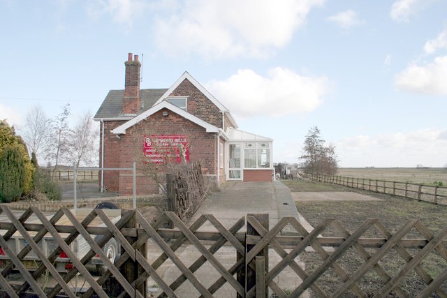
The village is primarily residential, with a mix of old cottages and more modern houses. The community is close-knit, with a friendly and welcoming atmosphere. While amenities are limited within the village itself, the nearby town of Spalding provides residents with access to shops, schools, and other essential services.

Guthram Gowt is a charming village that offers a peaceful and tranquil setting for its residents. Its rich history, beautiful surroundings, and close proximity to larger towns make it an attractive place to live for those seeking a rural lifestyle in Lincolnshire.

If you have any feedback on the listing, please let us know in the comments section below.

Guthram Gowt Images

Images are sourced within 2km of 52.786443/-0.264322 or Grid Reference TF1722. Thanks to Geograph Open Source API. All images are credited.

Flax stubble burning on Pinchbeck South Fen near Guthram Gowt: aerial 2021 At least I think it was a flax/linseed crop, since a similar fate befell what I know was a flax field nearby. Ironical that the stems of this plant should be discarded whereas flax and hemp were once valued for their fibre in our Lincolnshire fields - see <a href="https://www.geograph.org.uk/photo/6860356">SK8395 : Site of retting pits NW of Blyton: aerial 2021 (5)</a>, <a href="https://www.geograph.org.uk/photo/6957236">TF2021 : Flax stubble burning on Pinchbeck Common SW of Pode Hole: aerial 2021 (2)</a> and <a href="https://www.geograph.org.uk/photo/6957235">TF2021 : Flax stubble burning on Pinchbeck Common SW of Pode Hole: aerial 2021 (1)</a>.
Flax stubble burning on Pinchbeck South Fen near Guthram Gowt: aerial 2021
At least I think it was a flax/linseed crop, since a similar fate befell what I know was a flax field nearby. Ironical that the stems of this plant should be discarded whereas flax and hemp were once valued for their fibre in our Lincolnshire fields - see SK8395 : Site of retting pits NW of Blyton: aerial 2021 (5), TF2021 : Flax stubble burning on Pinchbeck Common SW of Pode Hole: aerial 2021 (2) and TF2021 : Flax stubble burning on Pinchbeck Common SW of Pode Hole: aerial 2021 (1).
Flooded woodland near Guthram Gowt This is the southern end of a narrow strip of woodland by the east bank of the River Glen. It lies on the edge of the Willow Tree Fen nature reserve.
Flooded woodland near Guthram Gowt
This is the southern end of a narrow strip of woodland by the east bank of the River Glen. It lies on the edge of the Willow Tree Fen nature reserve.
Field Drain, Pinchbeck South Fen An overgrown field drain divides two large arable fields in Pinchbeck South Fen. The photo is taken looking southeast from Slipe Drove, with the River Glen behind the photographer.
Field Drain, Pinchbeck South Fen
An overgrown field drain divides two large arable fields in Pinchbeck South Fen. The photo is taken looking southeast from Slipe Drove, with the River Glen behind the photographer.
Labyrinth by Slipe Drove, Pinchbeck West According to Lauren Artress, “A maze is designed to make you lose your way, while a labyrinth is designed to help you find your way.” 

A labyrinth is typically circular (though square ones also exist), with a single winding path leading to the centre. The design has been known and used for at least 4000 years, as surviving art works attest. For Christians it symbolises the journey of faith; the famous labyrinth in the floor of Chartres Cathedral, a pilgrimage site in France, has been walked by pilgrims since 1205. See this article by Sarah James in Earth & Altar <span class="nowrap"><a title="https://earthandaltarmag.com/posts/qs6pevk77i0lhpqlvv8w0u23f1sbwk" rel="nofollow ugc noopener" href="https://earthandaltarmag.com/posts/qs6pevk77i0lhpqlvv8w0u23f1sbwk">Link</a><img style="margin-left:2px;" alt="External link" title="External link - shift click to open in new window" src="https://s1.geograph.org.uk/img/external.png" width="10" height="10"/></span> .

This Lincolnshire labyrinth belongs to an Anglican Franciscan hermitage.
Labyrinth by Slipe Drove, Pinchbeck West
According to Lauren Artress, “A maze is designed to make you lose your way, while a labyrinth is designed to help you find your way.” A labyrinth is typically circular (though square ones also exist), with a single winding path leading to the centre. The design has been known and used for at least 4000 years, as surviving art works attest. For Christians it symbolises the journey of faith; the famous labyrinth in the floor of Chartres Cathedral, a pilgrimage site in France, has been walked by pilgrims since 1205. See this article by Sarah James in Earth & Altar LinkExternal link . This Lincolnshire labyrinth belongs to an Anglican Franciscan hermitage.
Drain by Slipe Drove, Pinchbeck West The drain is overlooked from the embankment that runs alongside the River Glen, and from which this photo is taken. The Slipe Drove road can be seen beyond the flooded land, running from right to left. The flooded land is part of the Pinchbeck Slipe nature reserve.
Drain by Slipe Drove, Pinchbeck West
The drain is overlooked from the embankment that runs alongside the River Glen, and from which this photo is taken. The Slipe Drove road can be seen beyond the flooded land, running from right to left. The flooded land is part of the Pinchbeck Slipe nature reserve.
Counter Drain by Willow Tree Fen
Ploughed Field near Willow Tree Farm The arable field is viewed from Slipe Drove.
Ploughed Field near Willow Tree Farm
The arable field is viewed from Slipe Drove.
Trees at Forty Foot Farm On Morton Fen, near the South Forty Foot drain.
Trees at Forty Foot Farm
On Morton Fen, near the South Forty Foot drain.
Flat field, Morton Fen near Gerrys Farm The Fens, also known as the Fenland, is a naturally marshy region in eastern England. Most of the fens were drained several centuries ago, resulting in a flat, damp, low-lying agricultural region.
A fen is the local name for an individual area of marshland or former marshland and also designates the type of marsh typical of the area, which has neutral or alkaline water chemistry and relatively large quantities of dissolved minerals, but few other plant nutrients.
Fenland primarily lies around the coast of the Wash; it reaches into four counties: Lincolnshire, Cambridgeshire, Norfolk and a small area of Suffolk, as well as the historic county of Huntingdonshire. In whole it occupies an area of nearly 1,500 sq miles.
Most of the Fenland lies within a few metres of sea level. As with similar areas in the Netherlands, much of the Fenland originally consisted of fresh- or salt-water wetlands, which have been artificially drained and continue to be protected from floods by drainage banks and pumps.
Flat field, Morton Fen near Gerrys Farm
The Fens, also known as the Fenland, is a naturally marshy region in eastern England. Most of the fens were drained several centuries ago, resulting in a flat, damp, low-lying agricultural region. A fen is the local name for an individual area of marshland or former marshland and also designates the type of marsh typical of the area, which has neutral or alkaline water chemistry and relatively large quantities of dissolved minerals, but few other plant nutrients. Fenland primarily lies around the coast of the Wash; it reaches into four counties: Lincolnshire, Cambridgeshire, Norfolk and a small area of Suffolk, as well as the historic county of Huntingdonshire. In whole it occupies an area of nearly 1,500 sq miles. Most of the Fenland lies within a few metres of sea level. As with similar areas in the Netherlands, much of the Fenland originally consisted of fresh- or salt-water wetlands, which have been artificially drained and continue to be protected from floods by drainage banks and pumps.
Morton Drove, Morton Fen Looking towards Gerrys Farm.
Morton Drove, Morton Fen
Looking towards Gerrys Farm.
Crop field, Morton Fen View over a drain from Morton Drove.
Crop field, Morton Fen
View over a drain from Morton Drove.
Drain beside Morton Drove The Fens, also known as the Fenland, is a naturally marshy region in eastern England. Most of the fens were drained several centuries ago, resulting in a flat, damp, low-lying agricultural region.
A fen is the local name for an individual area of marshland or former marshland and also designates the type of marsh typical of the area, which has neutral or alkaline water chemistry and relatively large quantities of dissolved minerals, but few other plant nutrients.
Fenland primarily lies around the coast of the Wash; it reaches into four counties: Lincolnshire, Cambridgeshire, Norfolk and a small area of Suffolk, as well as the historic county of Huntingdonshire. In whole it occupies an area of nearly 1,500 sq miles.
Most of the Fenland lies within a few metres of sea level. As with similar areas in the Netherlands, much of the Fenland originally consisted of fresh- or salt-water wetlands, which have been artificially drained and continue to be protected from floods by drainage banks and pumps.
Drain beside Morton Drove
The Fens, also known as the Fenland, is a naturally marshy region in eastern England. Most of the fens were drained several centuries ago, resulting in a flat, damp, low-lying agricultural region. A fen is the local name for an individual area of marshland or former marshland and also designates the type of marsh typical of the area, which has neutral or alkaline water chemistry and relatively large quantities of dissolved minerals, but few other plant nutrients. Fenland primarily lies around the coast of the Wash; it reaches into four counties: Lincolnshire, Cambridgeshire, Norfolk and a small area of Suffolk, as well as the historic county of Huntingdonshire. In whole it occupies an area of nearly 1,500 sq miles. Most of the Fenland lies within a few metres of sea level. As with similar areas in the Netherlands, much of the Fenland originally consisted of fresh- or salt-water wetlands, which have been artificially drained and continue to be protected from floods by drainage banks and pumps.
Morton Drove towards Forty Foot Farm The Fens, also known as the Fenland, is a naturally marshy region in eastern England. Most of the fens were drained several centuries ago, resulting in a flat, damp, low-lying agricultural region.
A fen is the local name for an individual area of marshland or former marshland and also designates the type of marsh typical of the area, which has neutral or alkaline water chemistry and relatively large quantities of dissolved minerals, but few other plant nutrients.
Fenland primarily lies around the coast of the Wash; it reaches into four counties: Lincolnshire, Cambridgeshire, Norfolk and a small area of Suffolk, as well as the historic county of Huntingdonshire. In whole it occupies an area of nearly 1,500 sq miles.
Most of the Fenland lies within a few metres of sea level. As with similar areas in the Netherlands, much of the Fenland originally consisted of fresh- or salt-water wetlands, which have been artificially drained and continue to be protected from floods by drainage banks and pumps.
Morton Drove towards Forty Foot Farm
The Fens, also known as the Fenland, is a naturally marshy region in eastern England. Most of the fens were drained several centuries ago, resulting in a flat, damp, low-lying agricultural region. A fen is the local name for an individual area of marshland or former marshland and also designates the type of marsh typical of the area, which has neutral or alkaline water chemistry and relatively large quantities of dissolved minerals, but few other plant nutrients. Fenland primarily lies around the coast of the Wash; it reaches into four counties: Lincolnshire, Cambridgeshire, Norfolk and a small area of Suffolk, as well as the historic county of Huntingdonshire. In whole it occupies an area of nearly 1,500 sq miles. Most of the Fenland lies within a few metres of sea level. As with similar areas in the Netherlands, much of the Fenland originally consisted of fresh- or salt-water wetlands, which have been artificially drained and continue to be protected from floods by drainage banks and pumps.
Fog on the fen It was dark and gloomy all day.  The vignetting  is not an affectation, it is the best that a couple of thousand quids worth of camera and lens could manage at 3pm a few days before the shortest day.
Fog on the fen
It was dark and gloomy all day. The vignetting is not an affectation, it is the best that a couple of thousand quids worth of camera and lens could manage at 3pm a few days before the shortest day.
Fenland fog Fog on the A151, between Guthram Gowt and Pinchbeck West, a builder's lorry with a brick hoist in the layby
Fenland fog
Fog on the A151, between Guthram Gowt and Pinchbeck West, a builder's lorry with a brick hoist in the layby
A skip lorry looms A skip lorry appeared out of the fog.
A skip lorry looms
A skip lorry appeared out of the fog.
The Macmillan Way and the River Glen
Entrance to Pinchbeck Fen Slipe Nature Reserve The bank of the River Glen forms the background.
Entrance to Pinchbeck Fen Slipe Nature Reserve
The bank of the River Glen forms the background.
Show me another place!

Guthram Gowt is located at Grid Ref: TF1722 (Lat: 52.786443, Lng: -0.264322)

Division: Parts of Kesteven

Administrative County: Lincolnshire

District: South Kesteven

Police Authority: Lincolnshire

What 3 Words

///upholding.withdraws.resources. Near Pinchbeck, Lincolnshire

Nearby Locations

Guthram Gowt

Related Wikis

River Glen, Lincolnshire

The River Glen is a river in Lincolnshire, England with a short stretch passing through Rutland near Essendine. The river's name appears to derive from...

Guthram Gowt

Guthram Gowt is a small settlement in the South Holland district of Lincolnshire, England. It is situated 5 miles (8 km) both east from Bourne and west...

Willow Tree Fen

Willow Tree Fen is a local nature reserve with an area of over 112.0 ha (277 acres) located near Bourne and Spalding, south of the River Glen, England...

Counter Drain railway station

Counter Drain railway station was a remote station in Lincolnshire serving the village of Tongue End. It was on the route of the Spalding and Bourne Railway...

Twenty, Lincolnshire

Twenty is a village in the South Kesteven district of Lincolnshire, England. It is situated approximately 3 miles (5 km) east of Bourne, and 5 miles (8...

Twenty railway station

Twenty railway station served the village of Twenty in Lincolnshire, England. It was on the route of the Spalding and Bourne Railway (opened 1866), later...

Tongue End

Tongue End is a small village in the South Holland district of Lincolnshire, England. It is situated 4 miles (6 km) east from Bourne and 6 miles (10 km...

North Drove railway station

North Drove railway station was a station serving Pode Hole in Lincolnshire, England. It was on the route of the Spalding and Bourne Railway (opened 1866...

Nearby Amenities

Located within 500m of 52.786443,-0.264322
Bus Stop
Horse Shoe House
Bus: yes
Naptan AtcoCode: 270000009765
Naptan Bearing: SW
Naptan CommonName: Horse Shoe House
Naptan Indicator: adj
Naptan Landmark: Horse Shoe House
Naptan NaptanCode: linjdwaj
Naptan Street: Bourne Road
Naptan Verified: no
Public Transport: platform
Source: naptan_import
Lat/Long: 52.7875842/-0.2632426
Bus Stop
Horse Shoe House
Bus: yes
Naptan AtcoCode: 2700LGB03276
Naptan Bearing: NE
Naptan CommonName: Horse Shoe House
Naptan Indicator: opp
Naptan Landmark: Horse Shoe House
Naptan NaptanCode: linawtjp
Naptan Street: Bourne Road
Naptan Verified: no
Public Transport: platform
Source: naptan_import
Lat/Long: 52.7876576/-0.2633435
Glen Farm
Place: farm
Source: Bing
Lat/Long: 52.78503/-0.265068
Guthram Gowt
Place: hamlet
Source: Bing
Lat/Long: 52.786784/-0.2633556
Barrier: kissing_gate
Foot: yes
Lat/Long: 52.7877467/-0.2627475
Power: pole
Lat/Long: 52.7874059/-0.2606332
Power: pole
Lat/Long: 52.7876902/-0.2618386
Power: pole
Lat/Long: 52.7868123/-0.2581718
Power: pole
Lat/Long: 52.7871305/-0.2594807
Power: pole
Lat/Long: 52.7875795/-0.264781
Power: pole
Lat/Long: 52.7876451/-0.2648311
Power: pole
Lat/Long: 52.7876737/-0.26433
Power: pole
Lat/Long: 52.7878318/-0.2659559
Power: pole
Lat/Long: 52.787853/-0.2630539
Power: pole
Lat/Long: 52.7879096/-0.2626876
Power: pole
Lat/Long: 52.7890608/-0.2650428
Power: pole
Lat/Long: 52.7898466/-0.2651954
Power: pole
Lat/Long: 52.7906058/-0.265355
Place: farm
Lat/Long: 52.7882287/-0.2646975
Toilets
Building: yes
Lat/Long: 52.7864541/-0.2604854
Toilets
Building: yes
Lat/Long: 52.7863665/-0.2603745
The data included in this document is from www.openstreetmap.org. The data is made available under ODbL.

Have you been to Guthram Gowt?

Leave your review of Guthram Gowt below (or comments, questions and feedback).