Bad Chathail

Downs, Moorland in Sutherland

Scotland

Bad Chathail

M O D boundary fence across Fashven ridge
M O D boundary fence across Fashven ridge Credit: Alan Reid

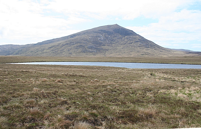
Bad Chathail is a remote and picturesque area located in Sutherland, Scotland. Situated amidst rolling hills, downs, and moorland, it offers breathtaking natural beauty that attracts nature enthusiasts and hikers alike. The name "Bad Chathail" translates to "Cathal's clump," referring to an ancient leader who may have once resided in the area.

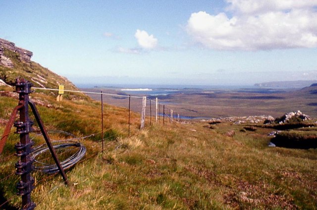
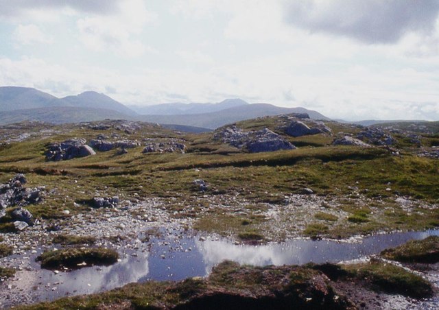
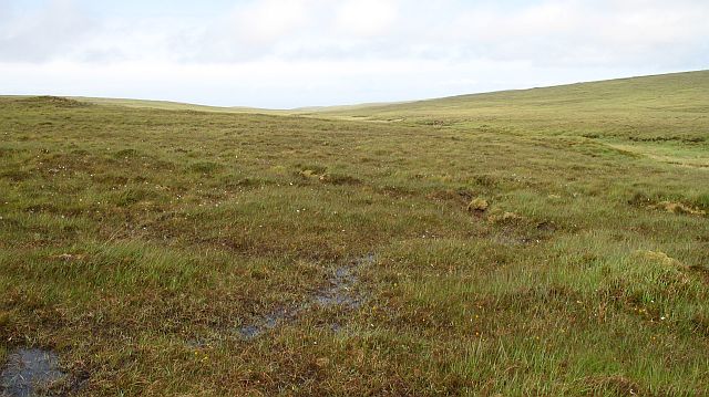
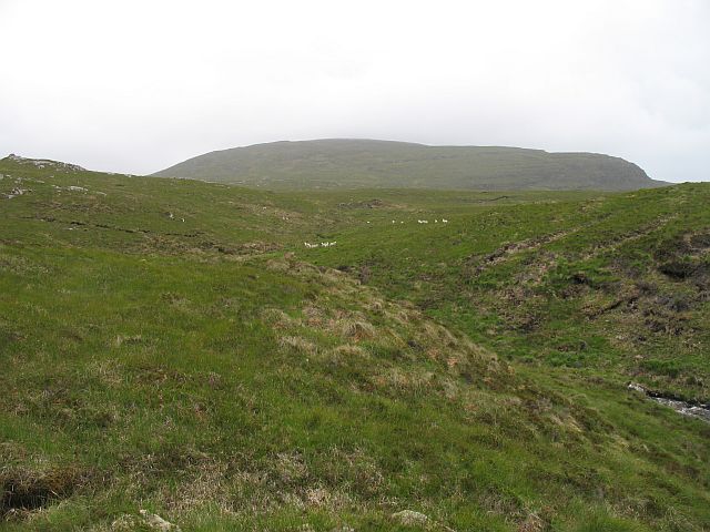
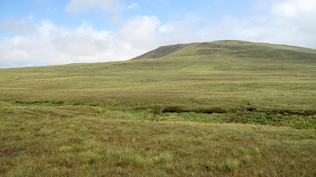
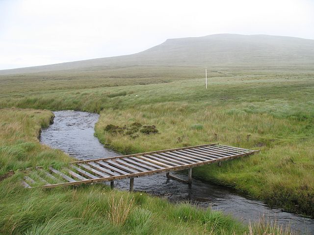
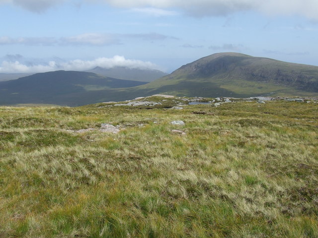
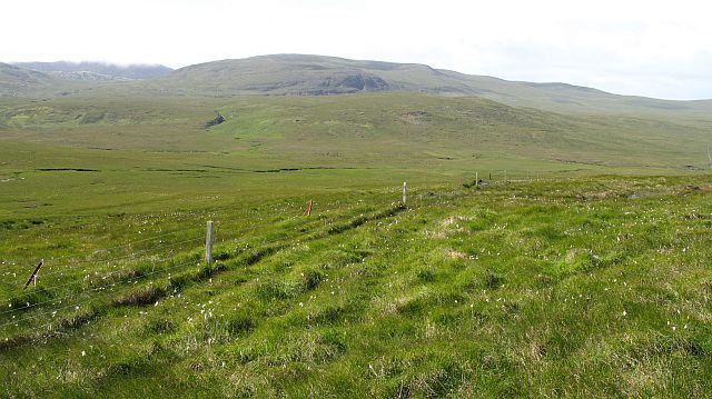
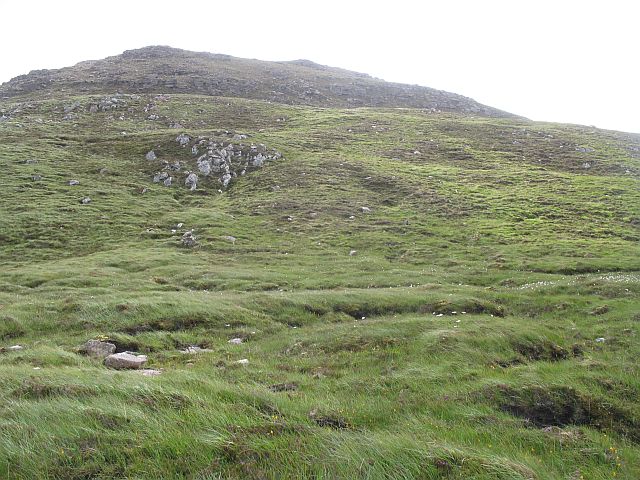
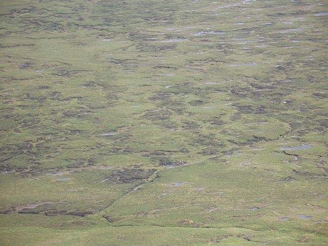
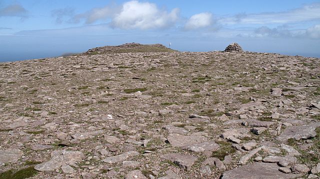
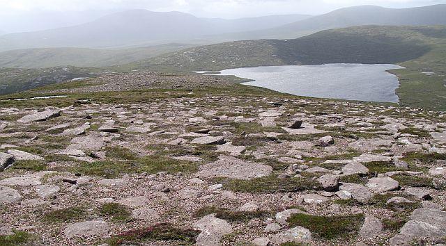
Covering a vast expanse of approximately 100 square miles, Bad Chathail is characterized by its rugged terrain, with steep slopes, rocky outcrops, and heather-covered moorlands. The area is dotted with small lochs and bogs, adding to its wild and untamed charm. These wetlands provide a habitat for various species of birds, including golden eagles and peregrine falcons, making it a popular destination for birdwatchers.

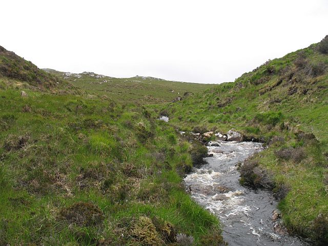
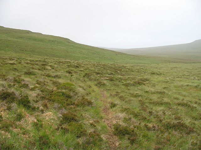
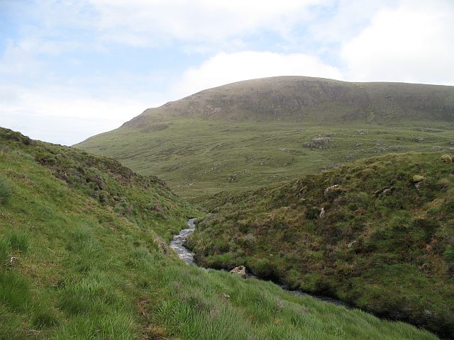
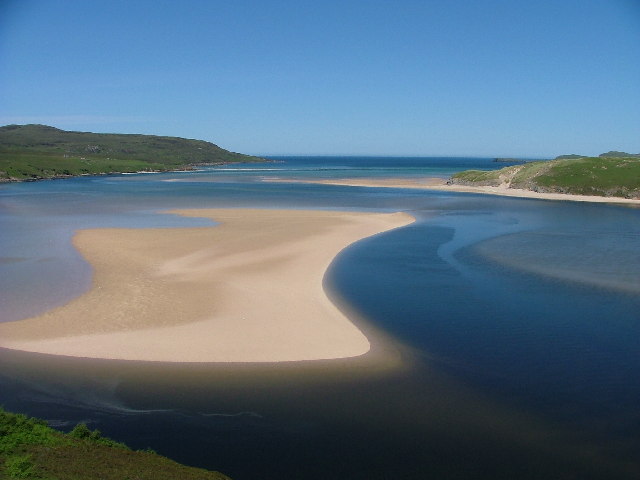
The landscape of Bad Chathail is further enhanced by the presence of several rivers and waterfalls, such as the Allt Bad Chathail and Falls of Balnagown, which add to the region's natural beauty. Visitors can explore the area on foot, following the numerous trails and paths that crisscross the hills and moorlands, allowing them to immerse themselves in the tranquility and solitude of this remote Scottish wilderness.

Although Bad Chathail is relatively uninhabited, there are a few scattered farms and crofts in the area, providing a glimpse into the traditional rural way of life. The lack of urban development and light pollution also makes it an ideal location for stargazing, offering mesmerizing views of the night sky.

In conclusion, Bad Chathail in Sutherland is a captivating and unspoiled landscape, offering visitors a chance to experience the raw beauty of the Scottish highlands.

If you have any feedback on the listing, please let us know in the comments section below.

Bad Chathail Images

Images are sourced within 2km of 58.559282/-4.9170695 or Grid Reference NC3067. Thanks to Geograph Open Source API. All images are credited.

M O D boundary fence across Fashven ridge
Rocky moorland at Leacach
Burn draining Loch na Glaic Tarsuinn Rather full burn, a headwater of the Kearvaig River.
Burn draining Loch na Glaic Tarsuinn
Rather full burn, a headwater of the Kearvaig River.
Moorland above the Kearvaig River Uniformly grassy and wet. Sheep grazing land on peat.
Moorland above the Kearvaig River
Uniformly grassy and wet. Sheep grazing land on peat.
Kearvaig River A shallow boggy glen drained reluctantly by the Kervaig River.
Kearvaig River
A shallow boggy glen drained reluctantly by the Kervaig River.
Burn draining Loch na Glaic Tarsuinn View upstream towards Beinn Dearg.
Burn draining Loch na Glaic Tarsuinn
View upstream towards Beinn Dearg.
Burn draining Loch na Glaic Tarsuinn Looking dowmstream with the bulk of Fashven in the background.
Burn draining Loch na Glaic Tarsuinn
Looking dowmstream with the bulk of Fashven in the background.
Maovally from the Kearvaig River Wide open grassland on peat.
Maovally from the Kearvaig River
Wide open grassland on peat.
Bridge over the Kearvaig River The upper of two bridges across the river.
Bridge over the Kearvaig River
The upper of two bridges across the river.
Summit of Cnoc Na Glaic Tarsuinn Looking towards Fashven and Maovally (the ground was dry)
Summit of Cnoc Na Glaic Tarsuinn
Looking towards Fashven and Maovally (the ground was dry)
The western shore of Airigh na Beinne There once was a spaniel that could even retrieve fish as the picture shows! This loch was over populated with trout with the result that the quality was poor.
The western shore of Airigh na Beinne
There once was a spaniel that could even retrieve fish as the picture shows! This loch was over populated with trout with the result that the quality was poor.
An evening's catch on Airigh na Beinne Due to the over-population of this loch every fish caught was taken to improve the quality and ease the demand on natural feeding.
An evening's catch on Airigh na Beinne
Due to the over-population of this loch every fish caught was taken to improve the quality and ease the demand on natural feeding.
Fashven and Lochan nam Breac Buidhe Snapped from the window of the Cape Wrath minibus. The loch's name means 'Little loch of the yellow trout'.
Fashven and Lochan nam Breac Buidhe
Snapped from the window of the Cape Wrath minibus. The loch's name means 'Little loch of the yellow trout'.
Fence, Maovally One of the sheep fences that provide rare man made intrusions to the wildness of Parph. Unfortunately some of the newer fences are barbed wire topped, which only invites destructive climbing, a seemingly wasteful act on land that is not used for cattle.  (This fence is not barbed wire, and I am tall enough to stride across the new barbed wire fences).
Fence, Maovally
One of the sheep fences that provide rare man made intrusions to the wildness of Parph. Unfortunately some of the newer fences are barbed wire topped, which only invites destructive climbing, a seemingly wasteful act on land that is not used for cattle. (This fence is not barbed wire, and I am tall enough to stride across the new barbed wire fences).
West side of Fashven Steep rocky slopes rise from the moor.
West side of Fashven
Steep rocky slopes rise from the moor.
Moorland below Fashven Bog pools seen from the slopes of Fashven.
Moorland below Fashven
Bog pools seen from the slopes of Fashven.
Fashven The summit area, the highest point appears to be a small rocky ridge beyond a wind damaged wind generator.
Fashven
The summit area, the highest point appears to be a small rocky ridge beyond a wind damaged wind generator.
South ridge of Fashven Dry windswept heath on a gentle ridge which contrasts greatly with the other, steep sides of the hill.
South ridge of Fashven
Dry windswept heath on a gentle ridge which contrasts greatly with the other, steep sides of the hill.
Show me another place!

Bad Chathail is located at Grid Ref: NC3067 (Lat: 58.559282, Lng: -4.9170695)

Unitary Authority: Highland

Police Authority: Highlands and Islands

What 3 Words

///tapes.mashing.hillsides. Near Oldshoremore, Highland

Nearby Locations

Bad Chathail

Related Wikis

Achiemore, Durness

Achiemore was a crofting community located on the Cape Wrath peninsula near the village of Durness in the Scottish county of Sutherland. The hamlet is...

Kyle of Durness

Kyle of Durness is a coastal inlet on the north coast of Scotland in the county of Sutherland. It extends 5+1⁄2 miles (9 kilometres) inland from Balnakeil...

River Dionard

The River Dionard is a river in the historic county of Sutherland in northwest Scotland. It arises as the outflow from Loch Dionard which lies below the...

Cape Wrath

Cape Wrath (Scottish Gaelic: Am Parbh, known as An Carbh in Lewis) is a cape in the Durness parish of the county of Sutherland in the Highlands of Scotland...

Sandwood Bay

Sandwood Bay (Scottish Gaelic: Bàgh Seannabhad) is a natural bay in Sutherland, on the far north-west coast of mainland Scotland. It is best known for...

Cape Wrath Lighthouse

Cape Wrath Lighthouse at Cape Wrath was built in 1828 by Robert Stevenson and was manned until 1998, when it was converted to automatic operation by the...

Balnakeil

Balnakeil is a hamlet in the parish of Durness, Sutherland, Scottish Highlands, and is in the Scottish council area of Highland. It is on the north coast...

Faraid Head

Faraid Head (Scottish Gaelic: An Fharaird) is a small peninsula on the northern coast of Sutherland, Highland, Scotland, located around 2 miles (3 kilometres...

Have you been to Bad Chathail?

Leave your review of Bad Chathail below (or comments, questions and feedback).