Berry Down

Downs, Moorland in Cornwall

England

Berry Down

Hut Circle Camp Trig Point Flush Bracket S5609
Hut Circle Camp Trig Point Flush Bracket S5609 Credit: thejackrustles

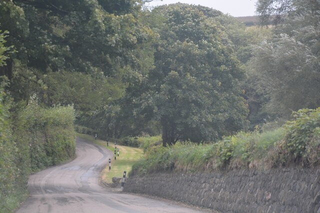
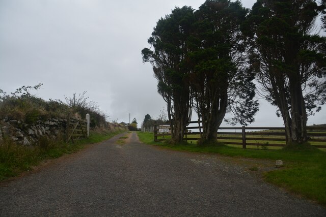
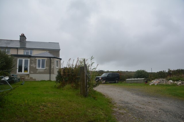
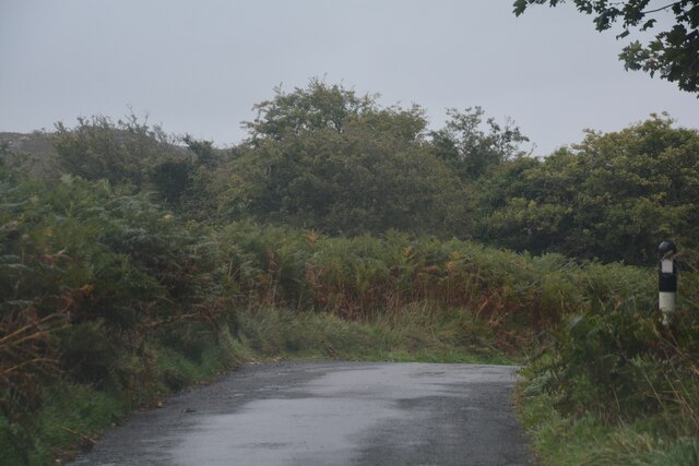
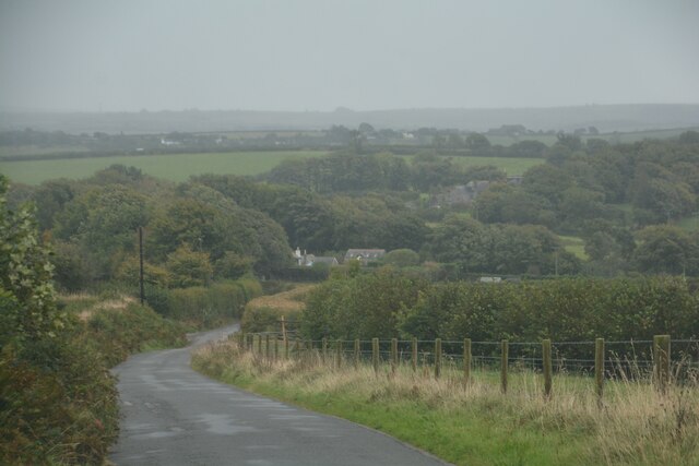
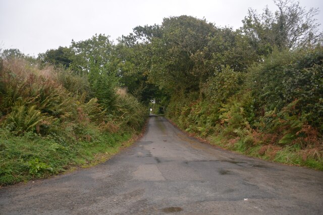
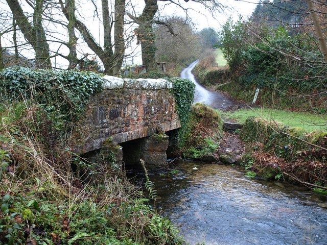
Berry Down is a picturesque area located in Cornwall, England. It is known for its stunning downs and moorland landscape, which attracts nature enthusiasts and hikers from all over the world. Situated near the town of Bude, Berry Down offers breathtaking views of the surrounding countryside and the Atlantic Ocean.

Covering an area of approximately 100 hectares, Berry Down is characterized by its rolling hills, lush meadows, and wild heathland. The downs are adorned with colorful wildflowers during the spring and summer months, creating a vibrant and captivating scene. The moorland, on the other hand, is home to a variety of rare and protected plant species, making it a haven for botanists and nature conservationists.

The diverse wildlife in Berry Down includes numerous species of birds, such as skylarks, stonechats, and kestrels, which can be spotted soaring above the open fields. Additionally, the area is inhabited by various mammals, including rabbits and foxes, which can be seen darting among the bushes and grasses.

Berry Down offers an array of walking trails and footpaths, allowing visitors to explore the area at their own pace. These paths lead to stunning viewpoints, where one can enjoy panoramic vistas of the surrounding countryside and coastline. It is also a popular spot for paragliding and kite flying due to its favorable wind conditions.

Overall, Berry Down is a natural gem in Cornwall, offering visitors a chance to immerse themselves in the beauty of the British countryside and experience the tranquility of the moorland and downs.

If you have any feedback on the listing, please let us know in the comments section below.

Berry Down Images

Images are sourced within 2km of 50.491698/-4.5419753 or Grid Reference SX1968. Thanks to Geograph Open Source API. All images are credited.

Hut Circle Camp Trig Point Flush Bracket S5609
Berry Down
Berry Down
St Neot : Grassy Path A grassy right of way heads up the hill.
St Neot : Grassy Path
A grassy right of way heads up the hill.
St Cleer : Country Lane A small lane heads through the countryside.
St Cleer : Country Lane
A small lane heads through the countryside.
Stone Stile SX1868a In a hedge on the west side of the lane from St Neot to Hilltown Farm.
Cattle stile with two steps each side and a top stone.
Non-definitive public footpath from the lane to Hilltown Farm to the lane to Chyseger Farm. Links to public footpath 632/32/1 silver.
Stone Stile SX1868a
In a hedge on the west side of the lane from St Neot to Hilltown Farm. Cattle stile with two steps each side and a top stone. Non-definitive public footpath from the lane to Hilltown Farm to the lane to Chyseger Farm. Links to public footpath 632/32/1 silver.
Stone Stile SX1868b Across a low wall between two fields at the end of the definitive footpath.
Five steps on north side and two steps on south side with separate large top bar – a cattle stile.
Public footpath 632/32/1 silver from field wall to the lane from St Neot to Chyseger Farm.
Stone Stile SX1868b
Across a low wall between two fields at the end of the definitive footpath. Five steps on north side and two steps on south side with separate large top bar – a cattle stile. Public footpath 632/32/1 silver from field wall to the lane from St Neot to Chyseger Farm.
St Neot's Church
St Neot's Church
St Neot : Whitebarrow Farm A track towards Whitebarrow Farm.
St Neot : Whitebarrow Farm
A track towards Whitebarrow Farm.
St Neot : Whitebarrow Cottages Looking towards the cottages in the countryside.
St Neot : Whitebarrow Cottages
Looking towards the cottages in the countryside.
St Neot : Road Looking along a road through the countryside.
St Neot : Road
Looking along a road through the countryside.
St Neot : Road Looking along a road through the countryside.
St Neot : Road
Looking along a road through the countryside.
St Neot : Road Looking along a road through the countryside.
St Neot : Road
Looking along a road through the countryside.
St Neot : Road Looking along a road through the countryside.
St Neot : Road
Looking along a road through the countryside.
St Neot : Road Looking along a road through the countryside.
St Neot : Road
Looking along a road through the countryside.
St Neot : Road Looking along a road through the countryside.
St Neot : Road
Looking along a road through the countryside.
St Neot : Grassy Field A right of way heads into the field.
St Neot : Grassy Field
A right of way heads into the field.
St Neot : Road Looking along a road through the countryside.
St Neot : Road
Looking along a road through the countryside.
St Neot : Road Looking along a road through the countryside.
St Neot : Road
Looking along a road through the countryside.
Show me another place!

Berry Down is located at Grid Ref: SX1968 (Lat: 50.491698, Lng: -4.5419753)

Unitary Authority: Cornwall

Police Authority: Devon and Cornwall

What 3 Words

///targeted.slamming.lordship. Near Dobwalls, Cornwall

Nearby Locations

Berry Down

Related Wikis

Trenant, Cornwall

Trenant is a hamlet in the civil parish of St Neot. There was formerly a Bible Christian chapel in Trenant.There are also places called Trenant in the...

St Neot, Cornwall

St Neot ( NEE-uut) (Cornish: Loveni) is a village and civil parish in Cornwall, England, United Kingdom. The parish population at the 2011 census was 947...

Trengale

Higher Trengale and Lower Trengale are two farming hamlets in the parish of St Cleer, Cornwall, England. It is located to the northwest of Liskeard. They...

Ocean Rain

Ocean Rain is the fourth studio album by the English post-punk band Echo & the Bunnymen. It was released on 4 May 1984 and reached number four on the UK...

Nearby Amenities

Located within 500m of 50.491698,-4.5419753
Barrier: stile
Material: wood
Source: survey;gps
Stile: stepover
Lat/Long: 50.4907497/-4.542073
Barrier: stile
Source: survey;gps
Stile: stepover
Lat/Long: 50.4892768/-4.5432903
Barrier: stile
Material: wood
Source: survey;gps
Stile: stepover
Lat/Long: 50.4890313/-4.5434363
Barrier: stile
Material: wood
Source: survey;gps
Stile: stepover
Lat/Long: 50.4918649/-4.5352233
Barrier: stile
Material: wood
Source: survey;gps
Stile: stepover
Lat/Long: 50.4892182/-4.5462113
Hut Circle Camp
Description: OS trig pillar
Ele: 282.4
Man Made: survey_point
Note: Accurate location import for imagery offset calibration. Please do not move.
Ref: SS30/22
Source: Ordnance Survey (OGL)
Survey Point: pillar
Lat/Long: 50.493218/-4.5440853
The data included in this document is from www.openstreetmap.org. The data is made available under ODbL.

Have you been to Berry Down?

Leave your review of Berry Down below (or comments, questions and feedback).