Blacktor Downs

Downs, Moorland in Cornwall

England

Blacktor Downs

Estate Boundary Marker in the valley between Brockabarrow Common and Sprey Moor Estate Boundary Marker in the valley between Brockabarrow Common and Sprey Moor, on the marshy ground by the north flowing stream that forms a tributary of the De Lank River.

One of a series of stones that mark the eastern boundary of Brockabarrow Common and Sprey Moor, and the parish boundary between Blisland and Cardinham Detached parishes until the 1930's. Now entirely in Blisland Parish. The Ordnance Survey maps of the late 19C and early 20C centuries show 18 boundary stones in this valley, to date only 11 have been located. This stone has M on its western side and G on its eastern face. Records show that Brockabarrow Common was owned in 1842 by Molesworth, but it is unclear who owned Sprey Moor. Major landowners in the adjacent areas were Francis Gregor, Davies Gilbert and Rev. Gerveys Grylls all of whom used the letter G on boundary stones showing their land. It is not certain when these stones were erected, but they are shown on the 1886 maps of the area.

Milestone Society National ID: CW_BLIS54em
Estate Boundary Marker in the valley between Brockabarrow Common and Sprey Moor Credit: P G Moore

Blacktor Downs is a picturesque area located in the county of Cornwall, England. It is known for its stunning moorland landscape and is situated near the village of Blacktor, which is in close proximity to the popular tourist destination of Bodmin Moor. The downs cover an extensive area of approximately 500 acres, offering visitors a vast expanse of natural beauty to explore.

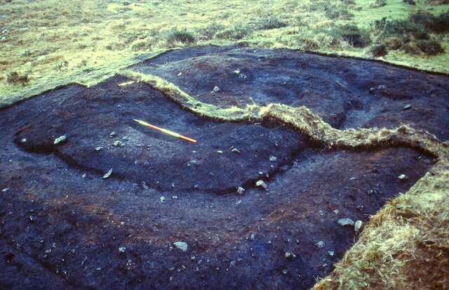
The landscape of Blacktor Downs is characterized by rolling hills, rocky outcrops, and expansive grasslands. It is home to a diverse range of flora and fauna, including heather, gorse, and various species of birds such as skylarks and kestrels. The area is also known for its rich archaeological heritage, with numerous ancient stone circles and burial sites scattered throughout.

Visitors to Blacktor Downs can enjoy a range of outdoor activities, including walking, hiking, and birdwatching. The downs offer several well-marked trails, providing visitors with the opportunity to explore the area's natural wonders at their own pace. The panoramic views from the higher points of the downs are particularly breathtaking, showcasing the rugged beauty of the surrounding countryside.

Due to its remote location, Blacktor Downs offers a tranquil and peaceful environment, making it an ideal destination for those seeking a break from the hustle and bustle of everyday life. Whether it's for a leisurely stroll or a more challenging hike, Blacktor Downs is a must-visit destination for nature lovers and outdoor enthusiasts alike.

If you have any feedback on the listing, please let us know in the comments section below.

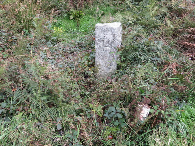
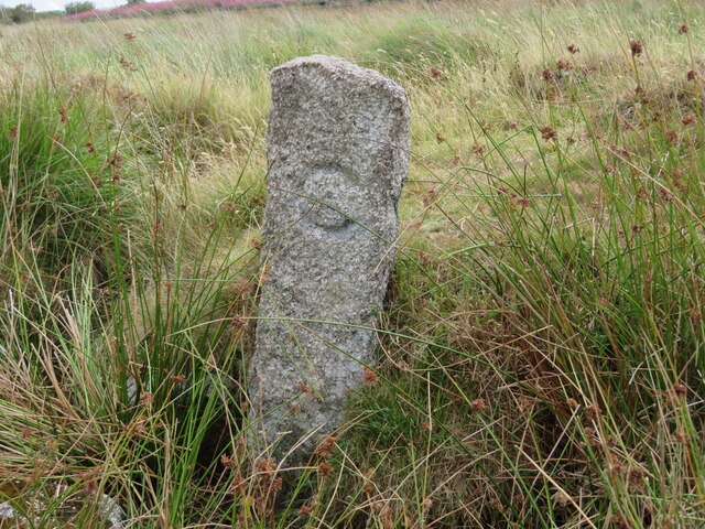
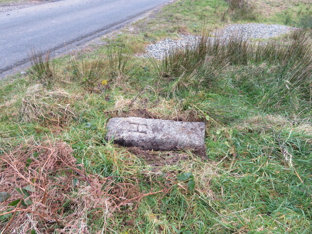
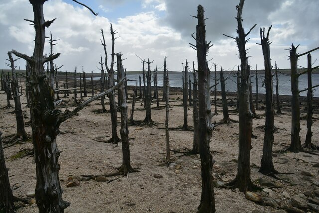
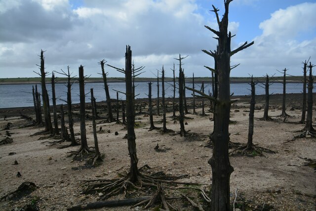
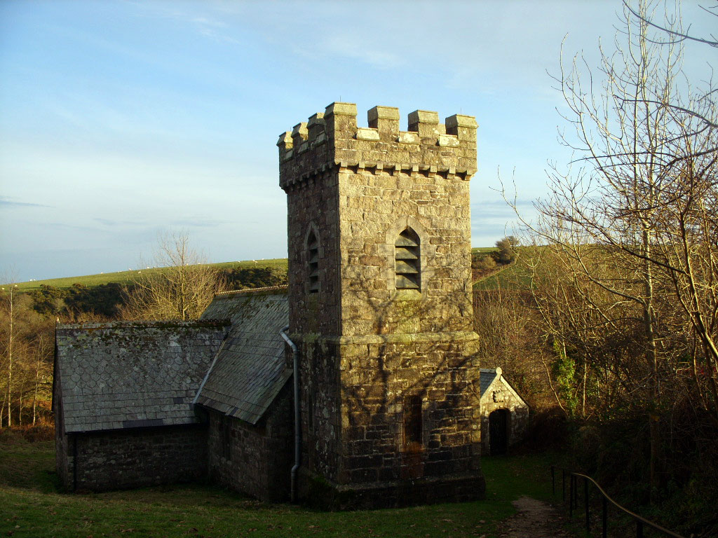
Blacktor Downs Images

Images are sourced within 2km of 50.531608/-4.6021491 or Grid Reference SX1573. Thanks to Geograph Open Source API. All images are credited.

Estate Boundary Marker in the valley between Brockabarrow Common and Sprey Moor Estate Boundary Marker in the valley between Brockabarrow Common and Sprey Moor, on the marshy ground by the north flowing stream that forms a tributary of the De Lank River.

One of a series of stones that mark the eastern boundary of Brockabarrow Common and Sprey Moor, and the parish boundary between Blisland and Cardinham Detached parishes until the 1930's. Now entirely in Blisland Parish. The Ordnance Survey maps of the late 19C and early 20C centuries show 18 boundary stones in this valley, to date only 11 have been located. This stone has M on its western side and G on its eastern face. Records show that Brockabarrow Common was owned in 1842 by Molesworth, but it is unclear who owned Sprey Moor. Major landowners in the adjacent areas were Francis Gregor, Davies Gilbert and Rev. Gerveys Grylls all of whom used the letter G on boundary stones showing their land. It is not certain when these stones were erected, but they are shown on the 1886 maps of the area.

Milestone Society National ID: CW_BLIS54em
Estate Boundary Marker in the valley between Brockabarrow Common and Sprey Moor
Estate Boundary Marker in the valley between Brockabarrow Common and Sprey Moor, on the marshy ground by the north flowing stream that forms a tributary of the De Lank River. One of a series of stones that mark the eastern boundary of Brockabarrow Common and Sprey Moor, and the parish boundary between Blisland and Cardinham Detached parishes until the 1930's. Now entirely in Blisland Parish. The Ordnance Survey maps of the late 19C and early 20C centuries show 18 boundary stones in this valley, to date only 11 have been located. This stone has M on its western side and G on its eastern face. Records show that Brockabarrow Common was owned in 1842 by Molesworth, but it is unclear who owned Sprey Moor. Major landowners in the adjacent areas were Francis Gregor, Davies Gilbert and Rev. Gerveys Grylls all of whom used the letter G on boundary stones showing their land. It is not certain when these stones were erected, but they are shown on the 1886 maps of the area. Milestone Society National ID: CW_BLIS54em
Estate Boundary Marker in the valley between Brockabarrow Common and Sprey Moor Estate Boundary Marker in the valley between Brockabarrow Common and Sprey Moor, on the marshy ground by the north flowing stream that forms a tributary of the De Lank River.

One of a series of stones that mark the eastern boundary of Brockabarrow Common and Sprey Moor, and the parish boundary between Blisland and Cardinham Detached parishes until the 1930's. Now entirely in Blisland Parish. The Ordnance Survey maps of the late 19C and early 20C centuries show 18 boundary stones in this valley, to date only 11 have been located. This stone has M on its western side and G on its eastern face. Records show that Brockabarrow Common was owned in 1842 by Molesworth, but it is unclear who owned Sprey Moor. Major landowners in the adjacent areas were Francis Gregor, Davies Gilbert and Rev. Gerveys Grylls all of whom used the letter G on boundary stones showing their land. It is not certain when these stones were erected, but they are shown on the 1886 maps of the area.

Milestone Society National ID: CW_BLIS57em
Estate Boundary Marker in the valley between Brockabarrow Common and Sprey Moor
Estate Boundary Marker in the valley between Brockabarrow Common and Sprey Moor, on the marshy ground by the north flowing stream that forms a tributary of the De Lank River. One of a series of stones that mark the eastern boundary of Brockabarrow Common and Sprey Moor, and the parish boundary between Blisland and Cardinham Detached parishes until the 1930's. Now entirely in Blisland Parish. The Ordnance Survey maps of the late 19C and early 20C centuries show 18 boundary stones in this valley, to date only 11 have been located. This stone has M on its western side and G on its eastern face. Records show that Brockabarrow Common was owned in 1842 by Molesworth, but it is unclear who owned Sprey Moor. Major landowners in the adjacent areas were Francis Gregor, Davies Gilbert and Rev. Gerveys Grylls all of whom used the letter G on boundary stones showing their land. It is not certain when these stones were erected, but they are shown on the 1886 maps of the area. Milestone Society National ID: CW_BLIS57em
Estate Boundary Marker in the valley between Brockabarrow Common and Sprey Moor Estate Boundary Marker in the valley between Brockabarrow Common and Sprey Moor, on the marshy ground by the north flowing stream that forms a tributary of the De Lank River.

One of a series of stones that mark the eastern boundary of Brockabarrow Common and Sprey Moor, and the parish boundary between Blisland and Cardinham Detached parishes until the 1930's. Now entirely in Blisland Parish. The Ordnance Survey maps of the late 19C and early 20C centuries show 18 boundary stones in this valley, to date only 11 have been located. This stone has M on its western side and G on its eastern face. Records show that Brockabarrow Common was owned in 1842 by Molesworth, but it is unclear who owned Sprey Moor. Major landowners in the adjacent areas were Francis Gregor, Davies Gilbert and Rev. Gerveys Grylls all of whom used the letter G on boundary stones showing their land. It is not certain when these stones were erected, but they are shown on the 1886 maps of the area.

Milestone Society National ID: CW_BLIS58em
Estate Boundary Marker in the valley between Brockabarrow Common and Sprey Moor
Estate Boundary Marker in the valley between Brockabarrow Common and Sprey Moor, on the marshy ground by the north flowing stream that forms a tributary of the De Lank River. One of a series of stones that mark the eastern boundary of Brockabarrow Common and Sprey Moor, and the parish boundary between Blisland and Cardinham Detached parishes until the 1930's. Now entirely in Blisland Parish. The Ordnance Survey maps of the late 19C and early 20C centuries show 18 boundary stones in this valley, to date only 11 have been located. This stone has M on its western side and G on its eastern face. Records show that Brockabarrow Common was owned in 1842 by Molesworth, but it is unclear who owned Sprey Moor. Major landowners in the adjacent areas were Francis Gregor, Davies Gilbert and Rev. Gerveys Grylls all of whom used the letter G on boundary stones showing their land. It is not certain when these stones were erected, but they are shown on the 1886 maps of the area. Milestone Society National ID: CW_BLIS58em
Estate Boundary Marker in the valley between Brockabarrow Common and Sprey Moor Estate Boundary Marker in the valley between Brockabarrow Common and Sprey Moor, on the marshy ground by the north flowing stream that forms a tributary of the De Lank River.

One of a series of stones that mark the eastern boundary of Brockabarrow Common and Sprey Moor, and the parish boundary between Blisland and Cardinham Detached parishes until the 1930's. Now entirely in Blisland Parish. The Ordnance Survey maps of the late 19C and early 20C centuries show 18 boundary stones in this valley, to date only 11 have been located. This stone has M on its western side and G on its eastern face. Records show that Brockabarrow Common was owned in 1842 by Molesworth, but it is unclear who owned Sprey Moor. Major landowners in the adjacent areas were Francis Gregor, Davies Gilbert and Rev. Gerveys Grylls all of whom used the letter G on boundary stones showing their land. It is not certain when these stones were erected, but they are shown on the 1886 maps of the area.

Milestone Society National ID: CW_BLIS59em
Estate Boundary Marker in the valley between Brockabarrow Common and Sprey Moor
Estate Boundary Marker in the valley between Brockabarrow Common and Sprey Moor, on the marshy ground by the north flowing stream that forms a tributary of the De Lank River. One of a series of stones that mark the eastern boundary of Brockabarrow Common and Sprey Moor, and the parish boundary between Blisland and Cardinham Detached parishes until the 1930's. Now entirely in Blisland Parish. The Ordnance Survey maps of the late 19C and early 20C centuries show 18 boundary stones in this valley, to date only 11 have been located. This stone has M on its western side and G on its eastern face. Records show that Brockabarrow Common was owned in 1842 by Molesworth, but it is unclear who owned Sprey Moor. Major landowners in the adjacent areas were Francis Gregor, Davies Gilbert and Rev. Gerveys Grylls all of whom used the letter G on boundary stones showing their land. It is not certain when these stones were erected, but they are shown on the 1886 maps of the area. Milestone Society National ID: CW_BLIS59em
Estate Boundary Marker in the valley between Brockabarrow Common and Sprey Moor Estate Boundary Marker in the valley between Brockabarrow Common and Sprey Moor, on the marshy ground by the north flowing stream that forms a tributary of the De Lank River.

One of a series of stones that mark the eastern boundary of Brockabarrow Common and Sprey Moor, and the parish boundary between Blisland and Cardinham Detached parishes until the 1930's. Now entirely in Blisland Parish. The Ordnance Survey maps of the late 19C and early 20C centuries show 18 boundary stones in this valley, to date only 11 have been located. This stone has M on its western side and G on its eastern face. Records show that Brockabarrow Common was owned in 1842 by Molesworth, but it is unclear who owned Sprey Moor. Major landowners in the adjacent areas were Francis Gregor, Davies Gilbert and Rev. Gerveys Grylls all of whom used the letter G on boundary stones showing their land. It is not certain when these stones were erected, but they are shown on the 1886 maps of the area.

Milestone Society National ID: CW_BLIS60em
Estate Boundary Marker in the valley between Brockabarrow Common and Sprey Moor
Estate Boundary Marker in the valley between Brockabarrow Common and Sprey Moor, on the marshy ground by the north flowing stream that forms a tributary of the De Lank River. One of a series of stones that mark the eastern boundary of Brockabarrow Common and Sprey Moor, and the parish boundary between Blisland and Cardinham Detached parishes until the 1930's. Now entirely in Blisland Parish. The Ordnance Survey maps of the late 19C and early 20C centuries show 18 boundary stones in this valley, to date only 11 have been located. This stone has M on its western side and G on its eastern face. Records show that Brockabarrow Common was owned in 1842 by Molesworth, but it is unclear who owned Sprey Moor. Major landowners in the adjacent areas were Francis Gregor, Davies Gilbert and Rev. Gerveys Grylls all of whom used the letter G on boundary stones showing their land. It is not certain when these stones were erected, but they are shown on the 1886 maps of the area. Milestone Society National ID: CW_BLIS60em
Old Boundary Marker on the minor road from Temple to the A30 flyover Estate Boundary Marker on the north side of the minor road from Temple to the A30 flyover. Blisland parish. 

This stone is marked H on its northwestern face indicating that the Hayward family, whose mark this is, were at some time the owners of Menacrin Downs. This stone is not shown on the Temple tithe map of 1841, at which time Menancrin Downs came under the ownership of the Manor of Barlendew (John Wallis, Lord of the Manor) and it is known that James Hayward acquired the Manor of Barlendew shortly after 1841. It can be assumed therefore that the stone was erected when the land changed hands or was subsequently marked with the letter H.

Milestone Society National ID: CW_BLIS61em
Old Boundary Marker on the minor road from Temple to the A30 flyover
Estate Boundary Marker on the north side of the minor road from Temple to the A30 flyover. Blisland parish. This stone is marked H on its northwestern face indicating that the Hayward family, whose mark this is, were at some time the owners of Menacrin Downs. This stone is not shown on the Temple tithe map of 1841, at which time Menancrin Downs came under the ownership of the Manor of Barlendew (John Wallis, Lord of the Manor) and it is known that James Hayward acquired the Manor of Barlendew shortly after 1841. It can be assumed therefore that the stone was erected when the land changed hands or was subsequently marked with the letter H. Milestone Society National ID: CW_BLIS61em
Old Boundary Marker north of the A30 in Blisland Estate Boundary Marker on an old field boundary bank on the north side of the A30, close to the lay-by and picnic area. Blisland parish. 

Marked C on its northwestern face, the meaning of this stone is unclear. The letter C was used by both Lord Clinton and the Collins family to mark ownership of areas of Bodmin Moor. The letter C is somewhat different than the letters carved on the stones on Manor Common near the Trippet Stones which could indicate that this stone refers to Collins. This stone is not shown on the Temple Tithe map, nor the 1880s 6 inch OS map. It is however shown on the 1907 6 inch map.

Milestone Society National ID: CW_BLIS62em
Old Boundary Marker north of the A30 in Blisland
Estate Boundary Marker on an old field boundary bank on the north side of the A30, close to the lay-by and picnic area. Blisland parish. Marked C on its northwestern face, the meaning of this stone is unclear. The letter C was used by both Lord Clinton and the Collins family to mark ownership of areas of Bodmin Moor. The letter C is somewhat different than the letters carved on the stones on Manor Common near the Trippet Stones which could indicate that this stone refers to Collins. This stone is not shown on the Temple Tithe map, nor the 1880s 6 inch OS map. It is however shown on the 1907 6 inch map. Milestone Society National ID: CW_BLIS62em
Menaglaze Tin Streamwork on Redhill Downs An eluvial tin streamwork on Bodmin Moor (Scale 2m) <span class="nowrap"><a title="https://earlytin.wordpress.com/surveys/menaglaze-eluvial-streamwork/" rel="nofollow ugc noopener" href="https://earlytin.wordpress.com/surveys/menaglaze-eluvial-streamwork/">Link</a><img style="margin-left:2px;" alt="External link" title="External link - shift click to open in new window" src="https://s1.geograph.org.uk/img/external.png" width="10" height="10"/></span>
Menaglaze Tin Streamwork on Redhill Downs
An eluvial tin streamwork on Bodmin Moor (Scale 2m) LinkExternal link
Tinners' Building at Redhill Marsh in 1983 Prior to the flooding of Colliford Reservoir a number of archaeological sites were excavated. This unusual turf-built tinners building was among them <span class="nowrap"><a title="https://earlytin.wordpress.com/surveys/redhill-marsh/" rel="nofollow ugc noopener" href="https://earlytin.wordpress.com/surveys/redhill-marsh/">Link</a><img style="margin-left:2px;" alt="External link" title="External link - shift click to open in new window" src="https://s1.geograph.org.uk/img/external.png" width="10" height="10"/></span>
Tinners' Building at Redhill Marsh in 1983
Prior to the flooding of Colliford Reservoir a number of archaeological sites were excavated. This unusual turf-built tinners building was among them LinkExternal link
Old Boundary Marker on the minor road from Temple to the A30 flyover state Boundary Marker on the north side of the minor road from Temple to the A30 flyover. Blisland parish. See <a title="https://www.geograph.org.uk/photo/7004448" href="https://www.geograph.org.uk/photo/7004448">Link</a>. Found to have been snapped off just above ground level.

Milestone Society National ID: CW_BLIS61em
Old Boundary Marker on the minor road from Temple to the A30 flyover
state Boundary Marker on the north side of the minor road from Temple to the A30 flyover. Blisland parish. See Link. Found to have been snapped off just above ground level. Milestone Society National ID: CW_BLIS61em
Reconstructed Longhouse at Colliford Lake Park This longhouse originally situated at Bunnings Park was excavated in 1983 <a href="https://www.geograph.org.uk/photo/6631371">SX1871 : Excavated medieval longhouse and barns at Bunnings Park</a> and reconstructed at this location early in 1984.
Reconstructed Longhouse at Colliford Lake Park
This longhouse originally situated at Bunnings Park was excavated in 1983 SX1871 : Excavated medieval longhouse and barns at Bunnings Park and reconstructed at this location early in 1984.
St Neot : Colliford Lake What remains of a small plantation alongside the reservoir.
St Neot : Colliford Lake
What remains of a small plantation alongside the reservoir.
St Neot : Colliford Lake Remains of a plantation at the lake.
St Neot : Colliford Lake
Remains of a plantation at the lake.
St Neot : Colliford Lake Branches and wood stick out from the water.
St Neot : Colliford Lake
Branches and wood stick out from the water.
St Neot : Highland Cow A Highland Cow in the open countryside.
St Neot : Highland Cow
A Highland Cow in the open countryside.
Former Bible Christian chapel
St Neot : Grassy Field A field overlooking Colliford Lake.
St Neot : Grassy Field
A field overlooking Colliford Lake.
St Neot : Car Park A car park with entrance to Colliford Lake.
St Neot : Car Park
A car park with entrance to Colliford Lake.
Show me another place!

Blacktor Downs is located at Grid Ref: SX1573 (Lat: 50.531608, Lng: -4.6021491)

Unitary Authority: Cornwall

Police Authority: Devon and Cornwall

What 3 Words

///finely.mount.drifters. Near Helland, Cornwall

Nearby Locations

Blacktor Downs

Related Wikis

Temple, Cornwall

Temple (Cornish: Tempel) is a small village and former civil parish, now in the parish of Blisland, on Bodmin Moor, in the Cornwall district, in the ceremonial...

Stripple stones

The Stripple stones (or Stripple stones circle) is a henge and stone circle located on the south slope of Hawk's Tor, Blisland, 10 kilometres (6.2 mi)...

Colliford Lake

Colliford Lake is a reservoir on Bodmin Moor, Cornwall, England, United Kingdom. Covering more than 900 acres (3.6 km2), it is the largest lake in Cornwall...

Cornwall Area of Outstanding Natural Beauty

The Cornwall National Landscape (Cornwall Area of Outstanding Natural Beauty) covers 958 square kilometres (370 sq mi) in Cornwall, England, UK; that is...

Nearby Amenities

Located within 500m of 50.531608,-4.6021491
tumulus
Historic: archaeological_site
Source: NPE
Lat/Long: 50.5331255/-4.6008641
hut circles
Historic: archaeological_site
Is In County: Cornwall
Source: NPE
Lat/Long: 50.5304521/-4.6010787
tumulus
Historic: archaeological_site
Is In County: Cornwall
Source: NPE
Lat/Long: 50.5323911/-4.6007
tumulus
Historic: archaeological_site
Is In County: Cornwall
Source: NPE
Lat/Long: 50.5325254/-4.6004779
Ford: yes
Lat/Long: 50.5313784/-4.5973596
The data included in this document is from www.openstreetmap.org. The data is made available under ODbL.

Have you been to Blacktor Downs?

Leave your review of Blacktor Downs below (or comments, questions and feedback).