Belah Meadow

Downs, Moorland in Cornwall

England

Belah Meadow

Otterham Station entrance sign
Otterham Station entrance sign Credit: Alex McGregor

Belah Meadow is a picturesque area located in Cornwall, England, known for its captivating beauty and diverse natural habitats. Situated in the heart of Cornwall, it encompasses a vast expanse of downs and moorland, making it a paradise for nature enthusiasts and hikers alike.

Covering an area of around 500 acres, Belah Meadow offers a stunning landscape characterized by rolling hills, lush meadows, and ancient woodlands. The downs, with their gently sloping hills, are carpeted with vibrant wildflowers in the spring and summer months, creating a kaleidoscope of colors. The moorland, on the other hand, boasts a more rugged terrain, adorned with heather and gorse, providing a unique habitat for a variety of wildlife.

The meadow is home to an array of flora and fauna, including rare orchids, butterflies, and birds. It is also famous for its ancient archaeological sites, such as standing stones and burial mounds, which add an element of historical intrigue to the area.

For outdoor enthusiasts, Belah Meadow offers an extensive network of well-maintained walking trails, allowing visitors to explore the stunning surroundings at their own pace. The meadow is also a popular spot for picnics, offering breathtaking panoramic views of the surrounding countryside.

Being located in Cornwall, Belah Meadow benefits from the region's mild climate, which makes it accessible and enjoyable throughout the year. Whether it's a leisurely stroll, a challenging hike, or simply a desire to immerse oneself in the tranquility of nature, Belah Meadow is a must-visit destination that promises a truly unforgettable experience.

If you have any feedback on the listing, please let us know in the comments section below.
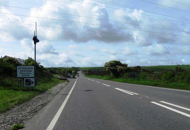
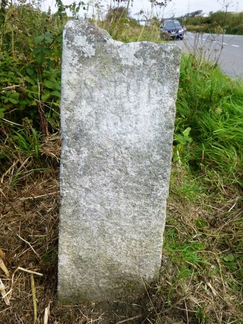
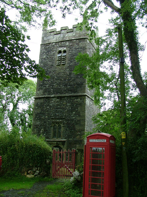
Belah Meadow Images

Images are sourced within 2km of 50.676147/-4.6120072 or Grid Reference SX1589. Thanks to Geograph Open Source API. All images are credited.

Otterham Station entrance sign
A39 north of Otterham Down Approaching electricity cables across the road and wind turbines on Otterham Down
A39 north of Otterham Down
Approaching electricity cables across the road and wind turbines on Otterham Down
North Cornwall : The A39 Looking along the A39 as it heads through Cornwall.
North Cornwall : The A39
Looking along the A39 as it heads through Cornwall.
Farm track & public footpath at West Holme Farm
Bend in the road on the B3262 near Greystone Cottage
Trewannion Gate The lane from Lesnewth reaches the A39 here.
Trewannion Gate
The lane from Lesnewth reaches the A39 here.
Field by Sedan Farm From the lane between Trewannion Gate and Lesnewth.
Field by Sedan Farm
From the lane between Trewannion Gate and Lesnewth.
Trewannion Gate A lay-by by the A39, and, on the right, the old road shown in <a href="https://www.geograph.org.uk/photo/733090">SX1588 : Former line of main road, Trewannion Gate</a>. The settlement ahead is Otterham Station.
Trewannion Gate
A lay-by by the A39, and, on the right, the old road shown in SX1588 : Former line of main road, Trewannion Gate. The settlement ahead is Otterham Station.
View near Sedan Farm From the same spot as <a href="https://www.geograph.org.uk/photo/4449982">SX1489 : Field by Sedan Farm</a>, with the scattered settlement of Otterham Station in the distance.
View near Sedan Farm
From the same spot as SX1489 : Field by Sedan Farm, with the scattered settlement of Otterham Station in the distance.
Old Direction Sign - Signpost by the A39, northwest of Davidstow Granite post and fingers but the fingers have been lost. By the A39 in the parish of Davidstow (North Cornwall District), on the north side of the Y-junction of the A39 and a minor road to Hendra.

Inscription reads:-
: PADSTOW : : CAMELFORD : : STRA/TTON : : LAN/SON :
Carved benchmark on Southeast face.

Grade II listed.
List Entry Number: 1142382 <span class="nowrap"><a title="https://historicengland.org.uk/listing/the-list/list-entry/1142382" rel="nofollow ugc noopener" href="https://historicengland.org.uk/listing/the-list/list-entry/1142382">Link</a><img style="margin-left:2px;" alt="External link" title="External link - shift click to open in new window" src="https://s1.geograph.org.uk/img/external.png" width="10" height="10"/></span>

Surveyed

Milestone Society National ID: CW_SX1488
Old Direction Sign - Signpost by the A39, northwest of Davidstow
Granite post and fingers but the fingers have been lost. By the A39 in the parish of Davidstow (North Cornwall District), on the north side of the Y-junction of the A39 and a minor road to Hendra. Inscription reads:- : PADSTOW : : CAMELFORD : : STRA/TTON : : LAN/SON : Carved benchmark on Southeast face. Grade II listed. List Entry Number: 1142382 LinkExternal link Surveyed Milestone Society National ID: CW_SX1488
Minor road to Trelash from B3262
Old Direction Sign - Signpost by the A39, north of Davidstow No finial, granite post and fingers by the A39, in parish of Davidstow (North Cornwall District), at junction, on verge.

Inscription reads:-
: PADSTOW : : CAMELFORD : : STRA/TTON : : LAN/SON :
Carved benchmark on Southeast face.

Grade II listed.
List Entry Number: 1142382 <span class="nowrap"><a title="https://historicengland.org.uk/listing/the-list/list-entry/1142382" rel="nofollow ugc noopener" href="https://historicengland.org.uk/listing/the-list/list-entry/1142382">Link</a><img style="margin-left:2px;" alt="External link" title="External link - shift click to open in new window" src="https://s1.geograph.org.uk/img/external.png" width="10" height="10"/></span>

Surveyed

Milestone Society National ID: CW_SX1488
Old Direction Sign - Signpost by the A39, north of Davidstow
No finial, granite post and fingers by the A39, in parish of Davidstow (North Cornwall District), at junction, on verge. Inscription reads:- : PADSTOW : : CAMELFORD : : STRA/TTON : : LAN/SON : Carved benchmark on Southeast face. Grade II listed. List Entry Number: 1142382 LinkExternal link Surveyed Milestone Society National ID: CW_SX1488
Old Boundary Marker Parish Boundary Marker 800 metres north of Otterham Station on west side of the A39. On the boundary of St Juliot and Otterham parishes. Inscribed ST JU / LIOT and OTTER / HAM on opposite faces.

Milestone Society National ID: CW_SJUOTT01pb
Old Boundary Marker
Parish Boundary Marker 800 metres north of Otterham Station on west side of the A39. On the boundary of St Juliot and Otterham parishes. Inscribed ST JU / LIOT and OTTER / HAM on opposite faces. Milestone Society National ID: CW_SJUOTT01pb
St Juliot: farm buildings at Trevilla A public footpath runs through the farm property. By a bank on the western side of the farm, probably an old leat, the remains of a waterwheel were visible in 1997
St Juliot: farm buildings at Trevilla
A public footpath runs through the farm property. By a bank on the western side of the farm, probably an old leat, the remains of a waterwheel were visible in 1997
Otterham Church 13th Century church dedicated to the French saint St Denis although no-one seems to know why. The tower was rebuilt in 1792 and the church had a major restoration in 1890.
Otterham Church
13th Century church dedicated to the French saint St Denis although no-one seems to know why. The tower was rebuilt in 1792 and the church had a major restoration in 1890.
Otterham Down with the A39 Atlantic Highway in the foreground
Otterham Down
with the A39 Atlantic Highway in the foreground
St. Tinney Farm, Otterham This is private property and there is no public right of way here.
St. Tinney Farm, Otterham
This is private property and there is no public right of way here.
St. Tinney Farm Holidays Coarse Fishing Lake
Show me another place!

Belah Meadow is located at Grid Ref: SX1589 (Lat: 50.676147, Lng: -4.6120072)

Unitary Authority: Cornwall

Police Authority: Devon and Cornwall

What 3 Words

///mammoth.bend.convinces. Near Camelford, Cornwall

Related Wikis

Otterham

Otterham (Cornish: Prasotri) is a village and a civil parish in north Cornwall, England, United Kingdom. The village is situated approximately ten miles...

St Denis' Church, Otterham

St Denis's Church, Otterham is a Grade II* listed parish church in the Church of England Diocese of Truro in Otterham, Cornwall. == History == The dedication...

North Cornwall (UK Parliament constituency)

North Cornwall is a constituency represented in the House of Commons of the UK Parliament by Scott Mann, a Conservative since the 2015 general election...

Marshgate

Marshgate is a hamlet partly in the parish of Otterham, Cornwall, England, UK. The population at the 2011 census was included in the civil parish of St...

Nearby Amenities

Located within 500m of 50.676147,-4.6120072
Otterham
Historic Railway: station
Railway: site
Source: npe
Lat/Long: 50.6747238/-4.6125576
Power: tower
Lat/Long: 50.6800261/-4.6148767
Wynnstay Stores
Shop: wholesale
Wholesale: agricultural
Lat/Long: 50.6762234/-4.6126552
Otterham Station
Name Kw: Gorsav Prasotri
Place: village
Lat/Long: 50.6756352/-4.6125259
Post Box
Brand: Royal Mail
Brand Wikidata: Q638098
Collection Times: Mo-Sa 10:30
Operator: Royal Mail
Operator Wikidata: Q638098
Post Box Mounting: pier
Post Box Type: lamp
Ref: PL32 28
Royal Cypher: EIIR
Royal Cypher Wikidata: Q33102113
Survey Date: 2022-12-17
Lat/Long: 50.6761467/-4.6135157
The data included in this document is from www.openstreetmap.org. The data is made available under ODbL.

Have you been to Belah Meadow?

Leave your review of Belah Meadow below (or comments, questions and feedback).