Monadh Cuil-Cheanna

Downs, Moorland in Inverness-shire

Scotland

Monadh Cuil-Cheanna

Clear-felled forestry above Inchree
Clear-felled forestry above Inchree Credit: Steven Brown

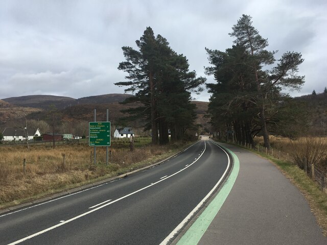
Monadh Cuil-Cheanna is a picturesque region located in Inverness-shire, Scotland. Known for its stunning natural landscapes, the area is primarily characterized by its downs and moorland.

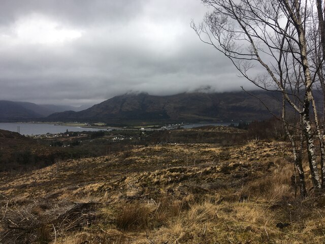
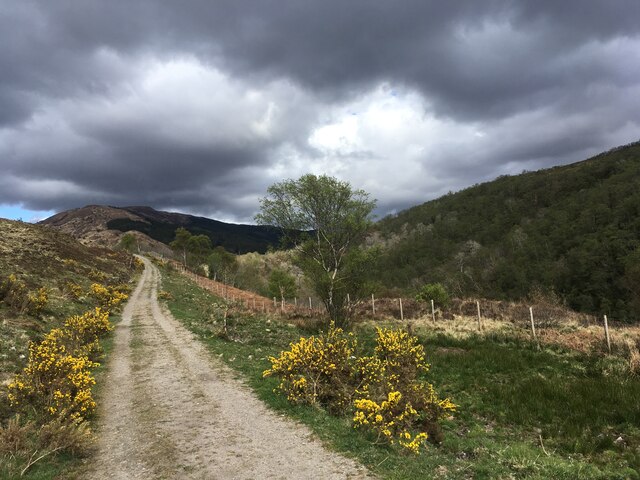
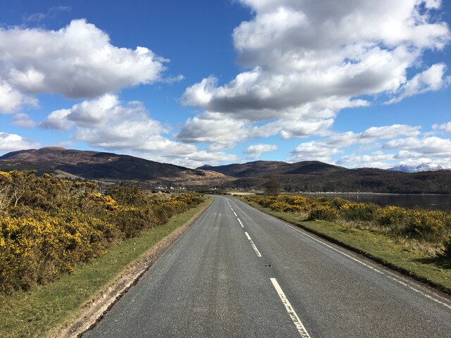
The downs of Monadh Cuil-Cheanna are rolling hills covered in lush greenery, offering breathtaking panoramic views of the surrounding countryside. These grassy slopes are dotted with wildflowers during the warmer months, creating a vibrant and colorful scene. The downs provide ample opportunities for hiking and walking, attracting nature enthusiasts and outdoor adventurers.

In addition to the downs, Monadh Cuil-Cheanna is also home to extensive moorland. This rugged and untamed terrain is characterized by its vast stretches of heather, giving the landscape a purple hue when in bloom. The moorland is a haven for wildlife, with various species of birds, deer, and smaller mammals inhabiting the area. It is a popular spot for birdwatching, as well as for those interested in observing the unique flora and fauna of the region.

Monadh Cuil-Cheanna offers a peaceful and serene escape from the hustle and bustle of city life. The unspoiled natural beauty of the downs and moorland provides a tranquil setting for visitors to relax and unwind. Whether it's exploring the rolling hills or immersing oneself in the wild moorland, Monadh Cuil-Cheanna is a destination that promises an unforgettable experience for nature lovers and adventure seekers alike.

If you have any feedback on the listing, please let us know in the comments section below.

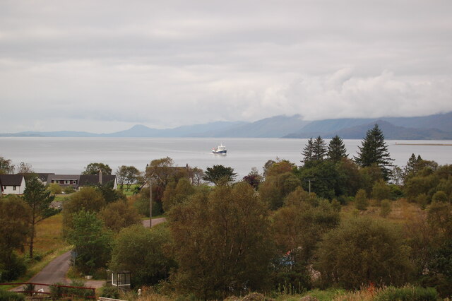
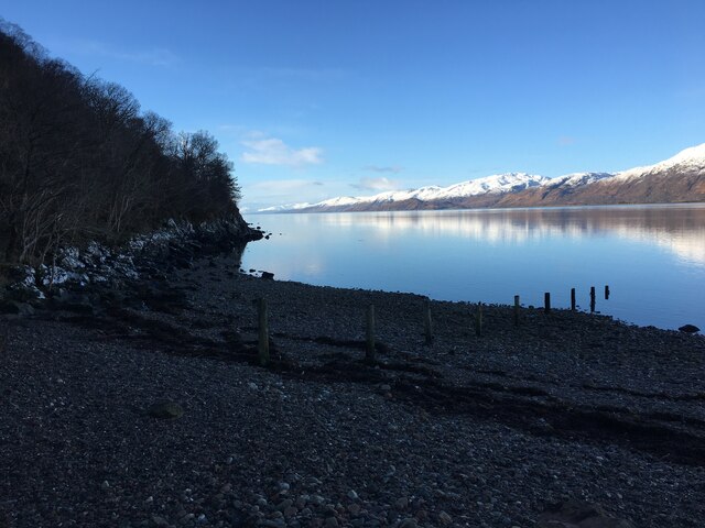
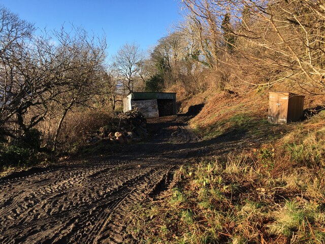
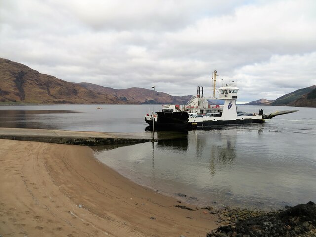
Monadh Cuil-Cheanna Images

Images are sourced within 2km of 56.7089/-5.232916 or Grid Reference NN0262. Thanks to Geograph Open Source API. All images are credited.

Clear-felled forestry above Inchree
Clear-felled forestry, Inchree
Track junction above Inchree
A82 with no traffic Photo taken during the initial Covid pandemic lockdown.
A82 with no traffic
Photo taken during the initial Covid pandemic lockdown.
Track from Onich to Glen Righ
Corran Lighthouse and shoreline at Corran Narrows
Loch Linnhe from Inchree Looking from Inchree over Bunree towards Loch Linnhe.
Loch Linnhe from Inchree
Looking from Inchree over Bunree towards Loch Linnhe.
Forestry road and evidence of harvesting, Inchree
Old water tank, Corran
Shoreline of Loch Linnhe at Bunree
Track and shed near Onich
Corran Ferry at Ardgour
A861 past Clovullin
A861 past Clovullin
New house by the ferry queue, Nether Lochaber There has been a lot of development here in the past few years.
New house by the ferry queue, Nether Lochaber
There has been a lot of development here in the past few years.
A861, Corran The long way round, just north of the ferry pier.
A861, Corran
The long way round, just north of the ferry pier.
Pier, Corran Ronja Harvester, which transports salmon from the fish farms is on Loch Linnhe.
Pier, Corran
Ronja Harvester, which transports salmon from the fish farms is on Loch Linnhe.
Mobile bank and ferry, Corran
Coffee caravan, Corran Handy for the ferry queue.
Coffee caravan, Corran
Handy for the ferry queue.
Show me another place!

Monadh Cuil-Cheanna is located at Grid Ref: NN0262 (Lat: 56.7089, Lng: -5.232916)

Unitary Authority: Highland

Police Authority: Highlands and Islands

What 3 Words

///hockey.flap.waddle. Near Glencoe, Highland

Nearby Locations

Monadh Cuil-Cheanna Bunree

Related Wikis

Onich

Onich (; Gaelic: Omhanaich, 'abounding in froth, frothy place'), also spelled Ounich, is a village in the historic county of Inverness-shire on the east...
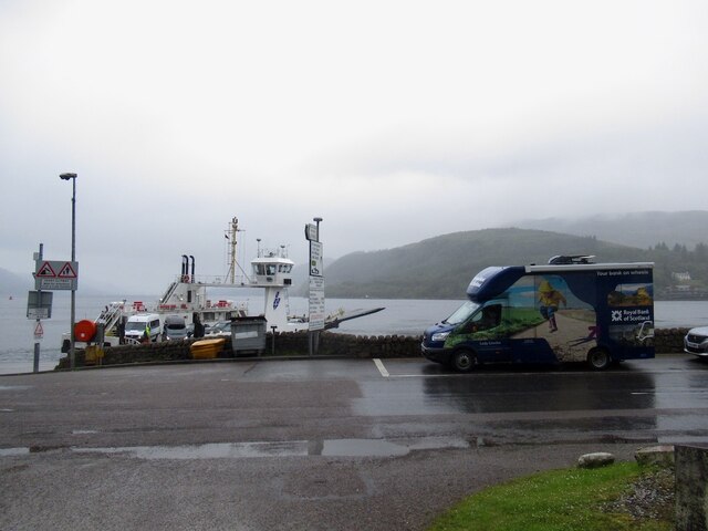
Corran Ferry

The Corran Ferry crosses Loch Linnhe at the Corran Narrows, south of Fort William, Scotland. == Description == Operated by Highland Council, the Corran...

Corran, Lochaber

Corran (Scottish Gaelic: An Corran) is a former fishing village, situated on Corran Point, on the west side of the Corran Narrows of Loch Linnhe, in Lochaber...

Loch Linnhe

Loch Linnhe ( lokh LIN-ee) is a sea loch on the west coast of Scotland. The part upstream of Corran is known in Gaelic as An Linne Dhubh (the black pool...

Inchree

Inchree (Scottish Gaelic: Innis an Ruighe) is a small hamlet, situated at the northern end of the village of Onich. It is 7 miles south of the town of...

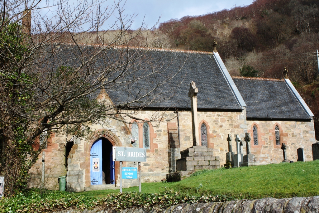
St Bride's Church, Onich

St Bride's Church (alternatively, Saint Brigid of Kildare Church) is an Episcopal parish church in North Ballachulish in the Scottish Highlands, within...

Nether Lochaber

Nether Lochaber ( NEDH-ər lokh-AH-bər) in Lochaber, Highland, Scotland, is the modern (1950s) name for the Parish of Ballachulish and Onich. This Parish...

Kentallen railway station

Kentallen was a railway station at the head of Kentallen Bay, which is on the southern shore of Loch Linnhe in the Highland council area of Scotland. It...

Nearby Amenities

Located within 500m of 56.7089,-5.232916
Source: PGS
Lat/Long: 56.7115374/-5.2385239
Source: PGS
Lat/Long: 56.7111019/-5.2384133
Source: PGS
Lat/Long: 56.7108186/-5.2386971
Source: PGS
Lat/Long: 56.7106399/-5.2390376
Source: PGS
Lat/Long: 56.7102827/-5.2398751
Source: PGS
Lat/Long: 56.7099991/-5.240329
Source: PGS
Lat/Long: 56.7097756/-5.2407372
Post Box
Brand: Royal Mail
Brand Wikidata: Q638098
Collection Times: Mo-Fr 13:45; Sa 12:00
Mapillary: 728497688584193
Operator: Royal Mail
Operator Wikidata: Q638098
Post Box Mounting: pier
Post Box Type: lamp
Ref: PH33 8
Source: survey
Survey Date: 2022-09-05
Lat/Long: 56.7063504/-5.2320013
Monadh Cuil-Cheanna
Place: locality
Lat/Long: 56.7087437/-5.2340284
Cuil Cheanna
Place: locality
Lat/Long: 56.7093587/-5.2367051
Cuilcheanna House
Tourism: guest_house
Website: https://www.cuilcheanna.co.uk/
Lat/Long: 56.7048931/-5.236441
Ele: 95
Natural: peak
Lat/Long: 56.7082976/-5.2368724
Give Way
Direction: forward
Lat/Long: 56.7062228/-5.2319155
Power: pole
Lat/Long: 56.7061164/-5.2276549
Power: pole
Lat/Long: 56.7065242/-5.2282316
Power: pole
Lat/Long: 56.7068511/-5.2287036
Power: pole
Lat/Long: 56.7112737/-5.2266195
Power: pole
Lat/Long: 56.7104346/-5.2272257
Power: pole
Lat/Long: 56.7096808/-5.2277514
Power: pole
Lat/Long: 56.7089123/-5.2283093
Power: pole
Lat/Long: 56.7081394/-5.2288726
Power: pole
Lat/Long: 56.7073752/-5.2294171
Power: pole
Lat/Long: 56.7062976/-5.2395298
Power: pole
Lat/Long: 56.7067209/-5.238461
Power: pole
Lat/Long: 56.7071496/-5.2373257
Power: pole
Lat/Long: 56.7075644/-5.2362785
Power: pole
Lat/Long: 56.7078824/-5.2354955
Power: pole
Lat/Long: 56.7083133/-5.2343485
Power: pole
Lat/Long: 56.7088322/-5.2335694
Power: pole
Lat/Long: 56.7094264/-5.2326866
Power: pole
Lat/Long: 56.7100141/-5.2318097
Power: pole
Lat/Long: 56.7098776/-5.2300617
Material: wood
Power: pole
Lat/Long: 56.709768/-5.2288285
Power: pole
Lat/Long: 56.7064061/-5.2382203
Power: pole
Lat/Long: 56.7058205/-5.2372416
Power: pole
Lat/Long: 56.7057646/-5.2371437
Power: pole
Lat/Long: 56.7050936/-5.2302095
Power: pole
Lat/Long: 56.7054546/-5.2300823
Power: pole
Lat/Long: 56.7061606/-5.2297847
Power: pole
Lat/Long: 56.7064582/-5.2302917
Power: pole
Lat/Long: 56.7067107/-5.2307165
Power: pole
Lat/Long: 56.7068278/-5.2314564
Material: wood
Power: pole
Lat/Long: 56.7068966/-5.2318518
Sanitary Dump Station
Lat/Long: 56.7124906/-5.23678
Bench
Backrest: yes
Lat/Long: 56.7113198/-5.2381567
Sanitary Dump Station
Lat/Long: 56.7119433/-5.2369915
Recycling
Lat/Long: 56.7119234/-5.2370277
Life Ring
Emergency: life_ring
Lat/Long: 56.711291/-5.2381689
The data included in this document is from www.openstreetmap.org. The data is made available under ODbL.

Have you been to Monadh Cuil-Cheanna?

Leave your review of Monadh Cuil-Cheanna below (or comments, questions and feedback).