Castlebythe Common

Downs, Moorland in Pembrokeshire

Wales

Castlebythe Common

Footpath southeast of Puncheston/Casmael A straight, slightly raised PROW, with a hard surface beneath the grass, between overgrown hedges leads downhill towards a ford and bridge across the Afon Anghof on the edge of the village. The stone set on the edge of the lane's end (left of the dog) appears to be some sort of marker, possibly connected with the long-dismantled railway line that ran NE-SW close to this point. See <span class="nowrap"><a title="http://www.disused-stations.org.uk/p/puncheston/index.shtml" rel="nofollow ugc noopener" href="http://www.disused-stations.org.uk/p/puncheston/index.shtml">Link</a><img style="margin-left:2px;" alt="External link" title="External link - shift click to open in new window" src="https://s1.geograph.org.uk/img/external.png" width="10" height="10"/></span>
Footpath southeast of Puncheston/Casmael Credit: Natasha Ceridwen de Chroustchoff

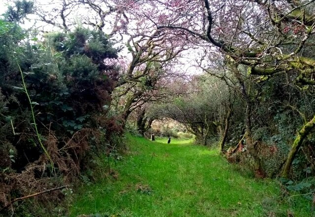
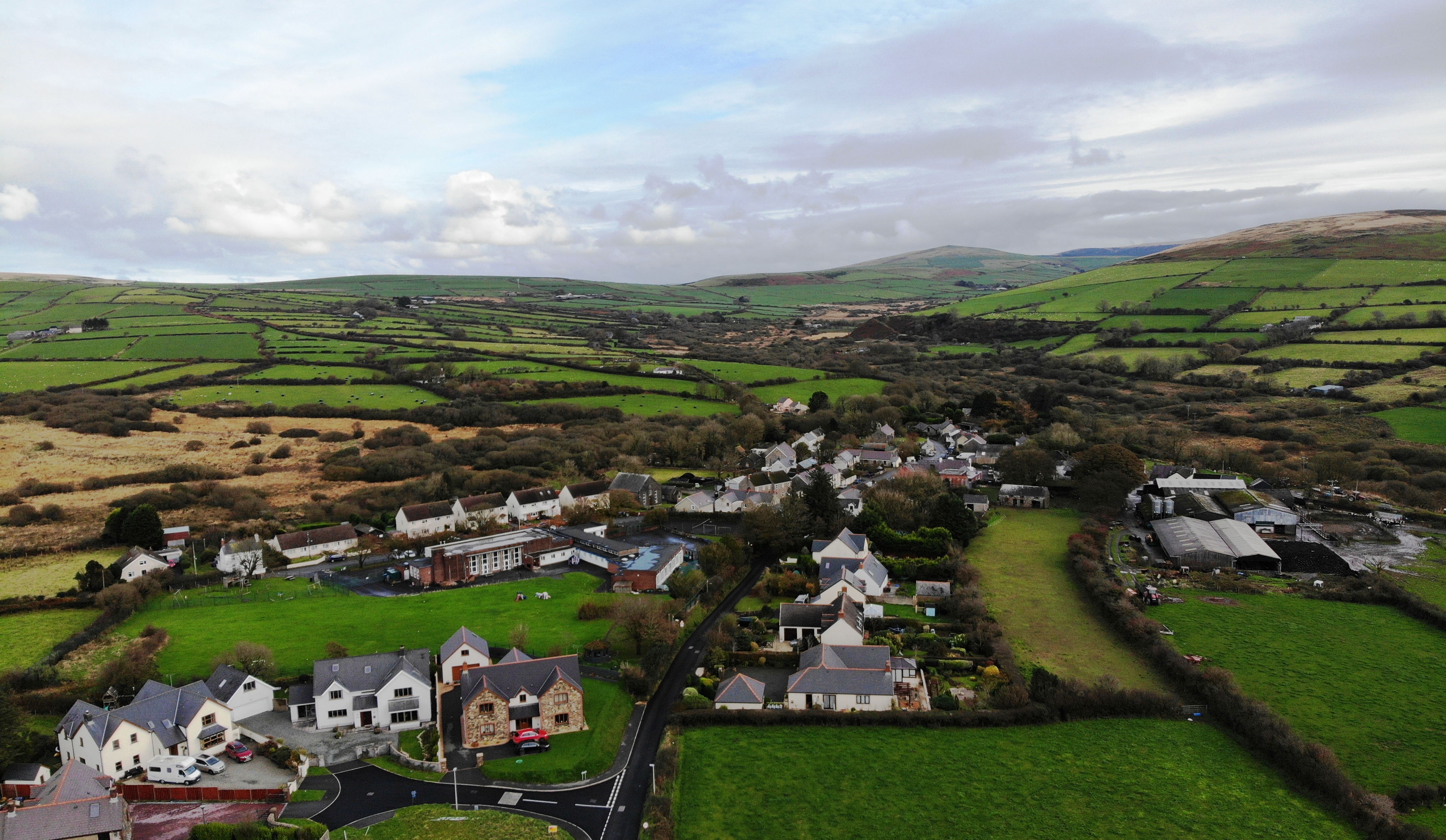
Castlebythe Common is a picturesque expanse of downs and moorland located in Pembrokeshire, Wales. Covering an area of approximately 500 acres, it is a designated Site of Special Scientific Interest due to its unique flora and fauna.

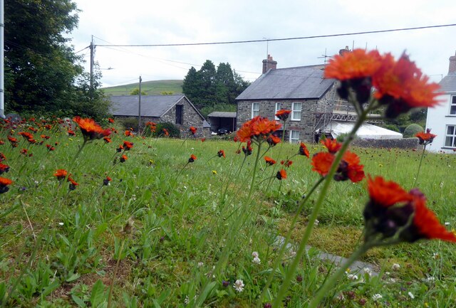
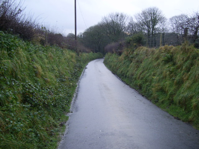
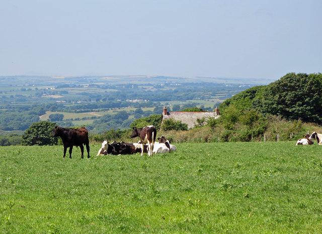
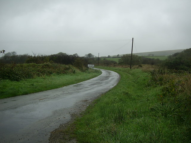
The common is characterized by its gently rolling hills, dotted with patches of scrubland and heather. The terrain is mostly composed of well-drained sandy soils, which support a diverse range of plant species. Visitors to Castlebythe Common can expect to encounter vibrant displays of purple heather, yellow gorse, and patches of wild grasses.

The common is home to a variety of bird species, making it a popular spot for birdwatchers. Visitors may catch a glimpse of the resident stonechats, skylarks, and meadow pipits, as well as migratory birds such as wheatears and warblers during the summer months.

In addition to its natural beauty, Castlebythe Common also boasts historical significance. The remains of an Iron Age hillfort can be found on the eastern edge of the common, offering a glimpse into the area's ancient past.

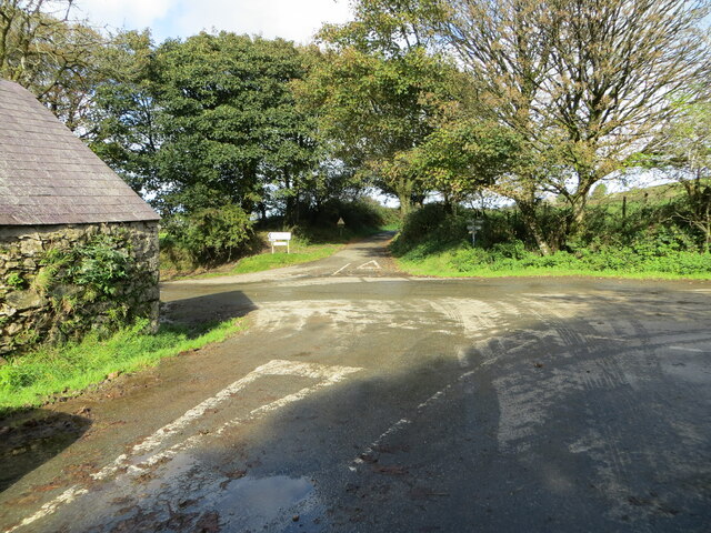
The common is accessible to the public via a network of footpaths, allowing visitors to explore its rugged terrain and enjoy breathtaking views of the surrounding countryside. It is recommended to wear appropriate footwear and bring binoculars for birdwatching enthusiasts.

Overall, Castlebythe Common offers a serene escape into nature, providing a haven for wildlife and a tranquil setting for outdoor enthusiasts to explore and appreciate.

If you have any feedback on the listing, please let us know in the comments section below.

Castlebythe Common Images

Images are sourced within 2km of 51.920674/-4.8867347 or Grid Reference SN0128. Thanks to Geograph Open Source API. All images are credited.

Footpath southeast of Puncheston/Casmael A straight, slightly raised PROW, with a hard surface beneath the grass, between overgrown hedges leads downhill towards a ford and bridge across the Afon Anghof on the edge of the village. The stone set on the edge of the lane's end (left of the dog) appears to be some sort of marker, possibly connected with the long-dismantled railway line that ran NE-SW close to this point. See <span class="nowrap"><a title="http://www.disused-stations.org.uk/p/puncheston/index.shtml" rel="nofollow ugc noopener" href="http://www.disused-stations.org.uk/p/puncheston/index.shtml">Link</a><img style="margin-left:2px;" alt="External link" title="External link - shift click to open in new window" src="https://s1.geograph.org.uk/img/external.png" width="10" height="10"/></span>
Footpath southeast of Puncheston/Casmael
A straight, slightly raised PROW, with a hard surface beneath the grass, between overgrown hedges leads downhill towards a ford and bridge across the Afon Anghof on the edge of the village. The stone set on the edge of the lane's end (left of the dog) appears to be some sort of marker, possibly connected with the long-dismantled railway line that ran NE-SW close to this point. See LinkExternal link
Fox-and-cubs in Casmael churchyard Pilosella aurantiaca, very often to be found growing in churchyards, cemeteries and other rough stony places with good drainage.
The name Fox-and-cubs refers to the way the open flowers and the buds are clustered together on the same stalk but it has a variety of other common names too.
Fox-and-cubs in Casmael churchyard
Pilosella aurantiaca, very often to be found growing in churchyards, cemeteries and other rough stony places with good drainage. The name Fox-and-cubs refers to the way the open flowers and the buds are clustered together on the same stalk but it has a variety of other common names too.
Hedge-lined minor road near Fleming's Castle Looking eastward.
Hedge-lined minor road near Fleming's Castle
Looking eastward.
Minor road at Henne Lodge Farm Looking eastward.
Minor road at Henne Lodge Farm
Looking eastward.
Track giving access to Henne Ganol Looking westward.
Track giving access to Henne Ganol
Looking westward.
Track at Rhos-Fâch Looking eastward
Track at Rhos-Fâch
Looking eastward
The crossing of minor roads at Castlebythe Farm Looking north-westward.
The crossing of minor roads at Castlebythe Farm
Looking north-westward.
Earth banked and tree-lined minor road near Garden Looking eastward.
Earth banked and tree-lined minor road near Garden
Looking eastward.
Road junction near Puncheston The tree-lined road junction east of Puncheston is just within the grid square.
Road junction near Puncheston
The tree-lined road junction east of Puncheston is just within the grid square.
Minor road heading for Puncheston This short stretch of road near Puncheston is within the grid square.
Minor road heading for Puncheston
This short stretch of road near Puncheston is within the grid square.
Mynydd Castlebythe TB testing at Griffiths, Parc-Y-Delyn, so romped up heather and snow from west after doing TT1. On detached duty at Carmarthen.
Name: Mynydd Castlebythe
Hill number: 5234
Height: 347m / 1138ft
Area: 31C: South-West Wales
Class: Hu
Grid ref: SN 02876 29652
Summit feature: trig point: OS measurement
Drop: 116m
Col: 231m  SN058299
Mynydd Castlebythe
TB testing at Griffiths, Parc-Y-Delyn, so romped up heather and snow from west after doing TT1. On detached duty at Carmarthen. Name: Mynydd Castlebythe Hill number: 5234 Height: 347m / 1138ft Area: 31C: South-West Wales Class: Hu Grid ref: SN 02876 29652 Summit feature: trig point: OS measurement Drop: 116m Col: 231m SN058299
Field bank near Henne, Castlebythe
Wheat field near Henne, Castlebythe
Cow pasture near Castlebythe
Field near Castlebythe
Track near Tufton, Henry's Moat
Country Road near Castlebythe Common A view of a bend in the road heading for Castlebythe.
Country Road near Castlebythe Common
A view of a bend in the road heading for Castlebythe.
Crossroads at Castlebythe Approaching the minor crossroads at Castlebythe from Puncheston. Straight ahead is the minor road to Tufton.
Crossroads at Castlebythe
Approaching the minor crossroads at Castlebythe from Puncheston. Straight ahead is the minor road to Tufton.
Show me another place!

Castlebythe Common is located at Grid Ref: SN0128 (Lat: 51.920674, Lng: -4.8867347)

Unitary Authority: Pembrokeshire

Police Authority: Dyfed Powys

What 3 Words

///fenced.craters.decoded. Near Ambleston, Pembrokeshire

Nearby Locations

Castlebythe Common

Related Wikis

Castlebythe

Castlebythe (Welsh: Cas-fuwch) is a village and parish in Pembrokeshire, Wales, on the southern slopes of the Preseli Hills, 10 km south-east of Fishguard...

Castlebythe Halt railway station

Castlebythe Halt railway station served the village of Puncheston, Pembrokeshire, Wales, from 1928 to 1937 on the North Pembrokeshire and Fishguard Railway...

Puncheston

Puncheston (Welsh: Cas-mael or Casmael) is a village, parish and community in Pembrokeshire, southwest Wales. It sits below the mountain known as Castlebythe...

Waun Fawr, Puncheston

Waun Fawr, Puncheston is a Site of Special Scientific Interest (or SSSI) in Pembrokeshire, South Wales. It has been designated as a Site of Special Scientific...

Puncheston railway station

Puncheston railway station served the village of Puncheston, Pembrokeshire, Wales, from 1895 to 1949 on the North Pembrokeshire and Fishguard Railway....

Martell Bridge Halt railway station

Martell Bridge Halt railway station served the village of Little Newcastle, Pembrokeshire, Wales, from 1930 to 1937 on the North Pembrokeshire and Fishguard...

Wallis Moor

Wallis Moor is a Site of Special Scientific Interest (or SSSI) 12 km to the north of Haverfordwest near the village of Ambleston in Pembrokeshire, South...

Tufton, Pembrokeshire

Tufton is a crossroads hamlet in the parish of Henry's Moat in Pembrokeshire, Wales, on the B4329, a road between Eglwyswrw and Haverfordwest across the...

Have you been to Castlebythe Common?

Leave your review of Castlebythe Common below (or comments, questions and feedback).