Burngullow Common

Downs, Moorland in Cornwall

England

Burngullow Common

Treverbyn: Wheal Martyn china clay pit Excavation of china clay had begun here by 1840. There were two pits: Wheal Martyn and Greensplat. Greensplat is to the left of this image. The two pits have now merged but are worked separately: Wheal Martyn pit is owned by Imerys Mineral Ltd. Clay is processed and refined - via a pipeline - at Littlejohns clayworks. This site is within Treverbyn parish, near St Austell
Treverbyn: Wheal Martyn china clay pit Credit: Martin Bodman

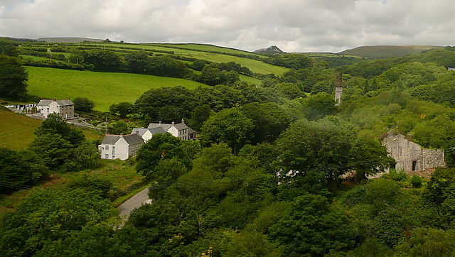
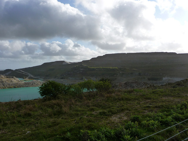
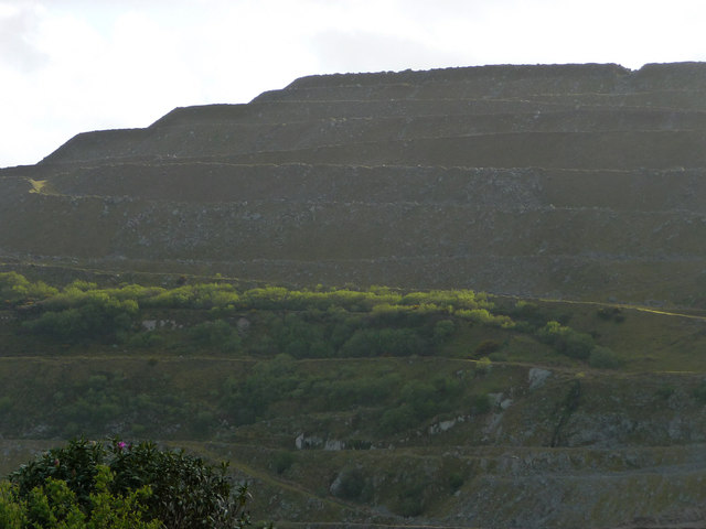
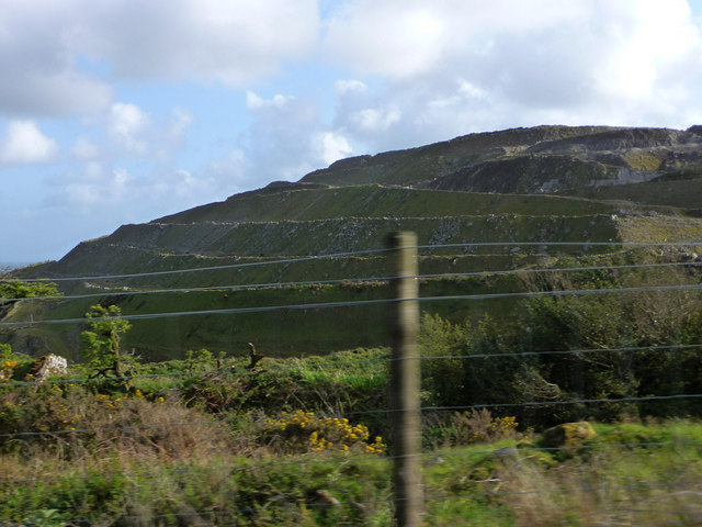
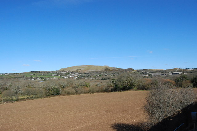
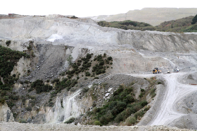
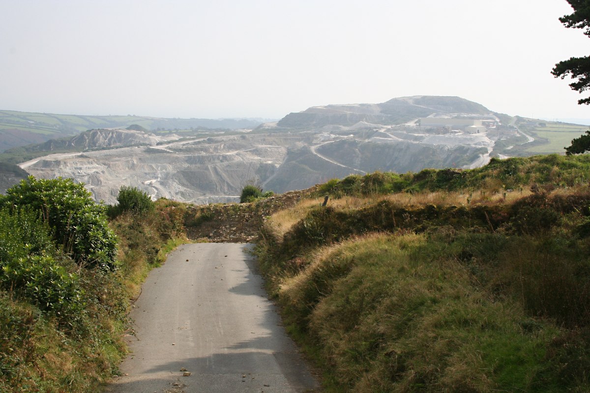
Burngullow Common is a picturesque area located in the county of Cornwall, England. Situated between the towns of St Austell and Truro, it is known for its stunning downs and moorland landscape. Covering an area of approximately 300 acres, Burngullow Common offers visitors a tranquil and natural environment to explore.

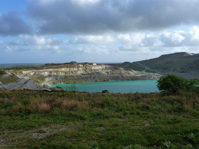
The common is characterized by its rolling hills and expansive open spaces, which are adorned with vibrant heather and gorse during the summer months. The diverse vegetation provides a habitat for a variety of wildlife, including birds, butterflies, and small mammals. It is not uncommon to spot species such as skylarks, kestrels, and adders within the common.

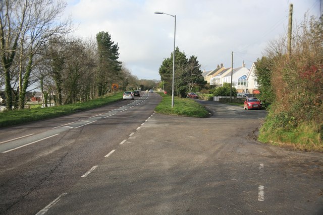
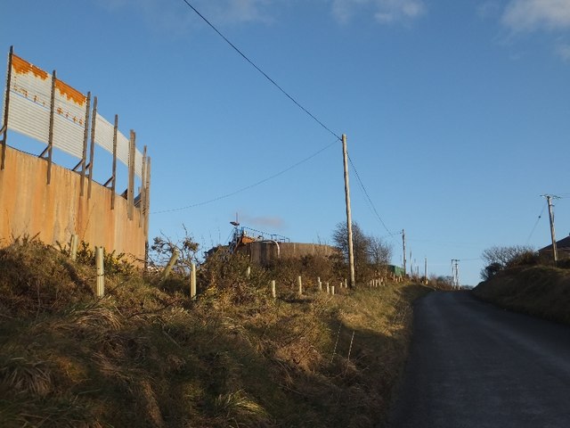
Walking trails wind their way through the area, allowing visitors to fully immerse themselves in the beauty of the surroundings. These paths offer breathtaking views of the surrounding countryside and provide an excellent opportunity for nature enthusiasts to observe the local flora and fauna.

Burngullow Common is also home to a number of archaeological sites, including ancient burial mounds and stone circles, dating back to the Neolithic and Bronze Age periods. These historical remnants provide a glimpse into the rich cultural heritage of the area.

Whether it's taking a leisurely walk, birdwatching, or simply relaxing in the peaceful atmosphere, Burngullow Common offers visitors a chance to escape the hustle and bustle of everyday life and connect with nature.

If you have any feedback on the listing, please let us know in the comments section below.

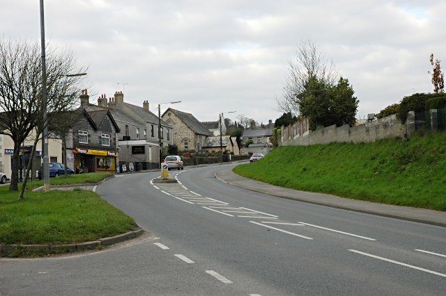
Burngullow Common Images

Images are sourced within 2km of 50.352123/-4.8333718 or Grid Reference SW9854. Thanks to Geograph Open Source API. All images are credited.

Treverbyn: Wheal Martyn china clay pit Excavation of china clay had begun here by 1840. There were two pits: Wheal Martyn and Greensplat. Greensplat is to the left of this image. The two pits have now merged but are worked separately: Wheal Martyn pit is owned by Imerys Mineral Ltd. Clay is processed and refined - via a pipeline - at Littlejohns clayworks. This site is within Treverbyn parish, near St Austell
Treverbyn: Wheal Martyn china clay pit
Excavation of china clay had begun here by 1840. There were two pits: Wheal Martyn and Greensplat. Greensplat is to the left of this image. The two pits have now merged but are worked separately: Wheal Martyn pit is owned by Imerys Mineral Ltd. Clay is processed and refined - via a pipeline - at Littlejohns clayworks. This site is within Treverbyn parish, near St Austell
Gover Valley This view from the Gover railway viaduct shows a valley once busy with the china clay industry, note the chimney, but now returning to an intense greenness.
This photo was taken from the 1158 Penzance to London Paddington train, having left Truro at 1244 and about to arrive at St Austell.
Gover Valley
This view from the Gover railway viaduct shows a valley once busy with the china clay industry, note the chimney, but now returning to an intense greenness. This photo was taken from the 1158 Penzance to London Paddington train, having left Truro at 1244 and about to arrive at St Austell.
Lanjeth on the A3058 Looking away from St Austell towards the west
Lanjeth on the A3058
Looking away from St Austell towards the west
The White Pyramid When the clay mines were at the peak then the waste tips looked liked white pyramids hence the name of this pub. Nowadays most of the tips have been landscaped or even flattened.
The White Pyramid
When the clay mines were at the peak then the waste tips looked liked white pyramids hence the name of this pub. Nowadays most of the tips have been landscaped or even flattened.
Minor road south of Carrancarrow This road skirts around a disused china clay pit, now marked as flooded on the OS map.  The vegetation by the road is typical of this china clay landscape.
Minor road south of Carrancarrow
This road skirts around a disused china clay pit, now marked as flooded on the OS map. The vegetation by the road is typical of this china clay landscape.
One of several tanks at Greensplat  This is one of several setting tanks at Greensplat China Clay Works
One of several tanks at Greensplat
This is one of several setting tanks at Greensplat China Clay Works
Blackpool China Clay works The bright blue colour of the water is due to mica in suspension
Blackpool China Clay works
The bright blue colour of the water is due to mica in suspension
Blackpool China Clay works
Blackpool China Clay works Terraces on the pit wall
Blackpool China Clay works
Terraces on the pit wall
Blackpool China Clay works Terraces on the side of the pit
Blackpool China Clay works
Terraces on the side of the pit
Greensplat Road
Greensplat Road
Greensplat Road Right in the middle of a china clay mining area but only farmland visible here.
Greensplat Road
Right in the middle of a china clay mining area but only farmland visible here.
Disused tip Blackpool China Clay Works
Disused tip
Blackpool China Clay Works
Olympic Torch Trewoon The olympic torch passing through Trewoon
Olympic Torch Trewoon
The olympic torch passing through Trewoon
View from a train towards St Stephen approaching Burngullow Entering "Clay Country" (China Clay) on a train from Truro to St Austell just pass Coombe approaching Burngullow.
View from a train towards St Stephen approaching Burngullow
Entering "Clay Country" (China Clay) on a train from Truro to St Austell just pass Coombe approaching Burngullow.
Wheal Martyn China Clay Mine Seen from the visitors viewpoint associated with the Wheal Martyn China Clay Museum.  At the top left of the photo a high pressure monitor is washing the clay out of the hillside.  The stream of clay-bearing water can then be seen dropping down to the next level of the mine to the right of the yellow digger on the right of the photo.   Finally, the water can be seen dropping down into the bottom of the mine in the lower centre of the photo.   From where it will be pumped to the clay processing works.  There are actually two china clay pits visible from the viewpoint.  As the workings have expanded the two have merged into one.  This end of the mine is the Greensplat end which was operated by Goonvean until 2012 when the company was taken over by Imerys.  The Wheal Martyn end of the mine was already Imerys operated.
Wheal Martyn China Clay Mine
Seen from the visitors viewpoint associated with the Wheal Martyn China Clay Museum. At the top left of the photo a high pressure monitor is washing the clay out of the hillside. The stream of clay-bearing water can then be seen dropping down to the next level of the mine to the right of the yellow digger on the right of the photo. Finally, the water can be seen dropping down into the bottom of the mine in the lower centre of the photo. From where it will be pumped to the clay processing works. There are actually two china clay pits visible from the viewpoint. As the workings have expanded the two have merged into one. This end of the mine is the Greensplat end which was operated by Goonvean until 2012 when the company was taken over by Imerys. The Wheal Martyn end of the mine was already Imerys operated.
Lanjeth : The A3058 The A3058 heading into Lanjeth with the village sign in view.
Lanjeth : The A3058
The A3058 heading into Lanjeth with the village sign in view.
Lanjeth : Roadside Scenery Along the roadside in Lanjeth with wood and trees.
Lanjeth : Roadside Scenery
Along the roadside in Lanjeth with wood and trees.
Show me another place!

Burngullow Common is located at Grid Ref: SW9854 (Lat: 50.352123, Lng: -4.8333718)

Unitary Authority: Cornwall

Police Authority: Devon and Cornwall

What 3 Words

///losses.cobras.something. Near Nanpean, Cornwall

Nearby Locations

Burngullow Common

Related Wikis

Hornick, Cornwall

Hornick is a hamlet in the parish of St Stephen-in-Brannel, Cornwall, England. == References ==
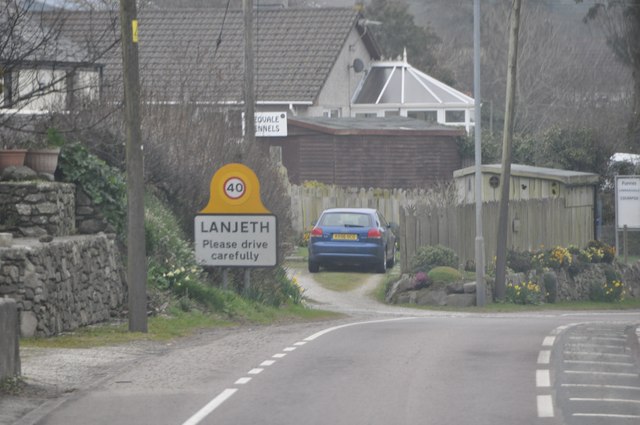
Lanjeth

Lanjeth is a village near St Austell in Cornwall, England, United Kingdom. It is in the civil parish of St Stephen-in-Brannel Its neighbouring smaller...

Greensplat

Greensplat is a location in south Cornwall, England, United Kingdom. It is immediately west of Carthew and is approximately two miles (3 km) north of St...

Trewoon

Trewoon (; Cornish: Trewoon) is a village in south Cornwall, England, United Kingdom. It is on the western outskirts of St Austell, on the A3058 road and...

Nearby Amenities

Located within 500m of 50.352123,-4.8333718
Barrier: block
Lat/Long: 50.3543138/-4.8308637
Access: no
Barrier: block
Material: stone
Lat/Long: 50.3542482/-4.8309472
Access: no
Barrier: block
Material: stone
Lat/Long: 50.3542833/-4.8310183
Material: wood
Power: pole
Lat/Long: 50.3483327/-4.8307855
Material: wood
Power: pole
Lat/Long: 50.3489592/-4.8305414
Material: wood
Power: pole
Lat/Long: 50.3495805/-4.8306139
Material: wood
Power: pole
Lat/Long: 50.350224/-4.8306997
Material: wood
Power: pole
Lat/Long: 50.3484115/-4.8321347
Material: wood
Power: pole
Lat/Long: 50.348978/-4.8316733
Ele: 208
Natural: peak
Lat/Long: 50.3554772/-4.829414
Ele: 201
Natural: saddle
Lat/Long: 50.3557452/-4.8297065
Natural: stone
Lat/Long: 50.3497979/-4.8314479
Natural: stone
Lat/Long: 50.3497783/-4.8314426
The data included in this document is from www.openstreetmap.org. The data is made available under ODbL.

Have you been to Burngullow Common?

Leave your review of Burngullow Common below (or comments, questions and feedback).