Guisborough
Settlement in Yorkshire
England
Guisborough

Guisborough is a small market town located in the ceremonial county of North Yorkshire, England. Situated at the northern edge of the North York Moors National Park, it lies approximately 10 miles south of Middlesbrough and 20 miles east of the historic city of York.
The town is known for its rich history, dating back to the Anglo-Saxon era. It was mentioned in the Domesday Book of 1086 and has since developed into a charming community with a population of around 18,000. Guisborough's economy is mainly centered around agriculture, with farming and horticulture playing a significant role.
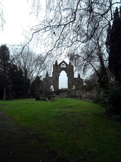
A prominent feature of Guisborough is its medieval priory, which was founded in the 12th century and is now a Grade I listed building. The priory ruins, surrounded by pleasant gardens and a beautiful woodland area known as the Guisborough Forest, attract tourists and history enthusiasts alike.
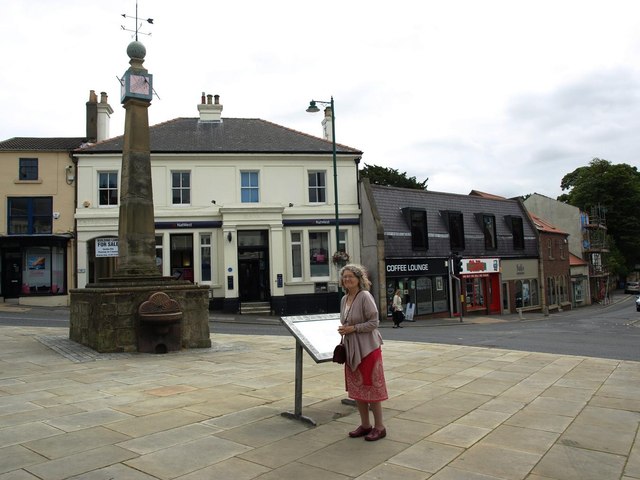
The town's market square is a focal point for local commerce and community events. It hosts a weekly market, where visitors can find a variety of fresh produce, crafts, and other goods. Guisborough also boasts an array of independent shops, cafes, and restaurants, offering a range of local and international cuisines.
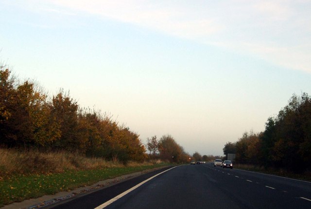
Guisborough is well-connected to surrounding areas by road and public transport. It has excellent links to major cities, making it an attractive place for commuters. The town's picturesque surroundings, historical landmarks, and friendly community make it an appealing destination for residents and tourists seeking a peaceful retreat in the heart of Yorkshire.
If you have any feedback on the listing, please let us know in the comments section below.
Guisborough Images
Images are sourced within 2km of 54.535827/-1.05099 or Grid Reference NZ6116. Thanks to Geograph Open Source API. All images are credited.


Guisborough is located at Grid Ref: NZ6116 (Lat: 54.535827, Lng: -1.05099)
Division: North Riding
Unitary Authority: Redcar and Cleveland
Police Authority: Cleveland
What 3 Words
///toolbar.identify.shame. Near Guisborough, North Yorkshire
Nearby Locations
Related Wikis
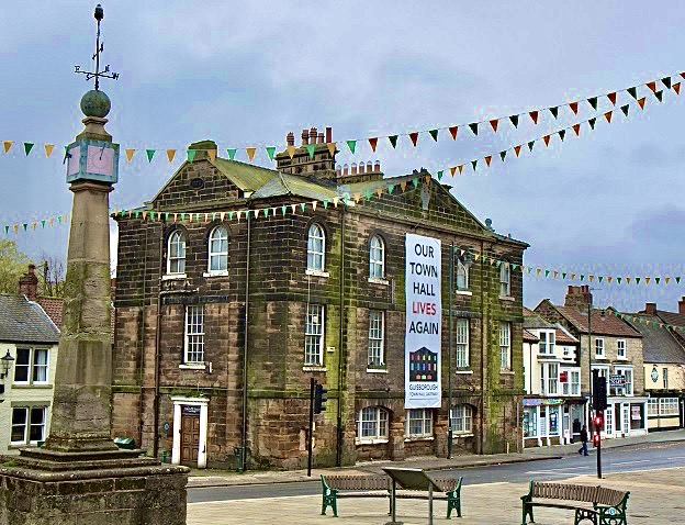
Guisborough Town Hall
Guisborough Town Hall is a municipal building on Westgate in Guisborough, North Yorkshire, England. The structure, which has mainly been used as a venue...
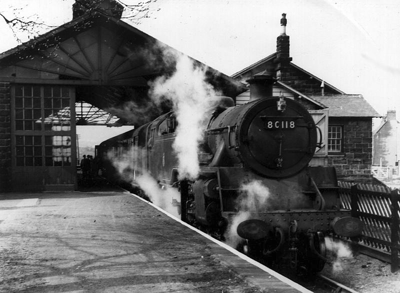
Guisborough railway station
Guisborough railway station was the terminus of the Middlesbrough and Guisborough Railway. It served the town of Guisborough in North Yorkshire, England...
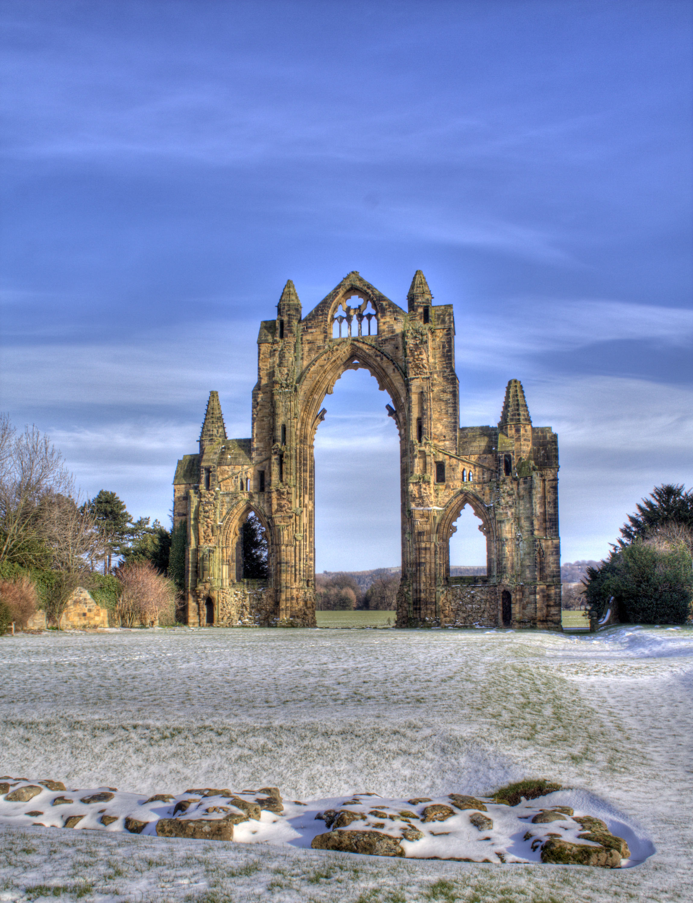
Gisborough Priory
Gisborough Priory is a ruined Augustinian priory in Guisborough in the current borough of Redcar and Cleveland, North Yorkshire, England. It was founded...

Guisborough
Guisborough ( GHIZ-bər-ə) is a market town and civil parish in the borough of Redcar and Cleveland, North Yorkshire, England. It lies north of the North...

Laurence Jackson School
Laurence Jackson School is a coeducational secondary school located in Guisborough, North Yorkshire, England. It has a capacity of 1,250 pupils. The school...
Hutton Junction railway station
Hutton Junction railway station served the town of Guisborough, in the historical county of North Riding of Yorkshire, England, from 1878 to 1891 on the...
Guisborough Town F.C.
Guisborough Town Football Club is a football club based in Guisborough, North Yorkshire, England. They are currently members of the Northern League Division...

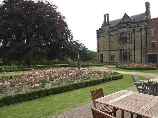
Gisborough Hall
Gisborough Hall is a 19th-century mansion house, now a hotel, at Guisborough, Redcar and Cleveland, England. It is a Grade II listed building. The manor...
Nearby Amenities
Located within 500m of 54.535827,-1.05099Have you been to Guisborough?
Leave your review of Guisborough below (or comments, questions and feedback).