Buckspool Down

Downs, Moorland in Pembrokeshire

Wales

Buckspool Down

St Govans Chapel
St Govans Chapel Credit: Paul Allison

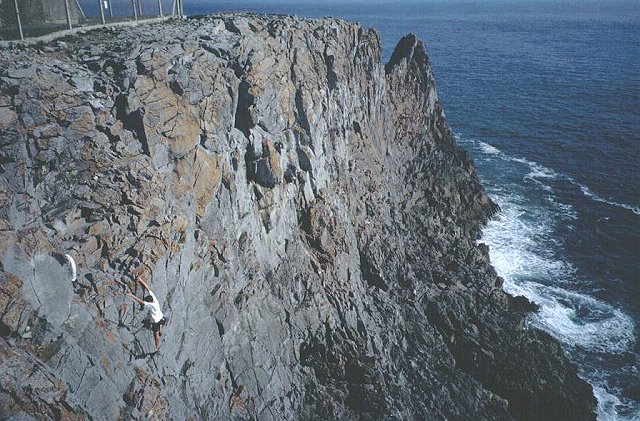
Buckspool Down, located in Pembrokeshire, Wales, is a stunning expanse of downs and moorland that spans over a vast area. This picturesque landscape is known for its rolling hills, open grasslands, and diverse flora and fauna.

Covering an area of approximately [insert size], Buckspool Down offers breathtaking panoramic views of the surrounding countryside, making it a popular destination for nature enthusiasts and hikers alike. The downland is characterized by its gentle slopes and fertile soil, which supports a variety of plant species including heather, gorse, and wildflowers. During the summer months, the downs come alive with vibrant colors, creating a spectacular sight for visitors.

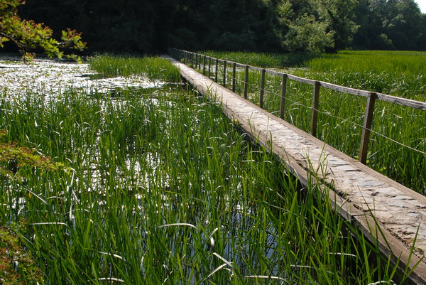
The moorland areas of Buckspool Down are rich in biodiversity, providing a habitat for numerous wildlife species. Visitors may spot animals such as red deer, foxes, badgers, and various bird species including skylarks and kestrels. The moorland is also home to several rare plant species, adding to the ecological significance of the area.

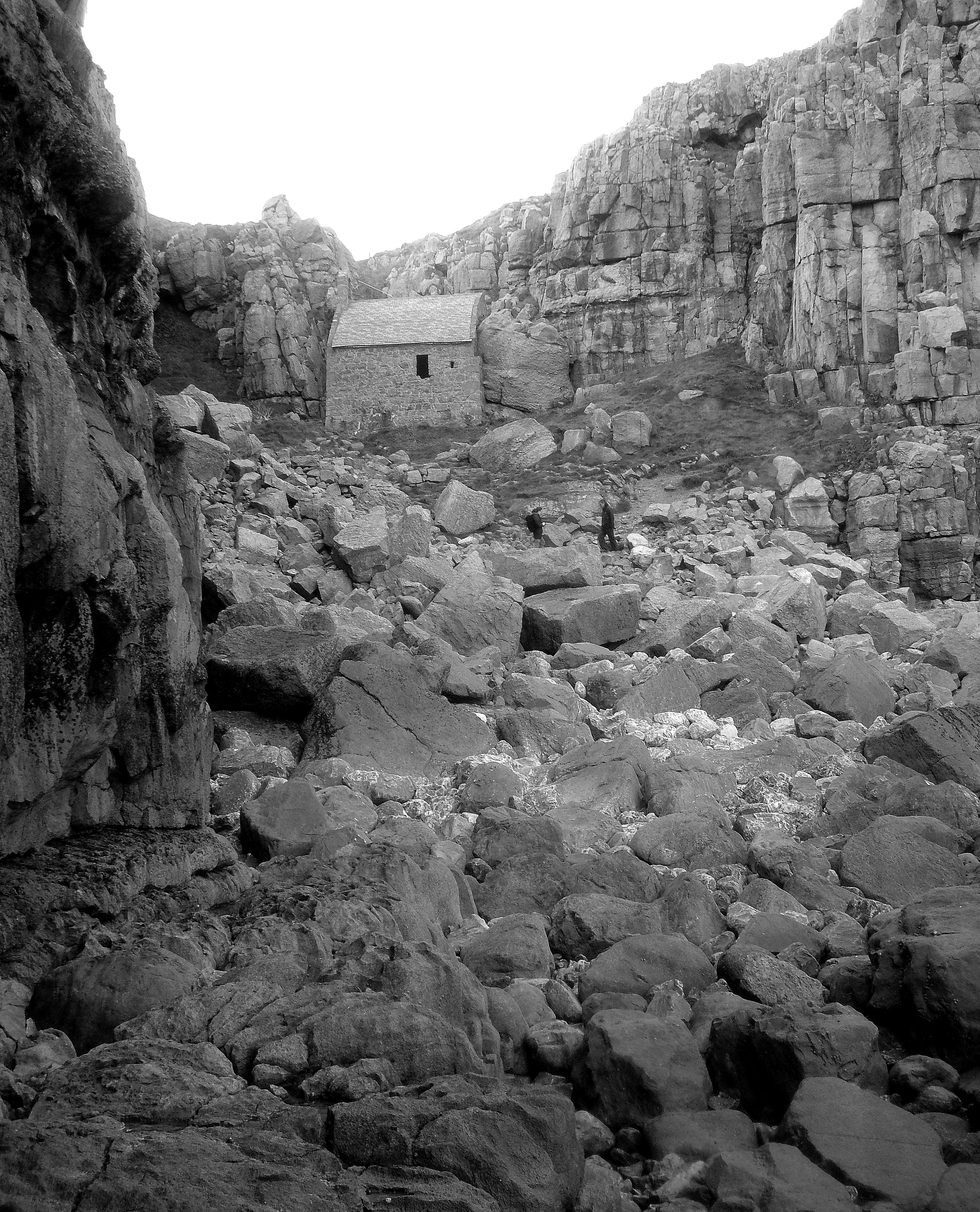
In addition to its natural beauty, Buckspool Down holds historical and cultural significance. The area is dotted with ancient burial mounds and standing stones, giving insight into its past human presence. These archaeological remains attract history enthusiasts who are interested in exploring the rich heritage of the area.

Overall, Buckspool Down in Pembrokeshire is a captivating destination for those seeking tranquility, natural beauty, and a glimpse into the history of the land.

If you have any feedback on the listing, please let us know in the comments section below.

Buckspool Down Images

Images are sourced within 2km of 51.604421/-4.953119 or Grid Reference SR9593. Thanks to Geograph Open Source API. All images are credited.

St Govans Chapel
St Govans Chapel
Bullslaughter Bay Looking South towards Mewsford Point.
Bullslaughter Bay
Looking South towards Mewsford Point.
Bosherton Lily Ponds In June this three mile stretch of water is covered with white lilies.
Bosherton Lily Ponds
In June this three mile stretch of water is covered with white lilies.
Bosherston Lakes The lakes, or lily ponds, are part of the National Trust's Stackpole Estate.
Bosherston Lakes
The lakes, or lily ponds, are part of the National Trust's Stackpole Estate.
Saddle Head The limestone crags of Pembroke. Saddle head is a promontory with some of the more friendly routes in Pembroke. This is Sea Mist (VS I think).
Saddle Head
The limestone crags of Pembroke. Saddle head is a promontory with some of the more friendly routes in Pembroke. This is Sea Mist (VS I think).
Saddle Head Looking out to sea along this narrow promontory. The dip that gives it its name can be seen, as well as the fence of the radar station.
Saddle Head
Looking out to sea along this narrow promontory. The dip that gives it its name can be seen, as well as the fence of the radar station.
Huntsmans Leap Massive chasm cut into the limestone by the sea. It extends well into the square to the south, but the climbers are in SR9693. The routes out of here tend to be hard.
Huntsmans Leap
Massive chasm cut into the limestone by the sea. It extends well into the square to the south, but the climbers are in SR9693. The routes out of here tend to be hard.
Triple Overhang. East of Mewsford Point, miles of fine limestone crags. The centrepiece of this scene is Triple Overhang, tackled by a very steep roof infested climb. Someone can be seen belaying at the base.
Triple Overhang.
East of Mewsford Point, miles of fine limestone crags. The centrepiece of this scene is Triple Overhang, tackled by a very steep roof infested climb. Someone can be seen belaying at the base.
Church at Bosherton The church is dedicated to St Michael and All Angels.
Church at Bosherton
The church is dedicated to St Michael and All Angels.
St. Govan's Chapel
St. Govan's Chapel
Bosherston Lily Ponds
St Govans
St Govans
The Castle - near Bosherton A fine stretch of limestone cliffs along the south coast of Pembrokeshire.
The Castle - near Bosherton
A fine stretch of limestone cliffs along the south coast of Pembrokeshire.
Stormy seas at St Govans Very wild weather on new years day 2007, spectacular !!
Stormy seas at St Govans
Very wild weather on new years day 2007, spectacular !!
St Michael's church, Bosherston At the time of the picture some work was being carried out on the roof of the church.
St Michael's church, Bosherston
At the time of the picture some work was being carried out on the roof of the church.
New Quay beach near St Govan's Head, Pembrokeshire
Path down to St Govan's Chapel
St Govan's Chapel
St Govan's Chapel
Show me another place!

Buckspool Down is located at Grid Ref: SR9593 (Lat: 51.604421, Lng: -4.953119)

Unitary Authority: Pembrokeshire

Police Authority: Dyfed Powys

What 3 Words

///quench.rigs.wounds. Near Bosherston, Pembrokeshire

Related Wikis

Huntsman's Leap

Huntsman's Leap is a deep, narrow and sheer-sided coastal chasm or geo developed in the Carboniferous Limestone of the Pembrokeshire Coast National Park...

Saint Govan

Saint Govan (Welsh: Gofan; died 586) was a hermit who lived in a fissure on the side of coastal cliff near Bosherston, in the Pembrokeshire Coast National...

St Govan's Chapel

St Govan's Chapel is a chapel located at St Govan's Head, Pembrokeshire in south west Wales. Built into the side of a limestone cliff, the building measures...

Bosherston Lakes

Bosherston Lakes or Bosherston Lily Ponds is a lake system with three principal arms. The lakes were created by damming a small river on the Stackpole...

Nearby Amenities

Located within 500m of 51.604421,-4.953119
Man Made: tower
Tower Type: communication
Lat/Long: 51.6019283/-4.9540068
The Castle
Place: locality
Lat/Long: 51.602676/-4.9537308
Buckspool Down
Place: locality
Lat/Long: 51.604284/-4.952034
The data included in this document is from www.openstreetmap.org. The data is made available under ODbL.

Have you been to Buckspool Down?

Leave your review of Buckspool Down below (or comments, questions and feedback).