Barras Moor

Downs, Moorland in Cornwall

England

Barras Moor

Pellyn-Wartha Trig Point Flush Bracket S7872
Pellyn-Wartha Trig Point Flush Bracket S7872 Credit: thejackrustles

Barras Moor is a picturesque area located in Cornwall, England, known for its stunning downs and moorland landscapes. Stretching across an expansive area, Barras Moor offers breathtaking views and a tranquil ambiance for visitors to enjoy.

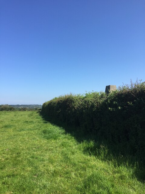
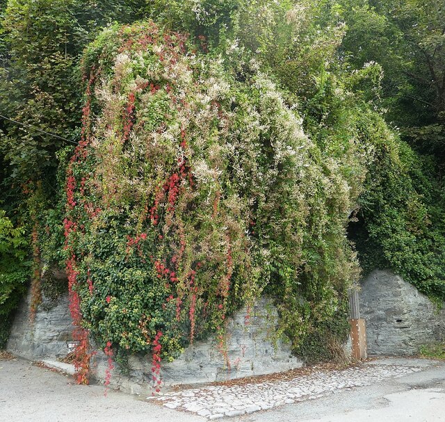
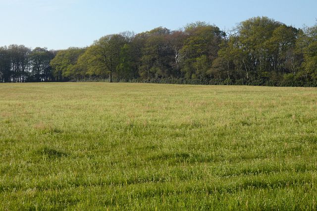
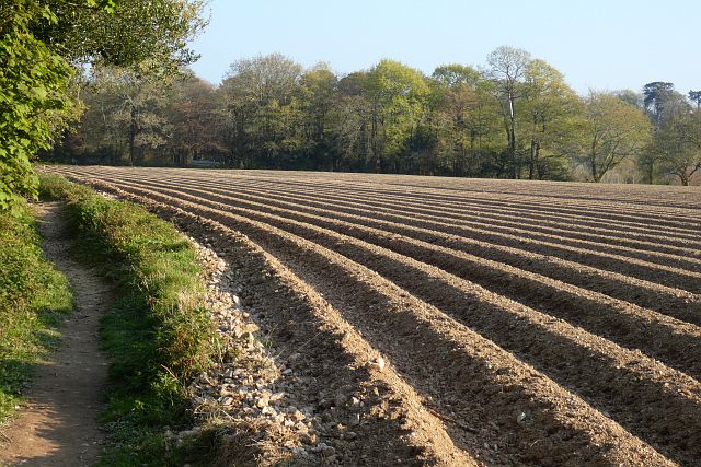
The moorland of Barras Moor is characterized by its vast open spaces, covered in heather, gorse, and grasses. This unique ecosystem supports a variety of wildlife, including birds, such as skylarks and meadow pipits, as well as smaller mammals like rabbits and voles. The moorland also boasts a diverse range of plant species, creating a colorful tapestry during the spring and summer months.

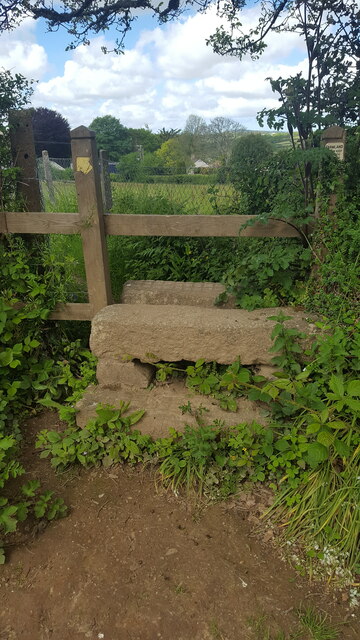
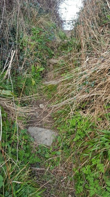
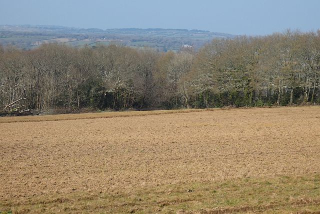
In addition to the moorland, Barras Moor is dotted with picturesque downs, which are gently rolling hills covered in grass. These downs offer panoramic views of the surrounding countryside, with the coastline visible in the distance. Visitors can enjoy leisurely walks or hikes through the downs, taking in the natural beauty and peaceful atmosphere.

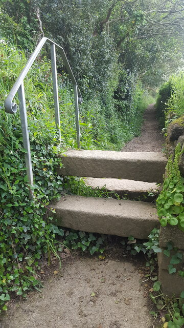
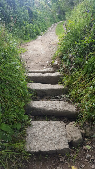
Barras Moor is a haven for outdoor enthusiasts, providing ample opportunities for activities such as hiking, bird watching, and photography. The moorland and downs provide a stunning backdrop for capturing the beauty of the region. Moreover, the area is crisscrossed by a network of footpaths and trails, allowing visitors to explore the surroundings and discover hidden gems.

Overall, Barras Moor is a beautiful and serene destination in Cornwall, offering visitors a chance to immerse themselves in the natural splendor of the downs and moorland. Whether it's enjoying a leisurely stroll or embracing more adventurous pursuits, this area is a must-visit for nature lovers and those seeking a peaceful retreat.

If you have any feedback on the listing, please let us know in the comments section below.

Barras Moor Images

Images are sourced within 2km of 50.195564/-5.1207353 or Grid Reference SW7737. Thanks to Geograph Open Source API. All images are credited.

Pellyn-Wartha Trig Point Flush Bracket S7872
Perranarworthal - Former lime kilns Hidden under a lot of greenery are the former lime kilns in Perranarworthal immediately to the northeast of the Norway Inn.
Perranarworthal - Former lime kilns
Hidden under a lot of greenery are the former lime kilns in Perranarworthal immediately to the northeast of the Norway Inn.
Stone Stile SW7739a On a public path that runs from the side of the Post Office in School Hill, Perranwell Station to St Piran’s Church, Perranarworthal.
Cattle stile made with just three long horizontal granite blocks.
Public footpath 313/1/4 gold from Perranwell to Churchtown.
Stone Stile SW7739a
On a public path that runs from the side of the Post Office in School Hill, Perranwell Station to St Piran’s Church, Perranarworthal. Cattle stile made with just three long horizontal granite blocks. Public footpath 313/1/4 gold from Perranwell to Churchtown.
Stone Stile SW7739b On a public footpath that runs from the side of the Post Office in School Hill, Perranwell Station to St Piran’s Church, Perranarworthal. This stile is sited at the top of the footpath towards the church & just beyond this point the footpath becomes a public byway.
Coffen stile with five long granite blocks.
Coffen stile – a stile built over a pit – like a granite cattle grid.
Coffen is a Cornish word for a man-made hole in the ground.
Public footpath 313/1/4 gold and byway 313/1/3 gold from Perranwell to the Churchtown.
Stone Stile SW7739b
On a public footpath that runs from the side of the Post Office in School Hill, Perranwell Station to St Piran’s Church, Perranarworthal. This stile is sited at the top of the footpath towards the church & just beyond this point the footpath becomes a public byway. Coffen stile with five long granite blocks. Coffen stile – a stile built over a pit – like a granite cattle grid. Coffen is a Cornish word for a man-made hole in the ground. Public footpath 313/1/4 gold and byway 313/1/3 gold from Perranwell to the Churchtown.
Stone Stile SW7739c On a public footpath leading from the top of the footpath from Post Office on School Hill, coming out in Perranwell Station on St Pirans Hill. Where this footpath leads off, the footpath from School Hill & the Church becomes a wider public byway.
It is a granite stile with a wooden top. Two granite steps on the east side, three granite steps on the west side. The granite is very even (quite new?) and the top step Public footpath 313/1/3 gold from St Pirans Hill to the Churchtown.has cross hatched markings.
Stone Stile SW7739c
On a public footpath leading from the top of the footpath from Post Office on School Hill, coming out in Perranwell Station on St Pirans Hill. Where this footpath leads off, the footpath from School Hill & the Church becomes a wider public byway. It is a granite stile with a wooden top. Two granite steps on the east side, three granite steps on the west side. The granite is very even (quite new?) and the top step Public footpath 313/1/3 gold from St Pirans Hill to the Churchtown.has cross hatched markings.
Stone Stile SW7739g Perranwell
Step stile through a gap in the hedge. The steps are set apart, embedded in the bank. East side 1 granite step Height 8” width 18 inches. On west side 4 steps Height 48 inches.
A long public footpath 313/7/3 (Gold) leads south west then curving around to south after passing under Railway bridge from Byway 313/12/1, joining public Footpath 313/7/2.
Stone Stile SW7739g
Perranwell Step stile through a gap in the hedge. The steps are set apart, embedded in the bank. East side 1 granite step Height 8” width 18 inches. On west side 4 steps Height 48 inches. A long public footpath 313/7/3 (Gold) leads south west then curving around to south after passing under Railway bridge from Byway 313/12/1, joining public Footpath 313/7/2.
Farmland, Mylor Beside the road descending from Carclew to Perranarworthal, this field was in the process of being cultivated.
Farmland, Mylor
Beside the road descending from Carclew to Perranarworthal, this field was in the process of being cultivated.
Grassland, Mylor With beech trees in the vicinity Carclew coming into leaf.
Grassland, Mylor
With beech trees in the vicinity Carclew coming into leaf.
Farmland, Mylor The footpath north of Rekedjack Cottages follows the edge of this furrowed potato field.
Farmland, Mylor
The footpath north of Rekedjack Cottages follows the edge of this furrowed potato field.
Woodland and footpath, Mylor The main access into Devichoys Wood, a Wildlife Trust nature reserve.
Woodland and footpath, Mylor
The main access into Devichoys Wood, a Wildlife Trust nature reserve.
Former Methodist Chapel, Lower Treluswell It was originally Wesleyan, and is dated no later than 1880, closing in 1954.
Former Methodist Chapel, Lower Treluswell
It was originally Wesleyan, and is dated no later than 1880, closing in 1954.
St Piran's Church
St Piran's Church
Wesleyan Chapel, Perranwell
Church of St Michael and all Angels
Ponsanooth Methodist Church
Cafe church In Ponsanooth Hall
Cafe church
In Ponsanooth Hall
Direction Sign - Signpost by Greenwith Hill, Perranwell Pyramid finial - Weld repair to arm 1; 'Cornwall' post by the UC road, in parish of Perranarworthal (Carrick District), Perranwell Station, junction of Greenwith Hill with Station Road.

Cornwall & Scilly HER.
HER Number: MCO56747 

Surveyed

Milestone Society National ID: CW_SW7739
Direction Sign - Signpost by Greenwith Hill, Perranwell
Pyramid finial - Weld repair to arm 1; 'Cornwall' post by the UC road, in parish of Perranarworthal (Carrick District), Perranwell Station, junction of Greenwith Hill with Station Road. Cornwall & Scilly HER. HER Number: MCO56747 Surveyed Milestone Society National ID: CW_SW7739
Fingerpost in Perranwell
Show me another place!

Barras Moor is located at Grid Ref: SW7737 (Lat: 50.195564, Lng: -5.1207353)

Unitary Authority: Cornwall

Police Authority: Devon and Cornwall

What 3 Words

///highs.spurted.snacks. Near Perranarworthal, Cornwall

Nearby Locations

Barras Moor

Related Wikis

Burnthouse, Cornwall

Burnthouse is a hamlet in the civil parish of Ponsanooth, Cornwall, England. Burnthouse lies on the A393 road 2 miles (3.2 km) north-west of Penryn....

Ponsongath

Ponsongath (Cornish: Pons an Gath) is a hamlet west of Coverack in west Cornwall, England.In 2017 Ponsongath Methodist Church merged with the Methodist...
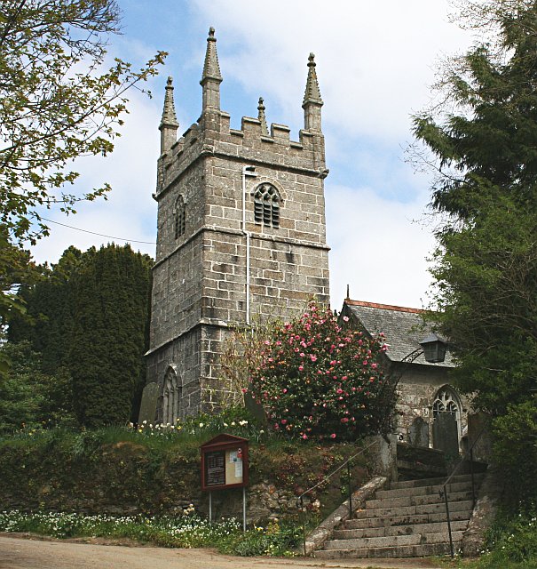
Perranarworthal

Perranarworthal (Cornish: Peran ar Wodhel) is a civil parish and village in Cornwall, England, United Kingdom. The village is about four miles (6.5 km...

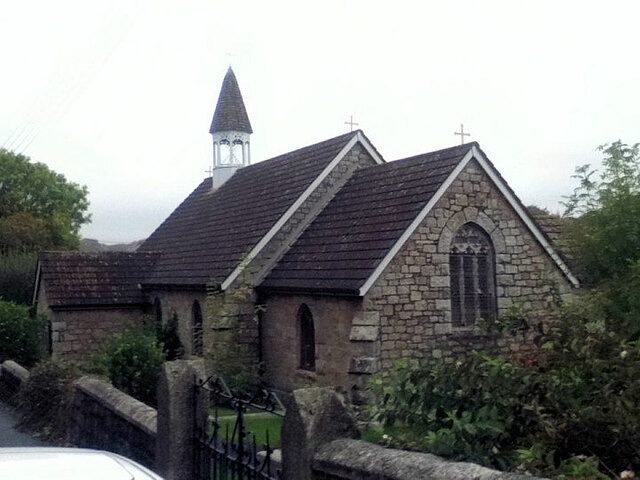
St Piran's Church, Perranarworthal

St Piran's Church is an active Anglican parish church in Perranarworthal, Cornwall, England. It is part of a united benefice consisting of eight churches...

Nearby Amenities

Located within 500m of 50.195564,-5.1207353
Devichoys Wood Nature Reserve
Leisure: nature_reserve
Website: https://www.wildlifetrusts.org/reserves/devichoys-wood
Lat/Long: 50.1970478/-5.1230692
Parking
Access: customers
Operator: Boot Up! Outdoor Learning
Parking: surface
Lat/Long: 50.1948682/-5.1230445
Generator Method: photovoltaic
Generator Output Electricity: small_installation
Generator Source: solar
Generator Type: solar_photovoltaic_panel
Location: roof
Power: generator
Source: bing;survey
Survey Date: 2020-07-25
Lat/Long: 50.1917603/-5.1177809
The data included in this document is from www.openstreetmap.org. The data is made available under ODbL.

Have you been to Barras Moor?

Leave your review of Barras Moor below (or comments, questions and feedback).