Bargus Common

Downs, Moorland in Cornwall

England

Bargus Common

The Cornish Arms in summer
The Cornish Arms in summer Credit: Phillip Roscorla

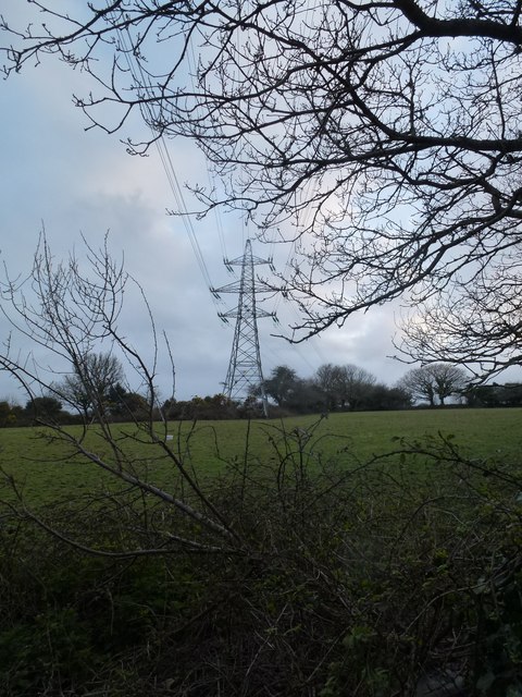
Bargus Common, located in Cornwall, England, is a vast expanse of natural beauty characterized by its picturesque downs and moorland. Covering an area of approximately 100 hectares, it is a popular destination for nature lovers and outdoor enthusiasts.

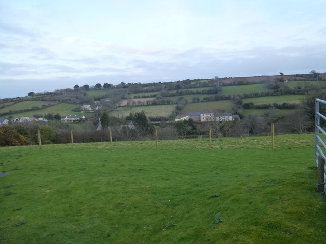
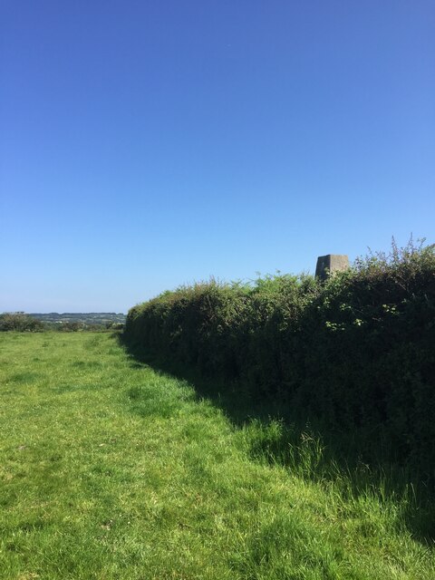
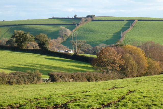
The common is primarily composed of rolling downs, offering stunning panoramic views of the surrounding countryside. These open grasslands are home to a diverse range of flora and fauna, including wildflowers, grasses, and various bird species. Visitors can enjoy leisurely walks or hikes through the downs, immersing themselves in the tranquility and serenity of the landscape.

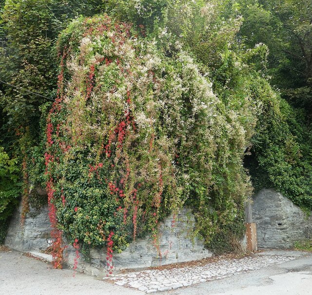
In addition to the downs, Bargus Common also features areas of moorland, adding to its diverse ecosystem. Moorland vegetation, such as heather and gorse, thrives in this environment, providing a habitat for wildlife such as rabbits, foxes, and various bird species, including skylarks and buzzards.

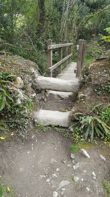
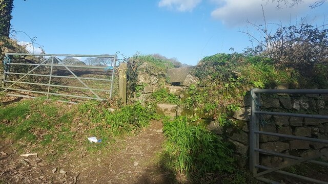
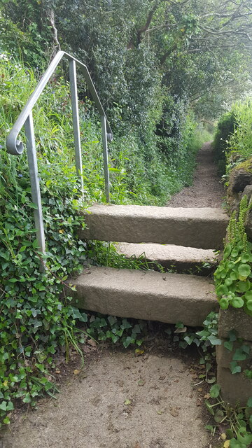
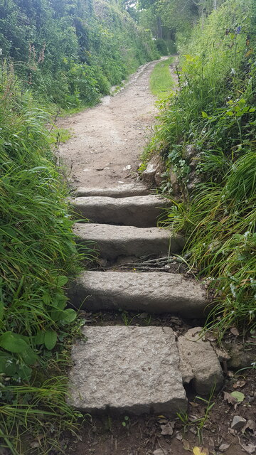
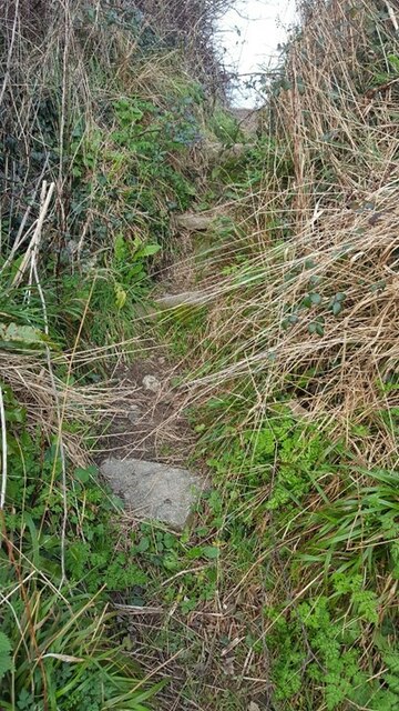
The common is well-maintained, with pathways and trails that guide visitors through its enchanting landscapes. It is a haven for outdoor activities such as picnicking, birdwatching, and photography. The expansive open spaces also make it an ideal location for kite flying and other recreational pursuits.

Bargus Common is easily accessible, with ample parking facilities nearby. It is a cherished natural gem in Cornwall, attracting visitors from far and wide who seek to experience the beauty and tranquility of the downs and moorland. Whether it's a leisurely stroll or a day of exploration, Bargus Common offers a delightful escape into nature's embrace.

If you have any feedback on the listing, please let us know in the comments section below.

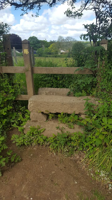
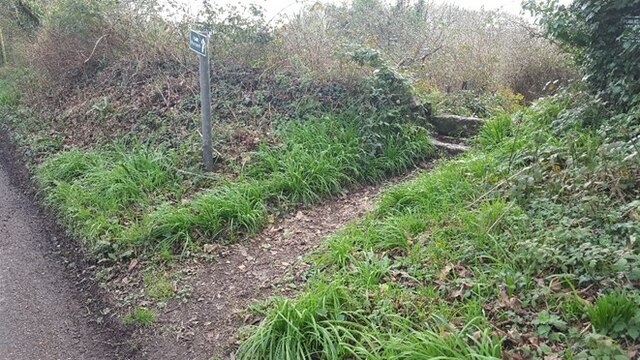
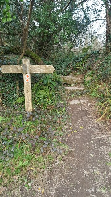
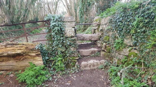
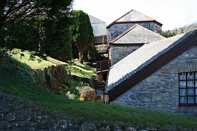
Bargus Common Images

Images are sourced within 2km of 50.215183/-5.1331336 or Grid Reference SW7639. Thanks to Geograph Open Source API. All images are credited.

The Cornish Arms in summer
Chimney, Point Mills Arsenic Refinery, Bissoe
Road into Bissoe
Road into Bissoe
Road junction, Bissoe
Pylon and field
Pylon and field
Looking south towards Hick's Mill
Pellyn-Wartha Trig Point Flush Bracket S7872
Perranarworthal - Former lime kilns Hidden under a lot of greenery are the former lime kilns in Perranarworthal immediately to the northeast of the Norway Inn.
Perranarworthal - Former lime kilns
Hidden under a lot of greenery are the former lime kilns in Perranarworthal immediately to the northeast of the Norway Inn.
Stone Stile SW7639a On byway 313/17/3&4 gold leading to Bargus Farm. Byway leads off Perranwell Station (Greenwith Road) to Frogpool road. The stile is at the west end of a footbridge, beside a ford.
Cattle stile with one ground level stone bar each side of a central raised stone bar.
Public byway 313/17/3&4 (gold) from: Perranwell Station to: Bargus Farm.
Stone Stile SW7639a
On byway 313/17/3&4 gold leading to Bargus Farm. Byway leads off Perranwell Station (Greenwith Road) to Frogpool road. The stile is at the west end of a footbridge, beside a ford. Cattle stile with one ground level stone bar each side of a central raised stone bar. Public byway 313/17/3&4 (gold) from: Perranwell Station to: Bargus Farm.
Stone Stile SW7639b At the junction of 3 footpaths 313/13/2 which runs from Trewedna Water Road to White Cottage in a west to east direction, 313/13/3 (bronze) which goes over the stile and runs from White Cottage to Bargus Farm, 313/13/1 runs from White Cottage back to Trewedna Water Road initially in a southerly direction.
East side 2 granite steps with a large flat slate slab across the top. 31 inches wide, 37 inches high.
West side the same large slate at the top, 2 granite slabs, stone step on the right side, some stones at the base. 50 inches high. 
Public footpath 313/13/3 (bronze) from White Cottage to Bargus Farm.
Stone Stile SW7639b
At the junction of 3 footpaths 313/13/2 which runs from Trewedna Water Road to White Cottage in a west to east direction, 313/13/3 (bronze) which goes over the stile and runs from White Cottage to Bargus Farm, 313/13/1 runs from White Cottage back to Trewedna Water Road initially in a southerly direction. East side 2 granite steps with a large flat slate slab across the top. 31 inches wide, 37 inches high. West side the same large slate at the top, 2 granite slabs, stone step on the right side, some stones at the base. 50 inches high. Public footpath 313/13/3 (bronze) from White Cottage to Bargus Farm.
Stone Stile SW7739a On a public path that runs from the side of the Post Office in School Hill, Perranwell Station to St Piran’s Church, Perranarworthal.
Cattle stile made with just three long horizontal granite blocks.
Public footpath 313/1/4 gold from Perranwell to Churchtown.
Stone Stile SW7739a
On a public path that runs from the side of the Post Office in School Hill, Perranwell Station to St Piran’s Church, Perranarworthal. Cattle stile made with just three long horizontal granite blocks. Public footpath 313/1/4 gold from Perranwell to Churchtown.
Stone Stile SW7739b On a public footpath that runs from the side of the Post Office in School Hill, Perranwell Station to St Piran’s Church, Perranarworthal. This stile is sited at the top of the footpath towards the church & just beyond this point the footpath becomes a public byway.
Coffen stile with five long granite blocks.
Coffen stile – a stile built over a pit – like a granite cattle grid.
Coffen is a Cornish word for a man-made hole in the ground.
Public footpath 313/1/4 gold and byway 313/1/3 gold from Perranwell to the Churchtown.
Stone Stile SW7739b
On a public footpath that runs from the side of the Post Office in School Hill, Perranwell Station to St Piran’s Church, Perranarworthal. This stile is sited at the top of the footpath towards the church & just beyond this point the footpath becomes a public byway. Coffen stile with five long granite blocks. Coffen stile – a stile built over a pit – like a granite cattle grid. Coffen is a Cornish word for a man-made hole in the ground. Public footpath 313/1/4 gold and byway 313/1/3 gold from Perranwell to the Churchtown.
Stone Stile SW7739c On a public footpath leading from the top of the footpath from Post Office on School Hill, coming out in Perranwell Station on St Pirans Hill. Where this footpath leads off, the footpath from School Hill & the Church becomes a wider public byway.
It is a granite stile with a wooden top. Two granite steps on the east side, three granite steps on the west side. The granite is very even (quite new?) and the top step Public footpath 313/1/3 gold from St Pirans Hill to the Churchtown.has cross hatched markings.
Stone Stile SW7739c
On a public footpath leading from the top of the footpath from Post Office on School Hill, coming out in Perranwell Station on St Pirans Hill. Where this footpath leads off, the footpath from School Hill & the Church becomes a wider public byway. It is a granite stile with a wooden top. Two granite steps on the east side, three granite steps on the west side. The granite is very even (quite new?) and the top step Public footpath 313/1/3 gold from St Pirans Hill to the Churchtown.has cross hatched markings.
Stone Stile SW7739d Perranwell, where footpath leads from Greenwith Road in a SW direction.
Cattle stile. Height on road side 19 inches high, 36 inches across, consist of top granite slab & a lower granite slab. On path side there is a top granite slab, 2 lower granite slabs & a lower stone. Height 39 inches. 
Public footpath 313/10/1 gold.
Stone Stile SW7739d
Perranwell, where footpath leads from Greenwith Road in a SW direction. Cattle stile. Height on road side 19 inches high, 36 inches across, consist of top granite slab & a lower granite slab. On path side there is a top granite slab, 2 lower granite slabs & a lower stone. Height 39 inches. Public footpath 313/10/1 gold.
Stone Stile SW7739e Perranwell, where footpath 313/11/1, leading south from Footpath 313/10/1, joins public Byway 313/12/2.
Cattle stile. North side of stile top granite slab, lower granite slab & stone at the bottom. Width 34 inches, height 28 inches. 
South side of stile top granite slab, lower granite slab & stone at the bottom. Height 37 inches. 
On North side of stile there is an overhanging tree that has to be ducked under.
Public footpath 313/11/1 joining public byway 313/12/2.
Stone Stile SW7739e
Perranwell, where footpath 313/11/1, leading south from Footpath 313/10/1, joins public Byway 313/12/2. Cattle stile. North side of stile top granite slab, lower granite slab & stone at the bottom. Width 34 inches, height 28 inches. South side of stile top granite slab, lower granite slab & stone at the bottom. Height 37 inches. On North side of stile there is an overhanging tree that has to be ducked under. Public footpath 313/11/1 joining public byway 313/12/2.
Stone Stile SW7739f Perranwell. About halfway along footpath 313/7/3, south of the railway bridge, beside a metal gate blocked by a tree.
Cattle stile. North side; 2 granite slabs with a metal bar across the top (metal bar looks repurposed) Width 30inches. Height to top of metal bar 36 inches. 
South side: 3 granite slabs & the same metal bar. Height 51 inches.  
A long public footpath 313/7/3 (Gold) leads south west then curving around to south after passing under Railway bridge from Byway 313/12/1, joining public Footpath 313/7/2
Stone Stile SW7739f
Perranwell. About halfway along footpath 313/7/3, south of the railway bridge, beside a metal gate blocked by a tree. Cattle stile. North side; 2 granite slabs with a metal bar across the top (metal bar looks repurposed) Width 30inches. Height to top of metal bar 36 inches. South side: 3 granite slabs & the same metal bar. Height 51 inches. A long public footpath 313/7/3 (Gold) leads south west then curving around to south after passing under Railway bridge from Byway 313/12/1, joining public Footpath 313/7/2
Stone Stile SW7739g Perranwell
Step stile through a gap in the hedge. The steps are set apart, embedded in the bank. East side 1 granite step Height 8” width 18 inches. On west side 4 steps Height 48 inches.
A long public footpath 313/7/3 (Gold) leads south west then curving around to south after passing under Railway bridge from Byway 313/12/1, joining public Footpath 313/7/2.
Stone Stile SW7739g
Perranwell Step stile through a gap in the hedge. The steps are set apart, embedded in the bank. East side 1 granite step Height 8” width 18 inches. On west side 4 steps Height 48 inches. A long public footpath 313/7/3 (Gold) leads south west then curving around to south after passing under Railway bridge from Byway 313/12/1, joining public Footpath 313/7/2.
Pasture, Gwennap A footpath descends to the gate on its way across fields to the east of South Tresamble.
Pasture, Gwennap
A footpath descends to the gate on its way across fields to the east of South Tresamble.
Show me another place!

Bargus Common is located at Grid Ref: SW7639 (Lat: 50.215183, Lng: -5.1331336)

Unitary Authority: Cornwall

Police Authority: Devon and Cornwall

What 3 Words

///epic.constants.impeached. Near Perranwell, Cornwall

Nearby Locations

Bargus Common

Related Wikis

Frogpool

Frogpool (Cornish: Polkwilkyn) is a hamlet in the parish of Gwennap (where the 2011 census population was included), Cornwall, England. Frogpool is situated...
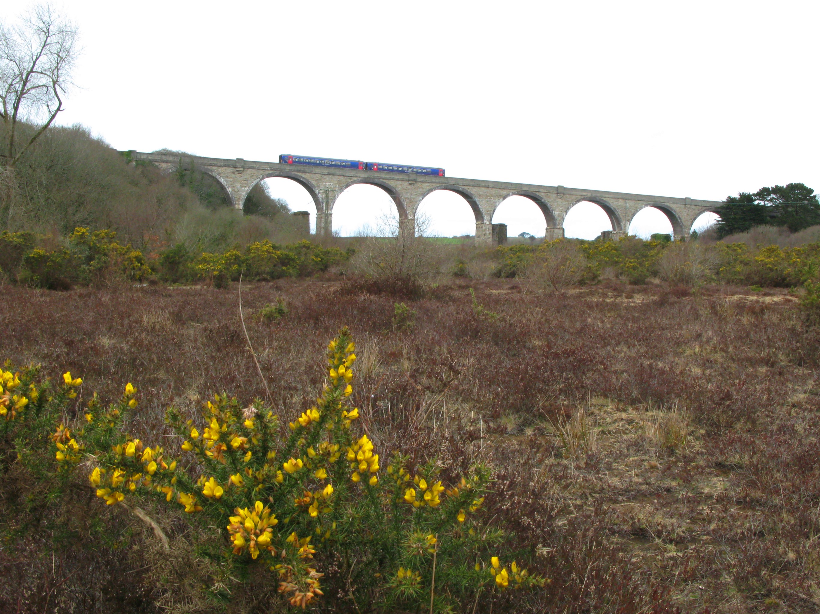
Maritime Line

The Maritime Line is a railway line that runs in the valley of the River Fal from Truro, the county town, to Falmouth on the south coast of Cornwall, England...

Greenwith Common

Greenwith Common is a hamlet in the parish of Perranarworthal, Cornwall, England. == References ==

Cusgarne

Cusgarne (Cornish: Kosgaran) is a village in Cornwall, England, UK. It is about 6 miles (9.7 km) from Truro and 5 miles (8.0 km) from Redruth. It is in...

Coombe, Gwennap

Coombe (Cornish: Komm) is a settlement in Gwennap civil parish, Cornwall, England, United Kingdom. It is situated approximately three-and-a-half miles...

Perranarworthal

Perranarworthal (Cornish: Peran ar Wodhel) is a civil parish and village in Cornwall, England, United Kingdom. The village is about four miles (6.5 km...

Hicks Mill

Hicks Mill is a rural hamlet in Cornwall, England. it is situated around the what3words address: ///jeep.removals.nimbly and is about 7 km (4.3 mi) WSW...

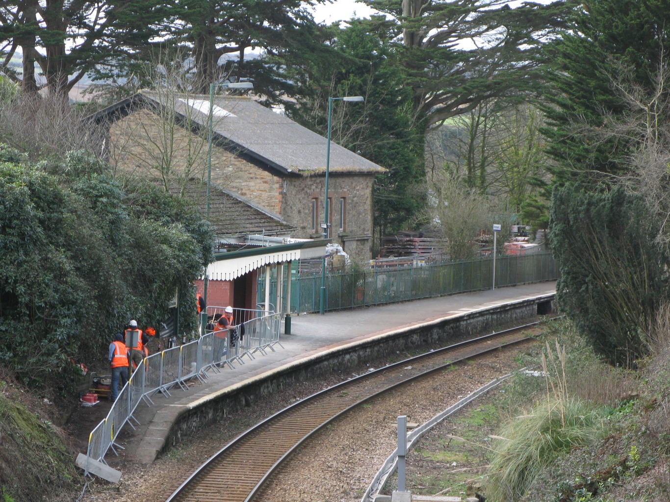
Perranwell railway station

Perranwell station (Cornish: Fentenberan) is on the Maritime Line between Truro and Falmouth Docks in south-west England. The station is managed by, and...

Nearby Amenities

Located within 500m of 50.215183,-5.1331336
Ford: yes
Layer: -1
Lat/Long: 50.2159011/-5.1274497
Ford: yes
Layer: -1
Lat/Long: 50.21694/-5.128092
The data included in this document is from www.openstreetmap.org. The data is made available under ODbL.

Have you been to Bargus Common?

Leave your review of Bargus Common below (or comments, questions and feedback).