Arrowan Common

Downs, Moorland in Cornwall

England

Arrowan Common

Lichen-covered rock
Lichen-covered rock Credit: Ian Cunliffe

Arrowan Common is a picturesque area located in Cornwall, England. Situated between the Downs and Moorland, this region offers a diverse and captivating landscape. Spanning approximately 500 acres, Arrowan Common is known for its stunning natural beauty and unique ecosystems.

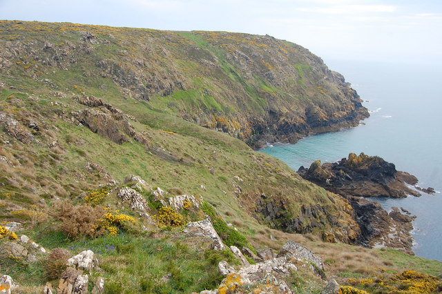
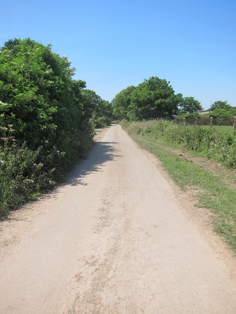
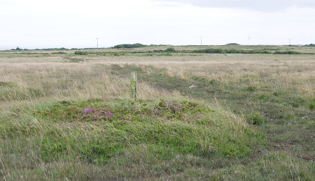
The Downs section of Arrowan Common features rolling hills and expansive grasslands, providing a serene and peaceful atmosphere. The area is home to a variety of plant and animal species, including wildflowers, grasses, and small mammals. Visitors can enjoy leisurely walks or hikes, taking in the breathtaking views of the surrounding countryside.

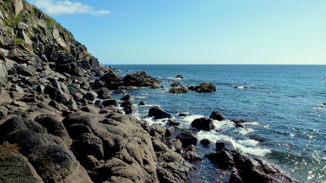
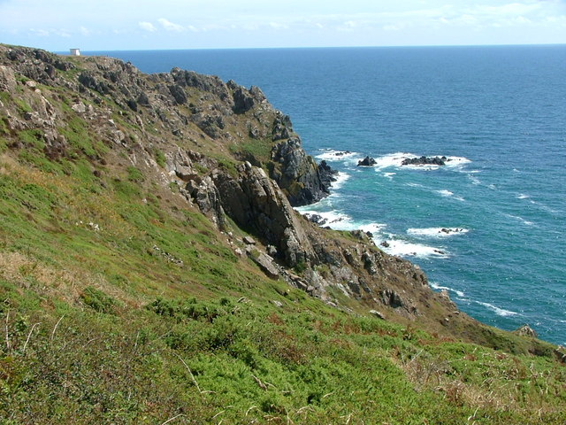
On the other hand, the Moorland region of Arrowan Common offers a stark contrast to the Downs. Characterized by its rugged terrain and open spaces, this area is rich in heather and gorse. Moorland birds, such as the iconic red grouse, can be spotted here, along with other unique wildlife species. The Moorland is also home to ancient stone circles, adding an element of history and intrigue to the area.

Arrowan Common is a haven for nature enthusiasts and outdoor adventurers. It provides ample opportunities for activities such as birdwatching, photography, and simply appreciating the wonders of the natural world. The area is well-maintained, with designated walking paths and information boards guiding visitors through its different sections.

Whether exploring the gentle slopes of the Downs or immersing oneself in the rugged beauty of the Moorland, Arrowan Common offers a truly memorable experience for those seeking to connect with nature in Cornwall.

If you have any feedback on the listing, please let us know in the comments section below.

Arrowan Common Images

Images are sourced within 2km of 50.015425/-5.1328719 or Grid Reference SW7517. Thanks to Geograph Open Source API. All images are credited.

Lichen-covered rock
Lichen-covered rock
Carrick Luz
Carrick Luz
Road across Crousa Downs Looking north towards Zoar.
Road across Crousa Downs
Looking north towards Zoar.
Rock Formation near Treleaver This rock formation is by the coastal path just before it descends towards Beagles Hole.
Rock Formation near Treleaver
This rock formation is by the coastal path just before it descends towards Beagles Hole.
View from Beagles Point Taken from the coastal path at Beagles Point, looking down on Beagles Hole and Meludjack with the headland of The Bees and Pedn Boar beyond.
View from Beagles Point
Taken from the coastal path at Beagles Point, looking down on Beagles Hole and Meludjack with the headland of The Bees and Pedn Boar beyond.
Downas Cove From Beagles Point, looking down on the cove with Carrick Luz beyond.
Downas Cove
From Beagles Point, looking down on the cove with Carrick Luz beyond.
Downas Cove Taking by the stream which flows through Downas Valley and into the sea at the cove.
Downas Cove
Taking by the stream which flows through Downas Valley and into the sea at the cove.
Downas Cove Looking down on the cove from The Gaider.
Downas Cove
Looking down on the cove from The Gaider.
Minor road at Penhallick west of Coverack
Eastern Cliff West of Kennack Sands at approaching high tide (didn't want to go any further into the square!)
Eastern Cliff
West of Kennack Sands at approaching high tide (didn't want to go any further into the square!)
Unnamed junction north of Penhallick
Pond at Arrowan
Pond at Arrowan
Farm buildings at Penhallock
Unnamed road junction at Penhallock
Unnamed road passes entrance to Eden Farm camp site
Former WWII radar station building at RAF Treleaver I'm guessing this was the control building given its size & complexity.
Former WWII radar station building at RAF Treleaver
I'm guessing this was the control building given its size & complexity.
The road heading SE to Treleaven and Trewillis farms
The road heading NW to Pednavounder
Show me another place!

Arrowan Common is located at Grid Ref: SW7517 (Lat: 50.015425, Lng: -5.1328719)

Unitary Authority: Cornwall

Police Authority: Devon and Cornwall

What 3 Words

///gathers.posting.pocketed. Near Landewednack, Cornwall

Nearby Locations

Ponsongath Arrowan Common

Related Wikis

Kennack to Coverack

Kennack to Coverack is a coastal Site of Special Scientific Interest (SSSI) on the Lizard Peninsula in Cornwall, England, UK, noted for both its biological...

Trelan

Trelan (Cornish: Trelann) is a hamlet in the parish of St Keverne in Cornwall, England, United Kingdom, on the eastern borders of Goonhilly Downs.Trelan...

Gwenter

Gwenter (Cornish: Gwynstir) is a hamlet in the parish of St Keverne (where the 2011 census population was included), Cornwall, England.Gwenter lies within...

Zoar, Cornwall

Zoar (Cornish: Zoara) is a hamlet on the Lizard Peninsula in south Cornwall, England, UK. It is situated 1+1⁄2 miles (2.4 km) northwest of the coastal...

Nearby Amenities

Located within 500m of 50.015425,-5.1328719
Ponsongath
Is In: Cornwall, England, UK
Is In Country: England
Is In Country Code: GB
Is In County: Cornwall
Name Kw: Pons an Gath
Place: hamlet
Source: npe
Wikidata: Q7227983
Lat/Long: 50.0197373/-5.1338776
Barrier: stile
Lat/Long: 50.0186461/-5.1371907
Generator Method: photovoltaic
Generator Output Electricity: yes
Generator Source: solar
Generator Type: solar_photovoltaic_panel
Location: roof
Power: generator
Lat/Long: 50.0192751/-5.133571
Power: pole
Lat/Long: 50.0120104/-5.1311812
Power: pole
Lat/Long: 50.0117726/-5.132187
Power: pole
Lat/Long: 50.0114451/-5.1335174
Power: pole
Lat/Long: 50.0186064/-5.1293707
Power: pole
Lat/Long: 50.01836/-5.1316559
Power: pole
Lat/Long: 50.0181963/-5.1332304
Power: pole
Lat/Long: 50.0180463/-5.1346707
Power: pole
Lat/Long: 50.0178257/-5.1365027
Power: pole
Lat/Long: 50.0177258/-5.1376078
Power: pole
Lat/Long: 50.017593/-5.1387826
Post Box
Brand: Royal Mail
Brand Wikidata: Q638098
Collection Times: Mo-Fr 09:00; Sa 07:00; Su off
Drive Through: no
Operator: Royal Mail
Operator Wikidata: Q638098
Post Box Design: type_b
Post Box Mounting: stone_wall
Post Box Type: wall
Ref: TR12 81D
Royal Cypher: GR
Source: survey;streetlevel imagery;aerial imagery
Lat/Long: 50.0193222/-5.1342237
The data included in this document is from www.openstreetmap.org. The data is made available under ODbL.

Have you been to Arrowan Common?

Leave your review of Arrowan Common below (or comments, questions and feedback).