Gubblecote

Settlement in Hertfordshire Dacorum

England

Gubblecote

Cheddington Lane, Long Marston
Cheddington Lane, Long Marston Credit: David Howard

Gubblecote is a small rural village located in the county of Hertfordshire, England. Situated in the Chiltern Hills, the village is nestled in a picturesque setting surrounded by rolling countryside and lush green fields. It falls within the administrative district of Dacorum and is part of the civil parish of Berkhamsted.

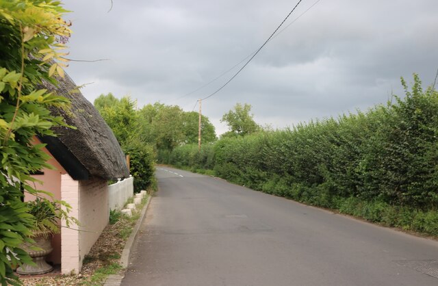
The village has a rich history, dating back to medieval times when it was primarily an agricultural community. Today, it retains its quaint charm and tranquil atmosphere, making it an ideal escape from the hustle and bustle of nearby towns and cities.

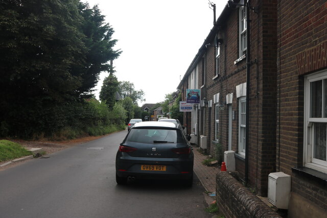
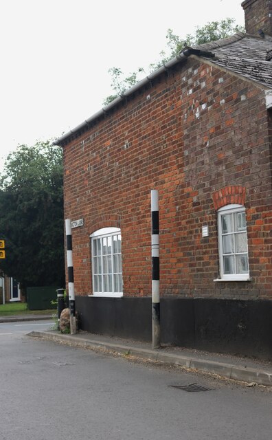
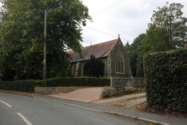
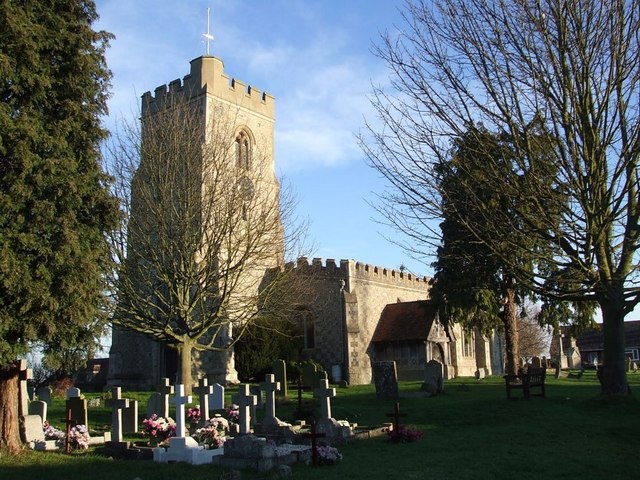
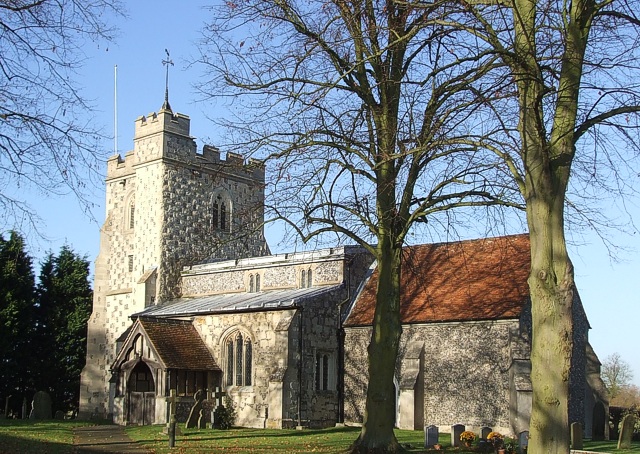
Gubblecote is home to a small population, with a close-knit community that takes pride in preserving its rural heritage. The village consists of a scattering of traditional cottages and farmhouses, giving it a timeless appeal. The local church, St. Mary's, is a noteworthy landmark, showcasing architectural features from different periods.

While Gubblecote is predominantly residential, it benefits from its proximity to nearby amenities. The larger town of Berkhamsted is just a short distance away, offering a range of shops, schools, and leisure facilities. The village also benefits from excellent transportation links, with the A41 road passing close by, connecting it to major towns and cities in the region.

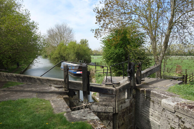
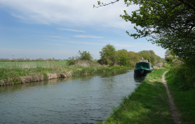
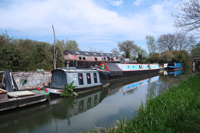
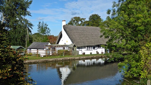
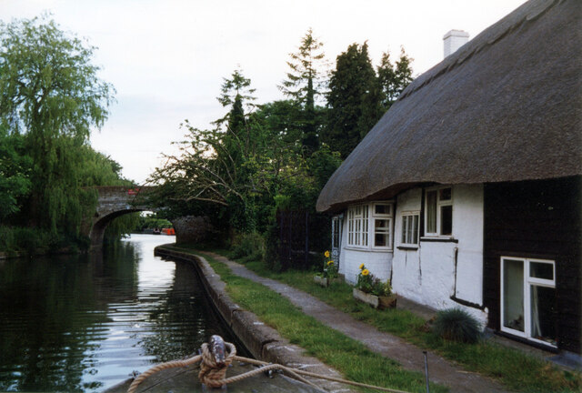
For those seeking outdoor activities, Gubblecote is surrounded by stunning natural beauty. The Chiltern Hills provide ample opportunities for walking, hiking, and exploring the countryside. The village is also close to the Grand Union Canal, offering scenic waterside walks and boating opportunities.

Overall, Gubblecote is a tranquil and picturesque village, offering a peaceful retreat for residents and visitors alike.

If you have any feedback on the listing, please let us know in the comments section below.
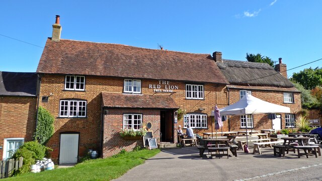
Gubblecote Images

Images are sourced within 2km of 51.827602/-0.688172 or Grid Reference SP9015. Thanks to Geograph Open Source API. All images are credited.

Cheddington Lane, Long Marston
Cheddington Lane, Long Marston This is the last house in the small village
Cheddington Lane, Long Marston
This is the last house in the small village
Stripy poles on Cheddington Lane, Long Marston These are on both sides of the roads to protect the buildings from traffic. They clearly work well as none have been damaged.
Stripy poles on Cheddington Lane, Long Marston
These are on both sides of the roads to protect the buildings from traffic. They clearly work well as none have been damaged.
Tring Road, Long Marston
All Saints' Church, Long Marston
Pylon on Station Road, Long Marston
Lock No. 10, Aylesbury Canal It looks really flat around here but the canal locks are not far apart, so there is quite a slope down into the Vale of Aylesbury.
Lock No. 10, Aylesbury Canal
It looks really flat around here but the canal locks are not far apart, so there is quite a slope down into the Vale of Aylesbury.
A Quiet Mooring In fact the whole canal is very quiet.
A Quiet Mooring
In fact the whole canal is very quiet.
Awaiting Restoration at Bates Boatyard Bates Boatyard specialises in restoring traditional and vintage canal boats. Some of the ones moored here look to be in a very challenging state. The little boat "Bosley"  could do with some weeding to start with. The writing on the side says
"Victorian Iron Icebreaker. Gorton Works, Manchester 1860"
Awaiting Restoration at Bates Boatyard
Bates Boatyard specialises in restoring traditional and vintage canal boats. Some of the ones moored here look to be in a very challenging state. The little boat "Bosley" could do with some weeding to start with. The writing on the side says "Victorian Iron Icebreaker. Gorton Works, Manchester 1860"
Cheddington Lane
Cheddington Lane
Cheddington Lane Heading towards Long Marston
Cheddington Lane
Heading towards Long Marston
The Red Lion, Marsworth
Vicarage Road Canal Bridge 130
The former Ship Inn, Marsworth
Wilstone reservoir looking west A view of Wilstone Reservoir from the footpath bordering it.  The reservoir was built to provide water for the nearby Grand Union Canal and is now a haven for wildlife.
Wilstone reservoir looking west
A view of Wilstone Reservoir from the footpath bordering it. The reservoir was built to provide water for the nearby Grand Union Canal and is now a haven for wildlife.
The Ship, Ship Lane, Lower End, Marsworth Grade II Listed 17th century former public house and shop. Canal side pubs generate many tales including here rumours of highwaymen bedding down for the evening. Information on the pub is thin on the ground but in 1941 a Bucks Herald obituary refers to a Mr Alfred Bird who had resided with his sister 'of the "Ship" Inn'. Searching directories under Marsworth (aka Masworth) I find no Ship but perhaps it is just listed as beer retailer, 1853 two beer retailers Thomas Lines and Robert Russell (& shopkeeper), 1876 John Jellis beer retailer (& grocer & coal merchant), 1883 two beer retailers George and John Jellis (George is John’s son and pubwiki lists John at the Ship from 1864 to 1891 when he’s shown as a publican in the census), 1899-1903 John Smith beer retailer and 1907-1915 Thomas Chamberlain beer retailer. Before 1853 Ma(r)sworth is not in my directories.
The Ship, Ship Lane, Lower End, Marsworth
Grade II Listed 17th century former public house and shop. Canal side pubs generate many tales including here rumours of highwaymen bedding down for the evening. Information on the pub is thin on the ground but in 1941 a Bucks Herald obituary refers to a Mr Alfred Bird who had resided with his sister 'of the "Ship" Inn'. Searching directories under Marsworth (aka Masworth) I find no Ship but perhaps it is just listed as beer retailer, 1853 two beer retailers Thomas Lines and Robert Russell (& shopkeeper), 1876 John Jellis beer retailer (& grocer & coal merchant), 1883 two beer retailers George and John Jellis (George is John’s son and pubwiki lists John at the Ship from 1864 to 1891 when he’s shown as a publican in the census), 1899-1903 John Smith beer retailer and 1907-1915 Thomas Chamberlain beer retailer. Before 1853 Ma(r)sworth is not in my directories.
Marsworth Lock 39 Lock on the Grand Union Canal.
Marsworth Lock 39
Lock on the Grand Union Canal.
Vicarage Road Grand Union Canal in Marsworth.
Vicarage Road
Grand Union Canal in Marsworth.
Show me another place!

Gubblecote is located at Grid Ref: SP9015 (Lat: 51.827602, Lng: -0.688172)

Administrative County: Hertfordshire

District: Dacorum

Police Authority: Hertfordshire

What 3 Words

///ember.trash.shudders. Near Cheddington, Buckinghamshire

Nearby Locations

Gubblecote

Related Wikis

Long Marston, Hertfordshire

Long Marston is a small village to the north of Tring in Hertfordshire, in the Tring Rural parish council area. It is in the Borough of Dacorum, Tring...

Astrope

Astrope is a village in Hertfordshire, England. It is in the civil parish of Tring Rural. == External links == Media related to Astrope at Wikimedia Commons

RAF Cheddington

Royal Air Force Cheddington or more simply RAF Cheddington (also known as RAF Marsworth) is a former Royal Air Force station located 1 mile (1.6 km) south...

Tring Rural

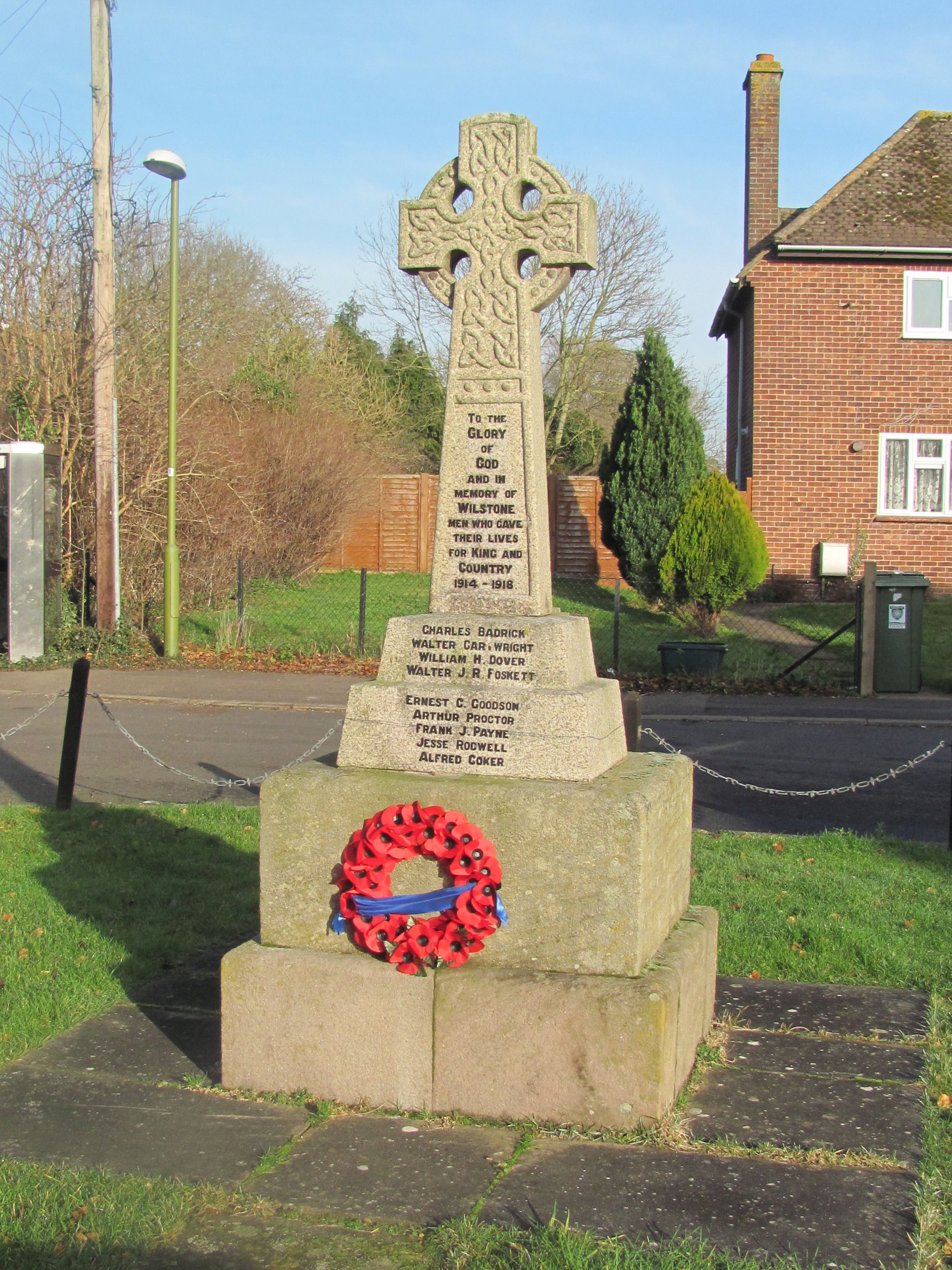
Tring Rural is a civil parish in Hertfordshire, England. It includes the villages of Long Marston, Wilstone, Puttenham, and the hamlets of Gubblecote and...

Wilstone

Wilstone is the name of an English village and a reservoir approximately two miles north-west of Tring, Hertfordshire. The village lies within the civil...

Marsworth

Marsworth is a village and a civil parish within the unitary authority area of Buckinghamshire, England. It is about 2 miles (3.2 km) north of Tring, Hertfordshire...

Puttenham, Hertfordshire

Puttenham is a village and former civil parish, now in the parish of Tring Rural, in the Dacorum district, in north west Hertfordshire, England. In 1961...
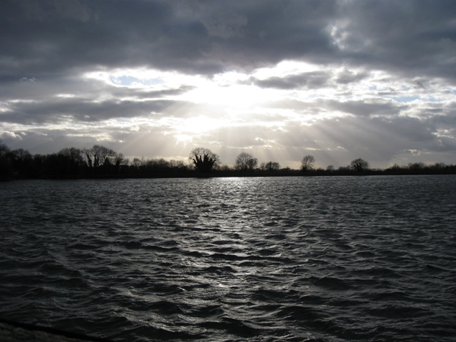
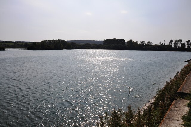
Tring Reservoirs

Tring Reservoirs is a group of four reservoirs close to Tring on the border of Hertfordshire and Buckinghamshire, England. Their purpose is to feed the...

Nearby Amenities

Located within 500m of 51.827602,-0.688172
FIXME: ?farm?; ?buildings?
Created By: Potlatch 0.8a
Source: npe
Lat/Long: 51.830044/-0.6907701
Gubblecote
Place: hamlet
Lat/Long: 51.8271266/-0.6892252
Fixme: ?buildings?;?farm?
Source: npe
Lat/Long: 51.8247394/-0.6873369
Bus Stop
Lukes Lane
Bus: yes
Local Ref: NR
Naptan AtcoCode: 210021424710
Naptan Bearing: SE
Naptan CommonName: Lukes Lane
Naptan Crossing: Wingrave Road
Naptan Indicator: nr
Naptan Landmark: Wingrave Road
Naptan NaptanCode: hrtdawjg
Naptan ShortCommonName: NA
Naptan Street: Tring Road
Naptan Verified: no
Public Transport: platform
Source: naptan_import
Lat/Long: 51.8276908/-0.6889748
Lukes Lane
Naptan AtcoCode: 210021426070
Naptan Bearing: NW
Naptan BusStopType: CUS
Naptan CommonName: Lukes Lane
Naptan Crossing: Wingrave Road
Naptan Indicator: opp
Naptan Landmark: Wingrave Road
Naptan NaptanCode: hrtgtdwt
Naptan ShortCommonName: NA
Naptan Street: Tring Road
Naptan Verified: no
Source: naptan_import
Lat/Long: 51.8275754/-0.6891088
Post Box
Brand: Royal Mail
Brand Wikidata: Q638098
Collection Times: Mo-Fr 16:15; Sa 09:00
Operator: Royal Mail
Operator Wikidata: Q638098
Post Box Type: lamp
Ref: HP23 113
Royal Cypher: EIIR
Royal Cypher Wikidata: Q33102113
Source: survey
Lat/Long: 51.8276866/-0.6891195
Power: pole
Lat/Long: 51.8258868/-0.6946492
Power: pole
Lat/Long: 51.8253472/-0.6935911
Power: pole
Lat/Long: 51.8248084/-0.6925276
Power: pole
Lat/Long: 51.8243782/-0.6918973
Power: pole
Lat/Long: 51.8238204/-0.6910725
Direction: 150
Generator Method: photovoltaic
Generator Output Electricity: yes
Generator Solar Modules: 6
Generator Source: solar
Generator Type: solar_photovoltaic_panel
Location: roof
Power: generator
Lat/Long: 51.8246597/-0.6855568
Direction: 150
Generator Method: photovoltaic
Generator Output Electricity: yes
Generator Solar Modules: 12
Generator Source: solar
Generator Type: solar_photovoltaic_panel
Location: roof
Power: generator
Lat/Long: 51.8246345/-0.6856814
The data included in this document is from www.openstreetmap.org. The data is made available under ODbL.

Have you been to Gubblecote?

Leave your review of Gubblecote below (or comments, questions and feedback).