Badger's Cross

Downs, Moorland in Cornwall

England

Badger's Cross

Sainsbury's superstore, Penzance My first visit to this location since 2012 when it was the site of the heliport for the Isles of Scilly. See <a href="https://www.geograph.org.uk/photo/3151496">SW4831 : Penzance Heliport</a> for details.
A new heliport with services to the Scillies has been established nearby.
Sainsbury's superstore, Penzance Credit: Jonathan Billinger

Badger's Cross is a small village located in the scenic county of Cornwall, England. Situated amidst the picturesque surroundings of Downs and Moorland, this quaint settlement offers a tranquil escape from the hustle and bustle of city life.

Nestled amidst rolling hills and lush green meadows, Badger's Cross boasts breathtaking natural beauty. The village is surrounded by vast stretches of moorland, providing ample opportunities for outdoor enthusiasts to explore and immerse themselves in the stunning landscapes. The moorland is home to an array of wildlife, including badgers, which is how the village got its name.

The village itself exudes charm with its traditional stone cottages and narrow winding lanes. The local community is known for its warm hospitality and welcoming nature, making visitors feel right at home. The village pub, a central hub for socializing, offers a cozy atmosphere where residents and tourists can enjoy a pint of ale and indulge in hearty, homemade meals.

For those seeking adventure, Badger's Cross offers various recreational activities. Hiking and cycling trails crisscross the surrounding countryside, allowing visitors to explore the area at their own pace. The nearby Downs offer stunning panoramic views, ideal for picnics or simply unwinding amidst nature's splendor.

In terms of amenities, Badger's Cross has a small village shop that caters to the daily needs of its residents. However, for a wider range of services and shopping options, the nearby town is just a short drive away.

Overall, Badger's Cross, Cornwall (Downs, Moorland) provides a charming retreat where visitors can immerse themselves in the beauty of nature, experience warm hospitality, and enjoy a peaceful getaway.

If you have any feedback on the listing, please let us know in the comments section below.

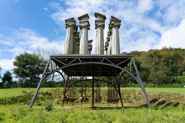
Badger's Cross Images

Images are sourced within 2km of 50.14568/-5.5220574 or Grid Reference SW4833. Thanks to Geograph Open Source API. All images are credited.

Sainsbury's superstore, Penzance My first visit to this location since 2012 when it was the site of the heliport for the Isles of Scilly. See <a href="https://www.geograph.org.uk/photo/3151496">SW4831 : Penzance Heliport</a> for details.
A new heliport with services to the Scillies has been established nearby.
Sainsbury's superstore, Penzance
My first visit to this location since 2012 when it was the site of the heliport for the Isles of Scilly. See SW4831 : Penzance Heliport for details. A new heliport with services to the Scillies has been established nearby.
Restless Temple sculpture at Tremenheere Sculpture Gardens
Frontage of the Sainsbury's store The Sainsbury's supermarket is what <a href="https://www.geograph.org.uk/photo/3616916">SW4831 : Steel frame under construction to new supermarket Penzance</a> turned into in due course.
Frontage of the Sainsbury's store
The Sainsbury's supermarket is what SW4831 : Steel frame under construction to new supermarket Penzance turned into in due course.
Trearrack : Polemennor Road At the road junction with Gear Hill.
Trearrack : Polemennor Road
At the road junction with Gear Hill.
Penzance : Chyandour - Jelbert Way A bus stop on Jelbert Way.
Penzance : Chyandour - Jelbert Way
A bus stop on Jelbert Way.
Ludgban : Longrock - Road A road at the back of Halfords.
Ludgban : Longrock - Road
A road at the back of Halfords.
Ludgvan : Longrock - A30 Heading along the A30.
Ludgvan : Longrock - A30
Heading along the A30.
St Gulval's Church
St Gulval's Church
Gulval Methodist  Church
Gulval Methodist Church
Gulval Village Hall Also called Lanisley Manor Hall, it was built in 1914 by R.F. Bolitho of Ponsandane. Restoration work was carried out in 2000. See also <a href="https://www.geograph.org.uk/photo/7452383">SW4831 : Gulval Village Hall stonework above the door</a> and <a href="https://www.geograph.org.uk/photo/7452373">SW4831 : Gulval Village Hall foundation stone</a>.
Gulval Village Hall
Also called Lanisley Manor Hall, it was built in 1914 by R.F. Bolitho of Ponsandane. Restoration work was carried out in 2000. See also SW4831 : Gulval Village Hall stonework above the door and SW4831 : Gulval Village Hall foundation stone.
Gulval Village Hall foundation stone The Village Hall <a href="https://www.geograph.org.uk/photo/7452365">SW4831 : Gulval Village Hall</a> is also called Lanisley Manor Hall; it was built by R.F. Bolitho. The foundation stone is to the right of the door.
Gulval Village Hall foundation stone
The Village Hall SW4831 : Gulval Village Hall is also called Lanisley Manor Hall; it was built by R.F. Bolitho. The foundation stone is to the right of the door.
Gulval Village Hall stonework above the door The stonework above the door of Gulval Village Hall <a href="https://www.geograph.org.uk/photo/7452365">SW4831 : Gulval Village Hall</a> reads "AD 1914 Lanisley (Manor) Hall erected by R.F. Bolitho : Ponsandane".
Gulval Village Hall stonework above the door
The stonework above the door of Gulval Village Hall SW4831 : Gulval Village Hall reads "AD 1914 Lanisley (Manor) Hall erected by R.F. Bolitho : Ponsandane".
Gulval School School buildings (with a van in the car park!).
Gulval School
School buildings (with a van in the car park!).
Triangular road junction A well-kept triangular road junction with a tree and a bench.
Triangular road junction
A well-kept triangular road junction with a tree and a bench.
Gate into Gulval churchyard This gate is on the south-east wall of the churchyard.
Gate into Gulval churchyard
This gate is on the south-east wall of the churchyard.
Steps into Gulval churchyard This flight of steps is on the west wall of the churchyard.
Steps into Gulval churchyard
This flight of steps is on the west wall of the churchyard.
Gate on north side of Gulval churchyard Taken from inside the churchyard, this is the gate to the north of the church.
Gate on north side of Gulval churchyard
Taken from inside the churchyard, this is the gate to the north of the church.
Fields off Gear Hill near Newmill
Show me another place!

Badger's Cross is located at Grid Ref: SW4833 (Lat: 50.14568, Lng: -5.5220574)

Unitary Authority: Cornwall

Police Authority: Devon and Cornwall

What 3 Words

///templates.consoled.junior. Near Penzance, Cornwall

Related Wikis

Castle Gate, Cornwall

Castle Gate is a hamlet in west Cornwall, England, United Kingdom. It is situated approximately three miles (4.5 km) north-northeast of Penzance at OS...

Gulval

Gulval (Cornish: Lannystli) is a village in Cornwall, England, United Kingdom. Although historically a parish in its own right, Gulval was incorporated...
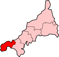
Penwith

Penwith (; Cornish: Pennwydh) is an area of Cornwall, England, located on the peninsula of the same name. It is also the name of a former local government...
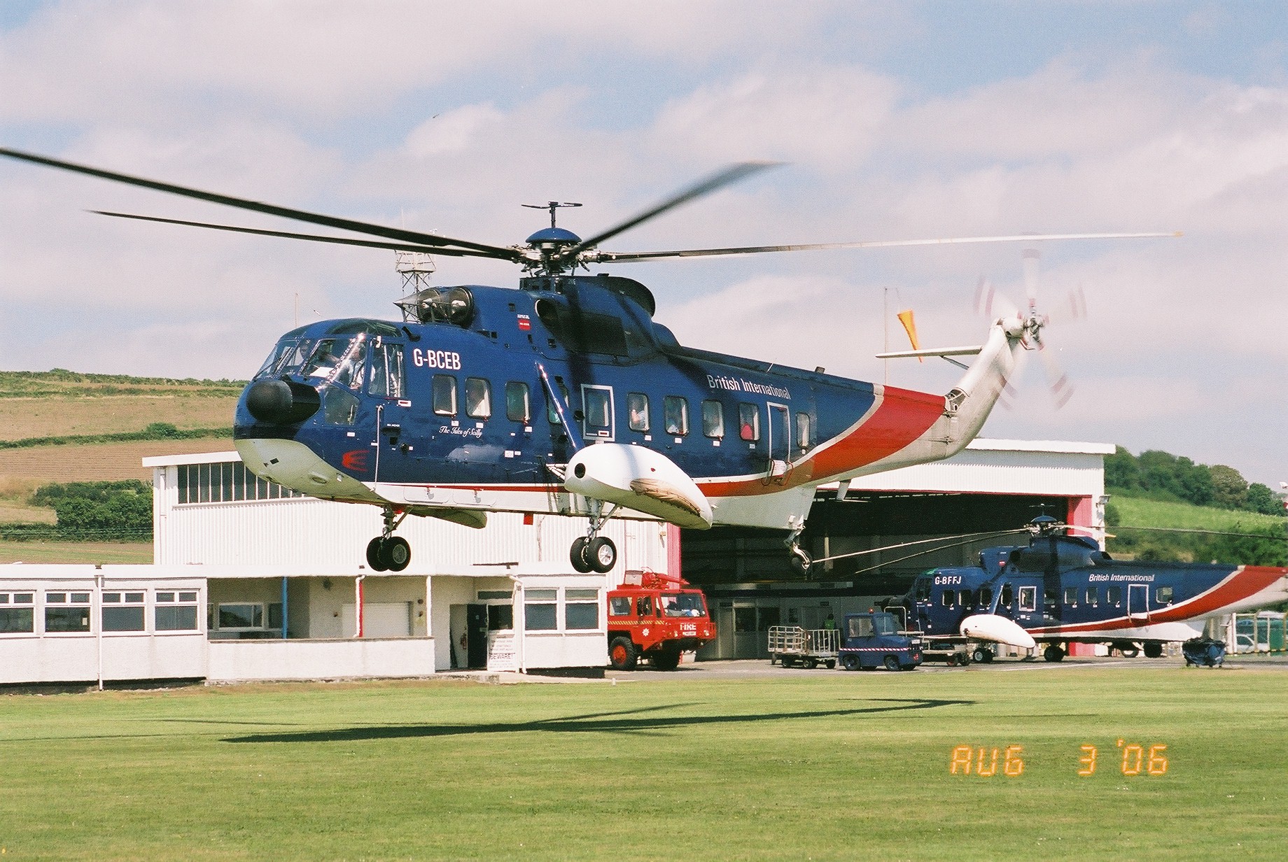
Penzance Heliport

Penzance Heliport (IATA: PZE, ICAO: EGHK) is located 0.6 NM (1.1 km; 0.69 mi) northeast of Penzance, Cornwall. The heliport hosts scheduled flights to...

Nearby Amenities

Located within 500m of 50.14568,-5.5220574
Badger's Cross
Name Kw: Krowshyns Brogh
Place: hamlet
Lat/Long: 50.1460585/-5.520565
Bus Stop
Badgers Lodge
Naptan AtcoCode: 0800COD40314
Naptan Bearing: S
Naptan CommonName: Badgers Lodge
Naptan NaptanCode: coragaja
Naptan PlusbusZoneRef: PENZNCE
Naptan Street: B3311
Naptan Verified: no
Source: naptan_import
Lat/Long: 50.1453636/-5.5202829
Power: pole
Lat/Long: 50.1494949/-5.5249657
Power: pole
Lat/Long: 50.149427/-5.523296
Power: pole
Lat/Long: 50.1493411/-5.5215794
Power: pole
Lat/Long: 50.1492895/-5.5205387
Power: pole
Lat/Long: 50.1492139/-5.5187228
Direction: SW
Generator Method: photovoltaic
Generator Output Electricity: small_installation
Generator Source: solar
Generator Type: solar_photovoltaic_panel
Location: roof
Power: generator
Source: bing
Lat/Long: 50.1460096/-5.5207345
Power: pole
Lat/Long: 50.1445972/-5.5153486
Power: pole
Lat/Long: 50.1446109/-5.5163652
Power: pole
Lat/Long: 50.1446848/-5.5178377
Power: pole
Lat/Long: 50.1447828/-5.5200157
Power: pole
Lat/Long: 50.1448808/-5.5217108
Power: pole
Lat/Long: 50.1449444/-5.5229232
Power: pole
Lat/Long: 50.1450492/-5.5245915
Power: pole
Lat/Long: 50.146726/-5.5204193
Power: pole
Transformer: distribution
Lat/Long: 50.1461115/-5.5206245
Power: pole
Lat/Long: 50.1478131/-5.5185351
Power: pole
Lat/Long: 50.1481706/-5.5177009
Power: pole
Lat/Long: 50.1485298/-5.5169231
Power: pole
Lat/Long: 50.1447244/-5.5158515
Power: pole
Lat/Long: 50.1454257/-5.5162337
Power: pole
Lat/Long: 50.1459327/-5.5170304
Power: pole
Lat/Long: 50.1462335/-5.5175185
Power: pole
Lat/Long: 50.1467406/-5.518696
Power: pole
Lat/Long: 50.1470328/-5.5193988
Power: pole
Lat/Long: 50.1472201/-5.5198091
Power: pole
Lat/Long: 50.147557/-5.5205655
Power: pole
Lat/Long: 50.1480641/-5.521743
Power: pole
Lat/Long: 50.1484027/-5.5225477
Power: pole
Lat/Long: 50.1487447/-5.5232906
Power: pole
Lat/Long: 50.1491305/-5.5242106
Power: pole
Lat/Long: 50.149543/-5.5249161
Power: pole
Lat/Long: 50.142537/-5.5257368
Power: pole
Transformer: distribution
Lat/Long: 50.1429779/-5.526925
The data included in this document is from www.openstreetmap.org. The data is made available under ODbL.

Have you been to Badger's Cross?

Leave your review of Badger's Cross below (or comments, questions and feedback).