Beagletodn Downs

Downs, Moorland in Cornwall

England

Beagletodn Downs

View towards Treveal Treveal is the farm on the hill. In the wooded valley is Trevail Mill.
View towards Treveal Credit: Robin Webster

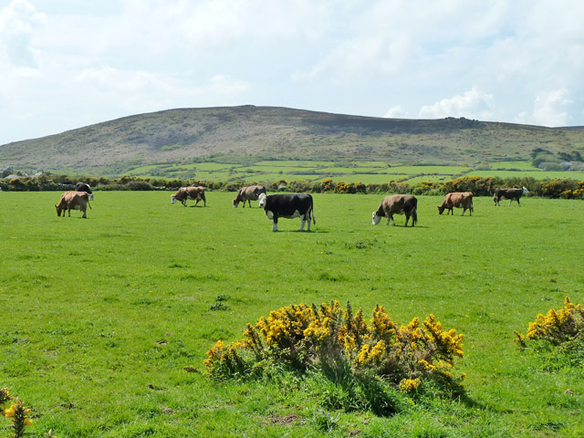
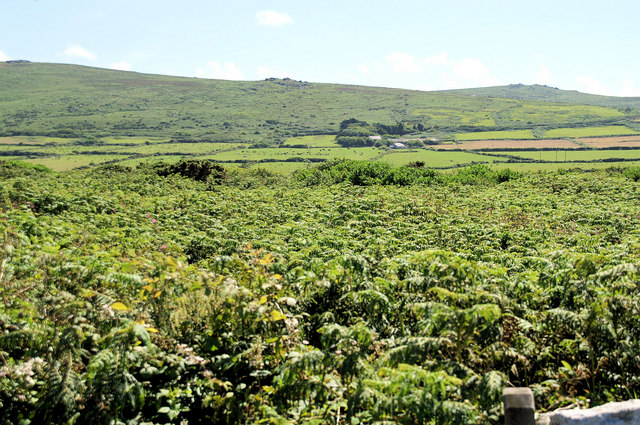
Beagletodn Downs is a picturesque area located in Cornwall, England. Situated in the southwestern part of the county, it is known for its beautiful landscape and unique natural features. The downs are situated on a plateau, providing breathtaking views of the surrounding countryside and coastline.

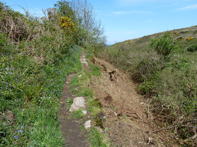
Covering an expansive area, Beagletodn Downs primarily consists of moorland, characterized by heather, gorse, and grasses. The moorland is home to a rich variety of flora and fauna, including rare species that thrive in this unique habitat. It is a haven for birdwatchers, with numerous species of birds, such as skylarks and stonechats, making their homes here.

Visitors to Beagletodn Downs can enjoy the tranquility and peacefulness of the area, as well as the opportunity for outdoor activities. The downs offer excellent walking and hiking trails, allowing enthusiasts to immerse themselves in the stunning surroundings. The rugged terrain also makes it a popular spot for mountain biking and horse riding.

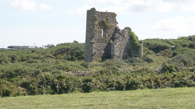
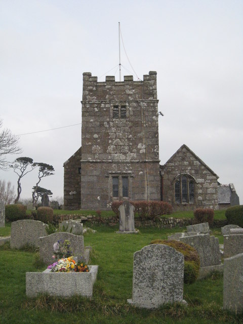
One of the standout features of Beagletodn Downs is its historical significance. The area is dotted with ancient archaeological sites, including standing stones and burial mounds, providing a glimpse into Cornwall's rich past. These sites offer a fascinating insight into the lives of the people who lived here thousands of years ago.

In conclusion, Beagletodn Downs, Cornwall, is a captivating area renowned for its natural beauty, diverse wildlife, and historical significance. Whether it's exploring the moorland, observing the local birdlife, or delving into the region's ancient past, visitors are sure to be enthralled by all that Beagletodn Downs has to offer.

If you have any feedback on the listing, please let us know in the comments section below.

Beagletodn Downs Images

Images are sourced within 2km of 50.191969/-5.5326686 or Grid Reference SW4738. Thanks to Geograph Open Source API. All images are credited.

View towards Treveal Treveal is the farm on the hill. In the wooded valley is Trevail Mill.
View towards Treveal
Treveal is the farm on the hill. In the wooded valley is Trevail Mill.
Path towards the coast Going uphill here to climb out of the stream valley that runs down to River Cove.
Path towards the coast
Going uphill here to climb out of the stream valley that runs down to River Cove.
Path towards the coast From Trevail Mill.
Path towards the coast
From Trevail Mill.
Path from Trevail Mill to Trevalgan Through a strip of rough land associated with former mining here.
Path from Trevail Mill to Trevalgan
Through a strip of rough land associated with former mining here.
Cattle, Trevega Wartha Trevalgan Hill is beyond.
Cattle, Trevega Wartha
Trevalgan Hill is beyond.
Cattle trough between fields Made out of an old bath.
Cattle trough between fields
Made out of an old bath.
Gorse on field bank The footpath from Trevail Mill to Trevalgan follows the bank on the near side.
Gorse on field bank
The footpath from Trevail Mill to Trevalgan follows the bank on the near side.
Derelict Mine Buildings near Trevega
Treveal A farm on the northern slope of the Penwith Peninsula.
Treveal
A farm on the northern slope of the Penwith Peninsula.
Path down to River Cove from Treveal The path follows the stream valley to meet the coast path just above River Cove.
Path down to River Cove from Treveal
The path follows the stream valley to meet the coast path just above River Cove.
Trevalgan A substantial granite wall around the farmyard.
Trevalgan
A substantial granite wall around the farmyard.
Stone Barn, Trevalgan
Below Trevalgan Rock, as it says on the map, though some picky people might call it a standing stone. A lonely lump of weathered granite, below the path from Trevalgan towards the mine.
Below Trevalgan
Rock, as it says on the map, though some picky people might call it a standing stone. A lonely lump of weathered granite, below the path from Trevalgan towards the mine.
Below Trevega Wartha A mass of bracken.
Below Trevega Wartha
A mass of bracken.
Below Trevega Wartha The footpath crosses a large field boundary. In the distance is Trevega Wartha farm, and behind is Rosewall Hill.
Below Trevega Wartha
The footpath crosses a large field boundary. In the distance is Trevega Wartha farm, and behind is Rosewall Hill.
Track below Trevega Wartha The bridleway from Trevega Wartha ends at this track, which is only a footpath. Confused?
Track below Trevega Wartha
The bridleway from Trevega Wartha ends at this track, which is only a footpath. Confused?
Bridleway from Trevega Wartha Looking up the bridleway towards Trevega Wartha and rocks at the western end of Rosewall Hill.
Bridleway from Trevega Wartha
Looking up the bridleway towards Trevega Wartha and rocks at the western end of Rosewall Hill.
Farm buildings at Treveal
Show me another place!

Beagletodn Downs is located at Grid Ref: SW4738 (Lat: 50.191969, Lng: -5.5326686)

Unitary Authority: Cornwall

Police Authority: Devon and Cornwall

What 3 Words

///defender.eclipses.harvest. Near St Ives, Cornwall

Related Wikis

Sperris Quoit

Sperris Quoit is a ruined megalithic burial chamber or dolmen, and one of a type of tomb unique to West Penwith, located on a moor around 365 metres northeast...

Towednack

Towednack (Cornish: Tewydnek) is a churchtown and civil parish in Cornwall, England, United Kingdom. The parish is bounded by those of Zennor in the west...

Amalveor

Amalveor (Cornish: Amal Veur, meaning "great Amal"; 'Amal' appears to be the name of a river) is a hamlet in West Penwith, Cornwall, England, United Kingdom...
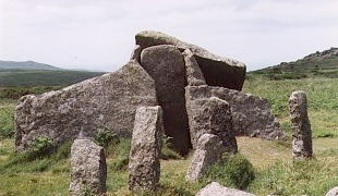
Zennor Quoit

Zennor Quoit is a ruined megalithic burial chamber or dolmen, located on a moor about a mile (1.6 km) east of the village of Zennor, Cornwall, England...

Nearby Amenities

Located within 500m of 50.191969,-5.5326686
Trendrine Hill
Description: OS trig pillar
Ele: 247.735
Man Made: survey_point
Note: Accurate location import for imagery offset calibration
Ref: S1707
Source: Ordnance Survey (OGL)
Survey Point: pillar
Lat/Long: 50.1950265/-5.5339944
Power: pole
Transformer: distribution
Lat/Long: 50.1879642/-5.5317315
Power: pole
Lat/Long: 50.18816/-5.5295911
The data included in this document is from www.openstreetmap.org. The data is made available under ODbL.

Have you been to Beagletodn Downs?

Leave your review of Beagletodn Downs below (or comments, questions and feedback).