Boswens Common

Downs, Moorland in Cornwall

England

Boswens Common

Former Bible Christian chapel
Former Bible Christian chapel Credit: Paul Barnett

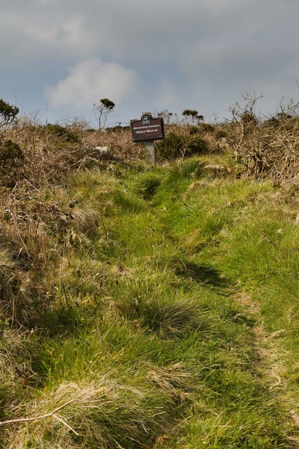
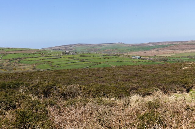
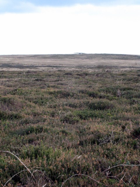
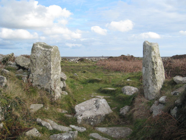
Boswens Common is a vast expanse of rugged moorland located in Cornwall, England. This area is characterized by its rolling hills, heather-covered landscapes, and scattered patches of woodland. The common is home to a variety of wildlife, including birds of prey, rabbits, and various species of wildflowers.

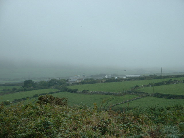
Boswens Common is popular among hikers and nature enthusiasts who come to explore its picturesque scenery and enjoy the peaceful surroundings. The common offers numerous walking trails that provide stunning views of the surrounding countryside and the nearby coastline.

The area is also of historical significance, with ancient stone circles and remnants of Bronze Age settlements scattered throughout the landscape. Visitors can explore these archaeological sites and learn about the rich history of the area.

Overall, Boswens Common is a tranquil and beautiful natural area that offers a unique opportunity to experience the wild beauty of Cornwall. Whether you are looking for a peaceful retreat or an outdoor adventure, this common has something to offer for everyone.

If you have any feedback on the listing, please let us know in the comments section below.

Boswens Common Images

Images are sourced within 2km of 50.138437/-5.630332 or Grid Reference SW4032. Thanks to Geograph Open Source API. All images are credited.

Former Bible Christian chapel
Footpath to Bosvenning Common The footpath goes uphill through scrubland with some willow trees.
Footpath to Bosvenning Common
The footpath goes uphill through scrubland with some willow trees.
Bosvenning Common Bosvenning Common is owned by Cornwall Wildlife Trust.
Bosvenning Common
Bosvenning Common is owned by Cornwall Wildlife Trust.
View from Bosvenning Common 1 Looking across the common to farms on the distant hillside. The strange Air Traffic Control Beacon can also be seen on the far left. See also <a href="https://www.geograph.org.uk/photo/7460424">SW4131 : View from Bosvenning Common 2</a>.
View from Bosvenning Common 1
Looking across the common to farms on the distant hillside. The strange Air Traffic Control Beacon can also be seen on the far left. See also SW4131 : View from Bosvenning Common 2.
View from Bosvenning Common 2 Another look across the common to distant farms. The far distant rocky outcrop is Carn Galver. See also <a href="https://www.geograph.org.uk/photo/7460419">SW4131 : View from Bosvenning Common 1</a>.
View from Bosvenning Common 2
Another look across the common to distant farms. The far distant rocky outcrop is Carn Galver. See also SW4131 : View from Bosvenning Common 1.
View to sallows As the footpath descends the ground becomes wetter and there's a small cluster of willows.
View to sallows
As the footpath descends the ground becomes wetter and there's a small cluster of willows.
Main road where the footpath emerges Houses on the A3071 opposite the footpath.
Main road where the footpath emerges
Houses on the A3071 opposite the footpath.
Footpath onto the common Footpath over heath and scrub, looking towards Bosvenning Common.
Footpath onto the common
Footpath over heath and scrub, looking towards Bosvenning Common.
Early September on Bosvenning Common In early September Bosvenning Common is a wonderful swathe of flowering gorse, ling, bell heather and cross-leaved heath.
Early September on Bosvenning Common
In early September Bosvenning Common is a wonderful swathe of flowering gorse, ling, bell heather and cross-leaved heath.
Flooding on Woon Gumpus Common After several days of heavy rain the peaty ground is saturated and the paths filled with water running like streams.
Flooding on Woon Gumpus Common
After several days of heavy rain the peaty ground is saturated and the paths filled with water running like streams.
Cottages and old field hedges, near Carn Kenidjack On the edge of the common land which surrounds Carn Kenidjack. Old hedges and old field boundaries.
Cottages and old field hedges, near Carn Kenidjack
On the edge of the common land which surrounds Carn Kenidjack. Old hedges and old field boundaries.
Disused stile on Botallack Common This stile survives on Botallack Common with no fence anywhere near it. The 1:25000 OS map shows various boundaries on the commons to the south of Carn Kenidjack (the granite outcrop on the horizon). The area seems to be well managed - note the lack of bracken.
Disused stile on Botallack Common
This stile survives on Botallack Common with no fence anywhere near it. The 1:25000 OS map shows various boundaries on the commons to the south of Carn Kenidjack (the granite outcrop on the horizon). The area seems to be well managed - note the lack of bracken.
Amusing milestone This milestone is at the junction of the B3318 and the road to Trewellard. There are quite a few of this style in the area, this one caught my eye because it makes you wonder how far the mason got before he realised that it just wasn't going to fit on. The "Tre" in Cornish placenames means "farm".
Amusing milestone
This milestone is at the junction of the B3318 and the road to Trewellard. There are quite a few of this style in the area, this one caught my eye because it makes you wonder how far the mason got before he realised that it just wasn't going to fit on. The "Tre" in Cornish placenames means "farm".
Holed stone, Kenidjack Common There are several "holed stones" in this part of Kenidjack Common, and this one sits to the north-west of the main alignment of four. At some point it has been broken in half, but now the two halves are cemented back together. Apparently there is another holed stone but its hole is suspiciously modern (straight through, without the bevelled edge).

Over the crest of the hill you can see the tip of the mast at Carn Bean (left) and the granite outcrop at Carn Kenidjack (right). These stones were discovered and re-erected in the nineteenth century, probably around the same time that the nearby Tregeseal Dancing Stones/Nine Maidens stone circle was restored.
Holed stone, Kenidjack Common
There are several "holed stones" in this part of Kenidjack Common, and this one sits to the north-west of the main alignment of four. At some point it has been broken in half, but now the two halves are cemented back together. Apparently there is another holed stone but its hole is suspiciously modern (straight through, without the bevelled edge). Over the crest of the hill you can see the tip of the mast at Carn Bean (left) and the granite outcrop at Carn Kenidjack (right). These stones were discovered and re-erected in the nineteenth century, probably around the same time that the nearby Tregeseal Dancing Stones/Nine Maidens stone circle was restored.
Milestone on the B3318 at Woon Gumpas
Woon Gumpas Common Looking very drab and colourless in late November but in late Summer this heathland is a riot of pink and yellow from the flowers of Cross-leaved Heath (Erica tetralix) and Western Gorse (Ulex gallii).  The strange-shaped building on the horizon is an air traffic control installation <a href="https://www.geograph.org.uk/photo/1489020">SW4032 : NATS navigation aid near Boswens Common</a>.
Woon Gumpas Common
Looking very drab and colourless in late November but in late Summer this heathland is a riot of pink and yellow from the flowers of Cross-leaved Heath (Erica tetralix) and Western Gorse (Ulex gallii). The strange-shaped building on the horizon is an air traffic control installation SW4032 : NATS navigation aid near Boswens Common.
Car Park on Woon Gumpas Common A popular spot for dog walkers and for access to Chun Quoit, which can just be seen on the horizon on the left of the picture.
Car Park on Woon Gumpas Common
A popular spot for dog walkers and for access to Chun Quoit, which can just be seen on the horizon on the left of the picture.
Flooded path on Woon Gumpus Common
Show me another place!

Boswens Common is located at Grid Ref: SW4032 (Lat: 50.138437, Lng: -5.630332)

Unitary Authority: Cornwall

Police Authority: Devon and Cornwall

What 3 Words

///outnumber.fight.technical. Near St Just, Cornwall

Nearby Locations

Boswens Common

Related Wikis

Higher Downs

Higher Downs is a moorland in the parish of Morvah in west Cornwall, England. == References ==

Great Bosullow

Great Bosullow (Cornish: Bos Chiwolow, meaning dwelling of the house of light) is a hamlet south-east of Morvah in west Cornwall, England, UK. Bosullow...

Chûn Castle

Chûn Castle is a large Iron Age hillfort (ringfort) near Penzance in Cornwall, England, United Kingdom. The fort was built about 2,500 years ago, and fell...
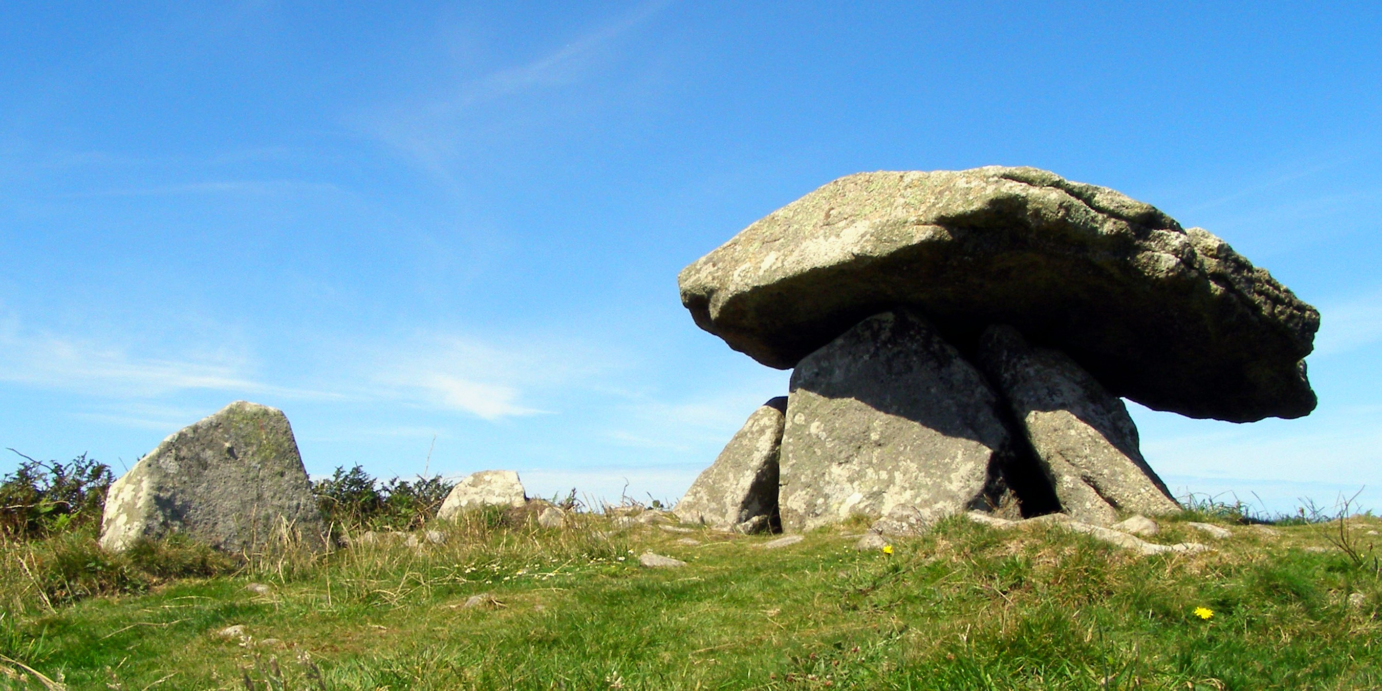
Chûn Quoit

Chûn Quoit is one of the best preserved of all Neolithic quoits (also called dolmens or cromlechs) in western Cornwall, England, United Kingdom. Chûn Quoit...

Have you been to Boswens Common?

Leave your review of Boswens Common below (or comments, questions and feedback).