Pairc Mhòr

Downs, Moorland in Argyllshire

Scotland

Pairc Mhòr

Carn Nan Gillean Trig Point Flush Bracket S9085
Carn Nan Gillean Trig Point Flush Bracket S9085 Credit: thejackrustles

Pairc Mhòr is a vast expanse of land located in Argyllshire, Scotland. Covering a significant area of downs and moorland, it is a picturesque landscape that offers a diverse range of natural features.

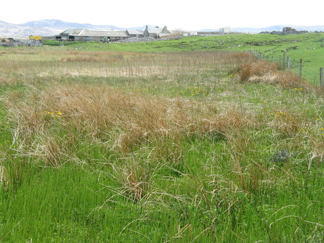
The downs of Pairc Mhòr are characterized by their gently rolling hills and expansive grassy plains. These open spaces provide ample grazing opportunities for livestock, making it an important area for agriculture in the region. The downs are also home to a variety of plant species, including heather and gorse, which add vibrant colors to the landscape.

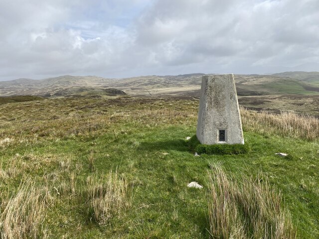
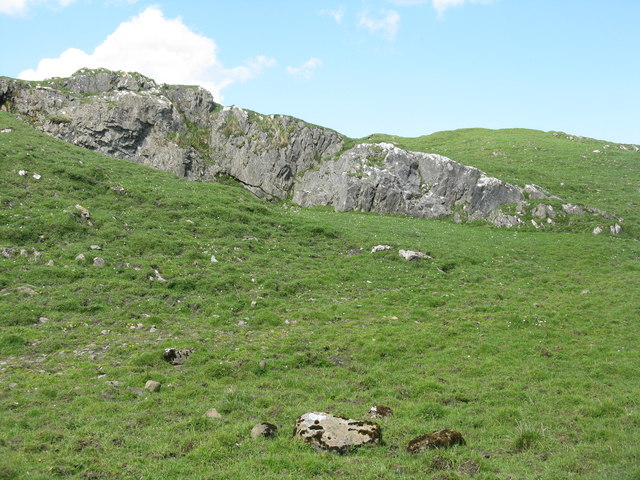
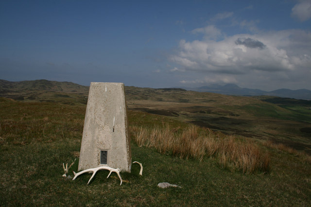
Moving towards the moorland, the terrain becomes more rugged and textured. The moorland of Pairc Mhòr is marked by its undulating topography, with numerous small hills and valleys. The land is predominantly covered in heather, creating a stunning purple hue during the flowering season. This habitat supports a diverse range of wildlife, including birds such as the golden eagle and red grouse, as well as various small mammals.

The climate of Pairc Mhòr is typically influenced by its coastal location, with mild winters and relatively cool summers. The area receives a moderate amount of rainfall throughout the year, contributing to the lush vegetation and vibrant ecosystem.

Pairc Mhòr is not only a haven for wildlife and agriculture but also a popular destination for outdoor enthusiasts. Its vast open spaces and scenic beauty make it an ideal location for activities such as hiking, cycling, and birdwatching. With its rich natural heritage, Pairc Mhòr is a true gem in the heart of Argyllshire.

If you have any feedback on the listing, please let us know in the comments section below.

Pairc Mhòr Images

Images are sourced within 2km of 55.833737/-6.2122311 or Grid Reference NR3668. Thanks to Geograph Open Source API. All images are credited.

Carn Nan Gillean Trig Point Flush Bracket S9085
New woods in the foreground The foreground of woods help lead the eye to the snow covered Paps of Jura in the far distance.
New woods in the foreground
The foreground of woods help lead the eye to the snow covered Paps of Jura in the far distance.
Marsh and rough grazing at Ballimartin
Rocky grassland near Ballimartin
Sheep pasture at Ballachlaven Fresh spring grass. The line of rocks is a late-Proterozoic sill of amphibolite and hornblende schist, formed more than 540 Million years ago. It looks more like a dyke, but the rocks have folded and inclined over that period.
Sheep pasture at Ballachlaven
Fresh spring grass. The line of rocks is a late-Proterozoic sill of amphibolite and hornblende schist, formed more than 540 Million years ago. It looks more like a dyke, but the rocks have folded and inclined over that period.
Looking across to Baile Tharbhach With fresh spring grazing for sheep. The rock in the foreground is part of a late-Proterozoic sill <a href="https://www.geograph.org.uk/photo/5773615">NR3667 : Sheep pasture at Ballachlaven</a>.
Looking across to Baile Tharbhach
With fresh spring grazing for sheep. The rock in the foreground is part of a late-Proterozoic sill NR3667 : Sheep pasture at Ballachlaven.
Rough grazing at Ballimartin With roofless house on Druim a' Chùirn and a derelict barn.
Rough grazing at Ballimartin
With roofless house on Druim a' Chùirn and a derelict barn.
The track to Ballachlaven Through rocky sheep pasture.
The track to Ballachlaven
Through rocky sheep pasture.
Pasture at Ballachlaven Good grass, but lumpy as a result of volcanic sills protruding through the surface.
Pasture at Ballachlaven
Good grass, but lumpy as a result of volcanic sills protruding through the surface.
Abhainn Airigh an t-Sluic, Islay River of the shieling of the pit/den/hollow.
Abhainn Airigh an t-Sluic, Islay
River of the shieling of the pit/den/hollow.
Farm road near Ballimartin The farm road linking Ballimartin with Ballachlaven in central Islay.
Farm road near Ballimartin
The farm road linking Ballimartin with Ballachlaven in central Islay.
On the way to Ballachlaven Farm Gateway and cattle grid, with a helpful notice for walkers at the entrance to the farm.
On the way to Ballachlaven Farm
Gateway and cattle grid, with a helpful notice for walkers at the entrance to the farm.
Pastureland at Ballachlaven A dull day and a rather dull picture. The barbed wire fence and locked gate prevented further exploration in search of a more interesting view.
Pastureland at Ballachlaven
A dull day and a rather dull picture. The barbed wire fence and locked gate prevented further exploration in search of a more interesting view.
Ballachlaven Farm Distant view of the farmhouse, which must be one of the highest on Islay at just over 100m above sea level.
Ballachlaven Farm
Distant view of the farmhouse, which must be one of the highest on Islay at just over 100m above sea level.
Damp pastures and soggy sheep The view west over farmland at Ballachlaven on a rather 'dreich' day. The 07-08 winter had been particularly wet on Islay and many fields had patches of standing water in early April.
Damp pastures and soggy sheep
The view west over farmland at Ballachlaven on a rather 'dreich' day. The 07-08 winter had been particularly wet on Islay and many fields had patches of standing water in early April.
Sheep near Ballimartin Rocky but green pasture.
Sheep near Ballimartin
Rocky but green pasture.
Trigpoint, Carn nan Gillean, Islay Looking north-east towards the Paps of Jura.
Trigpoint, Carn nan Gillean, Islay
Looking north-east towards the Paps of Jura.
Deer gate at Balole, Islay
Show me another place!

Pairc Mhòr is located at Grid Ref: NR3668 (Lat: 55.833737, Lng: -6.2122311)

Unitary Authority: Argyll and Bute

Police Authority: Argyll and West Dunbartonshire

What 3 Words

///micro.infringe.design. Near Ballygrant, Argyll & Bute

Nearby Locations

Pairc Mhòr Airidh Ruadh

Related Wikis

Finlaggan

Finlaggan (NR 388 680, Scottish Gaelic: Port an Eilein) is a historic site on Eilean Mòr in Loch Finlaggan. The Loch, the island, and Finlaggan Castle...

Ballygrant

Ballygrant (Scottish Gaelic: Baile a' Ghràna) is a small village on the Inner Hebrides island of Islay of the western coast of Scotland. The village is...

Dun Guaidhre

Dun Guaidhre, also known as Dùn Ghùaidhre, is an Iron Age fort southwest of Kilmeny, Islay, Scotland. It is protected as a scheduled monument.Local tradition...

Dun Bhruichlinn

Dun Bhruichlinn is an Iron Age fort south of Esknish, Islay, Scotland. The fort, or dun is circular with an internal diameter of 16 metres and the walls...

Have you been to Pairc Mhòr?

Leave your review of Pairc Mhòr below (or comments, questions and feedback).