The Cliff

Cliff, Slope in Suffolk Babergh

England

The Cliff

Freston Tower A brick built towner probably dating from the 16th Century: <span class="nowrap"><a title="https://en.wikipedia.org/wiki/Freston_Tower" rel="nofollow ugc noopener" href="https://en.wikipedia.org/wiki/Freston_Tower">Link</a><img style="margin-left:2px;" alt="External link" title="External link - shift click to open in new window" src="https://s1.geograph.org.uk/img/external.png" width="10" height="10"/></span>. It now belongs to the Landmark Trust and can be rented as a holdiay home: <span class="nowrap"><a title="https://www.landmarktrust.org.uk/search-and-book/properties/freston-tower-7680/#Overview" rel="nofollow ugc noopener" href="https://www.landmarktrust.org.uk/search-and-book/properties/freston-tower-7680/#Overview">Link</a><img style="margin-left:2px;" alt="External link" title="External link - shift click to open in new window" src="https://s1.geograph.org.uk/img/external.png" width="10" height="10"/></span>
Freston Tower Credit: Chris Holifield

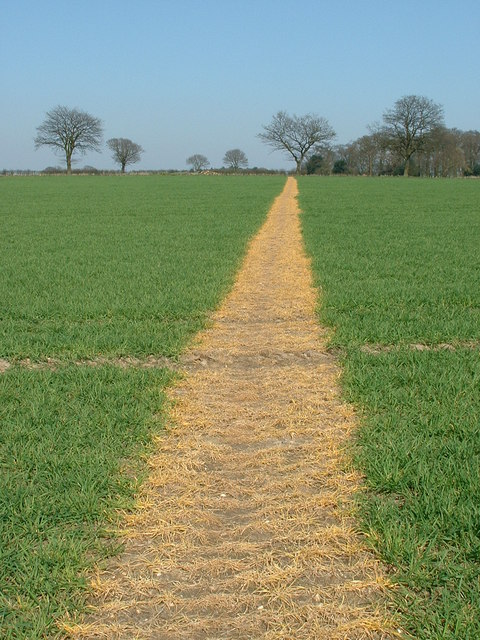
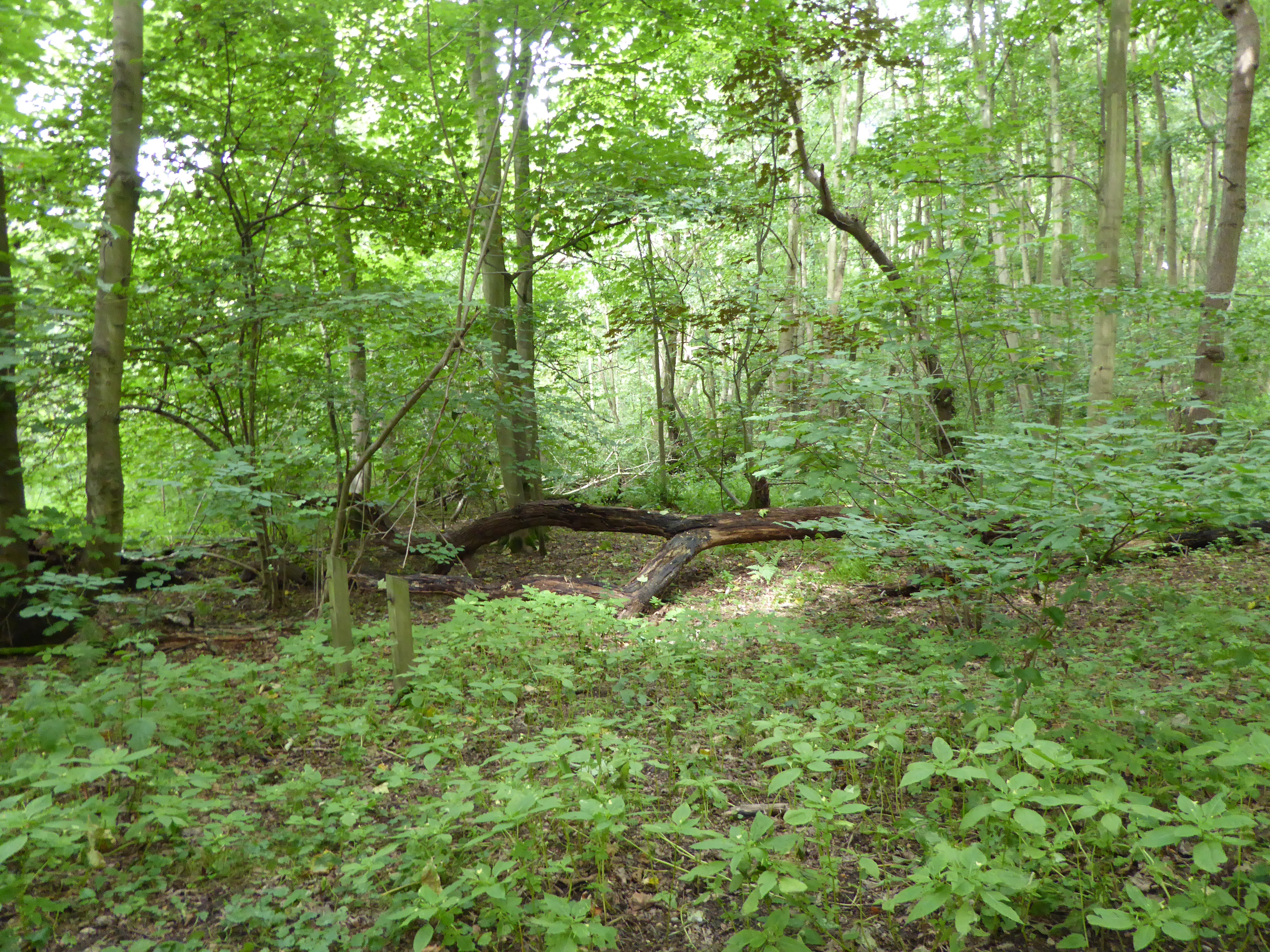
The Cliff, located in Suffolk, England, is a prominent landform that stands as a stunning natural feature within the landscape. This magnificent coastal cliff stretches for approximately 1.5 kilometers along the eastern coastline of Suffolk, overlooking the North Sea. With its towering height and steep slope, it offers breathtaking panoramic views of the surrounding area.

The Cliff, also known as the Suffolk Cliff or simply the Cliff, is composed of layers of sedimentary rock, predominantly sandstone and clay. These layers have been formed over millions of years through natural processes such as erosion and deposition. The varying colors and textures of the rock formations create a visually striking scene, making it a popular spot for nature enthusiasts and photographers.

The cliff face itself is characterized by its steep incline, which reaches heights of up to 30 meters in some areas. This vertical drop creates an impressive sight, especially when viewed from the beach below or from the top where visitors can enjoy awe-inspiring vistas. However, caution is advised when approaching the edge of the cliff due to potential erosion and unstable sections.

The Cliff is not only a geological marvel but also a haven for diverse flora and fauna. The surrounding area is home to an array of plant species, including sea thrift, sea lavender, and wild grasses that grow on the cliff's slopes. Various seabirds, such as gulls and cormorants, can be spotted nesting and soaring above the cliffs, adding to the vibrant ecosystem.

Overall, The Cliff in Suffolk stands as a remarkable natural wonder, showcasing the power and beauty of nature. Its scenic views, geological formations, and thriving wildlife make it a must-visit destination for anyone seeking a connection with the natural world.

If you have any feedback on the listing, please let us know in the comments section below.
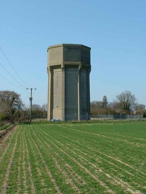
The Cliff Images

Images are sourced within 2km of 52.006546/1.1862655 or Grid Reference TM1839. Thanks to Geograph Open Source API. All images are credited.

Freston Tower A brick built towner probably dating from the 16th Century: <span class="nowrap"><a title="https://en.wikipedia.org/wiki/Freston_Tower" rel="nofollow ugc noopener" href="https://en.wikipedia.org/wiki/Freston_Tower">Link</a><img style="margin-left:2px;" alt="External link" title="External link - shift click to open in new window" src="https://s1.geograph.org.uk/img/external.png" width="10" height="10"/></span>. It now belongs to the Landmark Trust and can be rented as a holdiay home: <span class="nowrap"><a title="https://www.landmarktrust.org.uk/search-and-book/properties/freston-tower-7680/#Overview" rel="nofollow ugc noopener" href="https://www.landmarktrust.org.uk/search-and-book/properties/freston-tower-7680/#Overview">Link</a><img style="margin-left:2px;" alt="External link" title="External link - shift click to open in new window" src="https://s1.geograph.org.uk/img/external.png" width="10" height="10"/></span>
Freston Tower
A brick built towner probably dating from the 16th Century: LinkExternal link. It now belongs to the Landmark Trust and can be rented as a holdiay home: LinkExternal link
Woolverstone Marina
Woolverstone Marina
Woolverstone Marina Wolverstone Marina is the Home of many pleasure crafts.  It is also next to the “Cat House” where it was said that years ago was the home to a man who was sympathetic to boats carrying contraband along the river.  He had a pet cat which he loved.  When it died he had it stuffed and when he could see that no customs boats were patrolling the river put the cat in the window for any smugglers to see, signalling that all was well.
Woolverstone Marina
Wolverstone Marina is the Home of many pleasure crafts. It is also next to the “Cat House” where it was said that years ago was the home to a man who was sympathetic to boats carrying contraband along the river. He had a pet cat which he loved. When it died he had it stuffed and when he could see that no customs boats were patrolling the river put the cat in the window for any smugglers to see, signalling that all was well.
Freston Tower Freston Tower, owned by The Landmark Trust. We stayed there in October 2005!
Freston Tower
Freston Tower, owned by The Landmark Trust. We stayed there in October 2005!
A long drive Woolverstone Hall Woolverstone Suffolk.Now a school. More info see <span class="nowrap"><a title="http://en.wikipedia.org/wiki/Woolverstone_Hall" rel="nofollow ugc noopener" href="http://en.wikipedia.org/wiki/Woolverstone_Hall">Link</a><img style="margin-left:2px;" alt="External link" title="External link - shift click to open in new window" src="https://s1.geograph.org.uk/img/external.png" width="10" height="10"/></span>
A long drive
Woolverstone Hall Woolverstone Suffolk.Now a school. More info see LinkExternal link
Snowdrops in Woolverstone wood
St Michael's, Woolverstone Taken from the drive down to the marina.
St Michael's, Woolverstone
Taken from the drive down to the marina.
'The Boot' inn at Freston, Suffolk This inn stands on Freston Hill on the B.1456
'The Boot' inn at Freston, Suffolk
This inn stands on Freston Hill on the B.1456
The Lych Gate to St. Peter's church, Freston, Suffolk
Phonebox and Public Footpath at Freston
Water Tower alongside the B.1080
Home Farm
Home Farm
The lodge at the entrance to Woolverstone Park
Farmhouse at Walnut Tree Farm
A giant haystack at Whitehouse Farm
Follow The Yellow Path Reinstated footpath across farmland North West of Holbrook Suffolk.
Follow The Yellow Path
Reinstated footpath across farmland North West of Holbrook Suffolk.
Water Tower Water tower near to Woolverstone Suffolk.
Water Tower
Water tower near to Woolverstone Suffolk.
Please Drive Carefully Entrance sign to Freston just off the B1456 Suffolk.
Please Drive Carefully
Entrance sign to Freston just off the B1456 Suffolk.
Show me another place!

The Cliff is located at Grid Ref: TM1839 (Lat: 52.006546, Lng: 1.1862655)

Administrative County: Suffolk

District: Babergh

Police Authority: Suffolk

What 3 Words

///quibble.flinches.rang. Near Holbrook, Suffolk

Related Wikis

Woolverstone

Woolverstone is a small village and civil parish in Suffolk, England located on the Shotley peninsula. It is situated about 6.4 km (4.0 mi) south of Ipswich...

Ipswich High School, Suffolk

Ipswich High School is a co-educational private school at Woolverstone Hall near Ipswich, England. Formerly an exclusive school for girls, it was converted...

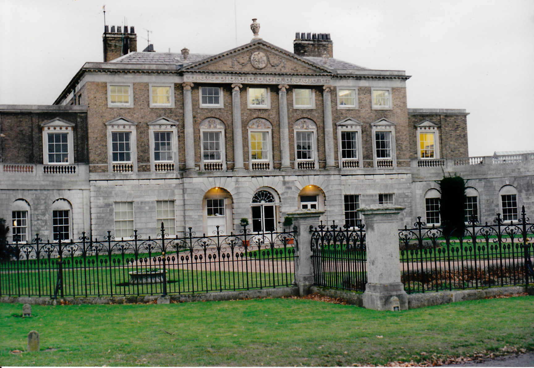
Woolverstone Hall School

In the early 1950s the London County Council obtained use of Woolverstone Hall near Ipswich, Suffolk, and some 50 acres (200,000 m2) of adjoining land...
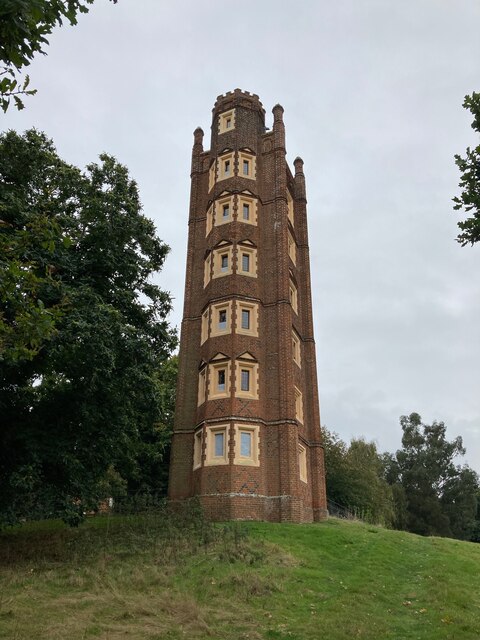
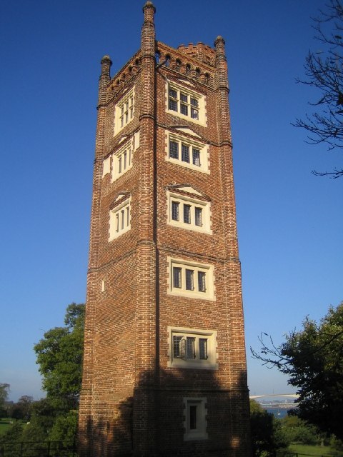
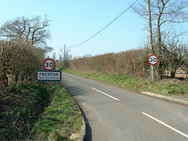
Freston Tower

Freston Tower is a six-storey red brick folly south of Ipswich, Suffolk in the village of Freston. It stands on the banks of the River Orwell. == History... ==

Bridge Wood

Bridge Wood is a 31 hectare Local Nature Reserve on the southern outskirts of Ipswich in Suffolk, England. It is owned and managed by Ipswich Borough Council...

Freston, Suffolk

Freston is a small village and civil parish in the Babergh district, in the county of Suffolk, England, located on the Shotley Peninsula, 4 miles south...

Alnesbourne Priory

Alnesbourne Priory, also known as Alnesbourn Priory, was a small Augustinian monastic house in the English county of Suffolk. It was located near Nacton...

Shotley Peninsula

The Shotley Peninsula is a rural area east of the A137 Ipswich-Colchester road located between the rivers Stour and Orwell in Suffolk, England. The peninsula...

Nearby Amenities

Located within 500m of 52.006546,1.1862655
Source: PGS
Lat/Long: 52.0065861/1.1934383
Source: PGS
Lat/Long: 52.0066344/1.1928278
Source: PGS
Lat/Long: 52.0068061/1.1923129
Source: PGS
Lat/Long: 52.0069915/1.1914852
Source: PGS
Lat/Long: 52.0068996/1.1911837
Source: PGS
Lat/Long: 52.006341/1.1909874
Source: PGS
Lat/Long: 52.006367/1.1901249
Source: PGS
Lat/Long: 52.0064666/1.1893679
Source: PGS
Lat/Long: 52.0064109/1.1883121
Source: PGS
Lat/Long: 52.006562/1.1877282
Source: PGS
Lat/Long: 52.0071846/1.1859351
Source: PGS
Lat/Long: 52.0075148/1.184755
Source: PGS
Lat/Long: 52.0082941/1.1830598
Source: PGS
Lat/Long: 52.0085582/1.1821371
Source: PGS
Lat/Long: 52.0090866/1.1815792
Power: pole
Lat/Long: 52.0054852/1.1795176
Seamark Buoy Lateral Category: port
Seamark Buoy Lateral Colour: red
Seamark Buoy Lateral Shape: can
Seamark Buoy Lateral System: iala-a
Seamark Light Character: Q
Seamark Light Colour: red
Seamark Name: Marina
Seamark Type: buoy_lateral
Lat/Long: 52.0086709/1.1921857
Seamark Buoy Lateral Category: port
Seamark Buoy Lateral Colour: red
Seamark Buoy Lateral Shape: can
Seamark Buoy Lateral System: iala-a
Seamark Light Character: Fl
Seamark Light Colour: red
Seamark Light Period: 2.5
Seamark Name: Deerpark
Seamark Type: buoy_lateral
Lat/Long: 52.0108733/1.1870871
Toilets
Lat/Long: 52.0024516/1.1892368
Fixme: incomplete
Lat/Long: 52.0035755/1.1831901
Drinking Water
Lat/Long: 52.0050306/1.1927994
The data included in this document is from www.openstreetmap.org. The data is made available under ODbL.

Have you been to The Cliff?

Leave your review of The Cliff below (or comments, questions and feedback).