Boolie

Cliff, Slope in Shetland

Scotland

Boolie

Sunrise beyond the Nev from Haroldswick
Sunrise beyond the Nev from Haroldswick Credit: Mike Pennington

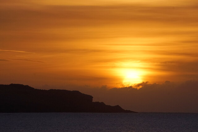
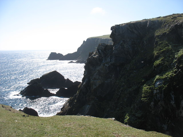
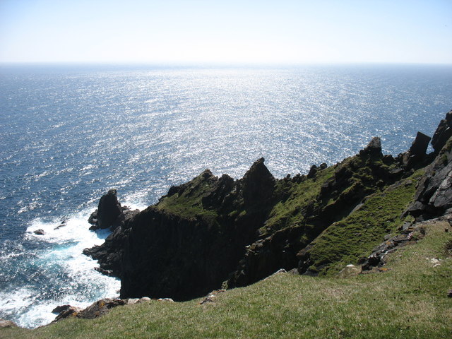
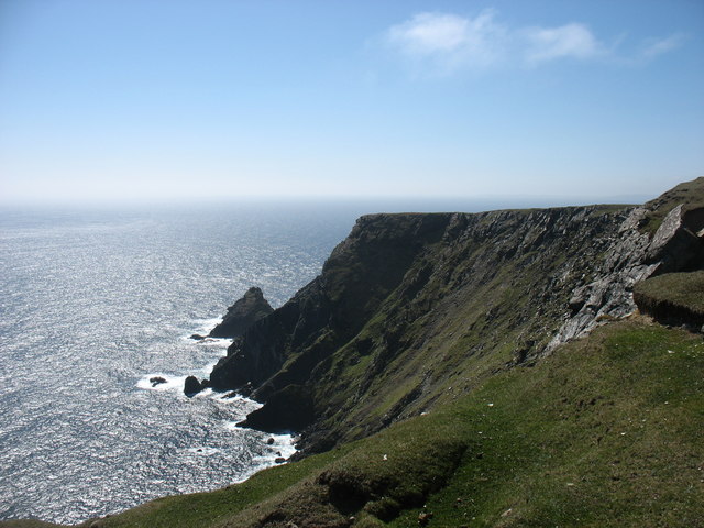
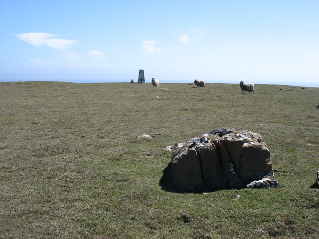
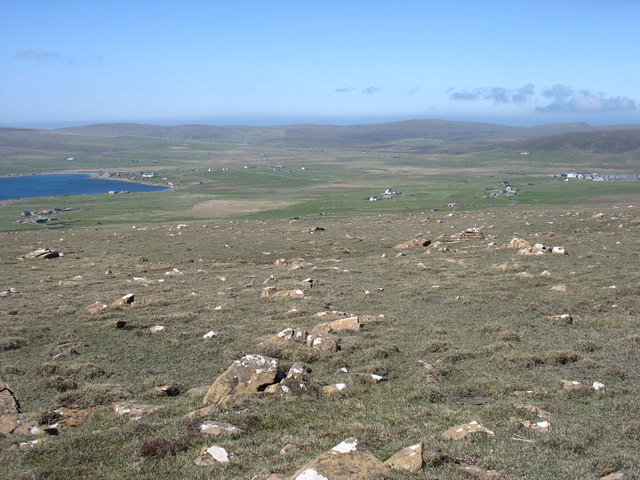
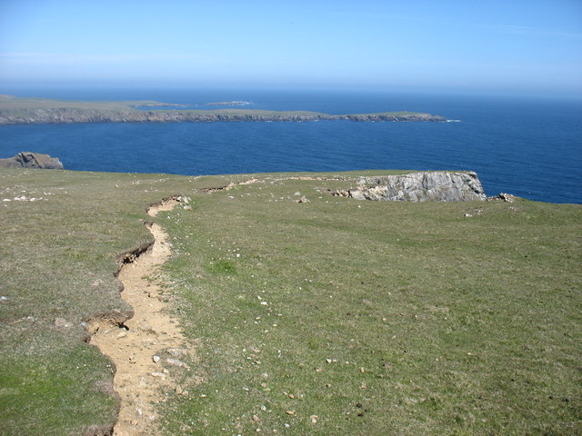
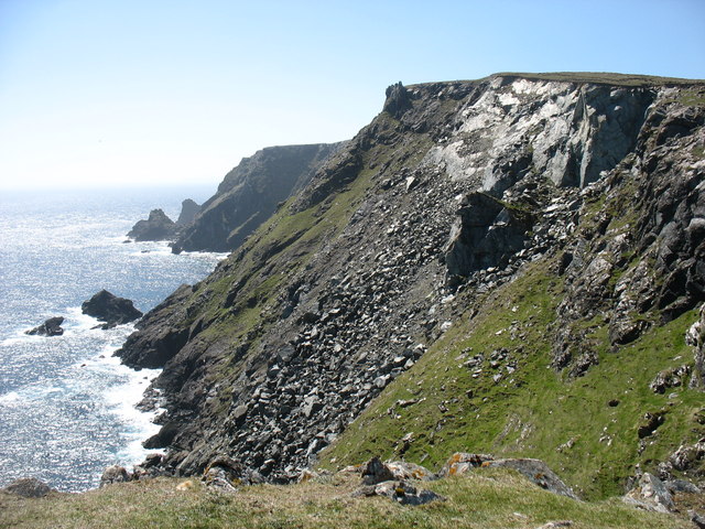
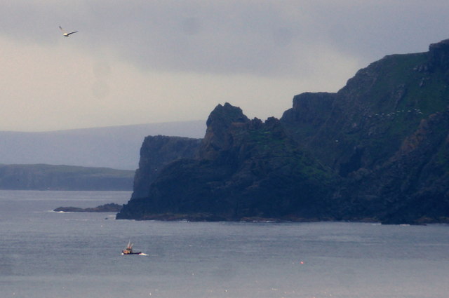
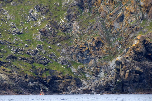
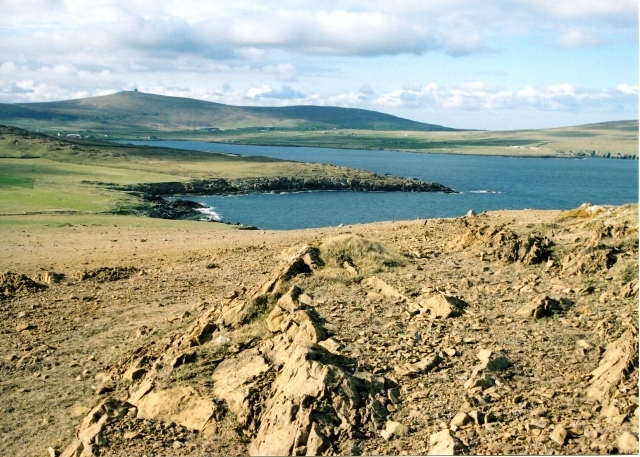
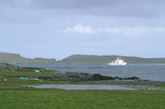
Boolie is a small but picturesque hamlet located in the Shetland Islands, an archipelago in Scotland. Nestled on a cliffside, it offers breathtaking views of the North Sea and the surrounding rugged landscape. The name "Boolie" is believed to have derived from the Old Norse word "bol" meaning a homestead or dwelling.

The hamlet is perched on a steep slope, with traditional stone houses dotting the landscape. These houses, built in a charming yet practical style, are a testament to the island's rich history and cultural heritage. Many of them have been well-preserved, with their distinctive thatched roofs and whitewashed walls.

Life in Boolie is closely linked to the sea. Fishing has been a significant source of livelihood for the locals for generations. The hamlet's strategic location near the coast grants easy access to the abundant marine resources found in the North Sea. The fishermen of Boolie are known for their skill and resilience, braving the often harsh weather conditions to bring home their catch.

Nature enthusiasts will find plenty to explore around Boolie. The surrounding cliffs provide a haven for seabirds, including puffins, guillemots, and fulmars. The area is also home to diverse marine life, with seals and otters often spotted along the rocky shoreline.

With its stunning coastal setting, rich maritime history, and abundant wildlife, Boolie is a hidden gem in the Shetland Islands. Whether for its breathtaking scenery or for a glimpse into traditional island life, visiting Boolie is an opportunity to experience the beauty and tranquility of this unique corner of Scotland.

If you have any feedback on the listing, please let us know in the comments section below.

Boolie Images

Images are sourced within 2km of 60.780846/-0.78069195 or Grid Reference HP6611. Thanks to Geograph Open Source API. All images are credited.

Sunrise beyond the Nev from Haroldswick
The cliffs at Girr Wick
Ship Stack from Valtoes
The Horns of Hagmark
Hill of Clibberswick summit The sheep seem very content, even though they are grazing only a few metres from a 160m sheer drop. (The actual highest point, by a few centimetres, of the hill is to the right and just out of shot.)
Hill of Clibberswick summit
The sheep seem very content, even though they are grazing only a few metres from a 160m sheer drop. (The actual highest point, by a few centimetres, of the hill is to the right and just out of shot.)
Western slopes of Hill of Clibberswick Looking towards the small village of Haroldswick, by the shore on the left.
Western slopes of Hill of Clibberswick
Looking towards the small village of Haroldswick, by the shore on the left.
Landslip danger ahead! Even quite far in from the cliff edge on Hill of Clibberswick there is clearly a risk of landslip. A local resident warned me that after the recent long period of dry weather, the risk was high. I thought that it would be greater after a period of wet weather, but I did not debate the point: I just made sure that I did not take any chances!
Landslip danger ahead!
Even quite far in from the cliff edge on Hill of Clibberswick there is clearly a risk of landslip. A local resident warned me that after the recent long period of dry weather, the risk was high. I thought that it would be greater after a period of wet weather, but I did not debate the point: I just made sure that I did not take any chances!
Towards the Horns of Hagmark This piece of landslip would appear to be fairly recent.
Towards the Horns of Hagmark
This piece of landslip would appear to be fairly recent.
Creel boat off Hinda Stack, Clibberswick Photographed from Lamba Ness.
Creel boat off Hinda Stack, Clibberswick
Photographed from Lamba Ness.
Clibberswick, Haroldswick The oldest inhabited house in the area.
Clibberswick, Haroldswick
The oldest inhabited house in the area.
Clibberswick,Haroldswick
Moving talc in the Clibberswick quarry
Sclaten, Haroldswick
Small boat off Hagdale
Small creel boat beside Mooa Stack, Clibberswick Taken from the STV Swan about 1 km to the south.
Small creel boat beside Mooa Stack, Clibberswick
Taken from the STV Swan about 1 km to the south.
Small creel boat off Clibberswick Mooa Stack and the Giant in the background. Taken from the STV Swan.
Small creel boat off Clibberswick
Mooa Stack and the Giant in the background. Taken from the STV Swan.
Hinda Stack and the Giant from the sea Taken from the STV Swan about 1.5 km offshore.
Hinda Stack and the Giant from the sea
Taken from the STV Swan about 1.5 km offshore.
Small creel boat off Clibberswick Just approaching Hinda Stack. Taken from the STV Swan about 1.5 km offshore.
Small creel boat off Clibberswick
Just approaching Hinda Stack. Taken from the STV Swan about 1.5 km offshore.
Show me another place!

Boolie is located at Grid Ref: HP6611 (Lat: 60.780846, Lng: -0.78069195)

Unitary Authority: Shetland Islands

Police Authority: Highlands and Islands

What 3 Words

///longingly.wiser.gobblers. Near Haroldswick, Shetland Islands

Related Wikis

Keen of Hamar

Keen of Hamar is a nature reserve on Unst, in Shetland, Scotland, managed by Scottish Natural Heritage. The reserve is primarily of botanical interest...

Haroldswick

Haroldswick or Harold's Wick (Old Norse: Haraldsvík, 'Harald's bay'), is on Unst, Shetland Islands, Scotland, and is one of the most northerly settlements...

Saxa Vord distillery

Saxa Vord distillery is a Scotch whisky and gin distillery on the island of Unst, part of the Shetland islands. The distillery takes its name from its...

Valhalla Brewery

The Valhalla Brewery in Unst, Shetland, Scotland, was the northernmost brewery in the United Kingdom. It was opened by the husband and wife team Sonny...
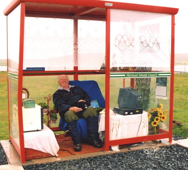
Unst Bus Shelter

The Unst Bus Shelter, also known as Bobby's Bus Shelter, is a bus shelter and bus stop near the village of Baltasound, on the isle of Unst, Shetland Islands...

Balta, Shetland

Balta (Scots: Balta; Old Norse: "Baltey") is an uninhabited island in Shetland, Scotland. == Geography == Balta lies off the east coast of Unst and Balta...

SaxaVord Spaceport

SaxaVord Spaceport, previously known as Shetland Space Centre, is a planned spaceport to be located on the Lamba Ness peninsula on Unst, the most northerly...

Balta Sound

Balta Sound is a sound (inlet) on the east coast of the island of Unst in the Shetland Islands, Scotland. The sound is sheltered from the North Sea to...

Nearby Amenities

Located within 500m of 60.780846,-0.78069195
Rurra Geo
Natural: cliff
Lat/Long: 60.7808417/-0.7869775
Brattaberg
Natural: cliff
Lat/Long: 60.7806853/-0.7839334
Sootra Geo
Natural: cliff
Lat/Long: 60.7803333/-0.7827318
The Nev
Natural: rock
Lat/Long: 60.7800716/-0.7806182
Second Nev
Natural: cliff
Lat/Long: 60.7810734/-0.7802961
Boolie
Natural: cliff
Lat/Long: 60.7812401/-0.7804506
Shinnaberg
Natural: cliff
Lat/Long: 60.7836245/-0.7791635
Mooa Stack
Natural: cliff
Lat/Long: 60.7841429/-0.7788038
The data included in this document is from www.openstreetmap.org. The data is made available under ODbL.

Have you been to Boolie?

Leave your review of Boolie below (or comments, questions and feedback).