The Battery Banks

Cliff, Slope in Shetland

Scotland

The Battery Banks

The Bight of Ham Small bay on the west coast of the Isle of Bressay.
The Bight of Ham Credit: Oliver Dixon

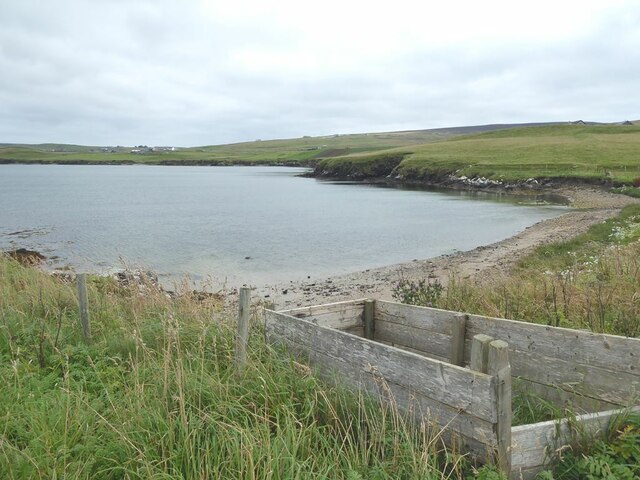
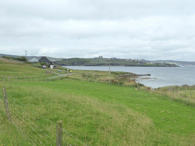
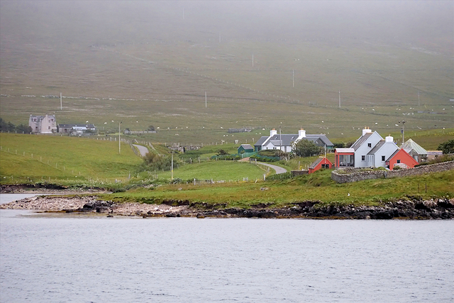
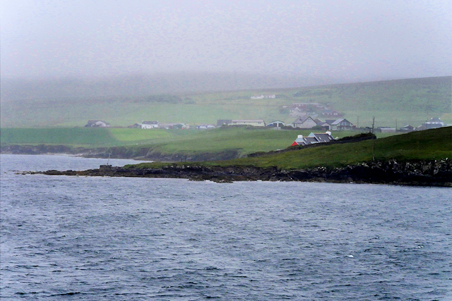
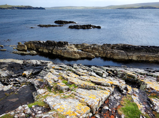
The Battery Banks, located in Shetland, Scotland, is a stunning natural feature comprising cliffs and slopes that stretch along the coastline. These geological formations are a prominent landmark in the area, attracting visitors and nature enthusiasts alike.

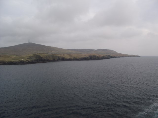
The Battery Banks are characterized by their steep cliffs, which rise dramatically from the sea, offering breathtaking views of the surrounding landscape. These cliffs are formed from layers of sedimentary rock, showcasing a variety of colors and textures that add to their visual appeal. The sheer height and ruggedness of the cliffs provide a perfect habitat for a diverse range of bird species, including puffins, guillemots, and fulmars, making it a popular spot for birdwatching.

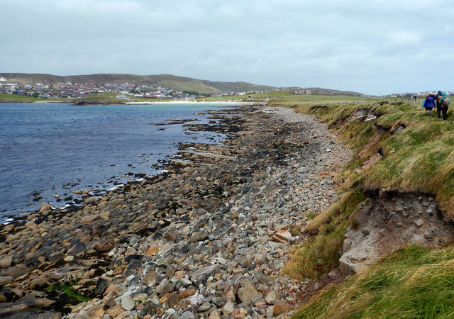
In addition to the cliffs, the Battery Banks also feature sloping areas, which gently descend towards the shoreline. These slopes are covered in lush vegetation, including grasses, heather, and wildflowers, creating a picturesque backdrop against the rugged cliffs. The slopes provide an ideal habitat for small mammals, such as voles and rabbits, as well as a variety of plant species.

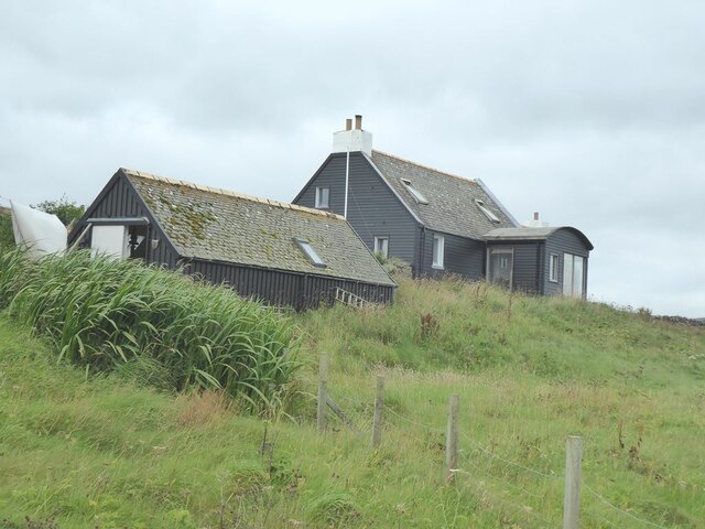
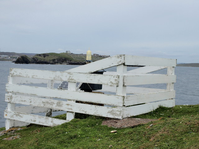
The Battery Banks are not only a visual spectacle but also hold historical significance. This area was once used as a defensive position during World War II, with gun emplacements and military structures dotting the landscape. Today, remnants of these structures can still be seen, adding an extra layer of interest for history enthusiasts.

Overall, the Battery Banks in Shetland offer a captivating blend of natural beauty, wildlife diversity, and historical significance. Whether it's for admiring the impressive cliffs, spotting unique bird species, or exploring the remnants of wartime defenses, a visit to the Battery Banks is sure to leave visitors in awe of Shetland's remarkable coastal landscape.

If you have any feedback on the listing, please let us know in the comments section below.

The Battery Banks Images

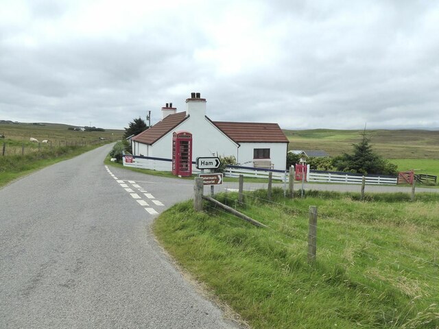
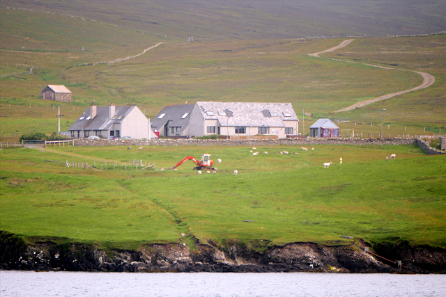
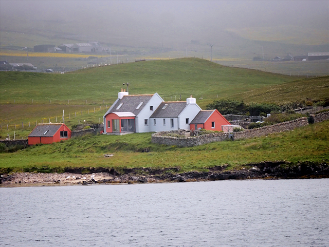
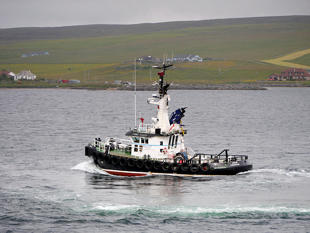
Images are sourced within 2km of 60.147204/-1.141356 or Grid Reference HU4740. Thanks to Geograph Open Source API. All images are credited.

The Bight of Ham Small bay on the west coast of the Isle of Bressay.
The Bight of Ham
Small bay on the west coast of the Isle of Bressay.
House at the Taing of Ham
Ham Peninsula on the west coast of the Isle of Bressay. Across the water are houses on the Ness of Sound <a href="https://www.geograph.org.uk/gridref/HU4639">HU4639</a> on Shetland Mainland.
Ham
Peninsula on the west coast of the Isle of Bressay. Across the water are houses on the Ness of Sound HU4639 on Shetland Mainland.
The road to Bressay Lighthouse
The turning for Ham On the road to Bressay Lighthouse.
The turning for Ham
On the road to Bressay Lighthouse.
MV Costa Fortuna at anchor in Bressay Sound The size of the MV Costa Fortuna (464 cabins, nine swimming pools and five restaurants) meant that it was obliged to anchor out in the Sound rather than at the quayside in Lerwick. A flotilla of barges were kept busy ferrying passengers to and from the Victoria Pier. The Costa Fortuna is a sister ship to the ill-starred Costa Concordia which sank off the Italian coast in 2012.
MV Costa Fortuna at anchor in Bressay Sound
The size of the MV Costa Fortuna (464 cabins, nine swimming pools and five restaurants) meant that it was obliged to anchor out in the Sound rather than at the quayside in Lerwick. A flotilla of barges were kept busy ferrying passengers to and from the Victoria Pier. The Costa Fortuna is a sister ship to the ill-starred Costa Concordia which sank off the Italian coast in 2012.
Pullar's Loch, Sound, from the air
Ness of Sound, Lerwick, from the air
Small boat off Ness of Sound Taken from the Knab in Lerwick.
Small boat off Ness of Sound
Taken from the Knab in Lerwick.
Coastal Farm, Bressay
Bressay, House at Ham
MV Knab, Lerwick Pilot Boat The Lerwick pilot boat, MV Knab, in Bressay Sound.
MV Knab, Lerwick Pilot Boat
The Lerwick pilot boat, MV Knab, in Bressay Sound.
Ham Coastal settlement on Bressay.
Ham
Coastal settlement on Bressay.
Cro of Ham
Cro of Ham
Light Beacon White construction, Cro of Ham on Bressay, containing a light beacon,
that anyone who has ever taken the Lerwick-Aberdeen Ferry, must have 
seen when entering/leaving Lerwick Harbour.
Across Bressay Sound you see South Ness Cemetery.
Light Beacon
White construction, Cro of Ham on Bressay, containing a light beacon, that anyone who has ever taken the Lerwick-Aberdeen Ferry, must have seen when entering/leaving Lerwick Harbour. Across Bressay Sound you see South Ness Cemetery.
Cro of Ham
Cro of Ham
Skerries on east side of Ness of Sound The gently dipping Middle Old Red Sandstone of east Mainland produces skerries with a steep side facing the shore of Ness of Sound, and a slope off into the waters of Brei Wick. This makes them easy for seals to haul out on the seaward side, and slide quickly away from the shore if disturbed, though the ones we saw had chosen a boulder beach a little way north where they seemed better camouflaged. Perhaps the less visible ones remained while ones here had already departed before we got to them ! There certainly seeme to be seal heads popping up all along the shore of Brei Wick, watching the people passing by.

In the distance in this view is Bressay Sound, overlooked by Lerwick on the left (with the prominent coastguard building on the hilltop) and Bressay on the right.
Skerries on east side of Ness of Sound
The gently dipping Middle Old Red Sandstone of east Mainland produces skerries with a steep side facing the shore of Ness of Sound, and a slope off into the waters of Brei Wick. This makes them easy for seals to haul out on the seaward side, and slide quickly away from the shore if disturbed, though the ones we saw had chosen a boulder beach a little way north where they seemed better camouflaged. Perhaps the less visible ones remained while ones here had already departed before we got to them ! There certainly seeme to be seal heads popping up all along the shore of Brei Wick, watching the people passing by. In the distance in this view is Bressay Sound, overlooked by Lerwick on the left (with the prominent coastguard building on the hilltop) and Bressay on the right.
Voe of Sound This is the low western side of Ness of Sound, with no cliffs and a short drop to the bouldery beach overlooking Voe of Sound. Although the Voe is not very wide, and doesn't have much in the way of waves even in the fresh gusty wind, it is clear that it can get a lot rougher. Much of the shoreline vegetation was blackened by dehydration caused by the salt spray which blows over - anything brave enough to stick up above the surrounding grasses seemed badly affected, particularly the nettles.

To the left (west) of Sands of Sound, the green lump is Holm of Sound, behind which are the houses of Sound and Upper Sound (now westerly suburbs of Lerwick).
Voe of Sound
This is the low western side of Ness of Sound, with no cliffs and a short drop to the bouldery beach overlooking Voe of Sound. Although the Voe is not very wide, and doesn't have much in the way of waves even in the fresh gusty wind, it is clear that it can get a lot rougher. Much of the shoreline vegetation was blackened by dehydration caused by the salt spray which blows over - anything brave enough to stick up above the surrounding grasses seemed badly affected, particularly the nettles. To the left (west) of Sands of Sound, the green lump is Holm of Sound, behind which are the houses of Sound and Upper Sound (now westerly suburbs of Lerwick).
Show me another place!

The Battery Banks is located at Grid Ref: HU4740 (Lat: 60.147204, Lng: -1.141356)

Unitary Authority: Shetland Islands

Police Authority: Highlands and Islands

What 3 Words

///overlaps.loss.flies. Near Lerwick, Shetland Islands

Related Wikis

Lerwick and Bressay Parish Church

Lerwick and Bressay Parish Church is the largest Church of Scotland congregation in Shetland, serving the islands' capital Lerwick and the surrounding...

Shetland Library

Shetland Library is the public library service of Shetland, with its main branch based in Lerwick. Membership is open to both residents of and visitors...

Lerwick Town Hall

Lerwick Town Hall is a municipal building located on Hillhead in Lerwick, Shetland, Scotland. It is used as an events venue and registrar's office. The...

Lerwick

Lerwick ( or ; Old Norse: Leirvik; Norn: Larvik) is the main town and port of the Shetland archipelago, Scotland. Shetland's only burgh, Lerwick had a...

Nearby Amenities

Located within 500m of 60.147204,-1.141356
Mini Roundabout
Lat/Long: 60.1517011/-1.141623
Waste Basket
Lat/Long: 60.1459588/-1.1383223
Waste Basket
Waste: dog_excrement
Lat/Long: 60.1458479/-1.1383114
Waste Basket
Check Date: 2023-05-04
Lat/Long: 60.1499536/-1.1445813
Bench
Backrest: yes
Lat/Long: 60.1459558/-1.1382296
Bench
Backrest: yes
Lat/Long: 60.1467802/-1.1362355
Bench
Lat/Long: 60.1473962/-1.134236
Bench
Lat/Long: 60.150317/-1.1476008
Bench
Lat/Long: 60.1499599/-1.1456606
Brucefield Stores
Brand: localsbest
Shop: convenience
Lat/Long: 60.1509863/-1.145026
Post Box
Brand: Royal Mail
Brand Wikidata: Q638098
Collection Times: Mo-Fr 17:15; Sa 15:15
Operator: Royal Mail
Operator Wikidata: Q638098
Post Box Mounting: brick_pillar
Post Box Type: wall
Ref: ZE1 12
Royal Cypher: scottish_crown
Lat/Long: 60.1508209/-1.1446643
Toilets
Description: Public toilet Lerwick
Drinking Water: yes
Fee: no
Lat/Long: 60.1476/-1.1388308
Man Made: tower
Lat/Long: 60.1485739/-1.1406334
Bench
Backrest: yes
Lat/Long: 60.1458299/-1.1381508
Bus Stop
Annsbrae
Bus: yes
Public Transport: platform
Shelter: yes
Lat/Long: 60.1515305/-1.1430541
Bench
Backrest: yes
Seats: 3
Lat/Long: 60.1476543/-1.1336427
Bench
Backrest: yes
Seats: 3
Lat/Long: 60.1475288/-1.1338667
Bench
Backrest: yes
Seats: 3
Lat/Long: 60.1473786/-1.1341376
Bench
Backrest: yes
Seats: 3
Lat/Long: 60.1473626/-1.1342476
Bench
Backrest: yes
Seats: 3
Lat/Long: 60.1463772/-1.1368044
Bench
Backrest: yes
Seats: 3
Lat/Long: 60.1466576/-1.1362585
Bench
Backrest: yes
Lat/Long: 60.1499645/-1.144751
Barrier: cycle_barrier
Lat/Long: 60.1494333/-1.1417843
Parking
Lat/Long: 60.1510721/-1.1405489
Parking
Lat/Long: 60.1508241/-1.1401593
The Knab
Place: locality
Lat/Long: 60.14796/-1.1408107
Bench
Backrest: yes
Lat/Long: 60.1487431/-1.1432321
Parking
Lat/Long: 60.1486241/-1.1347161
Generator Method: photovoltaic
Generator Output Electricity: yes
Generator Source: solar
Generator Type: solar_photovoltaic_panel
Location: roof
Power: generator
Lat/Long: 60.1489706/-1.1390416
Bight of the Sletts
Natural: bay
Lat/Long: 60.1491795/-1.149466
The data included in this document is from www.openstreetmap.org. The data is made available under ODbL.

Have you been to The Battery Banks?

Leave your review of The Battery Banks below (or comments, questions and feedback).