Bikie's Goat

Cliff, Slope in Banffshire

Scotland

Bikie's Goat

Logie Head Logie Head comprises the whole of this promontory. At both ends of the headland the rocks belong to the Cullen Quartzite Formation, but in between is the Dicky Hare Semipelite Member. In simple terms, quartzite is metamorphosed pure sand, but semipelite is metamorphosed muddy sand. As well as being metamorphosed, the strata have been tilted through 90º by tectonic forces, and you can see in this view that the cliff looks like a row of verticals. The name Dicky Hare is applied to the beach below the semipelite cliffs, but I have no as yet discovered the origin of this rather odd name.
Logie Head Credit: Anne Burgess

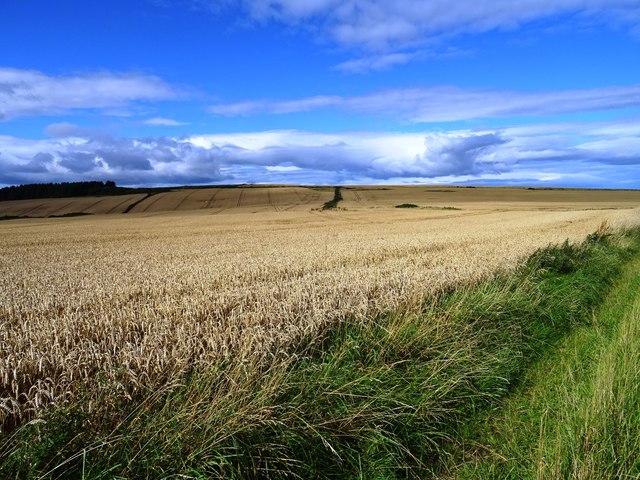
Bikie's Goat, located in Banffshire, Scotland, is a prominent cliff or slope formation that draws the attention of nature lovers and outdoor enthusiasts. This geological wonder is situated in a picturesque landscape, surrounded by lush greenery and breathtaking views.

Bikie's Goat is known for its imposing height, with the cliff rising several meters above the surrounding terrain. Its rugged and jagged appearance adds to its allure, creating a dramatic contrast against the serene backdrop of the Scottish countryside.

The cliff or slope formation is believed to have been shaped by natural erosion processes over millions of years. The specific origin of the name "Bikie's Goat" remains somewhat of a mystery, with several theories circulating among locals. However, it is widely believed that the name is derived from a local legend or folklore.

Visitors to Bikie's Goat can enjoy a variety of activities depending on their level of adventure and expertise. Rock climbers are particularly drawn to this site, as it offers a challenging and exhilarating experience. The rugged nature of the cliff provides ample opportunities for climbers to test their skills and conquer new heights. Hiking enthusiasts can also explore the surrounding area, taking in the breathtaking views and immersing themselves in the natural beauty of Banffshire.

Overall, Bikie's Goat in Banffshire is a captivating natural wonder that attracts visitors from far and wide. Its rugged beauty, rich history, and outdoor recreational opportunities make it a must-visit destination for nature enthusiasts and thrill-seekers alike.

If you have any feedback on the listing, please let us know in the comments section below.

Bikie's Goat Images

Images are sourced within 2km of 57.69443/-2.8033707 or Grid Reference NJ5267. Thanks to Geograph Open Source API. All images are credited.

Logie Head Logie Head comprises the whole of this promontory. At both ends of the headland the rocks belong to the Cullen Quartzite Formation, but in between is the Dicky Hare Semipelite Member. In simple terms, quartzite is metamorphosed pure sand, but semipelite is metamorphosed muddy sand. As well as being metamorphosed, the strata have been tilted through 90º by tectonic forces, and you can see in this view that the cliff looks like a row of verticals. The name Dicky Hare is applied to the beach below the semipelite cliffs, but I have no as yet discovered the origin of this rather odd name.
Logie Head
Logie Head comprises the whole of this promontory. At both ends of the headland the rocks belong to the Cullen Quartzite Formation, but in between is the Dicky Hare Semipelite Member. In simple terms, quartzite is metamorphosed pure sand, but semipelite is metamorphosed muddy sand. As well as being metamorphosed, the strata have been tilted through 90º by tectonic forces, and you can see in this view that the cliff looks like a row of verticals. The name Dicky Hare is applied to the beach below the semipelite cliffs, but I have no as yet discovered the origin of this rather odd name.
Bridge beneath a Bridge The old railway viaduct over a road bridge.
Bridge beneath a Bridge
The old railway viaduct over a road bridge.
Findlater Castle Remnants of the largely 15th century castle constructed by Sir William Ogilvy of Auchleven  on an earlier 13th century site. Nowadays the site is only accessible to the intrepid. The information board gives the following warning 'THE CASTLE PROMONTORY IS DANGEROUS ~ PLEASE DO NOT TAKE UNNECESSARY RISKS'.
Findlater Castle
Remnants of the largely 15th century castle constructed by Sir William Ogilvy of Auchleven on an earlier 13th century site. Nowadays the site is only accessible to the intrepid. The information board gives the following warning 'THE CASTLE PROMONTORY IS DANGEROUS ~ PLEASE DO NOT TAKE UNNECESSARY RISKS'.
Beach at Findlater Castle The castle could be supplied by sea with boats drawn up onto the beach below the castle.
Beach at Findlater Castle
The castle could be supplied by sea with boats drawn up onto the beach below the castle.
Slopes of Crannoch Hill Farmland near Barnyards of Findlater.
Slopes of Crannoch Hill
Farmland near Barnyards of Findlater.
Unlisted building and listed phone box An interloper into the early 19th century planned expansion of Seatown. Possibly a 20th century office or shop now converted to private housing.
Unlisted building and listed phone box
An interloper into the early 19th century planned expansion of Seatown. Possibly a 20th century office or shop now converted to private housing.
Seafield Street The planned 'high town' at Cullen dates from the mid 19th century and is contemporary with the railway.
Seafield Street
The planned 'high town' at Cullen dates from the mid 19th century and is contemporary with the railway.
Footbridges over the Burn of Cullen The solid modern footbridge joins the former railway viaduct to provide a coastal trail and cycleway along the Moray coastline.

It makes a pleasant change to find a footbridge that does not flex or move when walked upon but I suppose at £418000 it should be robust.
Footbridges over the Burn of Cullen
The solid modern footbridge joins the former railway viaduct to provide a coastal trail and cycleway along the Moray coastline. It makes a pleasant change to find a footbridge that does not flex or move when walked upon but I suppose at £418000 it should be robust.
Railway viaduct, Cullen The Category B listed viaduct built in 1884-6 consists of a total of 8 arches (only 7 visible in the photograph) where the former Great North of Scotland Railway line crosses the Burn of Cullen. It has been disused since the railway closed in 1968.
Railway viaduct, Cullen
The Category B listed viaduct built in 1884-6 consists of a total of 8 arches (only 7 visible in the photograph) where the former Great North of Scotland Railway line crosses the Burn of Cullen. It has been disused since the railway closed in 1968.
Houses beside the viaduct, Cullen The houses at Seatown, Cullen are dwarfed by the Category B listed viaduct built by the former Great North of Scotland Railway. Another section of viaduct is just visible in the distance on the left.
Houses beside the viaduct, Cullen
The houses at Seatown, Cullen are dwarfed by the Category B listed viaduct built by the former Great North of Scotland Railway. Another section of viaduct is just visible in the distance on the left.
Footbridge over the Cullen Burn The bridge crosses the burn just before it enters the sea. The Seatown area of Cullen is behind.
Footbridge over the Cullen Burn
The bridge crosses the burn just before it enters the sea. The Seatown area of Cullen is behind.
The beach at Cullen Looking east from beside the car park.
The beach at Cullen
Looking east from beside the car park.
The Three Kings, Cullen Two of the distinctive outcrops of Cullen Quartzite, known as the 'Three Kings'.
The Three Kings, Cullen
Two of the distinctive outcrops of Cullen Quartzite, known as the 'Three Kings'.
The Three Kings, Cullen Two of the distinctive outcrops of Cullen Quartzite, known as the 'Three Kings'.
The Three Kings, Cullen
Two of the distinctive outcrops of Cullen Quartzite, known as the 'Three Kings'.
Cullen Beach
Cullen Beach
Cullen Harbour Viewed from near Seatown.
Cullen Harbour
Viewed from near Seatown.
The Mercat Cross, Cullen 1959
Cullen Salmon Bothy Circular Path The newly upgraded path passes by this concrete pier
Cullen Salmon Bothy Circular Path
The newly upgraded path passes by this concrete pier
Show me another place!

Bikie's Goat is located at Grid Ref: NJ5267 (Lat: 57.69443, Lng: -2.8033707)

Unitary Authority: Moray

Police Authority: North East

What 3 Words

///reverted.bubble.necks. Near Cullen, Moray

Related Wikis

Cullen railway station

Cullen railway station was a railway station that served the small fishing village of Cullen, close to Portknockie in Moray. The railway station was opened...

Cullen Town Hall

Cullen Town Hall is a municipal building in The Square, Cullen, Moray, Scotland. The structure, which is currently used as a heritage centre, is a Category...
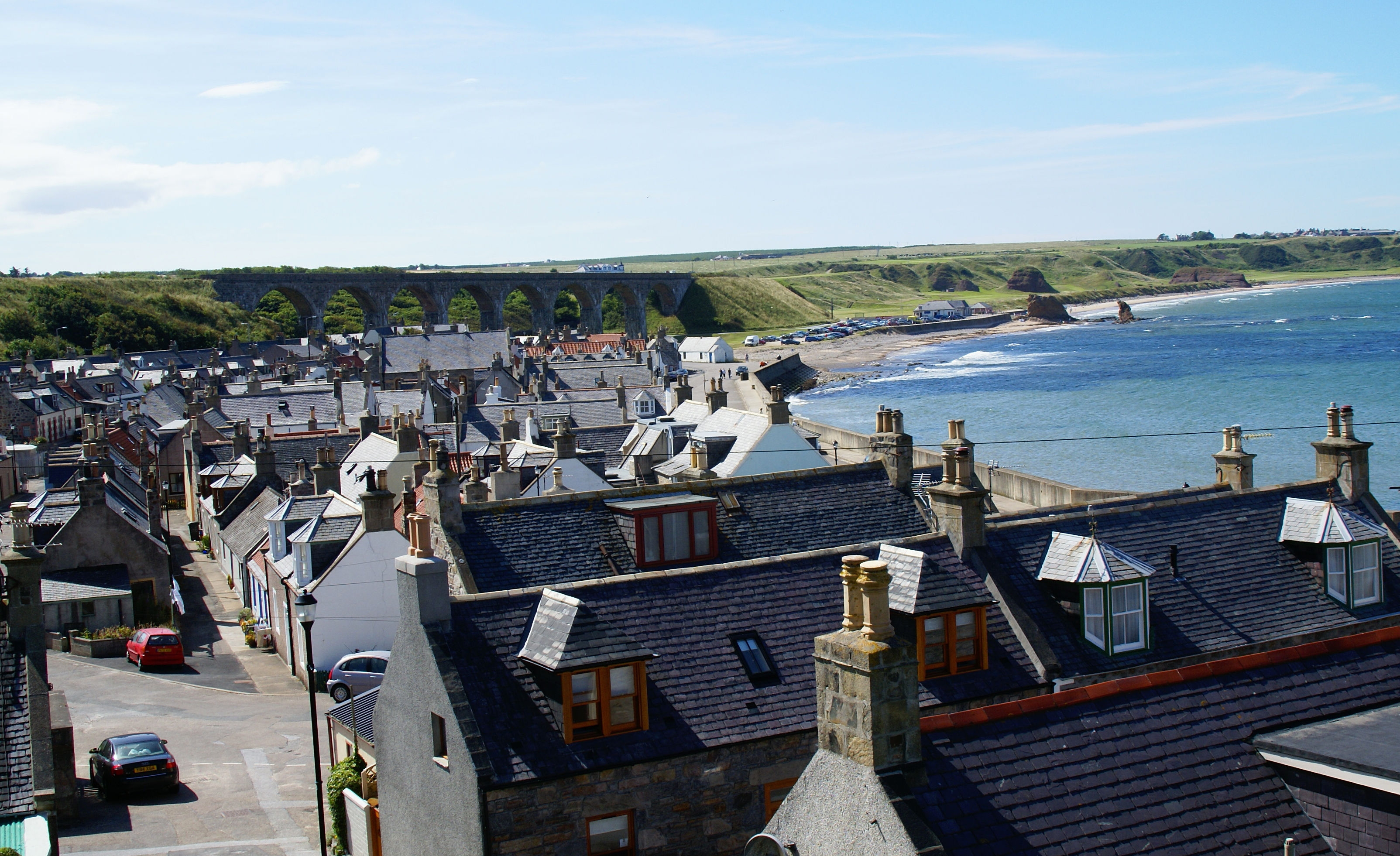
Cullen, Moray

Cullen (Scottish Gaelic: Inbhir Cuilinn) is a village and former royal burgh in Moray but historically in Banffshire, Scotland, on the North Sea coast...
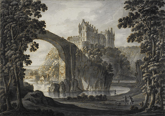
Cullen Castle

Cullen Castle was a royal castle about 0.5 miles (0.80 km) west of Cullen, Moray, Scotland, west of the burn of Deskford, and south of Seatown. The remains...

Nearby Amenities

Located within 500m of 57.69443,-2.8033707
Created By: almien_coastlines
Source: PGS
Lat/Long: 57.697437/-2.797205
Created By: almien_coastlines
Source: PGS
Lat/Long: 57.697182/-2.797684
Created By: almien_coastlines
Source: PGS
Lat/Long: 57.696671/-2.798165
Created By: almien_coastlines
Source: PGS
Lat/Long: 57.696415/-2.798405
Created By: almien_coastlines
Source: PGS
Lat/Long: 57.696417/-2.799361
Created By: almien_coastlines
Source: PGS
Lat/Long: 57.695905/-2.799364
Created By: almien_coastlines
Source: PGS
Lat/Long: 57.695778/-2.800321
Created By: almien_coastlines
Source: PGS
Lat/Long: 57.695523/-2.801278
Created By: almien_coastlines
Source: PGS
Lat/Long: 57.695268/-2.801758
Created By: almien_coastlines
Source: PGS
Lat/Long: 57.69527/-2.803192
Created By: almien_coastlines
Source: PGS
Lat/Long: 57.695528/-2.804147
Created By: almien_coastlines
Source: PGS
Lat/Long: 57.695784/-2.804624
Created By: almien_coastlines
Source: PGS
Lat/Long: 57.696041/-2.805101
Created By: almien_coastlines
Source: PGS
Lat/Long: 57.69617/-2.805578
Created By: almien_coastlines
Source: PGS
Lat/Long: 57.696683/-2.805815
Created By: almien_coastlines
Source: PGS
Lat/Long: 57.697195/-2.806051
Created By: almien_coastlines
Source: PGS
Lat/Long: 57.697068/-2.807008
Created By: almien_coastlines
Source: PGS
Lat/Long: 57.696814/-2.807965
Created By: almien_coastlines
Source: PGS
Lat/Long: 57.696558/-2.808445
Source: PGS
Lat/Long: 57.6963226/-2.8086187
Source: PGS
Lat/Long: 57.6959436/-2.8095991
Source: PGS
Lat/Long: 57.695726/-2.8113354
Tourism: viewpoint
Lat/Long: 57.6960472/-2.8073327
Power: pole
Lat/Long: 57.6919201/-2.809768
Power: pole
Lat/Long: 57.6916387/-2.8087129
Power: pole
Lat/Long: 57.691339/-2.8076711
Power: pole
Lat/Long: 57.691009/-2.8065005
Power: pole
Lat/Long: 57.6906941/-2.8053716
Power: pole
Lat/Long: 57.6904461/-2.8044852
Power: pole
Lat/Long: 57.6900604/-2.8030721
Bench
Lat/Long: 57.6955829/-2.7997344
Information: guidepost
Tourism: information
Lat/Long: 57.6962024/-2.8061884
Tourism: picnic_site
Lat/Long: 57.6963857/-2.8062109
Tourism: picnic_site
Lat/Long: 57.6964384/-2.8062763
Information: board
Tourism: information
Lat/Long: 57.6963626/-2.8063347
Bench
Lat/Long: 57.6957452/-2.8099353
The data included in this document is from www.openstreetmap.org. The data is made available under ODbL.

Have you been to Bikie's Goat?

Leave your review of Bikie's Goat below (or comments, questions and feedback).