Hanging Rocks

Cliff, Slope in East Lothian

Scotland

Hanging Rocks

West Links Poor old dunes; if the golfers don't get them, the buckthorn will.  Sea buckthorn is getting established on the dunes between Muirfield and the beach.

--
2016
This buckthorn was cleared in December 2016.
West Links Credit: Richard Webb

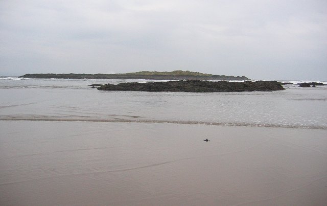
Hanging Rocks, located in East Lothian, Scotland, is a stunning natural feature that consists of a series of impressive cliffs and slopes. Situated on the coastline, it offers breathtaking views of the North Sea and is a popular destination for both locals and tourists alike.

The cliffs at Hanging Rocks are composed of sedimentary rocks, primarily sandstone and shale, which have been formed over millions of years. These rocks showcase fascinating geological formations, with layers that reveal the history of the area. Visitors can observe the distinct stratification patterns and marvel at the different colors and textures of the rocks.

The cliffs rise to a height of around 20 meters, creating an imposing backdrop against the vast expanse of the sea. They are known for their vertical nature, providing a challenge for rock climbers who are drawn to the area. The slopes leading up to the cliffs are also notable, featuring lush vegetation that adds to the natural beauty of the site.

Hanging Rocks is not only visually appealing but also holds historical significance. It is believed that the area was once a quarry, where sandstone was extracted for construction purposes. Today, remnants of this activity can still be seen, adding an intriguing element to the site's allure.

With its dramatic cliffs, picturesque slopes, and captivating geology, Hanging Rocks offers a captivating experience for nature enthusiasts, geology enthusiasts, and history buffs alike. It is a must-visit destination for anyone seeking to explore the natural wonders of East Lothian.

If you have any feedback on the listing, please let us know in the comments section below.

Hanging Rocks Images

Images are sourced within 2km of 56.06195/-2.8056406 or Grid Reference NT4985. Thanks to Geograph Open Source API. All images are credited.

West Links Poor old dunes; if the golfers don't get them, the buckthorn will.  Sea buckthorn is getting established on the dunes between Muirfield and the beach.

--
2016
This buckthorn was cleared in December 2016.
West Links
Poor old dunes; if the golfers don't get them, the buckthorn will. Sea buckthorn is getting established on the dunes between Muirfield and the beach. -- 2016 This buckthorn was cleared in December 2016.
West Links A roe deer makes a run for it across the dunes. Raids on Gullane and Dirleton's gardens have made the deer unpopular and the population is to be reduced.
West Links
A roe deer makes a run for it across the dunes. Raids on Gullane and Dirleton's gardens have made the deer unpopular and the population is to be reduced.
Muirfield Looking across the course to the surviving woodland at Archerfield.
Muirfield
Looking across the course to the surviving woodland at Archerfield.
Rocks, Freshwater Haven Outcrops on one of Gullane's beaches.
Rocks, Freshwater Haven
Outcrops on one of Gullane's beaches.
Eyebroughy A small island in the Firth of Forth.  The rocks in the foreground appear to be a basalt formation.
Eyebroughy
A small island in the Firth of Forth. The rocks in the foreground appear to be a basalt formation.
Sand and rocks The coast W of Wreaklaw Rocks with the island of Fidra coming into view. The Isle of May is on the horizon, about 21km away.
Sand and rocks
The coast W of Wreaklaw Rocks with the island of Fidra coming into view. The Isle of May is on the horizon, about 21km away.
Fidra A small island of basalt lava, said to be the model for Stevenson's 'Treasure Island'. The detached rock of North Dog is to the left and part of the Isle of May is on the horizon, about 21km away.
Fidra
A small island of basalt lava, said to be the model for Stevenson's 'Treasure Island'. The detached rock of North Dog is to the left and part of the Isle of May is on the horizon, about 21km away.
Renaissance Club golf course A course situated between Archerfield and Muirfield on the East Lothian 'Golf Coast'. The tower on the left supports a radar antenna.
Renaissance Club golf course
A course situated between Archerfield and Muirfield on the East Lothian 'Golf Coast'. The tower on the left supports a radar antenna.
Red House These scraps of masonry are shown on the first edition of the Ordnance Survey six-inch (surveyed 1853) as the ruins of Red House. The Name Book describes it as 'The Ruins of a Small cottage, once the residence of a fisherman; so named from the reddish colour of the stones by which it is Constructed'.
Red House
These scraps of masonry are shown on the first edition of the Ordnance Survey six-inch (surveyed 1853) as the ruins of Red House. The Name Book describes it as 'The Ruins of a Small cottage, once the residence of a fisherman; so named from the reddish colour of the stones by which it is Constructed'.
Rabbit Warren This area of the dunes is named on the maps as 'Rabbit Warren'. The Ordnance Survey Name Book says, 'It is farmed as a Rabbit Warren etc by Mr McKay and Mr Shepherd who partly supplies the Edinbro' [Edinburgh] market with Rabbits'. Mrs James Shepherd, warrener, Gullane, is cited as one of the authorities consulted when the Name Book was compiled in the 1850s.
Rabbit Warren
This area of the dunes is named on the maps as 'Rabbit Warren'. The Ordnance Survey Name Book says, 'It is farmed as a Rabbit Warren etc by Mr McKay and Mr Shepherd who partly supplies the Edinbro' [Edinburgh] market with Rabbits'. Mrs James Shepherd, warrener, Gullane, is cited as one of the authorities consulted when the Name Book was compiled in the 1850s.
Beach at Weaklaw Rocks According to the maps, the shore here is a rock platform. So either the maps are wrong or my GPS is wrong. The lighthouse is on Fidra.
Beach at Weaklaw Rocks
According to the maps, the shore here is a rock platform. So either the maps are wrong or my GPS is wrong. The lighthouse is on Fidra.
Weaklaw Rocks The rocks at the east end of the beach, which doesn't appear to have a name, are a wave-cut platform of volcanic breccia and tuff. Fidra is in the distance.
Weaklaw Rocks
The rocks at the east end of the beach, which doesn't appear to have a name, are a wave-cut platform of volcanic breccia and tuff. Fidra is in the distance.
Weaklaw Rocks There's a platform of rock to be crossed on the way to the nameless sandy beach.
Weaklaw Rocks
There's a platform of rock to be crossed on the way to the nameless sandy beach.
Hanging Rocks These two bluffs above the beach are formed of pyroclastic breccia reverse-faulted against younger rocks.
Hanging Rocks
These two bluffs above the beach are formed of pyroclastic breccia reverse-faulted against younger rocks.
Snow Cloud above Fidra Lovely day on East Lothians coast, though bitterly cold and the anvil shaped cloud above Fidra had snow in it. Fortunately for me I managed to avoid the snow showers.
Snow Cloud above Fidra
Lovely day on East Lothians coast, though bitterly cold and the anvil shaped cloud above Fidra had snow in it. Fortunately for me I managed to avoid the snow showers.
Dune blow out, Gullane Former wooded area of dunes.
Dune blow out, Gullane
Former wooded area of dunes.
Path, West Links The big grassland north of Gullane. The number of paths seems to have increased, although this one is long established.
Path, West Links
The big grassland north of Gullane. The number of paths seems to have increased, although this one is long established.
Old gate, Muirfield To the south of the golf course.
Old gate, Muirfield
To the south of the golf course.
Show me another place!

Hanging Rocks is located at Grid Ref: NT4985 (Lat: 56.06195, Lng: -2.8056406)

Unitary Authority: East Lothian

Police Authority: The Lothians and Scottish Borders

What 3 Words

///lives.repeating.breakaway. Near Gullane, East Lothian

Nearby Locations

Hanging Rocks

Related Wikis

Archerfield Estate and Links

Archerfield and Archerfield Links are a country house (now hotel) and pair of golf courses in the parish of Dirleton, East Lothian, Scotland. An older...

Eyebroughy

Eyebroughy (or archaically Ibris; NT493859) is a small, rocky islet in the Firth of Forth, 200 m off East Lothian, Scotland. == Location == Eyebroughy...

Scottish Open (golf)

The Genesis Scottish Open is a professional golf tournament in Scotland, and is one of five tournaments that are part of the Rolex Series, which identifies...

Renaissance Club

The Renaissance Club is a golf club in Scotland, located in North Berwick, twenty miles (30 km) east of Edinburgh. It hosted the 2017 Scottish Senior Open...

Nearby Amenities

Located within 500m of 56.06195,-2.8056406
Created By: almien_coastlines
Lat/Long: 56.063175/-2.802889
Created By: almien_coastlines
Lat/Long: 56.062934/-2.812502
Golf: pin
Lat/Long: 56.0618921/-2.8047747
Golf: pin
Lat/Long: 56.0587079/-2.8085158
Golf: pin
Lat/Long: 56.0579563/-2.8078358
Golf: pin
Lat/Long: 56.061666/-2.8021625
Golf: pin
Lat/Long: 56.0604187/-2.8078134
Golf: pin
Lat/Long: 56.0604726/-2.8070835
The data included in this document is from www.openstreetmap.org. The data is made available under ODbL.

Have you been to Hanging Rocks?

Leave your review of Hanging Rocks below (or comments, questions and feedback).