Coteley Bank

Cliff, Slope in Cumberland Copeland

England

Coteley Bank

The path to Fell Brow A pleasant track with a wonderful view of the south-west Cumbrian coastline.

This photograph was taken during the Coronavirus (COVID-19) pandemic of 2020/21.
The path to Fell Brow Credit: James T M Towill

Coteley Bank, Cumberland is a prominent geological feature located in the county of Cumbria, England. It is a steep cliff or slope that stretches over a considerable distance, providing an impressive view of the surrounding landscape.

Situated in the western part of the county, Coteley Bank offers a commanding vista of the Cumbrian countryside, with its rolling hills and picturesque valleys. The bank is composed of sedimentary rock formations, predominantly consisting of sandstone and shale layers that have been shaped by natural processes over millions of years.

With its considerable height and steep incline, Coteley Bank is a popular destination for hikers, nature enthusiasts, and geology enthusiasts alike. The cliff provides a unique opportunity for visitors to observe and learn about the geological history of the region. The various layers of rock visible along the bank offer insights into the ancient environments and geological events that have shaped the area.

The site also boasts a diverse range of flora and fauna, with vegetation clinging to the cliffside and surrounding areas. Visitors may encounter various plant species, including mosses, lichens, and ferns, as well as small animals such as birds, insects, and rodents.

Given its accessibility and scenic beauty, Coteley Bank attracts a significant number of visitors throughout the year. The site provides an excellent opportunity for outdoor activities such as hiking, photography, and nature walks. Moreover, its geological significance contributes to the educational value and scientific interest surrounding the area.

If you have any feedback on the listing, please let us know in the comments section below.

Coteley Bank Images

Images are sourced within 2km of 54.223334/-3.3551255 or Grid Reference SD1181. Thanks to Geograph Open Source API. All images are credited.

The path to Fell Brow A pleasant track with a wonderful view of the south-west Cumbrian coastline.

This photograph was taken during the Coronavirus (COVID-19) pandemic of 2020/21.
The path to Fell Brow
A pleasant track with a wonderful view of the south-west Cumbrian coastline. This photograph was taken during the Coronavirus (COVID-19) pandemic of 2020/21.
In Moor Gill A view back down to the fertile coastal farmland of this corner of Cumbria from the path leading to Black Combe.

This photograph was taken during the Coronavirus (COVID-19) pandemic of 2020/21.
In Moor Gill
A view back down to the fertile coastal farmland of this corner of Cumbria from the path leading to Black Combe. This photograph was taken during the Coronavirus (COVID-19) pandemic of 2020/21.
A5093 passing under power lines near Silecroft
A595 at Wood House Farm
The track to Giant's Grave Giant's Grave is two large standing stones
The track to Giant's Grave
Giant's Grave is two large standing stones
Giant's Grave With the hill Seaness (part of Black Combe) in the distance
Giant's Grave
With the hill Seaness (part of Black Combe) in the distance
Paragliding the cliffs at Silecroft There were some 50 odd paragliders here taking part in the 2016 Lakes Charity Classic paragliding competition.
Paragliding the cliffs at Silecroft
There were some 50 odd paragliders here taking part in the 2016 Lakes Charity Classic paragliding competition.
Path by Fell Brow
Path by Fell Brow
Track near Kirkbank
Track near Kirkbank
Ordnance Survey Cut Mark This OS cut mark can be found on the gatepost of Newland. It marks a point 14.018m above mean sea level.
Ordnance Survey Cut Mark
This OS cut mark can be found on the gatepost of Newland. It marks a point 14.018m above mean sea level.
Ordnance Survey Cut Mark This OS cut mark can be found on the Signal Box. It marks a point 11.7226m above mean sea level.
Ordnance Survey Cut Mark
This OS cut mark can be found on the Signal Box. It marks a point 11.7226m above mean sea level.
Ordnance Survey Cut Mark This OS cut mark can be found on a gatepost at Cumpstones House. It marks a point 27.225m above mean sea level.
Ordnance Survey Cut Mark
This OS cut mark can be found on a gatepost at Cumpstones House. It marks a point 27.225m above mean sea level.
Welcome to Silecroft On the A5093.
Welcome to Silecroft
On the A5093.
Hillside grazing near Silecroft
Hodgson Green Farm
Hodgson Green Farm
John Bull Inn near Silecroft On the A5093.
John Bull Inn near Silecroft
On the A5093.
A595 towards Bootle
A595 towards Bootle
Grazing near Sledbank View down the valley toward the Cumbrian Coast Line.
Grazing near Sledbank
View down the valley toward the Cumbrian Coast Line.
Show me another place!

Coteley Bank is located at Grid Ref: SD1181 (Lat: 54.223334, Lng: -3.3551255)

Administrative County: Cumbria

District: Copeland

Police Authority: Cumbria

What 3 Words

///enough.singles.activity. Near Haverigg, Cumbria

Nearby Locations

Coteley Bank

Related Wikis

Silecroft railway station

Silecroft is a railway station on the Cumbrian Coast Line, which runs between Carlisle and Barrow-in-Furness. The station, situated 19 miles (31 km) north...

Silecroft

The village of Silecroft in Cumbria, England, is in the parish of Whicham. It is situated between the towns of Millom and Bootle, and also neighbours the...

Giant's Grave, Cumbria

Giant's Grave (grid reference SD135810) are two standing stones at the foot of Black Combe in Cumbria, England. The smaller stone has three cup and ring...

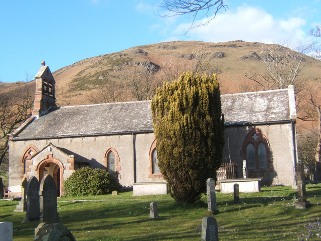
St Mary's Church, Whicham

St Mary's Church is on the A595 road in Whicham, Cumbria, England. It is an active Anglican parish church in the deanery of Calder, the archdeaconry of...

Nearby Amenities

Located within 500m of 54.223334,-3.3551255
Source: PGS
Lat/Long: 54.2267603/-3.359538
Source: PGS
Lat/Long: 54.2264547/-3.3591844
Source: PGS
Lat/Long: 54.2261278/-3.3588017
Source: PGS
Lat/Long: 54.2256471/-3.3582817
Source: PGS
Lat/Long: 54.2251745/-3.3577228
Source: PGS
Lat/Long: 54.2245246/-3.35706
Created By: almien_coastlines
Source: PGS
Lat/Long: 54.224032/-3.356447
Source: PGS
Lat/Long: 54.2235301/-3.3560549
Created By: almien_coastlines
Source: PGS
Lat/Long: 54.22319/-3.355631
Created By: almien_coastlines
Source: PGS
Lat/Long: 54.222698/-3.3551077
Created By: almien_coastlines
Source: PGS
Lat/Long: 54.222263/-3.3547317
Created By: almien_coastlines
Source: PGS
Lat/Long: 54.2221065/-3.354528
Created By: almien_coastlines
Source: PGS
Lat/Long: 54.2219415/-3.3543415
Source: PGS
Lat/Long: 54.2216646/-3.3540788
Source: PGS
Lat/Long: 54.2213235/-3.3537428
Source: PGS
Lat/Long: 54.2207041/-3.3531634
Source: PGS
Lat/Long: 54.2200367/-3.3524828
Source: PGS
Lat/Long: 54.2196173/-3.3520418
Source: PGS
Lat/Long: 54.2193435/-3.3517465
Barrier: cattle_grid
Lat/Long: 54.2231775/-3.3537208
Barrier: cattle_grid
Lat/Long: 54.2251993/-3.3555774
Power: pole
Lat/Long: 54.2270678/-3.3568946
Power: pole
Lat/Long: 54.2259726/-3.3563405
Power: pole
Lat/Long: 54.2258369/-3.3551601
Power: pole
Lat/Long: 54.2256878/-3.3537475
Power: pole
Lat/Long: 54.2259716/-3.3527536
Power: pole
Lat/Long: 54.2262719/-3.3517368
Power: pole
Lat/Long: 54.2265927/-3.3506461
The data included in this document is from www.openstreetmap.org. The data is made available under ODbL.

Have you been to Coteley Bank?

Leave your review of Coteley Bank below (or comments, questions and feedback).