Grimsbury

Settlement in Northamptonshire Cherwell

England

Grimsbury

Oxford Road at the junction of Upper Windsor Street
Oxford Road at the junction of Upper Windsor Street Credit: David Howard

Grimsbury is a small village located in the county of Northamptonshire, England. Situated in the eastern part of the county, it is about 6 miles northwest of the town of Banbury, Oxfordshire. Grimsbury is nestled amidst picturesque countryside, with rolling hills and green fields surrounding the village.

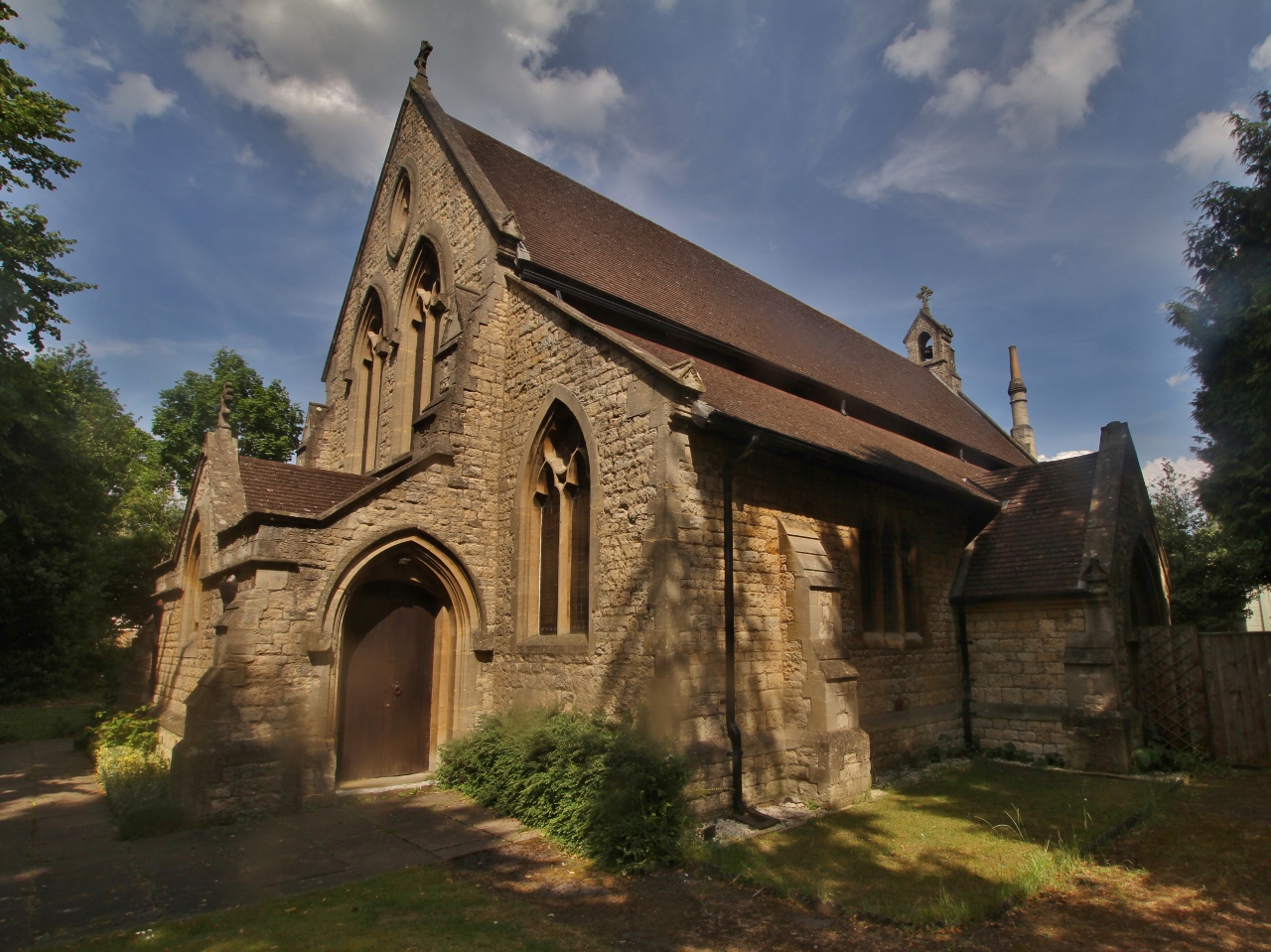
The village itself has a population of around 500 residents and maintains a close-knit community atmosphere. It is known for its charming thatched-roof cottages and traditional stone houses, which give the village a quaint and timeless feel. The local church, St. Mary's, is a prominent feature and dates back to the 13th century, adding to the historical significance of Grimsbury.

Despite its small size, the village offers several amenities to its residents. These include a primary school, a village hall, and a local pub, which serves as a hub for social gatherings and community events. Grimsbury also benefits from its proximity to larger towns such as Banbury, where residents can access a wider range of services and facilities.

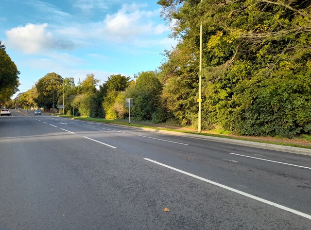
The surrounding countryside provides ample opportunities for outdoor activities, including walking, cycling, and horse riding. Grimsbury is located near the borders of both Northamptonshire and Oxfordshire, making it an ideal base for exploring the beautiful landscapes and historic sites of both counties.

Overall, Grimsbury offers a peaceful and idyllic setting for residents seeking a rural lifestyle, while still benefiting from nearby amenities and access to larger towns.

If you have any feedback on the listing, please let us know in the comments section below.

Grimsbury Images

Images are sourced within 2km of 52.065189/-1.319453 or Grid Reference SP4640. Thanks to Geograph Open Source API. All images are credited.

Oxford Road at the junction of Upper Windsor Street
Oxford Road, Banbury My last visit <a title="https://www.geograph.org.uk/photo/6923307" href="https://www.geograph.org.uk/photo/6923307">Link</a>
Oxford Road, Banbury
My last visit Link
Hightown Road, Banbury By the New Foscote Hospital
Hightown Road, Banbury
By the New Foscote Hospital
Hightown Road, Banbury
Ashlea guest house, Oxford Road, Banbury A traditional bed and breakfast guest house. I stayed here for four nights and can recommend it.
Ashlea guest house, Oxford Road, Banbury
A traditional bed and breakfast guest house. I stayed here for four nights and can recommend it.
Houses on Oxford Road, Banbury Several older properties in the area are grade II listed, but not these.
Houses on Oxford Road, Banbury
Several older properties in the area are grade II listed, but not these.
Oxford Road, Banbury Looking towards the town centre. I thought the regrading of the main road (formerly the A41, now the B4100) that has left the houses stranded on a higher level would be relatively recent, but even the 1882 OS map appears to show this arrangement.
Oxford Road, Banbury
Looking towards the town centre. I thought the regrading of the main road (formerly the A41, now the B4100) that has left the houses stranded on a higher level would be relatively recent, but even the 1882 OS map appears to show this arrangement.
Transmitter at Horton General Hospital
Entrance to Horton General Hospital The hospital is the main one for North Oxfordshire.
Entrance to Horton General Hospital
The hospital is the main one for North Oxfordshire.
Hightown Road, Banbury The road just cuts across the north-west corner of this grid square.
Hightown Road, Banbury
The road just cuts across the north-west corner of this grid square.
Rocking it down Upper Windsor Street A flatbed truck carrying three large boulders, weighing perhaps twenty tonnes altogether, descends the Banbury inner relief road.
Rocking it down Upper Windsor Street
A flatbed truck carrying three large boulders, weighing perhaps twenty tonnes altogether, descends the Banbury inner relief road.
Path to the footbridge over Upper Windsor Street The bridge in the distance carries Green Lane, a public bridleway <a href="https://www.geograph.org.uk/photo/3369727">SP4540 : Green Lane, Banbury</a>.
Path to the footbridge over Upper Windsor Street
The bridge in the distance carries Green Lane, a public bridleway SP4540 : Green Lane, Banbury.
Banbury, Bloxham Road
Vestiges of a bridge on the Oxford Canal
New housing by the canal
Drawbridge on the Oxford Canal Though I couldn't reach the rope to draw it down.
Drawbridge on the Oxford Canal
Though I couldn't reach the rope to draw it down.
Oxford Canal towpath
Copse by the canal
Copse by the canal
Show me another place!

Grimsbury is located at Grid Ref: SP4640 (Lat: 52.065189, Lng: -1.319453)

Administrative County: Oxfordshire

District: Cherwell

Police Authority: Thames Valley

What 3 Words

///lodge.moment.belong. Near Banbury, Oxfordshire

Nearby Locations

Grimsbury

Related Wikis

Grimsbury

Grimsbury is a largely residential area which forms the eastern part of Banbury, Oxfordshire, England. It is situated east of the River Cherwell, the Oxford...
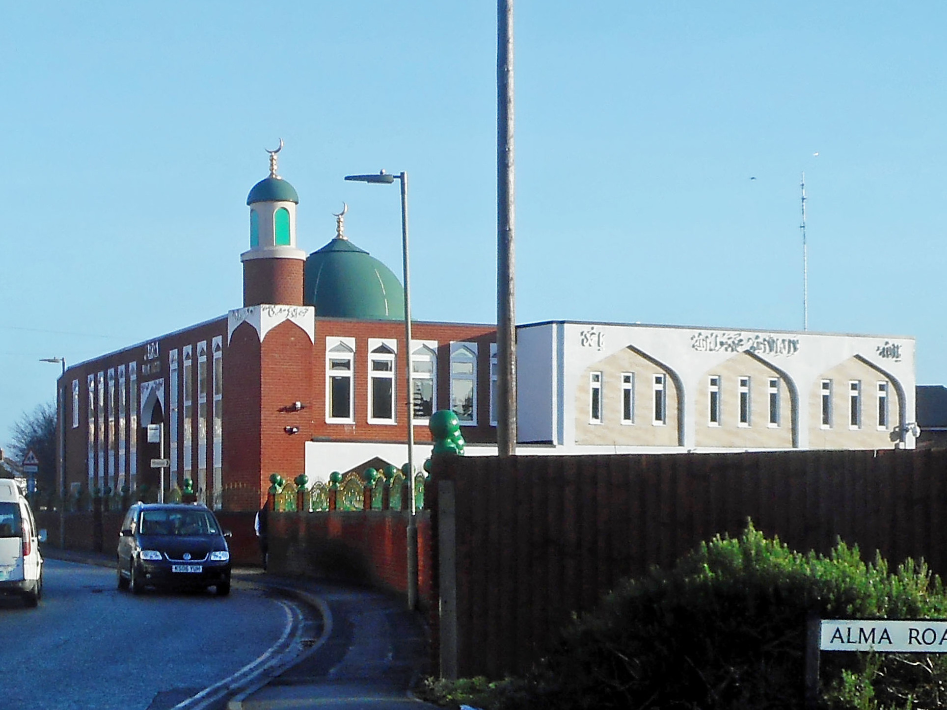
Banbury Mosque

Banbury Mosque is a mosque located in Banbury, Oxfordshire, England. In September 2008, the mosque was given permission to expand its size to allow women...

Banbury Merton Street railway station

Banbury Merton Street was the first railway station to serve the Oxfordshire market town of Banbury in England. It opened in 1850 as the northern terminus...

Banbury railway station

Banbury railway station serves the town of Banbury in Oxfordshire, England. The station is operated by Chiltern Railways, on the Chiltern Main Line, and...

Banbury Museum

Banbury Museum & Gallery is a local museum in the town of Banbury, north Oxfordshire, England.The museum is located in the centre of Banbury by the Oxford...
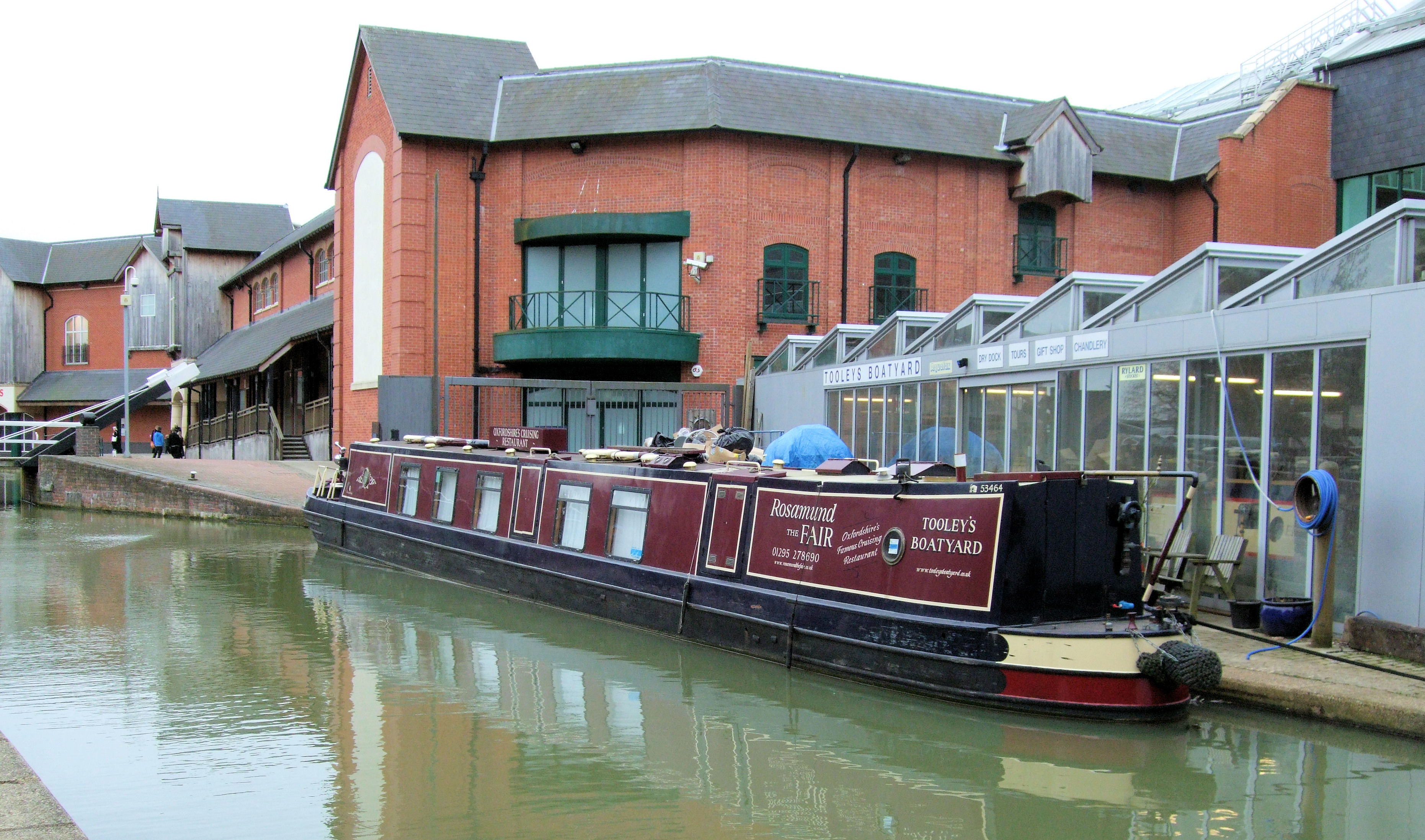
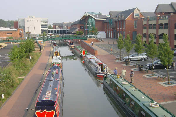
Tooley's Boatyard

Tooley's Boatyard is a dockyard on the Oxford Canal in the centre of the town of Banbury, Oxfordshire, England. The opening of the Oxford Canal from Hawkesbury...

Castle Quay Shopping Centre

Castle Quay Shopping Centre is a shopping centre in the town of Banbury, North Oxfordshire, England. The shopping centre is located in the centre of Banbury...

Nethercote, Banbury

Nethercote is a hamlet on the edge of north Oxfordshire, a semi-rural area bordering with West Northamptonshire. The hamlet sits South East of J11 of M40...

Nearby Amenities

Located within 500m of 52.065189,-1.319453
Crossing
Crossing: traffic_signals
Crossing Ref: pelican
Lat/Long: 52.0682959/-1.3157517
Traffic Signals
Lat/Long: 52.0665721/-1.3208196
Post Box
Collection Times: Mo-Fr 09:00, Sa 07:00
Fixme: Survey for ref
Ref: OX16 1201D
Royal Cypher: EIIR
Royal Cypher Wikidata: Q33102113
Lat/Long: 52.067457/-1.3204638
Crossing
Crossing: traffic_signals
Crossing Island: no
Crossing Ref: pelican
Traffic Signals Sound: yes
Lat/Long: 52.0671409/-1.3195235
Post Box
Collection Times: Mo-Fr 18:00, Sa 10:30
Post Box Type: pillar
Ref: OX16 1917
Royal Cypher: EIIR
Royal Cypher Wikidata: Q33102113
Lat/Long: 52.0628327/-1.3171919
Post Box
Collection Times: Mo-Fr 18:00, Sa 08:00
Post Box Type: meter
Ref: OX16 75P
Royal Cypher: EIIR
Royal Cypher Wikidata: Q33102113
Lat/Long: 52.0628112/-1.3171892
Bus Stop
Tesco Express
Bench: yes
Bus: yes
Naptan AtcoCode: 340001415OEA
Naptan Bearing: SW
Naptan CommonName: Buffalo Bill's
Naptan Indicator: Opposite
Naptan Landmark: Buffalo Bill's
Naptan NaptanCode: oxfagjwd
Naptan PlusbusZoneRef: BNBR
Naptan Street: Middleton Road
Naptan Verified: no
Public Transport: platform
Shelter: yes
Source: naptan_import
Tactile Paving: no
Lat/Long: 52.0659934/-1.3223254
Bus Stop
Tesco Express
Bench: yes
Bus: yes
Naptan AtcoCode: 340001415OUT
Naptan Bearing: NE
Naptan CommonName: Buffalo Bill's
Naptan Indicator: Outside
Naptan Landmark: Buffalo Bill's
Naptan NaptanCode: oxfagjwa
Naptan PlusbusZoneRef: BNBR
Naptan Street: Middleton Road
Naptan Verified: no
Network: Stagecoach
Public Transport: platform
Shelter: yes
Source: naptan_import
Tactile Paving: no
Lat/Long: 52.0662545/-1.3218845
Bus Stop
Edward Street
Bus: yes
Naptan AtcoCode: 340001416OUT
Naptan Bearing: W
Naptan CommonName: Edward Street
Naptan Indicator: Outside
Naptan Landmark: Edward Street
Naptan NaptanCode: oxfagjtw
Naptan PlusbusZoneRef: BNBR
Naptan Street: Causeway
Naptan Verified: no
Public Transport: platform
Source: naptan_import
Lat/Long: 52.062918/-1.3213553
Bus Stop
Brinkburn Grove
Bench: yes
Bus: yes
Naptan AtcoCode: 340001419OBG
Naptan Bearing: N
Naptan CommonName: Brinkburn Grove
Naptan Indicator: Opposite
Naptan Landmark: Brinkburn Grove
Naptan NaptanCode: oxfagjtj
Naptan PlusbusZoneRef: BNBR
Naptan Street: Daventry Road
Naptan Verified: no
Public Transport: platform
Shelter: yes
Source: naptan_import
Tactile Paving: no
Lat/Long: 52.0691807/-1.3207611
Bus Stop
Centre Street
Bus: yes
Naptan AtcoCode: 340001420OPC
Naptan Bearing: E
Naptan CommonName: Centre Street
Naptan Indicator: Opposite
Naptan Landmark: Centre Street
Naptan NaptanCode: oxfagmaj
Naptan PlusbusZoneRef: BNBR
Naptan Street: North Street
Naptan Verified: no
Public Transport: platform
Source: naptan_import
Lat/Long: 52.0672484/-1.3256047
Bus Stop
Centre Street
Bus: yes
Naptan AtcoCode: 340001420OUT
Naptan Bearing: W
Naptan CommonName: Centre Street
Naptan Indicator: Corner
Naptan Landmark: Centre Street
Naptan NaptanCode: oxfagjtd
Naptan PlusbusZoneRef: BNBR
Naptan Street: North Street
Naptan Verified: no
Public Transport: platform
Source: naptan_import
Lat/Long: 52.0672879/-1.3246412
Bus Stop
Avenue Road
Bench: no
Bus: yes
Naptan AtcoCode: 3400014215
Naptan Bearing: S
Naptan CommonName: Avenue Road
Naptan NaptanCode: oxfagjta
Naptan PlusbusZoneRef: BNBR
Naptan Street: Howard Road
Naptan Verified: no
Public Transport: platform
Shelter: no
Source: naptan_import
Tactile Paving: no
Lat/Long: 52.0654478/-1.3220431
Bus Stop
West Street Church
Bench: no
Bus: yes
Lit: yes
Naptan AtcoCode: 340001422OUT
Naptan Bearing: N
Naptan CommonName: West Street Church
Naptan Indicator: outside
Naptan Landmark: West Street Church
Naptan NaptanCode: oxfagm
Naptan PlusbusZoneRef: BNBR
Naptan Street: West Street
Naptan Verified: no
Public Transport: platform
Shelter: no
Source: naptan_import
Tactile Paving: no
Lat/Long: 52.065103/-1.3262059
Bus Stop
The Byeway
Bus: yes
Naptan AtcoCode: 340001462OPP
Naptan Bearing: E
Naptan CommonName: The Byeway
Naptan Indicator: Opposite
Naptan Landmark: The Byeway
Naptan NaptanCode: oxfagwga
Naptan PlusbusZoneRef: BNBR
Naptan Street: Grimsbury Drive
Naptan Verified: no
Public Transport: platform
Source: naptan_import
Lat/Long: 52.068942/-1.321465
Bus Stop
Howard Road
Bus: yes
Naptan AtcoCode: 340003144OUT
Naptan Bearing: S
Naptan CommonName: Howard Road
Naptan Indicator: Outside No 30
Naptan Landmark: No 30
Naptan NaptanCode: oxfatpda
Naptan PlusbusZoneRef: BNBR
Naptan Street: Howard Road
Naptan Verified: no
Public Transport: platform
Source: naptan_import
Lat/Long: 52.0636324/-1.3206265
Bus Stop
East Close
Bus: yes
Naptan AtcoCode: 340003146CNR
Naptan Bearing: S
Naptan CommonName: East Close
Naptan Indicator: Corner
Naptan Landmark: East Close
Naptan NaptanCode: oxfatmtp
Naptan PlusbusZoneRef: BNBR
Naptan Street: East Street
Naptan Verified: no
Public Transport: platform
Source: naptan_import
Lat/Long: 52.0671307/-1.323885
Grimsbury
Place: suburb
Wikidata: Q5609302
Lat/Long: 52.0666415/-1.3211654
Traffic Calming: choker
Lat/Long: 52.0633392/-1.319261
Turning Circle
Lat/Long: 52.0612658/-1.3208395
Turning Circle
Lat/Long: 52.0614867/-1.3201158
Barrier: bollard
Lat/Long: 52.0677332/-1.3241407
Crossing
Crossing: uncontrolled
Lat/Long: 52.0643917/-1.3137388
Crossing
Crossing: uncontrolled
Lat/Long: 52.0643777/-1.3138882
Fuel
Ermont Way Service Station
Addr City: Banbury
Addr Postcode: OX16 4SZ
Addr Street: Ermont Way
Brand: Esso
Brand Wikidata: Q867662
Fuel Diesel: yes
Fuel Octane 95: yes
Fuel Octane 98: yes
Operator: Euro Garages
Phone: +44 1295 259413
Website: https://www.esso.co.uk/en-gb/find-station/esso-banbury-essoegermontway-100200733
Lat/Long: 52.0689632/-1.31626
Crossing
Button Operated: yes
Crossing: traffic_signals
Crossing Island: no
Crossing Ref: pelican
Tactile Paving: yes
Traffic Signals Sound: yes
Traffic Signals Vibration: yes
Lat/Long: 52.0674903/-1.3210936
Crossing
Crossing: uncontrolled
Crossing Ref: zebra
Lat/Long: 52.0658154/-1.3230262
Recycling
Location: overground
Recycling Cans: yes
Recycling Clothes: yes
Recycling Glass Bottles: yes
Recycling Shoes: yes
Recycling Type: container
Source: Bing
Lat/Long: 52.0674406/-1.3202667
Turning Circle
Lat/Long: 52.0695014/-1.317777
Turning Circle
Lat/Long: 52.0692095/-1.3172714
Turning Circle
Lat/Long: 52.0686761/-1.318355
Turning Circle
Lat/Long: 52.0642927/-1.315032
Addr Housenumber: 101
Addr Street: West Street
Lat/Long: 52.0666118/-1.3262164
Addr Housenumber: 95
Addr Street: West Street
Lat/Long: 52.0664426/-1.32622
Addr Housenumber: 75-87
Addr Street: West Street
Lat/Long: 52.0665289/-1.3262168
Addr Housenumber: 111
Addr Street: West Street
Lat/Long: 52.066811/-1.3262446
Addr Housenumber: 57
Addr Street: West Street
Lat/Long: 52.0656217/-1.3262589
Addr Housenumber: 63
Addr Street: West Street
Lat/Long: 52.0657907/-1.3262148
Addr Housenumber: 86
Addr Street: West Street
Lat/Long: 52.0669702/-1.3260019
Banbury Van and care Hire Ltd
Shop: car
Lat/Long: 52.0617506/-1.3171661
Waste Basket
Lat/Long: 52.067458/-1.319938
Cafe
Reg's Cafe
Lat/Long: 52.0618096/-1.3171812
Post Box
Collection Times: Mo-Fr 09:00, Sa 07:00
Operator: Royal Mail
Post Box Type: pillar
Ref: OX16 1128D
Royal Cypher: GVIR
Royal Cypher Wikidata: Q33102169
Source: drive-by survey
Lat/Long: 52.0663182/-1.3214062
Addr City: Banbury
Addr Housenumber: 107
Addr Postcode: OX16 3QS
Addr Street: Middleton Road
Lat/Long: 52.0648999/-1.3250016
Addr City: Banbury
Addr Housenumber: 121
Addr Postcode: OX16 3QS
Addr Street: Middleton Road
Lat/Long: 52.0651885/-1.324551
Addr City: Banbury
Addr Housenumber: 77
Addr Postcode: OX16 3QS
Addr Street: Middleton Road
Lat/Long: 52.0642123/-1.3258492
Addr City: Banbury
Addr Housenumber: 105
Addr Postcode: OX16 3QS
Addr Street: Middleton Road
Lat/Long: 52.0646955/-1.325302
Addr Housenumber: 8
Addr Street: West Street
Lat/Long: 52.0647332/-1.3260121
Addr Housenumber: 18
Addr Street: West Street
Lat/Long: 52.0654522/-1.3259155
Addr Housenumber: 38
Addr Street: West Street
Lat/Long: 52.0659089/-1.3259209
Addr Housenumber: 70
Addr Street: West Street
Lat/Long: 52.0666179/-1.3259169
Post Box
Collection Times: Mo-Fr 09:00, Sa 07:00
Post Box Design: type_m
Post Box Type: lamp
Ref: OX16 1024
Royal Cypher: EIIR
Royal Cypher Wikidata: Q33102113
Lat/Long: 52.0627529/-1.3218819
Entrance: yes
Lat/Long: 52.0637364/-1.3254465
Entrance: yes
Lat/Long: 52.0637619/-1.3251654
Recycling
Recycling Glass: yes
Recycling Type: container
Lat/Long: 52.0669529/-1.3236969
Waste Basket
Lat/Long: 52.0640198/-1.3259482
Recycling
Recycling Type: container
Lat/Long: 52.0640092/-1.3259575
Crossing
Crossing: traffic_signals
Kerb: lowered
Tactile Paving: yes
Lat/Long: 52.0640893/-1.325782
Traffic Signals
Traffic Signals: signal
Lat/Long: 52.0671504/-1.3195057
Compressed Air
Lat/Long: 52.0688769/-1.3164043
Telephone
Booth: K6
Check Date: 2021-06-24
Covered: booth
Lat/Long: 52.0617081/-1.317007
Post Box
Collection Times: Mo-Fr 09:00, Sa 07:00
Ref: OX16 1016D
Royal Cypher: EIIR
Royal Cypher Wikidata: Q33102113
Lat/Long: 52.0657347/-1.3249644
Euro Car Parts
Brand: Euro Car Parts
Brand Wikidata: Q23782692
Brand Wikipedia: en:Euro Car Parts
Shop: car_parts
Lat/Long: 52.0634171/-1.3127952
Direction: 75
Generator Method: photovoltaic
Generator Output Electricity: yes
Generator Source: solar
Generator Type: solar_photovoltaic_panel
Power: generator
Lat/Long: 52.0674974/-1.3237406
Direction: 255
Generator Method: photovoltaic
Generator Output Electricity: yes
Generator Source: solar
Generator Type: solar_photovoltaic_panel
Power: generator
Lat/Long: 52.0674953/-1.3238247
Crossing
Lat/Long: 52.067422/-1.3205182
Fast Food
Greggs
Brand: Greggs
Brand Wikidata: Q3403981
Brand Wikipedia: en:Greggs
Contact Website: https://www.greggs.co.uk/shop-finder?shop-code=3602
Cuisine: sandwich;bakery
Takeaway: yes
Lat/Long: 52.0688814/-1.3159558
Cafe
Starbucks
Brand: Starbucks
Brand Wikidata: Q37158
Brand Wikipedia: en:Starbucks
Cuisine: coffee_shop
Official Name: Starbucks Coffee
Takeaway: yes
Lat/Long: 52.0689178/-1.3159834
Spar
Brand: Spar
Brand Wikidata: Q610492
Brand Wikipedia: en:SPAR (retailer)
Shop: convenience
Lat/Long: 52.0689725/-1.316024
Generator Method: photovoltaic
Generator Output Electricity: yes
Generator Source: solar
Generator Type: solar_photovoltaic_panel
Location: roof
Power: generator
Lat/Long: 52.0651494/-1.3130781
Generator Method: photovoltaic
Generator Output Electricity: yes
Generator Source: solar
Generator Type: solar_photovoltaic_panel
Location: roof
Power: generator
Lat/Long: 52.0658618/-1.3132954
Power: substation
Ref: 770713
Source: wpd_opendata
Lat/Long: 52.0672543/-1.3137701
Location: outdoor
Power: transformer
Lat/Long: 52.0628302/-1.3214352
Barrier: bollard
Lat/Long: 52.0627409/-1.325032
Barrier: bollard
Lat/Long: 52.0626055/-1.3248865
Generator Method: photovoltaic
Generator Output Electricity: yes
Generator Solar Modules: 16
Generator Source: solar
Generator Type: solar_photovoltaic_panel
Location: roof
Power: generator
Lat/Long: 52.0629555/-1.3232779
Generator Method: photovoltaic
Generator Output Electricity: yes
Generator Solar Modules: 6
Generator Source: solar
Generator Type: solar_photovoltaic_panel
Location: roof
Power: generator
Lat/Long: 52.0627133/-1.3226958
Atm
Lat/Long: 52.0665016/-1.3218777
Waste Basket
Waste: dog_excrement
Lat/Long: 52.0662168/-1.316036
Waste Basket
Lat/Long: 52.0654352/-1.3179631
Waste Basket
Waste: dog_excrement
Lat/Long: 52.0654765/-1.3179771
Bench
Lat/Long: 52.0666334/-1.3211695
Waste Basket
Waste: dog_excrement
Lat/Long: 52.0636639/-1.3240037
Barrier: cycle_barrier
Lat/Long: 52.0645089/-1.3251935
Bench
Lat/Long: 52.0615916/-1.3203972
Recycling
Recycling Type: container
Lat/Long: 52.0617155/-1.3204398
Turning Circle
Lat/Long: 52.0673156/-1.3170742
Turning Circle
Lat/Long: 52.0673494/-1.3169848
Barrier: cycle_barrier
Lat/Long: 52.0676081/-1.3187527
Barrier: cycle_barrier
Lat/Long: 52.0672021/-1.3195951
Parcel Locker
Brand: InPost
Brand Wikidata: Q3182097
Parcel Mail In: yes
Parcel Pickup: yes
Lat/Long: 52.0672657/-1.3199135
Addr Housenumber: 88
Addr Street: West Street
Lat/Long: 52.0670543/-1.3260351
Addr Housename: Wits End
Addr Street: North Street
Lat/Long: 52.0670737/-1.3259059
Man Made: utility_pole
Material: wood
Lat/Long: 52.0672733/-1.3247354
Man Made: utility_pole
Material: wood
Lat/Long: 52.0657725/-1.3249212
Turning Circle
Lat/Long: 52.0666871/-1.3201369
Turning Circle
Lat/Long: 52.0655522/-1.3203685
Recycling
Recycling Type: container
Lat/Long: 52.0638464/-1.3165733
Waste Basket
Lat/Long: 52.0639719/-1.3165733
Waste Basket
Lat/Long: 52.0640797/-1.3156744
Avire
Addr City: Banbury
Addr Housename: The Exclusive Building
Addr Postcode: OX16 4UZ
Addr Street: Thorpe Drive
Office: estate_agent
Website: https://avire.co.uk/
Lat/Long: 52.0635982/-1.3169715
Traffic Calming: choker
Lat/Long: 52.0632658/-1.3196915
The data included in this document is from www.openstreetmap.org. The data is made available under ODbL.

Have you been to Grimsbury?

Leave your review of Grimsbury below (or comments, questions and feedback).