The Bourtrees

Cliff, Slope in Buteshire

Scotland

The Bourtrees

Passing Meadow Point Passing Meadow Point after a passage between the Broad Islands, islets off the east coast of Little Cumbrae Island.  Millport on Great Cumbrae Island can be seen in the background.

This photograph was taken during the Coronavirus (COVID-19) pandemic of 2020/21.
Passing Meadow Point Credit: James T M Towill

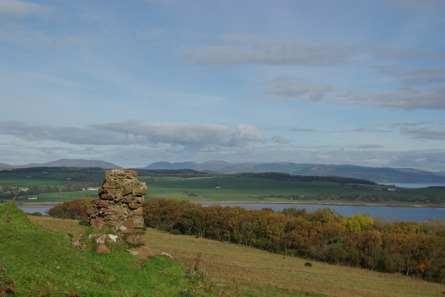
The Bourtrees, located in Buteshire, is a picturesque area encompassing a cliff and slope landscape that is renowned for its natural beauty and breathtaking views. Situated on the western coast of Scotland, this coastal region is a haven for nature enthusiasts and adventurers alike.

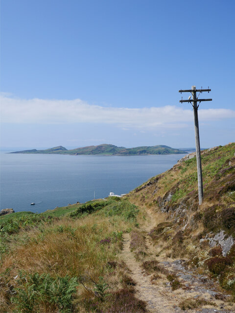
The Bourtrees cliff stands tall, offering a dramatic backdrop to the surrounding landscape. With its rugged and steep formation, it provides an awe-inspiring sight for visitors who appreciate the raw power of nature. The cliff face is adorned with vibrant green vegetation, adding to its charm and creating a striking contrast against the deep blue waters of the nearby sea.

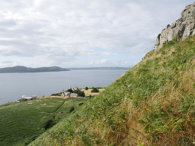
Adjacent to the cliff is the Bourtrees slope, a gentle incline that leads down towards the shore. Covered in lush grass and dotted with wildflowers, this slope is a paradise for walkers, hikers, and picnickers. The slope offers panoramic views of the sea and the coastal scenery, making it an ideal spot for nature photography or simply taking in the tranquil ambiance.

The Bourtrees is also home to a diverse range of wildlife, including seabirds, marine mammals, and various plant species. Visitors may be lucky enough to spot seabirds soaring above the cliff or catch a glimpse of seals basking on the rocks below. The area is also abundant in flora, with wildflowers such as primroses and sea thrift adding bursts of color to the landscape.

Overall, The Bourtrees in Buteshire is a destination that combines natural beauty, breathtaking views, and abundant wildlife. It offers a serene and tranquil environment for those seeking a peaceful retreat or an opportunity to connect with nature in all its glory.

If you have any feedback on the listing, please let us know in the comments section below.

The Bourtrees Images

Images are sourced within 2km of 55.724697/-4.9628221 or Grid Reference NS1451. Thanks to Geograph Open Source API. All images are credited.

Passing Meadow Point Passing Meadow Point after a passage between the Broad Islands, islets off the east coast of Little Cumbrae Island.  Millport on Great Cumbrae Island can be seen in the background.

This photograph was taken during the Coronavirus (COVID-19) pandemic of 2020/21.
Passing Meadow Point
Passing Meadow Point after a passage between the Broad Islands, islets off the east coast of Little Cumbrae Island. Millport on Great Cumbrae Island can be seen in the background. This photograph was taken during the Coronavirus (COVID-19) pandemic of 2020/21.
One of the Broad Islands One of the Broad Islands, south of Meadow Point on the eastern side of Little Cumbrae Island.

This photograph was taken during the Coronavirus (COVID-19) pandemic of 2020/21.
One of the Broad Islands
One of the Broad Islands, south of Meadow Point on the eastern side of Little Cumbrae Island. This photograph was taken during the Coronavirus (COVID-19) pandemic of 2020/21.
'Tonka' at Little Cumbrae 'Tonka' is a Halmatic landing craft built in 1984, formerly used by the Royal Navy and currently operated by Mirren Marine, trading as Clyde Charters.  The vessel has been used for sightseeing trips at various locations in the Clyde, with a capacity for 12 passengers.  This trip to Little Cumbrae was from Fairlie Quay Marina, with a journey time of approximately 25 minutes. 

More about 'Tonka' and Mirren Marine's other vessels can be found at <span class="nowrap"><a title="https://www.mirrenmarine.com/fleet" rel="nofollow ugc noopener" href="https://www.mirrenmarine.com/fleet">Link</a><img style="margin-left:2px;" alt="External link" title="External link - shift click to open in new window" src="https://s1.geograph.org.uk/img/external.png" width="10" height="10"/></span>

This photograph was taken during the Coronavirus (COVID-19) pandemic of 2020/21.
'Tonka' at Little Cumbrae
'Tonka' is a Halmatic landing craft built in 1984, formerly used by the Royal Navy and currently operated by Mirren Marine, trading as Clyde Charters. The vessel has been used for sightseeing trips at various locations in the Clyde, with a capacity for 12 passengers. This trip to Little Cumbrae was from Fairlie Quay Marina, with a journey time of approximately 25 minutes. More about 'Tonka' and Mirren Marine's other vessels can be found at LinkExternal link This photograph was taken during the Coronavirus (COVID-19) pandemic of 2020/21.
Little Cumbrae Castle A view of Little Cumbrae Castle which stands on a small tidal island off the east coast of Little Cumbrae Island.  It is a 16th century tower house and offers fine views from the short climb to the top.  This view is taken aboard Clyde Charters' vessel 'Tonka' moored at the jetty and ready to depart on a fine July afternoon.

This photograph was taken during the Coronavirus (COVID-19) pandemic of 2020/21.
Little Cumbrae Castle
A view of Little Cumbrae Castle which stands on a small tidal island off the east coast of Little Cumbrae Island. It is a 16th century tower house and offers fine views from the short climb to the top. This view is taken aboard Clyde Charters' vessel 'Tonka' moored at the jetty and ready to depart on a fine July afternoon. This photograph was taken during the Coronavirus (COVID-19) pandemic of 2020/21.
View along the north-east coast of Little Cumbrae Island Looking along the north-east coast of Little Cumbrae from atop Little Cumbrae Castle; the Broad Islands are conspicuous in the middle distance.  The settlement of Millport on Great Cumbrae Island can be seen in the distance.

This photograph was taken during the Coronavirus (COVID-19) pandemic of 2020/21.
View along the north-east coast of Little Cumbrae Island
Looking along the north-east coast of Little Cumbrae from atop Little Cumbrae Castle; the Broad Islands are conspicuous in the middle distance. The settlement of Millport on Great Cumbrae Island can be seen in the distance. This photograph was taken during the Coronavirus (COVID-19) pandemic of 2020/21.
Lush vegetation on Little Cumbrae Island Vegetation has recently been cleared from some of the paths on Little Cumbrae, such as this 'main route' over to the lighthouse on the west side of the island.

This photograph was taken during the Coronavirus (COVID-19) pandemic of 2020/21.
Lush vegetation on Little Cumbrae Island
Vegetation has recently been cleared from some of the paths on Little Cumbrae, such as this 'main route' over to the lighthouse on the west side of the island. This photograph was taken during the Coronavirus (COVID-19) pandemic of 2020/21.
The track to the lighthouse, Little Cumbrae Island The southern end of the Isle of Bute provides a stunning backdrop whilst a long-redundant telephone pole leans beside the track in the foreground.  The southernmost lighthouse buildings can be glimpsed mid shot.

This photograph was taken during the Coronavirus (COVID-19) pandemic of 2020/21.
The track to the lighthouse, Little Cumbrae Island
The southern end of the Isle of Bute provides a stunning backdrop whilst a long-redundant telephone pole leans beside the track in the foreground. The southernmost lighthouse buildings can be glimpsed mid shot. This photograph was taken during the Coronavirus (COVID-19) pandemic of 2020/21.
An old telephone pole near Lighthouse Bog Long redundant and showing the effects of the exposed location, this telephone pole is near Lighthouse Bog and just beside the main track across Little Cumbrae.

This photograph was taken during the Coronavirus (COVID-19) pandemic of 2020/21.
An old telephone pole near Lighthouse Bog
Long redundant and showing the effects of the exposed location, this telephone pole is near Lighthouse Bog and just beside the main track across Little Cumbrae. This photograph was taken during the Coronavirus (COVID-19) pandemic of 2020/21.
Bridge across a burn A makeshift bridge across a small burn, captured on the return trek to the west side of Little Cumbrae Island.

This photograph was taken during the Coronavirus (COVID-19) pandemic of 2020/21.
Bridge across a burn
A makeshift bridge across a small burn, captured on the return trek to the west side of Little Cumbrae Island. This photograph was taken during the Coronavirus (COVID-19) pandemic of 2020/21.
Little Cumbrae Lighthouse crane The crane will have been used to lift lighthouse supplies from the harbour down below.  The lighthouse, dating from 1797, can be seen behind the crane.

This photograph was taken during the Coronavirus (COVID-19) pandemic of 2020/21.
Little Cumbrae Lighthouse crane
The crane will have been used to lift lighthouse supplies from the harbour down below. The lighthouse, dating from 1797, can be seen behind the crane. This photograph was taken during the Coronavirus (COVID-19) pandemic of 2020/21.
Rusting away The jib of Little Cumbrae Lighthouse crane is slowly rusting away on the clifftop above the harbour.

This photograph was taken during the Coronavirus (COVID-19) pandemic of 2020/21.
Rusting away
The jib of Little Cumbrae Lighthouse crane is slowly rusting away on the clifftop above the harbour. This photograph was taken during the Coronavirus (COVID-19) pandemic of 2020/21.
Little Cumbrae Lighthouse lantern room Sadly showing the effects of 24 years of dereliction, Little Cumbrae Lighthouse is a fascinating ruin to visit.

This photograph was taken during the Coronavirus (COVID-19) pandemic of 2020/21.
Little Cumbrae Lighthouse lantern room
Sadly showing the effects of 24 years of dereliction, Little Cumbrae Lighthouse is a fascinating ruin to visit. This photograph was taken during the Coronavirus (COVID-19) pandemic of 2020/21.
View from Little Cumbrae Lighthouse lantern room A view down to the dilapidated remains of the boathouse and its patent slipway together with the jetty with 2' gauge rail tracks for conveying supplies to the cliff base beneath Little Cumbrae Lighthouse.

This photograph was taken during the Coronavirus (COVID-19) pandemic of 2020/21.
View from Little Cumbrae Lighthouse lantern room
A view down to the dilapidated remains of the boathouse and its patent slipway together with the jetty with 2' gauge rail tracks for conveying supplies to the cliff base beneath Little Cumbrae Lighthouse. This photograph was taken during the Coronavirus (COVID-19) pandemic of 2020/21.
Little Cumbrae Lighthouse building A view of the lighthouse buildings from the balcony outside the lantern room.  The lighthouse dates from 1797.

This photograph was taken during the Coronavirus (COVID-19) pandemic of 2020/21.
Little Cumbrae Lighthouse building
A view of the lighthouse buildings from the balcony outside the lantern room. The lighthouse dates from 1797. This photograph was taken during the Coronavirus (COVID-19) pandemic of 2020/21.
View from the top of the steps The view from the top of the steps leading from Little Cumbrae Lighthouse down to the jetty and slipways.  An old pump can be seen by the steps, bottom right of shot.  Kilchattan Bay on the Isle of Bute can be seen in the distance.

This photograph was taken during the Coronavirus (COVID-19) pandemic of 2020/21.
View from the top of the steps
The view from the top of the steps leading from Little Cumbrae Lighthouse down to the jetty and slipways. An old pump can be seen by the steps, bottom right of shot. Kilchattan Bay on the Isle of Bute can be seen in the distance. This photograph was taken during the Coronavirus (COVID-19) pandemic of 2020/21.
Foghorn block and compressed air tanks, Little Cumbrae Lighthouse A solar array in front of nine compressed air tanks and the foghorn block on Little Cumbrae.  The singularly unimpressive modern light is atop the old foghorn tower to the left.  The foghorn was the first in Britain, dating from 1865.

This photograph was taken during the Coronavirus (COVID-19) pandemic of 2020/21.
Foghorn block and compressed air tanks, Little Cumbrae Lighthouse
A solar array in front of nine compressed air tanks and the foghorn block on Little Cumbrae. The singularly unimpressive modern light is atop the old foghorn tower to the left. The foghorn was the first in Britain, dating from 1865. This photograph was taken during the Coronavirus (COVID-19) pandemic of 2020/21.
A curious structure near the foghorn block, Little Cumbrae Island A curious structure with function unknown, near the foghorn block by Little Cumbrae Lighthouse.  It did provide a useful seat and table for lunch, however!  The southern extreme of the Isle of Bute, including Garroch Head, is in the background.

This photograph was taken during the Coronavirus (COVID-19) pandemic of 2020/21.
A curious structure near the foghorn block, Little Cumbrae Island
A curious structure with function unknown, near the foghorn block by Little Cumbrae Lighthouse. It did provide a useful seat and table for lunch, however! The southern extreme of the Isle of Bute, including Garroch Head, is in the background. This photograph was taken during the Coronavirus (COVID-19) pandemic of 2020/21.
View down to Cumbrae Elbow on the west side of Little Cumbrae Island Approaching Little Cumbrae Lighthouse with a view towards the southern end of the Isle of Bute.

This photograph was taken during the Coronavirus (COVID-19) pandemic of 2020/21.
View down to Cumbrae Elbow on the west side of Little Cumbrae Island
Approaching Little Cumbrae Lighthouse with a view towards the southern end of the Isle of Bute. This photograph was taken during the Coronavirus (COVID-19) pandemic of 2020/21.
Show me another place!

The Bourtrees is located at Grid Ref: NS1451 (Lat: 55.724697, Lng: -4.9628221)

Unitary Authority: North Ayrshire

Police Authority: Ayrshire

What 3 Words

///swerving.stray.surfaces. Near Millport, North Ayrshire

Related Wikis

Little Cumbrae

Little Cumbrae (Scots: Wee Cumbrae, Scottish Gaelic: Cumaradh Beag) or Little Cumbrae Island is an island in the Firth of Clyde, in North Ayrshire, Scotland...

Castle Island, Scotland

Castle Island (Scottish Gaelic: Eilean a' Chaisteil) or Allimturrail is a small tidal island, lying off the east coast of Little Cumbrae, and to the west...

The Eileans

The Eileans are two small, low-lying islands located in Newtown Bay, Millport on the island of Great Cumbrae, Scotland. (grid reference NS164545). The...

Millport, Great Cumbrae

Millport (Scottish Gaelic: Port a' Mhuilinn) is the only town on the island of Great Cumbrae in the Firth of Clyde off the coast of mainland Scotland,...

Millport Town Hall

Millport Town Hall is a municipal building in Clifton Street, Millport, North Ayrshire, Scotland. The structure is used as a community events centre....
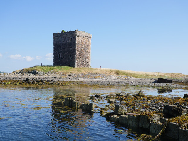
Kelspoke Castle

Kelspoke Castle is a ruined castle overlooking Kilchattan Bay, Isle of Bute, Scotland. Only a small amount of the ruins are above ground. == Notes ==

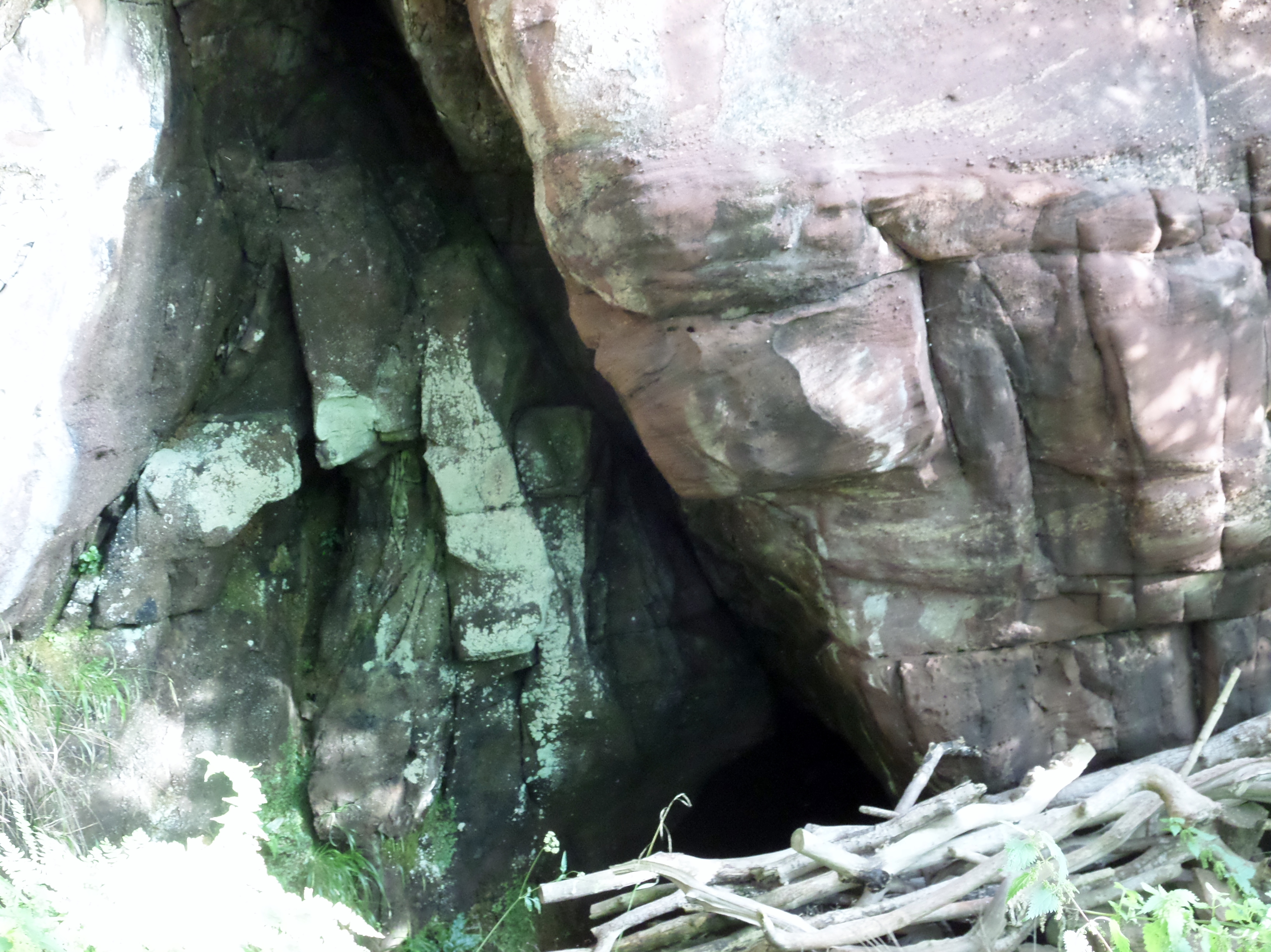
The Holy Cave, Hunterston

The Holy Cave at Hunterston in the Parish of West Kilbride is associated with Saint Mungo, also known as St Kentigern and is often referred to as the Hawking...

Hunterston A nuclear power station

Hunterston A nuclear power station is a former Magnox nuclear power station located at Hunterston in Ayrshire, Scotland, adjacent to Hunterston B. The...

Nearby Amenities

Located within 500m of 55.724697,-4.9628221
Source: PGS
Lat/Long: 55.7215802/-4.9677653
Source: PGS
Lat/Long: 55.7220946/-4.96715
Source: PGS
Lat/Long: 55.7225962/-4.966786
Created By: almien_coastlines
Source: PGS
Lat/Long: 55.722888/-4.966523
Source: PGS
Lat/Long: 55.7232913/-4.9661804
Created By: almien_coastlines
Source: PGS
Lat/Long: 55.723538/-4.965874
Created By: almien_coastlines
Source: PGS
Lat/Long: 55.723802/-4.965433
Source: PGS
Lat/Long: 55.7239919/-4.9650794
Source: PGS
Lat/Long: 55.7242307/-4.9642819
Created By: almien_coastlines
Source: PGS
Lat/Long: 55.724467/-4.963879
Source: PGS
Lat/Long: 55.7249018/-4.9634282
Created By: almien_coastlines
Source: PGS
Lat/Long: 55.725253/-4.962783
Source: PGS
Lat/Long: 55.7256986/-4.9622641
Source: PGS
Lat/Long: 55.7260559/-4.9616746
Source: PGS
Lat/Long: 55.7262969/-4.961376
Source: PGS
Lat/Long: 55.7264906/-4.96118
Source: PGS
Lat/Long: 55.7266891/-4.9606505
Created By: almien_coastlines
Source: PGS
Lat/Long: 55.726829/-4.960367
Created By: almien_coastlines
Source: PGS
Lat/Long: 55.727092/-4.959926
Source: PGS
Lat/Long: 55.7273032/-4.9594636
Source: PGS
Lat/Long: 55.7274562/-4.9588387
Source: PGS
Lat/Long: 55.7277343/-4.9581362
Lighthouse Hill
Ele: 123
Natural: peak
Lat/Long: 55.7214575/-4.9576269
Power: pole
Lat/Long: 55.72127/-4.9655851
The data included in this document is from www.openstreetmap.org. The data is made available under ODbL.

Have you been to The Bourtrees?

Leave your review of The Bourtrees below (or comments, questions and feedback).