Am Faradh
Cliff, Slope in Argyllshire
Scotland
Am Faradh
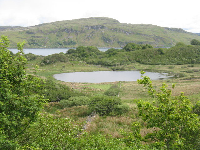
![Torsa from Luing The land in the foreground is the western coast of the isle of Luing at its northern end, looking across to the uninhabited isle of Torsa.
Torsa is almost connected (fordable at low tide) to Luing near Ardinamir Bay.
Although no longer permanently inhabited since the early 1960s, it is possible to stay in a holiday let in the island&#039;s only remaining house - see <span class="nowrap"><a title="https://torsa-island.co.uk" rel="nofollow ugc noopener" href="https://torsa-island.co.uk">Link</a><img style="margin-left:2px;" alt="External link" title="External link - shift click to open in new window" src="https://s1.geograph.org.uk/img/external.png" width="10" height="10"/></span>
The island has never had a large population, but at the beginning of the C19th there were eleven families living here. It has an area of 113ha (280 acres) and its highest point, 62m (203&#039;) is an unnamed hill in the centre of the island.
See also <a href="https://www.geograph.org.uk/photo/7258530">NM7512 : Torsa Beag and Sgeir a' Bhodaich from Luing</a>
[Edit Late 2023] The entire island of Torsa comprising Torsa, Torsa Beag, Eilean na h-Eaglaise, and their reclaimed foreshore is currently up for sale for &quot;offers over £1.5m&quot; - you do get about 270 acres and several buildings for your money though! See <span class="nowrap"><a title="https://island-seeker.com/islands-for-sale/scotland" rel="nofollow ugc noopener" href="https://island-seeker.com/islands-for-sale/scotland">Link</a><img style="margin-left:2px;" alt="External link" title="External link - shift click to open in new window" src="https://s1.geograph.org.uk/img/external.png" width="10" height="10"/></span>](https://s2.geograph.org.uk/geophotos/07/25/83/7258358_d28f3352.jpg)
Am Faradh is a picturesque cliff located in Argyllshire, Scotland. It is situated in a remote and rugged area, surrounded by stunning natural beauty. The cliff stands tall, overlooking the vast expanse of the Atlantic Ocean, providing breathtaking panoramic views that attract visitors from near and far.
With its steep slopes and jagged edges, Am Faradh offers an exhilarating experience for those seeking adventure and thrill. The cliff is composed of sedimentary rock formations, characterized by layers of sandstone and shale. These geological features make it a fascinating site for geological enthusiasts and researchers.
The cliff is home to a diverse range of plant and animal species, making it an important ecological site. The rugged terrain provides habitats for various seabirds, including puffins, guillemots, and razorbills. Visitors can witness these magnificent creatures nesting and flying around the cliff, adding to the enchanting atmosphere.
Access to Am Faradh is limited due to its remote location, and caution should be exercised while exploring the area. The cliff can be reached by hiking trails that offer stunning views along the way. Safety measures, such as wearing appropriate footwear and staying away from the cliff edges, should be followed to ensure a safe visit.
Am Faradh is not only a natural wonder but also a place of tranquility and serenity. Its untouched beauty and awe-inspiring landscape leave a lasting impression on all who visit, making it a must-see destination for nature lovers and adventure seekers alike.
If you have any feedback on the listing, please let us know in the comments section below.
Am Faradh Images
Images are sourced within 2km of 56.267827/-5.5928625 or Grid Reference NM7714. Thanks to Geograph Open Source API. All images are credited.


Am Faradh is located at Grid Ref: NM7714 (Lat: 56.267827, Lng: -5.5928625)
Unitary Authority: Argyll and Bute
Police Authority: Argyll and West Dunbartonshire
What 3 Words
///sweeper.headers.sampling. Near Oban, Argyll & Bute
Nearby Locations
Related Wikis

Torsa
Torsa (occasionally Torsay) is one of the Slate Islands in Argyll and Bute, Scotland. Lying east of Luing and south of Seil, this tidal island was inhabited...

Cuan Sound
Cuan Sound is a narrow channel, 200 metres (660 ft) wide, located in Argyll, western Scotland. It separates Seil and Luing and later becomes the Firth...
Balvicar
Balvicar (Scottish Gaelic: Baile a' Bhiocair) is a village on the island of Seil, a small island seven miles (eleven kilometres) southwest of Oban, Scotland...

Slate Islands
The Slate Islands are an island group in the Inner Hebrides, lying immediately off the west coast of Scotland, north of Jura and southwest of Oban. The...
Have you been to Am Faradh?
Leave your review of Am Faradh below (or comments, questions and feedback).