Kynance Cliff

Cliff, Slope in Cornwall

England

Kynance Cliff

Kynance Cove north-west of Lizard in Cornwall This is the view to the west from near the South West Coast Path.

The image has been scanned from a Kodak Gold 100 negative dating from August 1990.
Kynance Cove north-west of Lizard in Cornwall Credit: Roger D Kidd

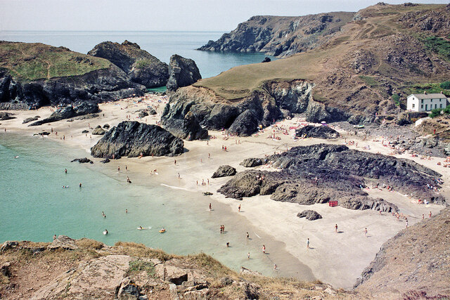
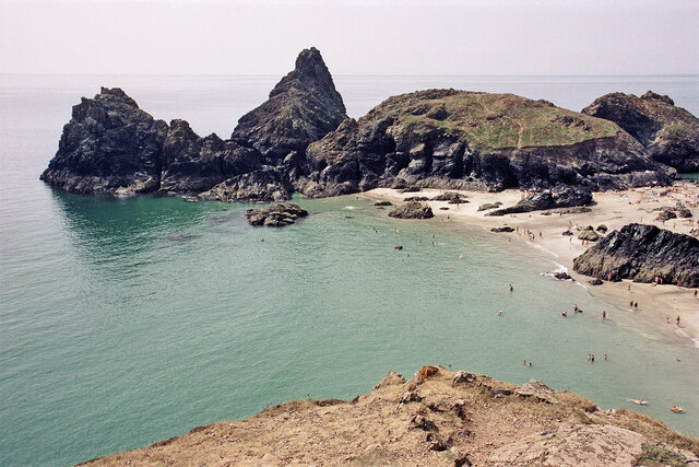
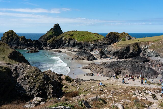
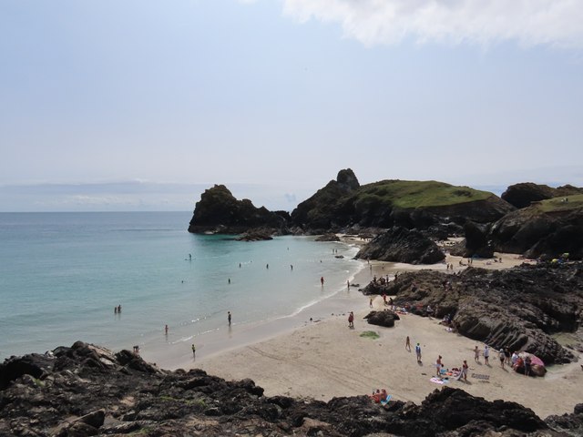
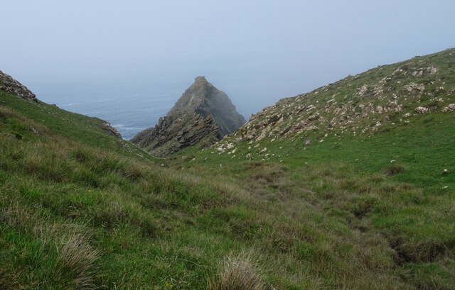
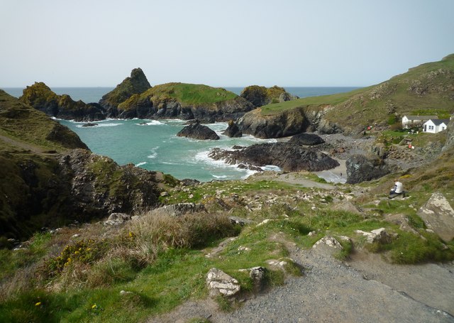
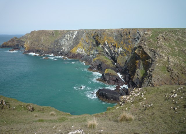
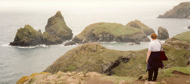
Kynance Cliff is a captivating coastal feature located in Cornwall, England. It forms part of the Lizard Peninsula, which is renowned for its dramatic cliffs and rugged landscapes. Situated near the village of Lizard, Kynance Cliff offers breathtaking views of the Atlantic Ocean and is a popular destination for tourists and nature enthusiasts alike.

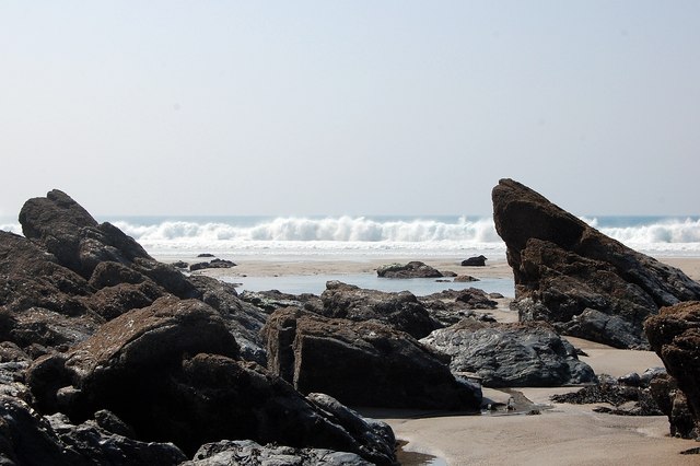
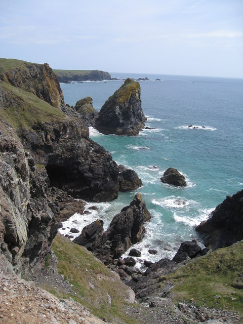
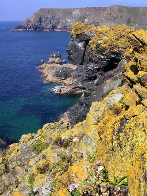
The cliff stands at an impressive height of approximately 70 meters (230 feet) and is composed of serpentine rock, a unique dark green stone that is characteristic of the region. The layers of rock are visible along the cliff face, showcasing the geological history of the area.

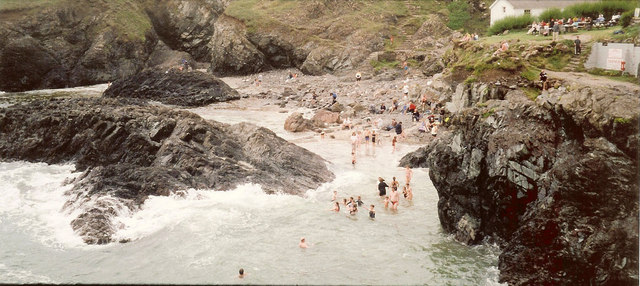
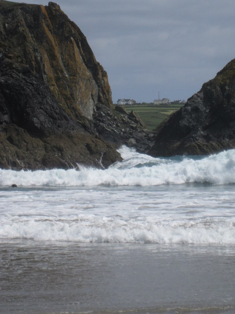
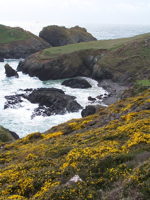
Kynance Cliff boasts a variety of stunning natural formations, such as sea caves, arches, and stacks, which have been sculpted by the relentless power of the ocean over thousands of years. At low tide, visitors can explore the beach below the cliff, which reveals an array of fascinating rock pools teeming with marine life.

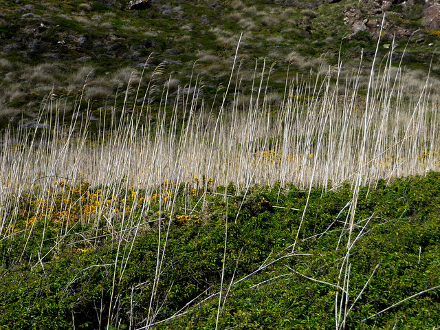
The area surrounding Kynance Cliff is also rich in biodiversity, with a diverse range of plant species that thrive in this maritime environment. Visitors can spot beautiful wildflowers, including thrift, sea campion, and heather, which add vibrant splashes of color to the landscape.

Accessible via a scenic coastal path, Kynance Cliff offers numerous walking opportunities, allowing visitors to experience the awe-inspiring beauty of the area firsthand. The National Trust, which manages the site, has provided well-maintained footpaths and seating areas to enhance the visitor experience and ensure the preservation of this natural wonder.

Overall, Kynance Cliff in Cornwall is a must-visit destination for nature enthusiasts seeking stunning coastal scenery, geological wonders, and a rich biodiversity.

If you have any feedback on the listing, please let us know in the comments section below.

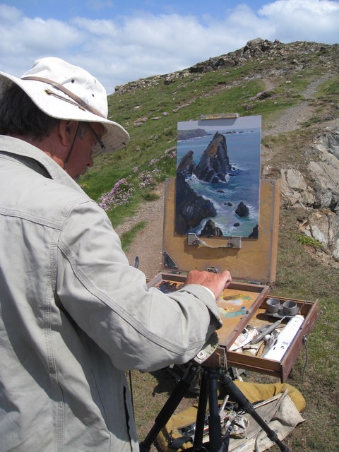
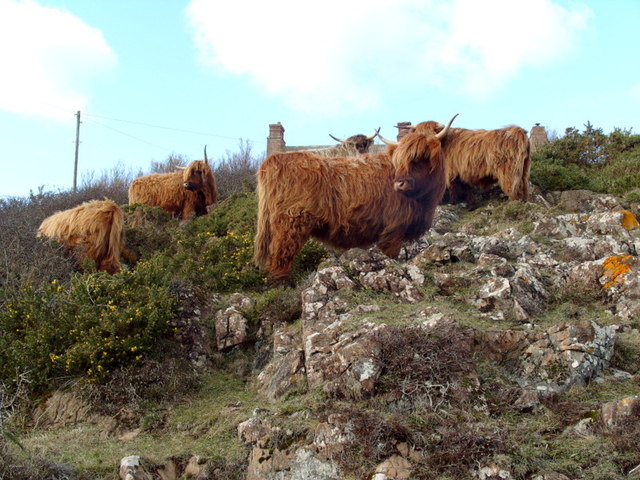
Kynance Cliff Images

Images are sourced within 2km of 49.977367/-5.2455143 or Grid Reference SW6713. Thanks to Geograph Open Source API. All images are credited.

Kynance Cove north-west of Lizard in Cornwall This is the view to the west from near the South West Coast Path.

The image has been scanned from a Kodak Gold 100 negative dating from August 1990.
Kynance Cove north-west of Lizard in Cornwall
This is the view to the west from near the South West Coast Path. The image has been scanned from a Kodak Gold 100 negative dating from August 1990.
View across Kynance Cove in Cornwall Looking south-west from near the South West Coast Path. On the left is Gull Rock, and the grass topped Asparagus Island is straight ahead.

The image has been scanned from a Kodak Gold 100 negative dating from August 1990.
View across Kynance Cove in Cornwall
Looking south-west from near the South West Coast Path. On the left is Gull Rock, and the grass topped Asparagus Island is straight ahead. The image has been scanned from a Kodak Gold 100 negative dating from August 1990.
Kynance Cove beach
Kynance Cove beach
Kynance Cove from Pistil Meadow headland Asparagus Island and Kynance Cove from Pistil Meadow headland.
Kynance Cove from Pistil Meadow headland
Asparagus Island and Kynance Cove from Pistil Meadow headland.
Kynance Cove
Kynance Cove
The Horse, Kynance Cliff, seen from The South West Coast Path The South West Coast Path National Trail - 630 miles of superb coastal walking. From Minehead on the edge of the Exmoor National Park to the shores of Poole Harbour in Dorset. It is the longest of all Britain's National Trails.
Website: <span class="nowrap"><a title="http://www.southwestcoastpath.com/" rel="nofollow ugc noopener" href="http://www.southwestcoastpath.com/">Link</a><img style="margin-left:2px;" alt="External link" title="External link - shift click to open in new window" src="https://s1.geograph.org.uk/img/external.png" width="10" height="10"/></span>
The Horse, Kynance Cliff, seen from The South West Coast Path
The South West Coast Path National Trail - 630 miles of superb coastal walking. From Minehead on the edge of the Exmoor National Park to the shores of Poole Harbour in Dorset. It is the longest of all Britain's National Trails. Website: LinkExternal link
Derelict buildings near Kynance Farm on The Lizard
Kynance Cove
Kynance Cove
On Pentreath Beach Rocks - many of serpentine.
On Pentreath Beach
Rocks - many of serpentine.
Kynance Cove
Kynance Cove
Asparagus Island and Bishop Rock at Kynance Cove
Lion Rock - south-east of Kynance Cove This stretch of coast of rocky coast with the prominent Lion Rock shown here in the middle distance is a favourite view for artists. Chatting to artist Michael Richardson, the skill he told me was to be able to capture the violent swells and movements in the water. To see the coast path which passed this scene and the artist working on painting this scene, follow this link. <a href="https://www.geograph.org.uk/photo/2423977">SW6813 : Cliff path to Tor Balk near Kynance Cove</a>

Note that the Lion Rock only looks like a squatting lion when viewed from the south.
Lion Rock - south-east of Kynance Cove
This stretch of coast of rocky coast with the prominent Lion Rock shown here in the middle distance is a favourite view for artists. Chatting to artist Michael Richardson, the skill he told me was to be able to capture the violent swells and movements in the water. To see the coast path which passed this scene and the artist working on painting this scene, follow this link. SW6813 : Cliff path to Tor Balk near Kynance Cove Note that the Lion Rock only looks like a squatting lion when viewed from the south.
Cliff path to Tor Balk near Kynance Cove This steep and rugged cliff path leads up to Tor Balk which can be seen in the distance. The path passes through locations often favoured by artists as in this case. So the polite thing to do is to stop for a chat, admire the artist's work and walk around them. This artist was capturing the view to his right which was a coastal scene featuring the impressive Lion Rock.

To see the scene the artist was painting in oils, follow the link. <a href="https://www.geograph.org.uk/photo/2423964">SW6813 : Lion Rock - south-east of Kynance Cove</a>
Cliff path to Tor Balk near Kynance Cove
This steep and rugged cliff path leads up to Tor Balk which can be seen in the distance. The path passes through locations often favoured by artists as in this case. So the polite thing to do is to stop for a chat, admire the artist's work and walk around them. This artist was capturing the view to his right which was a coastal scene featuring the impressive Lion Rock. To see the scene the artist was painting in oils, follow the link. SW6813 : Lion Rock - south-east of Kynance Cove
Kynance Cove - violent waves and currents This telephoto view from the beach at Kynance Cove at low tide shows the waves coming into the cove at two angles. Firstly the wave comes straight in towards the rocks, then the wave bounces of those rocks to approach the beach from a totally different angle. No wonder there are signs warning of the danger of the treacherous currents in the sea.

For an alternative view at high tide follow the link. <a href="https://www.geograph.org.uk/photo/2031936">SW6813 : High tide at Kynance Cove</a>
Kynance Cove - violent waves and currents
This telephoto view from the beach at Kynance Cove at low tide shows the waves coming into the cove at two angles. Firstly the wave comes straight in towards the rocks, then the wave bounces of those rocks to approach the beach from a totally different angle. No wonder there are signs warning of the danger of the treacherous currents in the sea. For an alternative view at high tide follow the link. SW6813 : High tide at Kynance Cove
Kynance Cove
Kynance Cove
Highland Cattle on Lower Predannack Downs Highland cattle grazing "The Lizard" National Nature Reserve near Jolly Town
Highland Cattle on Lower Predannack Downs
Highland cattle grazing "The Lizard" National Nature Reserve near Jolly Town
Kynance Cove Reeds beside the path from the car park
Kynance Cove
Reeds beside the path from the car park
Show me another place!

Kynance Cliff is located at Grid Ref: SW6713 (Lat: 49.977367, Lng: -5.2455143)

Unitary Authority: Cornwall

Police Authority: Devon and Cornwall

What 3 Words

///indulgent.troubles.wizard. Near Landewednack, Cornwall

Related Wikis

Rill Cove Wreck

The Rill Cove Wreck is an underwater wreck of a 16th-century Spanish cargo ship lying off the coast of Rill Cove, west of Kynance Cove, in Cornwall, England...

Asparagus Island

Asparagus Island (Cornish: Enys Merlosowen) is a small tidal island on the eastern side of Mount's Bay, within the parish of Mullion, Cornwall, United...

Kynance Cove

Kynance Cove (Cornish: Porth Keynans, meaning ravine cove) is a cove on the eastern side of Mount's Bay, Cornwall, England. It is situated on the Lizard...

Pentreath

Higher Pentreath and Lower Pentreath (Cornish: Penntreth, representing penn an treth, meaning head (of) the beach) are hamlets to the west of Praa Sands...

Nearby Amenities

Located within 500m of 49.977367,-5.2455143
The Horse
Natural: cape
Source: PGS
Lat/Long: 49.9794804/-5.2484486
The data included in this document is from www.openstreetmap.org. The data is made available under ODbL.

Have you been to Kynance Cliff?

Leave your review of Kynance Cliff below (or comments, questions and feedback).