Black Cliff

Cliff, Slope in Cornwall

England

Black Cliff

Gravity Gradiometry survey aircraft A 1940s-era Dakota DC-3 aircraft, operated by a geological survey company, is here seen flying one of many passes across the beach near Phillack Towans. It was operating from a base at Southampton for several weeks in late 2021, surveying a large area of southern Cornwall for gravity anomalies, in the hope (expectation?) of finding commercially viable mineral deposits, such as lithium, as well as potential geothermal localities.
Gravity Gradiometry survey aircraft Credit: Richard Law

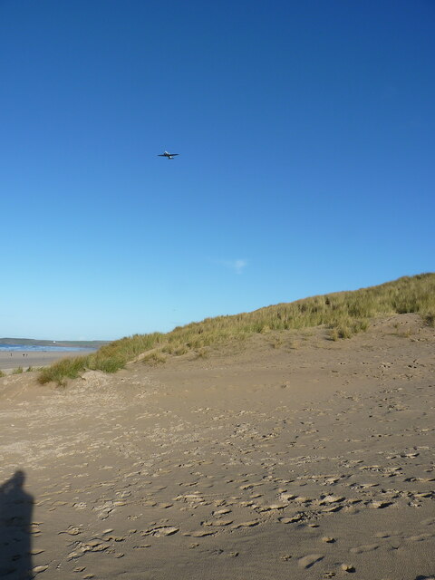
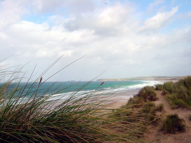
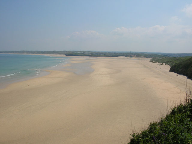
Black Cliff is a prominent geographical feature located in Cornwall, England. It is situated on the rugged coastline, near the small town of Portreath. The cliff, also known as Black Cliff Slope, is characterized by its imposing height and steep gradient, creating a dramatic landscape that attracts both locals and tourists alike.

Standing at approximately 120 meters (394 feet) tall, Black Cliff offers stunning panoramic views of the surrounding area, including the vast expanse of the Atlantic Ocean. Its dark, jagged rock formations contribute to its name, giving the cliff a distinct and rugged appearance. The cliffs are composed mainly of slate and shale, adding to the natural beauty and appeal of the area.

Black Cliff is renowned for its rich biodiversity. The cliff face supports a variety of plant species, including hardy coastal grasses and shrubs that cling to the rocky surface. The surrounding waters are home to a diverse range of marine life, making it a popular spot for fishing enthusiasts and wildlife enthusiasts.

The cliff's location also makes it a haven for outdoor enthusiasts and adventurers. Hikers and climbers are drawn to the challenge of scaling its steep slopes, while birdwatchers flock to observe the numerous seabirds that nest in the crags and crevices of the cliff face.

Overall, Black Cliff in Cornwall is a unique and captivating natural landmark that offers breathtaking views, diverse flora and fauna, and thrilling outdoor activities for those who visit.

If you have any feedback on the listing, please let us know in the comments section below.

Black Cliff Images

Images are sourced within 2km of 50.198162/-5.4284737 or Grid Reference SW5538. Thanks to Geograph Open Source API. All images are credited.

Gravity Gradiometry survey aircraft A 1940s-era Dakota DC-3 aircraft, operated by a geological survey company, is here seen flying one of many passes across the beach near Phillack Towans. It was operating from a base at Southampton for several weeks in late 2021, surveying a large area of southern Cornwall for gravity anomalies, in the hope (expectation?) of finding commercially viable mineral deposits, such as lithium, as well as potential geothermal localities.
Gravity Gradiometry survey aircraft
A 1940s-era Dakota DC-3 aircraft, operated by a geological survey company, is here seen flying one of many passes across the beach near Phillack Towans. It was operating from a base at Southampton for several weeks in late 2021, surveying a large area of southern Cornwall for gravity anomalies, in the hope (expectation?) of finding commercially viable mineral deposits, such as lithium, as well as potential geothermal localities.
Runners on Gwithian Beach
Gwinear-Gwithian : Upton Towans Beach Looking along the coastline.
Gwinear-Gwithian : Upton Towans Beach
Looking along the coastline.
Hayle : Mexico Towans Beach Looking along Mexico Towans Beach.
Hayle : Mexico Towans Beach
Looking along Mexico Towans Beach.
Beach near Upton Towans
Low tide, Gwithian Beach Standing in Gwinear-Gwithian parish, with the boundary with Hayle parish running down the beach to the sea some way ahead.
Low tide, Gwithian Beach
Standing in Gwinear-Gwithian parish, with the boundary with Hayle parish running down the beach to the sea some way ahead.
Racing Powerboats near Upton Towans Two racing powerboats in the waves just off the beach at Upton Towans, Hayle.
Racing Powerboats near Upton Towans
Two racing powerboats in the waves just off the beach at Upton Towans, Hayle.
Sand, Marram Grass and sea on Upton Towans
Hayle old quay The disused quay in Hayle Harbour.
Hayle old quay
The disused quay in Hayle Harbour.
Railway at Lelant Looking north east from Lelant station
Railway at Lelant
Looking north east from Lelant station
Carbis Bay From a rented house, overlooking Carbis Bay with St. Ives in the background
Carbis Bay
From a rented house, overlooking Carbis Bay with St. Ives in the background
Porth Kidney Sands The large stretch of beach with estuary splitting it from joining Hayle Towans.
Porth Kidney Sands
The large stretch of beach with estuary splitting it from joining Hayle Towans.
Holiday chalets on Hayle Towans
The White Hart Hotel, Hayle The building to the left of the Hotel, now the Masonic Hall, was the original hotel building.
The White Hart Hotel, Hayle
The building to the left of the Hotel, now the Masonic Hall, was the original hotel building.
Phillack Looking across the river at Hayle over to Phillack
Phillack
Looking across the river at Hayle over to Phillack
Dunes & beach at Phillack Towans, Godrevy Point and Island in the distance
Hayle Community School The striking blue coloured glass front of an otherwise drab three story block is mirrored in the colour of the gates and fence although this does not show up well in the photograph.
Hayle Community School
The striking blue coloured glass front of an otherwise drab three story block is mirrored in the colour of the gates and fence although this does not show up well in the photograph.
New affordable housing and a derelict Mill The apartment block under construction is being built to be rented to local people, most of whom cannot afford to buy anywhere to live in the local area due to incomers being able to pay far higher prices than local people can afford.  This is a common problem in many rural areas of Great Britain.  The derelict industrial building behind is a reminder that Hayle was a leading industrial town in the 19th century.
New affordable housing and a derelict Mill
The apartment block under construction is being built to be rented to local people, most of whom cannot afford to buy anywhere to live in the local area due to incomers being able to pay far higher prices than local people can afford. This is a common problem in many rural areas of Great Britain. The derelict industrial building behind is a reminder that Hayle was a leading industrial town in the 19th century.
Show me another place!

Black Cliff is located at Grid Ref: SW5538 (Lat: 50.198162, Lng: -5.4284737)

Unitary Authority: Cornwall

Police Authority: Devon and Cornwall

What 3 Words

///unfit.pancake.topples. Near Hayle, Cornwall

Related Wikis

Hayle Power Station

Hayle Power Station was a coal-fired power station situated at the mouth of the River Hayle, at Hayle in Cornwall, South West England. == History == On...
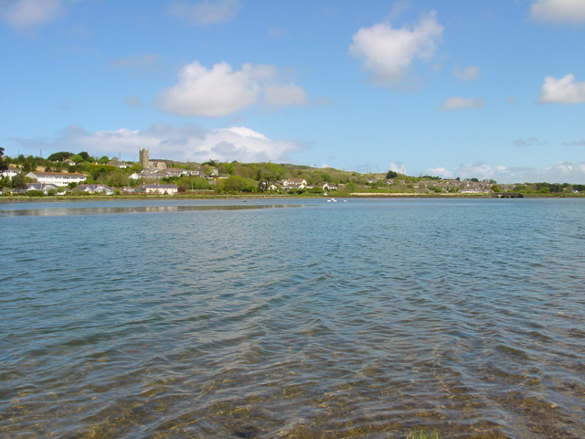
Hayle Estuary

The Hayle Estuary (Cornish: Heyl, meaning estuary) is an estuary in west Cornwall, England, United Kingdom. It is one of the few natural harbours on the...

Hayle Estuary and Carrack Gladden SSSI

The Hayle Estuary and Carrack Gladden SSSI is a Site of Special Scientific Interest, noted for its biological interest, in west Cornwall, England, UK....

River Hayle

The River Hayle (Cornish: Heyl, meaning estuary) is a small river in West Cornwall, England, United Kingdom which issues into St Ives Bay at Hayle on Cornwall...

Nearby Amenities

Located within 500m of 50.198162,-5.4284737
Source: PGS
Lat/Long: 50.2005254/-5.4246312
Source: PGS
Lat/Long: 50.2002712/-5.4258999
Source: PGS
Lat/Long: 50.2001886/-5.4262563
Source: PGS
Lat/Long: 50.200088/-5.4265547
Source: PGS
Lat/Long: 50.1995427/-5.4273061
Source: PGS
Lat/Long: 50.1993645/-5.4278489
Source: PGS
Lat/Long: 50.1986939/-5.4285031
Source: PGS
Lat/Long: 50.1983046/-5.4288199
Source: PGS
Lat/Long: 50.1979549/-5.428955
Source: PGS
Lat/Long: 50.1976708/-5.4298179
Source: PGS
Lat/Long: 50.1975298/-5.4300999
Source: PGS
Lat/Long: 50.1971046/-5.4301371
Source: PGS
Lat/Long: 50.195211/-5.4310655
Source: PGS
Lat/Long: 50.1948444/-5.4316097
Source: PGS
Lat/Long: 50.1944544/-5.4319912
Bus Stop
Hayle Towans
Bus: yes
Naptan AtcoCode: 0800COD40913
Naptan Bearing: NW
Naptan CommonName: Hayle Towans
Naptan NaptanCode: coragpwt
Naptan Street: Unclassified
Naptan Verified: no
Public Transport: platform
Source: naptan_import
Lat/Long: 50.1967355/-5.4255922
Leisure: playground
Lat/Long: 50.196839/-5.4298825
Barrier: stile
Lat/Long: 50.1994794/-5.4270492
Post Box
Collection Times: Mo-Fr 16:00; Sa 10:30
Operator: Royal Mail
Operator Wikidata: Q638098
Post Box Type: wall
Ref: TR27 142
Royal Cypher: EIIR
Royal Cypher Wikidata: Q33102113
Source: survey
Survey Date: 2016-04-23
Lat/Long: 50.1970391/-5.4257055
Power: pole
Source: Bing
Lat/Long: 50.1946558/-5.4242122
Power: pole
Source: Bing
Lat/Long: 50.1952058/-5.4232548
Riviere Towans
Addr Village: Phillack
Name Kw: Tewynnow Ruvyer
Place: hamlet
Population: 100
Postal Code: TR27 5AT
Wikidata: Q7769721
Wikipedia: en:The Towans
Lat/Long: 50.1950745/-5.4264498
Information: board
Tourism: information
Lat/Long: 50.1957324/-5.4302046
Phone
Emergency: phone
Lat/Long: 50.200702/-5.4234571
Information: board
Tourism: information
Lat/Long: 50.2003807/-5.4240556
Hiking: yes
Information: guidepost
Source: GPS survey
Tourism: information
Lat/Long: 50.2004022/-5.4241937
Hiking: yes
Information: guidepost
Source: GPS survey
Tourism: information
Lat/Long: 50.1986131/-5.4277182
Hiking: yes
Information: guidepost
Source: GPS survey
Tourism: information
Lat/Long: 50.1981762/-5.4280414
Hiking: yes
Information: guidepost
Source: GPS survey
Tourism: information
Lat/Long: 50.1976594/-5.4292309
Phone
Emergency: phone
Lat/Long: 50.1974628/-5.4298244
Bench
Lat/Long: 50.1961728/-5.4299531
Hiking: yes
Information: guidepost
Source: GPS survey
Tourism: information
Lat/Long: 50.1960857/-5.4297828
Hiking: yes
Information: guidepost
Source: GPS survey
Tourism: information
Lat/Long: 50.1958449/-5.4300651
Hiking: yes
Information: guidepost
Source: GPS survey
Tourism: information
Lat/Long: 50.1955272/-5.4300644
Bench
Backrest: yes
Lat/Long: 50.1947953/-5.4306619
Generator Method: photovoltaic
Generator Output Electricity: small_installation
Generator Source: solar
Generator Type: solar_photovoltaic_panel
Location: roof
Power: generator
Source: bing
Lat/Long: 50.1975323/-5.4271026
Playground: slide
Lat/Long: 50.1965097/-5.4245822
Man Made: surveillance
Lat/Long: 50.1971374/-5.4254243
Recycling
Recycling Type: container
Lat/Long: 50.1994068/-5.4240063
Recycling
Recycling Type: container
Lat/Long: 50.1991896/-5.4237931
Recycling
Recycling Type: container
Lat/Long: 50.1992344/-5.4245126
Recycling
Recycling Type: container
Lat/Long: 50.1991088/-5.424972
Recycling
Recycling Type: container
Lat/Long: 50.1988734/-5.4247279
Recycling
Recycling Type: container
Lat/Long: 50.1986777/-5.4244163
Recycling
Recycling Type: container
Lat/Long: 50.1979838/-5.4238444
Recycling
Recycling Type: container
Lat/Long: 50.1980566/-5.4234643
Recycling
Recycling Type: container
Lat/Long: 50.198392/-5.4240726
Recycling
Recycling Type: container
Lat/Long: 50.1982678/-5.4228759
Recycling
Recycling Type: container
Lat/Long: 50.1988043/-5.4233952
Recycling
Recycling Type: container
Lat/Long: 50.1976641/-5.4240097
Recycling
Recycling Type: container
Lat/Long: 50.1978684/-5.424302
Recycling
Recycling Type: container
Lat/Long: 50.1994/-5.4251125
Recycling
Recycling Type: container
Lat/Long: 50.1996107/-5.4245895
Recycling
Recycling Type: container
Lat/Long: 50.1988163/-5.425569
Recycling
Recycling Type: container
Lat/Long: 50.1984837/-5.425165
Recycling
Recycling Type: container
Lat/Long: 50.1983163/-5.4249456
Recycling
Recycling Type: container
Lat/Long: 50.1979718/-5.4244202
Recycling
Recycling Type: container
Lat/Long: 50.1978455/-5.4249981
Recycling
Recycling Type: container
Lat/Long: 50.1977932/-5.4253507
Recycling
Recycling Type: container
Lat/Long: 50.1973783/-5.4254881
Recycling
Recycling Type: container
Lat/Long: 50.1972231/-5.4250404
Recycling
Recycling Type: container
Lat/Long: 50.1973081/-5.4237513
The data included in this document is from www.openstreetmap.org. The data is made available under ODbL.

Have you been to Black Cliff?

Leave your review of Black Cliff below (or comments, questions and feedback).