An Dainnire

Cliff, Slope in Inverness-shire

Scotland

An Dainnire

Cliffline south of Ollisdal Looking along the southern part of the Duirinish coast, with Macleod's Maidens sea stacks  <a href="https://www.geograph.org.uk/gridref/NG2436">NG2436</a>  in view.
Cliffline south of Ollisdal Credit: John Allan

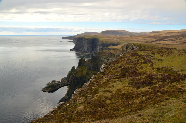
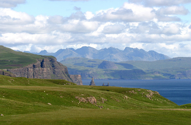
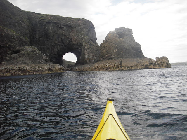
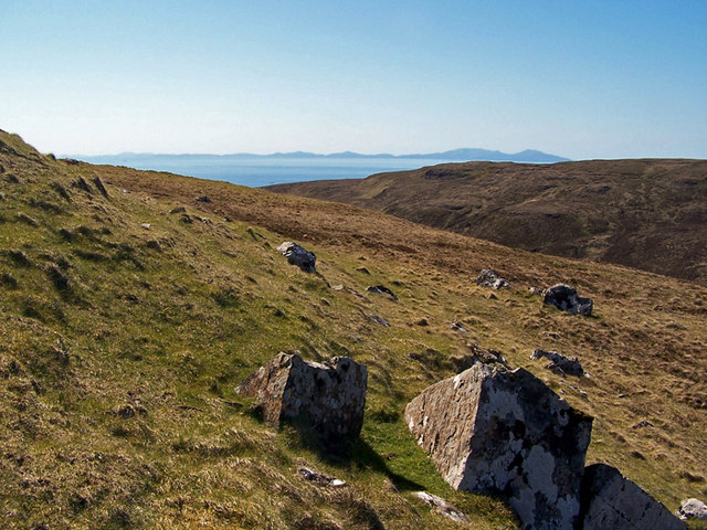
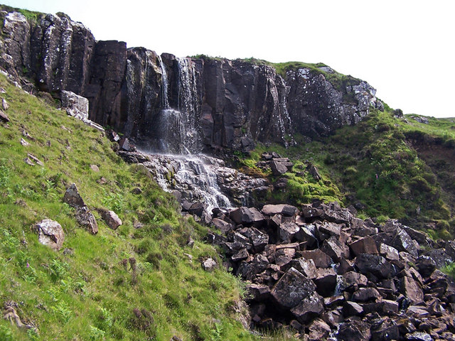
An Dainnire is a stunning cliff located in Inverness-shire, Scotland. It is situated on the coast overlooking the North Sea, offering breathtaking views of the water and surrounding landscape. The cliff rises steeply from the shoreline, creating a dramatic and impressive natural feature.

The slope of An Dainnire is rugged and rocky, with layers of sedimentary rock visible along its face. The cliff is home to a variety of plant and animal species, including seabirds such as gulls and puffins that nest in the crevices of the rocks. Visitors to An Dainnire can often spot these birds soaring overhead or perched on the cliff face.

The location of An Dainnire makes it a popular destination for hikers and nature enthusiasts looking to explore the Scottish coastline. The cliff offers challenging terrain for those seeking a more adventurous hike, with opportunities to climb and scramble along its rocky surface. The views from the top of An Dainnire are truly spectacular, providing a unique perspective of the surrounding landscape and the vast expanse of the North Sea.

If you have any feedback on the listing, please let us know in the comments section below.
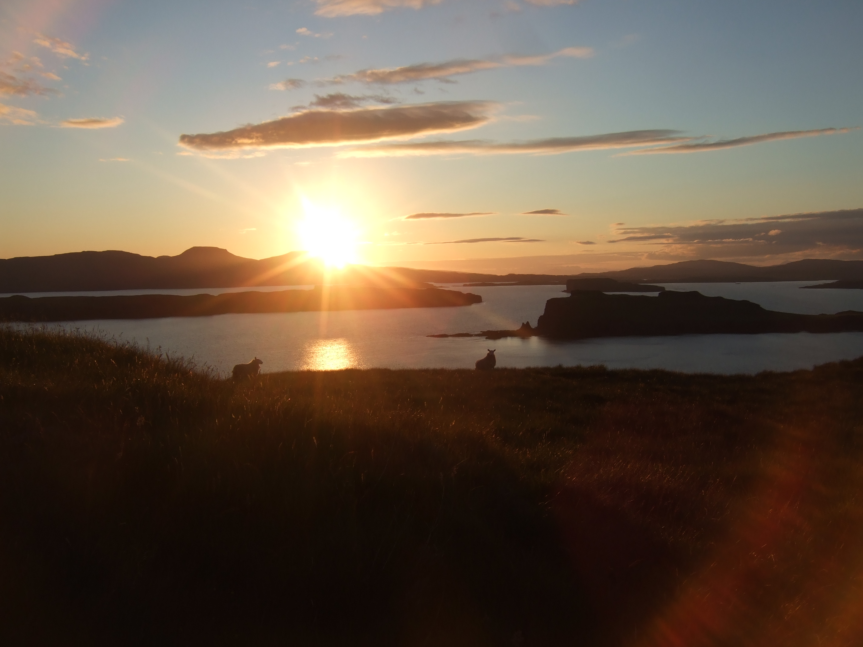
An Dainnire Images

Images are sourced within 2km of 57.345954/-6.6143264 or Grid Reference NG2237. Thanks to Geograph Open Source API. All images are credited.

Cliffline south of Ollisdal Looking along the southern part of the Duirinish coast, with Macleod's Maidens sea stacks  <a href="https://www.geograph.org.uk/gridref/NG2436">NG2436</a>  in view.
Cliffline south of Ollisdal
Looking along the southern part of the Duirinish coast, with Macleod's Maidens sea stacks NG2436 in view.
Sea Cliffs at Duirinish, Isle of Skye View looking south near Idrigill Point.
Sea Cliffs at Duirinish, Isle of Skye
View looking south near Idrigill Point.
Sea Cliffs on the West Coast of Skye, British Isles
Coast near Glen Ollisdal, Isle of Skye All of the cliffs visible in this photograph are on the west coast of the Isle of Skye.
Coast near Glen Ollisdal, Isle of Skye
All of the cliffs visible in this photograph are on the west coast of the Isle of Skye.
Sea cliffs north of Macleod's Maidens
Cuillin view Taken at the end of a wonderful walk in Lorgill.  Macleod's Maidens are just visible beyond Geodha Mor.  The Cuillin dominates the skyline.
Cuillin view
Taken at the end of a wonderful walk in Lorgill. Macleod's Maidens are just visible beyond Geodha Mor. The Cuillin dominates the skyline.
Sea Arch - Skye A fabulous sea arch, only really visible from the sea
Sea Arch - Skye
A fabulous sea arch, only really visible from the sea
View across to the waterfall of the Lorgasdal River Macleod's Maidens are in the far distance.
View across to the waterfall of the Lorgasdal River
Macleod's Maidens are in the far distance.
Cliffs south of Flossnan The basalt cliffs here are some 200m high.
Cliffs south of Flossnan
The basalt cliffs here are some 200m high.
Shallow cave below Flossnan There are many caves and sea arches along this section of the coast of west Skye. Here is what seems to be another cave in the early stages of its formation.
Shallow cave below Flossnan
There are many caves and sea arches along this section of the coast of west Skye. Here is what seems to be another cave in the early stages of its formation.
Gob an Dainnire A minor headland on the line of cliffs west of Loch Bracadale.
Gob an Dainnire
A minor headland on the line of cliffs west of Loch Bracadale.
Sea arch at the foot of Glen Lorgasdal Cathedral cliffs above the Little Minch. The Lorgasdal River drops to the sea in the background.
Sea arch at the foot of Glen Lorgasdal
Cathedral cliffs above the Little Minch. The Lorgasdal River drops to the sea in the background.
Biod a' Mhurain A 100m tall sea cliff above the Minch. There was a Sea Eagle circling, probably looking for new-born lambs in the flock of sheep on the summit.
Biod a' Mhurain
A 100m tall sea cliff above the Minch. There was a Sea Eagle circling, probably looking for new-born lambs in the flock of sheep on the summit.
West from Beinn na Boineid Viewed from close to the summit, over the grass and heather moorland. 
On this clear, calm day, the Outer Isles were clear on the horizon.
West from Beinn na Boineid
Viewed from close to the summit, over the grass and heather moorland. On this clear, calm day, the Outer Isles were clear on the horizon.
Lorgasdal River A small burn, but named a river. The burn collects water from the western slopes of Beinn na Boineid and Ben Idrigill and makes its way through some rocky gorges before entering the sea via a spectacular waterfall.
Lorgasdal River
A small burn, but named a river. The burn collects water from the western slopes of Beinn na Boineid and Ben Idrigill and makes its way through some rocky gorges before entering the sea via a spectacular waterfall.
Lorgasdal River The burn is little more than a trickle after several days with no rainfall. Just as it disappears from this picture it falls spectacularly over the cliffs into the sea.
Also in this picture, the small islands on the left are An Dubh Sgier, while the mountains of South Uist are on the horizon.
Lorgasdal River
The burn is little more than a trickle after several days with no rainfall. Just as it disappears from this picture it falls spectacularly over the cliffs into the sea. Also in this picture, the small islands on the left are An Dubh Sgier, while the mountains of South Uist are on the horizon.
North from the summit of Ben Cuidad The unremarkable summit of this hill is not marked by a cairn.
To the north, and central in this picture is Beinn Bhac-ghlais, with Healabhal Bheag to its left.
North from the summit of Ben Cuidad
The unremarkable summit of this hill is not marked by a cairn. To the north, and central in this picture is Beinn Bhac-ghlais, with Healabhal Bheag to its left.
Glen Lorgasdal The Lorgasdal river flows south through this beautiful and seldom visited glen.
Glen Lorgasdal
The Lorgasdal river flows south through this beautiful and seldom visited glen.
Show me another place!

An Dainnire is located at Grid Ref: NG2237 (Lat: 57.345954, Lng: -6.6143264)

Unitary Authority: Highland

Police Authority: Highlands and Islands

What 3 Words

///hiked.zoom.hails. Near Dunvegan, Highland

Related Wikis

Eas Mòr, Durinish

Eas Mòr is a waterfall on the Duirinish peninsula of the island of Skye in Scotland. It lies on the Allt Mhicheil, a tributary of the Dibidal River below...

Healabhal Bheag

Healabhal Bheag is a hill located on the Duirinish peninsula of the Isle of Skye in the Inner Hebrides, Scotland. It is also known as MacLeod's Table South...

Harlosh Island

Harlosh Island is one of four islands to be found in Skye's Loch Bracadale. Harlosh Island is one mile (1.5 kilometres) from the coast of the Duirinish...

Loch Bracadale

Loch Bracadale (Scottish Gaelic: Loch Bhràcadail) is a sea loch on the west coast of Skye in Scotland. It separates the Minginish Peninsula in the south...

Nearby Amenities

Located within 500m of 57.345954,-6.6143264
Source: PGS
Lat/Long: 57.3468709/-6.6197409
Source: PGS
Lat/Long: 57.3471731/-6.6198909
Source: PGS
Lat/Long: 57.3472731/-6.6202109
Source: PGS
Lat/Long: 57.3475231/-6.6201809
Source: PGS
Lat/Long: 57.347594/-6.6198335
Source: PGS
Lat/Long: 57.3476224/-6.6194928
Source: PGS
Lat/Long: 57.3474075/-6.6190193
Source: PGS
Lat/Long: 57.3467359/-6.6191755
The data included in this document is from www.openstreetmap.org. The data is made available under ODbL.

Have you been to An Dainnire?

Leave your review of An Dainnire below (or comments, questions and feedback).