Gob na Hoe

Cliff, Slope in Inverness-shire

Scotland

Gob na Hoe

Hot and cold food Ice cream, tea and coffee - by the side of the Galtrigill road.  I think the food will be no longer hot!
Hot and cold food Credit: Tiger

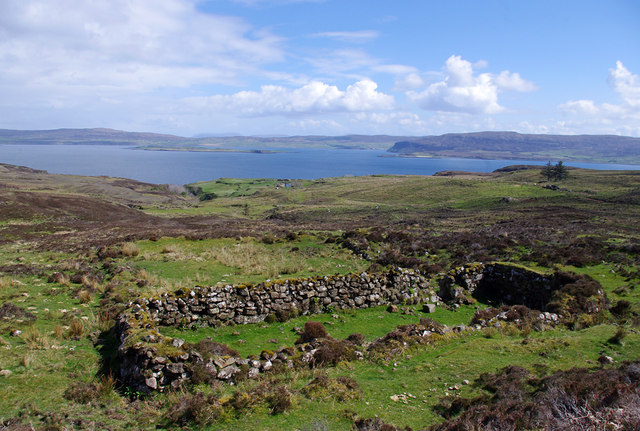
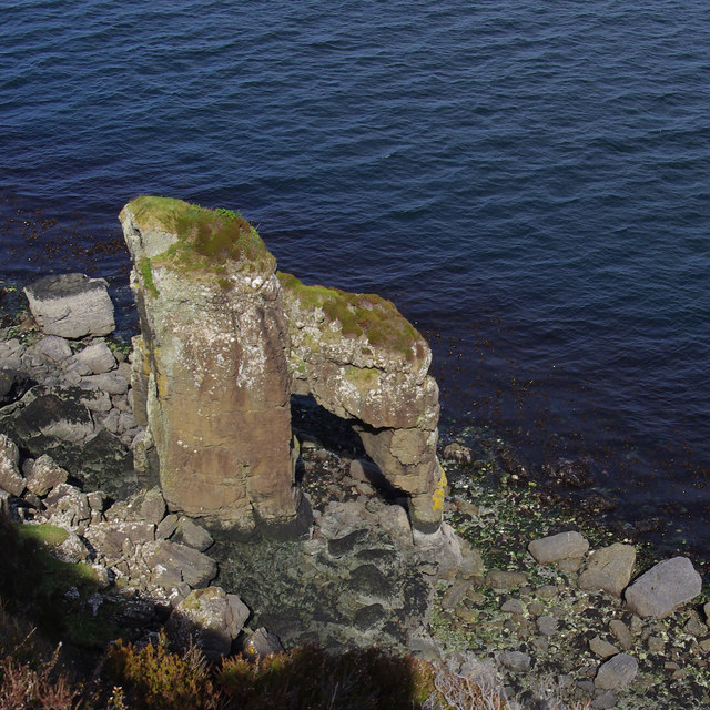
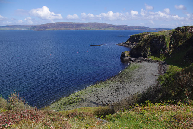
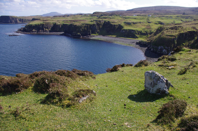
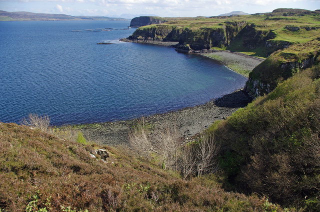
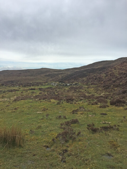
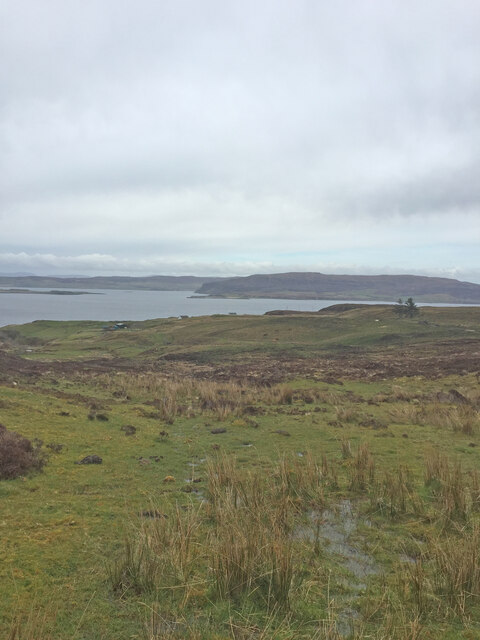
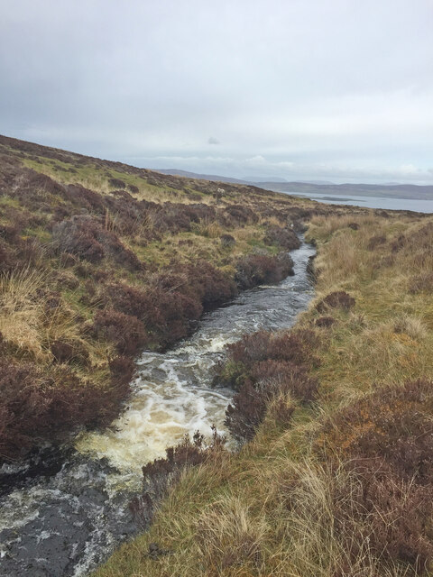
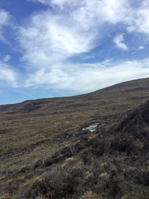
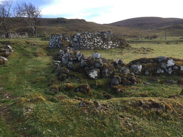
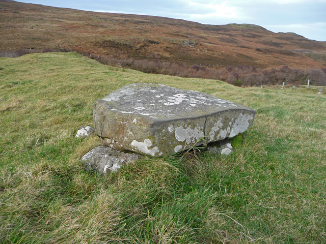
Gob na Hoe is a prominent cliff located in Inverness-shire, Scotland. Situated on the western coast of the Scottish Highlands, it is a striking geological feature that stretches along the coastline for several kilometers. The cliff is formed primarily of sedimentary rocks, including sandstone and shale, which have been shaped over millions of years by natural processes such as erosion and weathering.

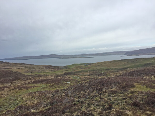
Rising to an impressive height of around 200 meters, Gob na Hoe offers breathtaking panoramic views of the surrounding landscape, including the vast expanse of the Atlantic Ocean. Its rugged and dramatic appearance makes it a popular destination for outdoor enthusiasts, hikers, and photographers looking to capture the beauty of the Scottish coast.

The cliff is renowned for its steep slope, making it a challenging terrain for climbers and adventurers seeking an adrenaline rush. The presence of various rock formations and crevices adds to the excitement and allure of Gob na Hoe. However, caution is advised as the cliff can be dangerous, and it is essential to follow safety guidelines and take appropriate precautions when exploring or attempting to ascend it.

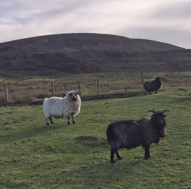
The area surrounding Gob na Hoe is rich in biodiversity, with numerous species of plants and wildlife thriving on the cliff face and in the surrounding coastal habitat. Visitors may have the opportunity to spot seabirds, such as puffins and gannets, nesting on the cliffs and soaring through the skies.

Overall, Gob na Hoe is a remarkable and awe-inspiring natural landmark that showcases the raw beauty of Inverness-shire's coastal landscape and provides an unforgettable experience for those who venture to explore it.

If you have any feedback on the listing, please let us know in the comments section below.

Gob na Hoe Images

Images are sourced within 2km of 57.489408/-6.6911422 or Grid Reference NG1854. Thanks to Geograph Open Source API. All images are credited.

Hot and cold food Ice cream, tea and coffee - by the side of the Galtrigill road.  I think the food will be no longer hot!
Hot and cold food
Ice cream, tea and coffee - by the side of the Galtrigill road. I think the food will be no longer hot!
Ruin above Galtrigill This is clearly the same ruined croft or blackhouse as shown in <a href="https://www.geograph.org.uk/photo/3955062">NG1754 : Ruined croft above Galtrigill</a>.
Ruin above Galtrigill
This is clearly the same ruined croft or blackhouse as shown in NG1754 : Ruined croft above Galtrigill.
Am Famhair h for a natural arch
Am Famhair
h for a natural arch
Ruined crofthouse at Galtrigill <a href="https://www.geograph.org.uk/photo/3360898">NG1854 : Ruin at Galtrigill</a> viewed from a different angle.
Ruined crofthouse at Galtrigill
NG1854 : Ruin at Galtrigill viewed from a different angle.
Bay below Galtrigill
Former museum, Borreraig The building used to house Borreraig Park Museum and Croft Shop. This is probably not the best location to operate a museum - the location is rather remote with no passing trade.
Former museum, Borreraig
The building used to house Borreraig Park Museum and Croft Shop. This is probably not the best location to operate a museum - the location is rather remote with no passing trade.
View to Loch Dunvegan on the way to Dunvegan Head Trig Point
Shieling on the way to Dunvegan Head Trig Point A shieling (Scottish Gaelic: àirigh), also spelt sheiling, shealing and sheeling, is a hut, or collection of huts, once common in wild or lonely places in the hills and mountains of Scotland and northern England.

<span class="nowrap"><a title="https://en.wikipedia.org/wiki/Shieling" rel="nofollow ugc noopener" href="https://en.wikipedia.org/wiki/Shieling">Link</a><img style="margin-left:2px;" alt="External link" title="External link - shift click to open in new window" src="https://s1.geograph.org.uk/img/external.png" width="10" height="10"/></span>
Shieling on the way to Dunvegan Head Trig Point
A shieling (Scottish Gaelic: àirigh), also spelt sheiling, shealing and sheeling, is a hut, or collection of huts, once common in wild or lonely places in the hills and mountains of Scotland and northern England. LinkExternal link
View to Loch Dunvegan on the way to Dunvegan Head Trig Point
Galtrigill Burn on the way to Dunvegan Head Trig Point
Galtrigill Burn on the way back from Dunvegan Head Trig Point
Waterfall near Galtrigill I was on the wrong side of the burn at this point and wondered if I would manage to cross it or have to back track
Waterfall near Galtrigill
I was on the wrong side of the burn at this point and wondered if I would manage to cross it or have to back track
Galtrigill Burn Looking rather uninviting as I was about to cross it
Galtrigill Burn
Looking rather uninviting as I was about to cross it
Stile at field corner Galtrigill Still not sure if this stile should be on your route to or from Biod an Athair.
Stile at field corner Galtrigill
Still not sure if this stile should be on your route to or from Biod an Athair.
Shielings near Galtrigill
Interesting Sheep encountered near Galtrigill
Show me another place!

Gob na Hoe is located at Grid Ref: NG1854 (Lat: 57.489408, Lng: -6.6911422)

Unitary Authority: Highland

Police Authority: Highlands and Islands

What 3 Words

///scanner.heartened.simply. Near Glendale, Highland

Related Wikis

Galtrigill

Galtrigill (Scottish Gaelic: Galtraigil) is a largely abandoned crofting township on the far north end of the east side of the Duirinish peninsula on the...

Borreraig

Borreraig (Scottish Gaelic: Boraraig) is a crofting settlement in Duirinish, north-west of Dunvegan on the Isle of Skye. The ancient and famous MacCrimmon...

Uig, Duirinish

Uig is a hamlet 14 miles (23 km) south west of Uig in Snizort, on the eastern shore of Loch Dunvegan, in the civil parish of Duirinish, on the Isle of...

Loch Dunvegan

Loch Dunvegan (Scottish Gaelic: Loch Dhùn Bheagain), is a sea loch on the west coast of the island of Skye in the Inner Hebrides of Scotland. Dunvegan...

Nearby Amenities

Located within 500m of 57.489408,-6.6911422
Borreraig
Name Gd: Boraraig
Place: hamlet
Source: OS_Opendata_Streetview
Wikidata: Q1918045
Wikipedia: en:Borreraig
Lat/Long: 57.4850623/-6.6923438
Post Box
Ref: IV55 133
Source: survey
Lat/Long: 57.486263/-6.6954117
Càrn Cuimhne Clann Mhic Cruimein
Historic: memorial
Inscription: A bha o dhualachas nam pìobairean aig MacLeòid fad dheich ginealach agus a bha cliùiteach airson deilbh is cluich is teagasg ciùil mhóir is ann dlùth air an làraich so a bha Sgoil Chiùil Mhic Cruimein 1500-1800. A.D.
Man Made: cairn
Material: stone
Memorial: cairn
Name En: MacCrimmon Memorial Cairn
Lat/Long: 57.4873836/-6.6895764
Power: pole
Lat/Long: 57.4854434/-6.6949331
The data included in this document is from www.openstreetmap.org. The data is made available under ODbL.

Have you been to Gob na Hoe?

Leave your review of Gob na Hoe below (or comments, questions and feedback).