Leum a' Bhreabadair

Cliff, Slope in Ross-shire

Scotland

Leum a' Bhreabadair

Mangurstadh Coastline Looking South The cliffs here are spectacular and the Lewisian Gneiss makes for some great climbing.
Mangurstadh Coastline Looking South Credit: RIJones

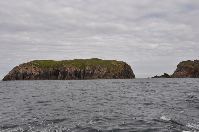
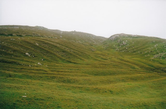
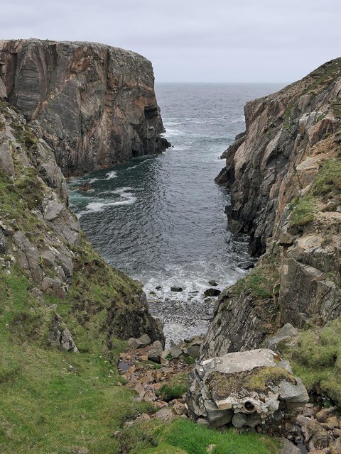
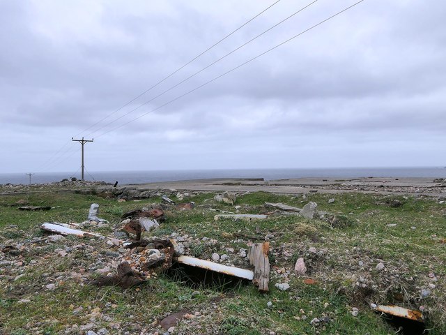
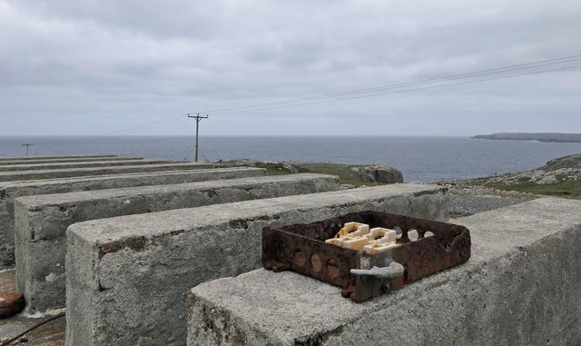
Leum a' Bhreabadair, located in Ross-shire, Scotland, is a prominent cliff or slope that attracts nature enthusiasts and adventurers alike. Rising majestically along the rugged coastline, this geological marvel offers breathtaking views of the surrounding landscape.

Standing at an impressive height of approximately 100 meters, Leum a' Bhreabadair showcases the raw power of nature. Its sheer cliffs, formed through millions of years of erosion, display a stunning tapestry of colors, with layers of rock revealing the area's geological history. The cliff's ruggedness and jagged edges create a dramatic and awe-inspiring sight.

Leum a' Bhreabadair also serves as a haven for wildlife. The cliff's exposed ledges and crevices provide nesting grounds for various seabirds, including puffins, guillemots, and razorbills. Birdwatchers flock to the area to observe these magnificent creatures in their natural habitat.

For the adventurous at heart, Leum a' Bhreabadair offers excellent opportunities for rock climbing and abseiling. Its challenging terrain attracts climbers seeking an adrenaline rush and a chance to conquer nature's obstacles. However, it is essential to exercise caution and have proper equipment and experience when engaging in these activities.

Visitors to Leum a' Bhreabadair can also enjoy scenic walks along the cliff's edge, taking in the panoramic views of the North Atlantic Ocean and the surrounding coastal landscape. The area's untouched beauty and tranquility make it an ideal destination for photographers, hikers, and nature lovers.

In conclusion, Leum a' Bhreabadair is a stunning cliff or slope that showcases the power and beauty of nature. With its towering heights, diverse wildlife, and opportunities for adventure, it is truly a must-visit destination for anyone exploring the Ross-shire region of Scotland.

If you have any feedback on the listing, please let us know in the comments section below.

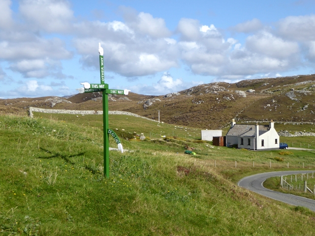
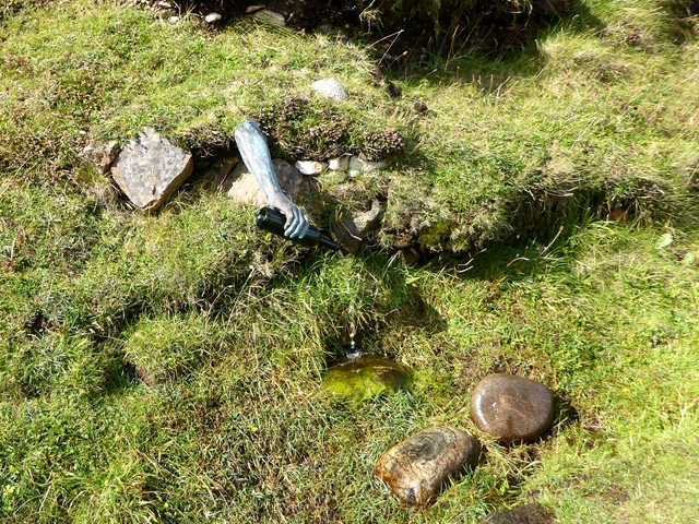
Leum a' Bhreabadair Images

Images are sourced within 2km of 58.185989/-7.1002107 or Grid Reference NB0033. Thanks to Geograph Open Source API. All images are credited.

Mangurstadh Coastline Looking South The cliffs here are spectacular and the Lewisian Gneiss makes for some great climbing.
Mangurstadh Coastline Looking South
The cliffs here are spectacular and the Lewisian Gneiss makes for some great climbing.
Eilean Molach Showing the narrow gap between it and mainland Lewis.
Eilean Molach
Showing the narrow gap between it and mainland Lewis.
Radio masts at Mangastra/Mhangarstaidh, Lewis, 1989 Compared to more recent images, it would appear a number of these buildings and one mast have been demolished in the intervening years.
Radio masts at Mangastra/Mhangarstaidh, Lewis, 1989
Compared to more recent images, it would appear a number of these buildings and one mast have been demolished in the intervening years.
The settlement at Mangurstadh With Mealaisbhal being mostly hidden in the cloud.
The settlement at Mangurstadh
With Mealaisbhal being mostly hidden in the cloud.
Lochan Tràghaidh on Ãird Mhòr Mheadhonach On the road from Mheadhonach radio station.
Lochan Tràghaidh on Ãird Mhòr Mheadhonach
On the road from Mheadhonach radio station.
Mheadhonach radio station On Ãird Mhòr Mheadhonach.
Mheadhonach radio station
On Ãird Mhòr Mheadhonach.
Gob Rubha Phàil transmitter Radio transmitter at Gob Rubha Phàil.
Gob Rubha Phàil transmitter
Radio transmitter at Gob Rubha Phàil.
Radio mast at Mangastra
Crofts at Mangersta
Crofts at Mangersta
Crazy signpost at Mangersta The fingers point to "this way", "that way", "other way", "might have been" and "dead end".
Crazy signpost at Mangersta
The fingers point to "this way", "that way", "other way", "might have been" and "dead end".
Art in the landscape at Mangersta The "Spring Well" perpetually pouring water from a bottle.
Art in the landscape at Mangersta
The "Spring Well" perpetually pouring water from a bottle.
Lazy beds Lazy beds are a form of agriculture that requires less work eventually.  They are a little like ridge and furrow but are wider and more raised. The form of agriculture used to be quite widespread but now is found only in the Hebrides.
Lazy beds
Lazy beds are a form of agriculture that requires less work eventually. They are a little like ridge and furrow but are wider and more raised. The form of agriculture used to be quite widespread but now is found only in the Hebrides.
OS Bolt, Àird Mhòr Mhangarstaidh, Isle of Lewis Looking towards Mealaisbhal.

The bolt lies just to the south of <a href="https://www.geograph.org.uk/photo/507162">NB0032 : Hilltop cairn [2]</a>.
OS Bolt, Àird Mhòr Mhangarstaidh, Isle of Lewis
Looking towards Mealaisbhal. The bolt lies just to the south of NB0032 : Hilltop cairn [2].
Torasgeo, Isle of Lewis The pipe in the concrete block is the outflow of the sewer system for <a href="https://www.geograph.org.uk/photo/13708">NB0033 : Mangersta - WWII LORAN radio station</a>.
Torasgeo, Isle of Lewis
The pipe in the concrete block is the outflow of the sewer system for NB0033 : Mangersta - WWII LORAN radio station.
Bathtub, Mhangarstadh, Isle of Lewis Possibly left behind from <a href="https://www.geograph.org.uk/photo/13708">NB0033 : Mangersta - WWII LORAN radio station</a>.
Bathtub, Mhangarstadh, Isle of Lewis
Remains of the Mangersta WWII radio station, Isle of Lewis Mangersta was a slave station in the North Atlantic Chain of the LORAN air navigation system.  The station was built during the Second World War and ceased operating in 1977.
Remains of the Mangersta WWII radio station, Isle of Lewis
Mangersta was a slave station in the North Atlantic Chain of the LORAN air navigation system. The station was built during the Second World War and ceased operating in 1977.
Spring Squill (Scilla verna) Surprisingly, given how exposed the headland at Mangarstadh is, and how scarce the soil, there was a carpet of stunted wildflowers including this Spring Squill.
Spring Squill (Scilla verna)
Surprisingly, given how exposed the headland at Mangarstadh is, and how scarce the soil, there was a carpet of stunted wildflowers including this Spring Squill.
Thrift (Armeria maritima) A cushion of thrift provides a splash of colour on the bleak and windswept clifftop. The flower stalks are taller in more benign conditions, but here they are stunted by the wind and weather. I wonder whether any insects brave the wind to pollinate the flowers>
Thrift (Armeria maritima)
A cushion of thrift provides a splash of colour on the bleak and windswept clifftop. The flower stalks are taller in more benign conditions, but here they are stunted by the wind and weather. I wonder whether any insects brave the wind to pollinate the flowers>
Show me another place!

Leum a' Bhreabadair is located at Grid Ref: NB0033 (Lat: 58.185989, Lng: -7.1002107)

Unitary Authority: Na h-Eileanan an Iar

Police Authority: Highlands and Islands

What 3 Words

///stereos.signed.pound. Near Carloway, Na h-Eileanan Siar

Related Wikis

Stac Dhòmhnaill Chaim

Stac Dhòmnuill Chaim, or Stac Dhòmhnaill Chaim, or Stac Domhnuill Chaim, is a fortified promontory located near Mangursta (or Mangersta, Scottish Gaelic...

Abhainn Dearg distillery

Abhainn Dearg distillery ( AV-in JAIRG) or Red River distillery is a Scotch whisky distillery in Uig, on the west coast of the Isle of Lewis in the Outer...

Ardroil

Ardroil (Scottish Gaelic: Eadar Dhà Fhadhail) is a village on the Isle of Lewis in the Outer Hebrides, Scotland. Ardroil is within the parish of Uig....

Uig, Lewis

Uig (Scottish Gaelic: Ùig [uːkʲ]), also known as Sgìr' Ùig, is a civil parish and community in the west of the Isle of Lewis in the Outer Hebrides, Scotland...

Related Videos

Expectations V reality at our dream location | Mangersta Sea Stacks

Expectations V Reality at our dream location, Mangersta Sea Stacks Mangersta sea stacks on the isle of Lewis is a location we've ...

Crab walking ,Mangersta Beach, Isle of Lewis, Scotland #oo #scotland #isleoflewis

Crab walking ,Mangersta Beach, Isle of Lewis, Scotland 25th July 2013.

Traigh Mhangurstadh / Mangersta Beach, Uig, Isle of Lewis. Sea stacks, Atlantic waves & sandy beach

Traigh Mhangurstadh / Mangersta Beach, Uig, Isle of Lewis, Outer Hebrides, Scotland. Sea stacks, Atlantic waves, sandy beach ...

Nearby Amenities

Located within 500m of 58.185989,-7.1002107
Turning Circle
Lat/Long: 58.1857687/-7.0981536
Man Made: tower
Tower Construction: lattice
Lat/Long: 58.1858562/-7.0982565
Power: pole
Lat/Long: 58.1836404/-7.094492
Power: pole
Lat/Long: 58.1841292/-7.0951537
Power: pole
Lat/Long: 58.1847599/-7.0960247
Power: pole
Lat/Long: 58.1853784/-7.0968711
Power: pole
Lat/Long: 58.1858327/-7.0972967
Power: pole
Lat/Long: 58.1861619/-7.0976109
Rubha Gheasbridh
Natural: cape
Lat/Long: 58.1866951/-7.0922355
Gob Rubha Phail
Natural: cape
Lat/Long: 58.1881344/-7.0954327
Rubha Phail
Natural: cape
Lat/Long: 58.1874897/-7.0942633
Torasgeo
Natural: bay
Lat/Long: 58.1861323/-7.0931153
Mhangerstadh Radio Station
Place: locality
Lat/Long: 58.1857562/-7.0977233
The data included in this document is from www.openstreetmap.org. The data is made available under ODbL.

Have you been to Leum a' Bhreabadair?

Leave your review of Leum a' Bhreabadair below (or comments, questions and feedback).