Barling Point

Coastal Feature, Headland, Point in Essex Rochford

England

Barling Point

Shuttlewood's Boatyard, Paglesham Eastend The boatyard fronts Paglesham Reach of the River Roach and since 1895 has been engaged in boatbuilding and maintenance.
Shuttlewood's Boatyard, Paglesham Eastend Credit: David Kemp

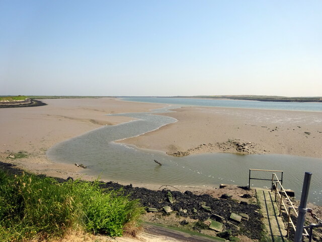
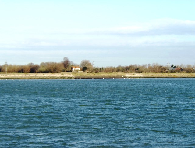
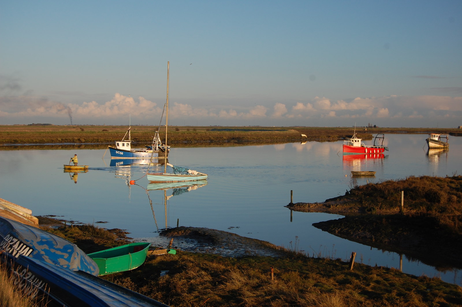
Barling Point is a prominent coastal feature located in the county of Essex, England. Situated on the east coast of the country, it is specifically found on the northern bank of the River Roach estuary. This headland, commonly referred to as a point, is known for its picturesque views and natural beauty.

Barling Point is characterized by its rugged and rocky terrain, which extends into the North Sea. The headland is formed by the erosion of surrounding cliffs and is made up of various types of sedimentary rocks, including chalk and clay. These geological formations contribute to its distinctive appearance and make it a popular destination for geology enthusiasts.

With its strategic position overlooking the estuary, Barling Point offers stunning panoramic views of the surrounding landscape. On a clear day, visitors can observe the wide expanse of the North Sea, as well as the nearby coastal towns of Southend-on-Sea and Shoeburyness.

In addition to its natural beauty, Barling Point is also home to a diverse range of wildlife. The headland provides a habitat for numerous bird species, including gulls, cormorants, and various wading birds. It is also a popular spot for birdwatching enthusiasts, who flock to this area to observe the seasonal migrations of different avian species.

Due to its accessibility and scenic qualities, Barling Point attracts both locals and tourists alike. Visitors can enjoy leisurely walks along the coastal path, take in the fresh sea air, and marvel at the breathtaking vistas that this headland offers.

If you have any feedback on the listing, please let us know in the comments section below.

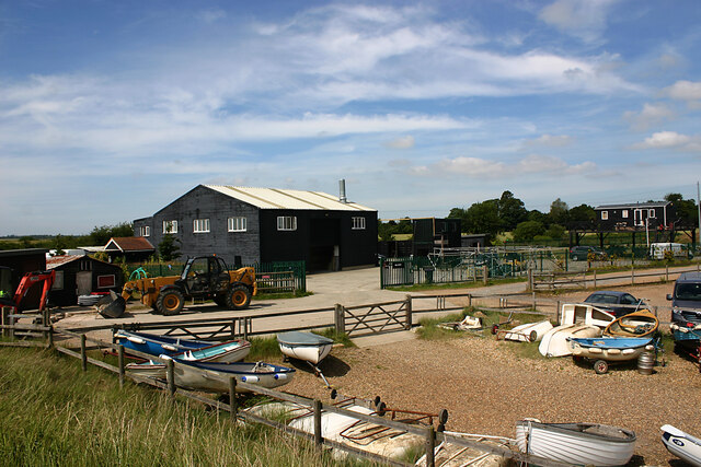
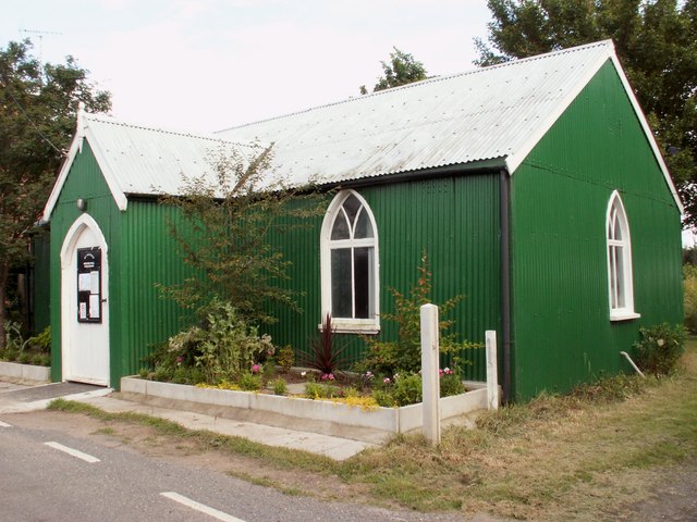
Barling Point Images

Images are sourced within 2km of 51.580357/0.80585321 or Grid Reference TQ9490. Thanks to Geograph Open Source API. All images are credited.

Shuttlewood's Boatyard, Paglesham Eastend The boatyard fronts Paglesham Reach of the River Roach and since 1895 has been engaged in boatbuilding and maintenance.
Shuttlewood's Boatyard, Paglesham Eastend
The boatyard fronts Paglesham Reach of the River Roach and since 1895 has been engaged in boatbuilding and maintenance.
River Roach, looking downstream from Stannets Creek
Barling Marsh Much of Barling Marsh has been given over to a landfill site and the extraction of sand and gravel. Vehicles reach the site by means of a dedicated road <a href="https://www.geograph.org.uk/gridref/TQ9288">TQ9288</a>. Taken from the berm beside Barlinghall Creek looking west.
Barling Marsh
Much of Barling Marsh has been given over to a landfill site and the extraction of sand and gravel. Vehicles reach the site by means of a dedicated road TQ9288. Taken from the berm beside Barlinghall Creek looking west.
River Roach This river is short, and in its lower reaches wide and tidal. Taken from Barling Marsh Sluice on the southern bank facing north.
River Roach
This river is short, and in its lower reaches wide and tidal. Taken from Barling Marsh Sluice on the southern bank facing north.
Looking towards Barling Ness Barling Ness is at the far end of the drainage channel. The water on the left is Paglesham Reach of the River Roach and the land just discernible on the horizon is Potton Island.
Looking towards Barling Ness
Barling Ness is at the far end of the drainage channel. The water on the left is Paglesham Reach of the River Roach and the land just discernible on the horizon is Potton Island.
Essex Creeks The land with the farm buildings (just outside the gridsquare in <a href="https://www.geograph.org.uk/gridref/TQ9590">TQ9590</a>) on it is Potton Island to which there is no public access. The part of the mainland across the water to the right of the island is separated from it by Potton Creek. The water on the left is known as The Violet and that on the right is Barlinghall Creek.
Essex Creeks
The land with the farm buildings (just outside the gridsquare in TQ9590) on it is Potton Island to which there is no public access. The part of the mainland across the water to the right of the island is separated from it by Potton Creek. The water on the left is known as The Violet and that on the right is Barlinghall Creek.
Great Potton farm buildings, Potton Island Although Potton Island is owned by the Ministry of Defence, much of the island has been used for farming. Taken from the mainland looking north across Potton Creek.
Great Potton farm buildings, Potton Island
Although Potton Island is owned by the Ministry of Defence, much of the island has been used for farming. Taken from the mainland looking north across Potton Creek.
Paglesham Eastend This row of cottages stands on an unmade road leading to a boatyard on the River Roach.
Paglesham Eastend
This row of cottages stands on an unmade road leading to a boatyard on the River Roach.
The Plough and Sail, Paglesham East End Village pub.
The Plough and Sail, Paglesham East End
Village pub.
Plough and Sail public house, Paglesham I drove all the way down there and it wasn't open!  If you think the weather is bad here, look at the historic photo:

<span class="nowrap"><a title="http://www.familyunited.co.uk/modules/gallery2/main.php?g2_view=core.DownloadItem&g2_itemId=336&g2_serialNumber=2" rel="nofollow ugc noopener" href="http://www.familyunited.co.uk/modules/gallery2/main.php?g2_view=core.DownloadItem&g2_itemId=336&g2_serialNumber=2">Link</a><img style="margin-left:2px;" alt="External link" title="External link - shift click to open in new window" src="https://s1.geograph.org.uk/img/external.png" width="10" height="10"/></span>

<a href="https://www.geograph.org.uk/photo/303679">TQ9492 : The Plough and Sail, Paglesham East End</a>
Plough and Sail public house, Paglesham
I drove all the way down there and it wasn't open! If you think the weather is bad here, look at the historic photo: LinkExternal link TQ9492 : The Plough and Sail, Paglesham East End
St. Peter's Mission Hall Paglesham East End
St. Peter's Mission Hall
Paglesham East End
Pub sign - Plough and Sail Paglesham Eastend.
Pub sign - Plough and Sail
Paglesham Eastend.
St. Peter's Mission Hall
Cottages, Paglesham Eastend Just past the Plough and Sail public house, on the other side of the road lies this attractive row of cottages.
Cottages, Paglesham Eastend
Just past the Plough and Sail public house, on the other side of the road lies this attractive row of cottages.
Seawall footpath, Paglesham Eastend This view looks south-west as the footpath passes close to Paglesham.
Seawall footpath, Paglesham Eastend
This view looks south-west as the footpath passes close to Paglesham.
Blackedge Point Looking at Blackedge Point and on across Paglesham Reach from the seawall footpath.
Blackedge Point
Looking at Blackedge Point and on across Paglesham Reach from the seawall footpath.
Drainage channel south of Barling Ness The curving drainage channel separates the large landfill site (left) from the sea wall and footpath. The water on the right is known as The Violet through which Barlinghall and Potton Creeks join the River Roach.
Drainage channel south of Barling Ness
The curving drainage channel separates the large landfill site (left) from the sea wall and footpath. The water on the right is known as The Violet through which Barlinghall and Potton Creeks join the River Roach.
The Violet The Violet is the creek through which Barlinghall Creek and Potton Creek reach the River Roach. The land beyond it is Potton Island.
The Violet
The Violet is the creek through which Barlinghall Creek and Potton Creek reach the River Roach. The land beyond it is Potton Island.
Show me another place!

Barling Point is located at Grid Ref: TQ9490 (Lat: 51.580357, Lng: 0.80585321)

Administrative County: Essex

District: Rochford

Police Authority: Essex

What 3 Words

///bother.importing.verve. Near Great Wakering, Essex

Related Wikis

Potton Island

Potton Island is a sparsely populated island west of Foulness in Essex, England. It is connected to the mainland by a swing bridge with a traffic light...

Barling, Essex

Barling is a village and former civil parish, now in the civil parish of Barling Magna in the Rochford district, in the county of Essex, England. It is...

HMS Beagle

HMS Beagle was a Cherokee-class 10-gun brig-sloop of the Royal Navy, one of more than 100 ships of this class. The vessel, constructed at a cost of £7...
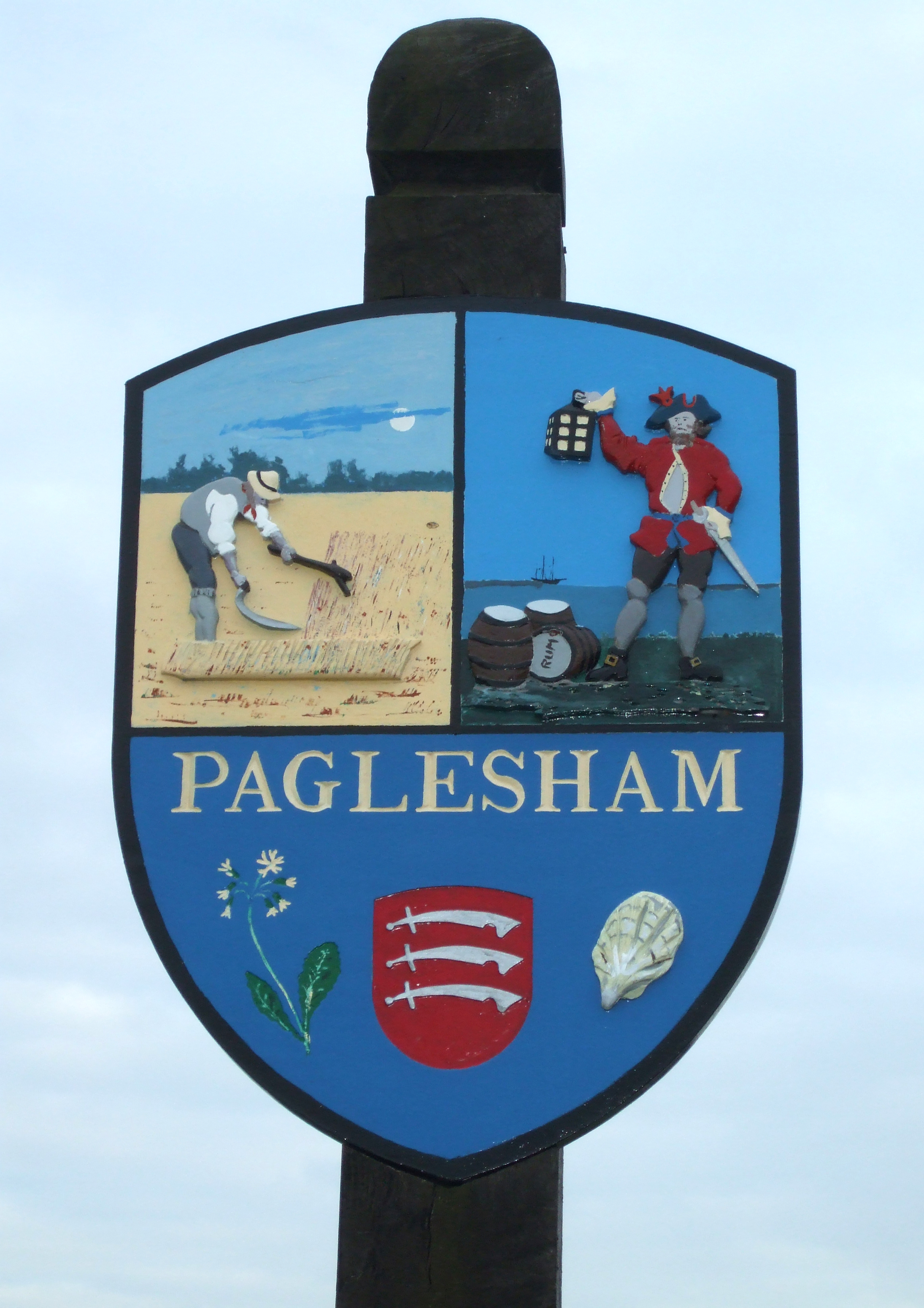
Paglesham

Paglesham ( PAG-əl-shəm) is a village and civil parish in the north east of the Rochford Rural District, Essex. The parish includes two hamlets of Eastend...

Nearby Amenities

Located within 500m of 51.580357,0.80585321
Source: PGS
Lat/Long: 51.5782314/0.8111793
Source: PGS
Lat/Long: 51.5786715/0.8106429
Source: PGS
Lat/Long: 51.5792915/0.8100528
Source: PGS
Lat/Long: 51.5799449/0.8098919
Source: PGS
Lat/Long: 51.580425/0.8099884
Source: PGS
Lat/Long: 51.5810116/0.8103103
Source: PGS
Lat/Long: 51.581545/0.8101815
Source: PGS
Lat/Long: 51.5830917/0.8091087
Source: PGS
Lat/Long: 51.5776031/0.8106337
Source: PGS
Lat/Long: 51.5777298/0.8100973
Source: PGS
Lat/Long: 51.5781431/0.8091746
Source: PGS
Lat/Long: 51.5785098/0.8083055
Source: PGS
Lat/Long: 51.5787232/0.808091
Source: PGS
Lat/Long: 51.5782431/0.8068786
Source: PGS
Lat/Long: 51.5781831/0.8063958
Source: PGS
Lat/Long: 51.5779164/0.8055804
Source: PGS
Lat/Long: 51.5776164/0.8047972
Source: PGS
Lat/Long: 51.5773964/0.8041213
Source: PGS
Lat/Long: 51.5772164/0.8038853
Source: PGS
Lat/Long: 51.5770563/0.803263
Source: PGS
Lat/Long: 51.576937/0.802671
Source: PGS
Lat/Long: 51.576743/0.801718
Source: PGS
Lat/Long: 51.5778992/0.8001553
Source: PGS
Lat/Long: 51.577923/0.800567
Source: PGS
Lat/Long: 51.57821/0.802198
Source: PGS
Lat/Long: 51.578481/0.803008
Source: PGS
Lat/Long: 51.578753/0.803818
Source: PGS
Lat/Long: 51.578897/0.804633
Source: PGS
Lat/Long: 51.579288/0.805026
Source: PGS
Lat/Long: 51.579296/0.805437
Source: PGS
Lat/Long: 51.57956/0.805836
Source: PGS
Lat/Long: 51.5797899/0.8069001
Source: PGS
Lat/Long: 51.58011/0.8071361
Source: PGS
Lat/Long: 51.58057/0.807415
Source: PGS
Lat/Long: 51.5811167/0.8075116
Source: PGS
Lat/Long: 51.581764/0.807169
Source: PGS
Lat/Long: 51.582268/0.806733
Source: PGS
Lat/Long: 51.582524/0.806721
Source: PGS
Lat/Long: 51.58278/0.806708
Source: PGS
Lat/Long: 51.5838701/0.8063422
Seamark Buoy Lateral Category: port
Seamark Buoy Lateral Colour: red
Seamark Buoy Lateral Shape: can
Seamark Buoy Lateral System: iala-a
Seamark Light Character: Q
Seamark Light Colour: red
Seamark Name: Barlinghall
Seamark Type: buoy_lateral
Lat/Long: 51.57935/0.8080333
The data included in this document is from www.openstreetmap.org. The data is made available under ODbL.

Have you been to Barling Point?

Leave your review of Barling Point below (or comments, questions and feedback).