Sandy Point

Coastal Feature, Headland, Point in Shetland

Scotland

Sandy Point

Sand Voe Sand Voe is an inlet at the north of the Northmavine area of Mainland, Shetland.
This view is of the sandy / shingly beach at the southern end of the voe near to the eponymously named settlement of Sandvoe (see <a href="https://www.geograph.org.uk/photo/2713084">HU3690 : Sandvoe settlement</a>)
Sand Voe Credit: Rob Farrow

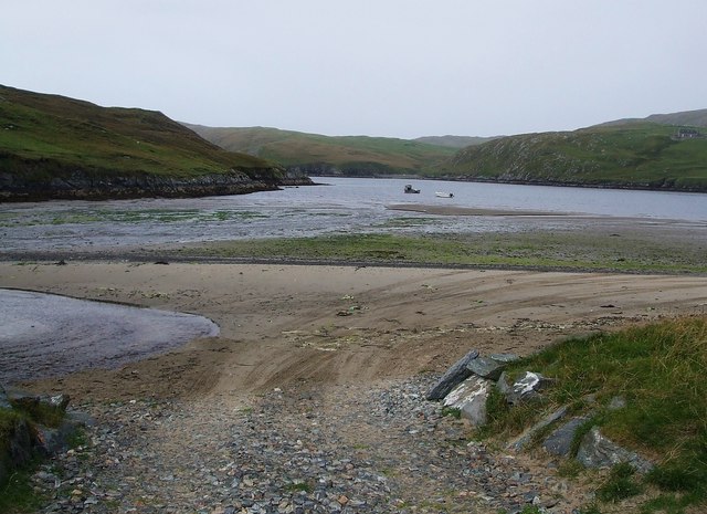
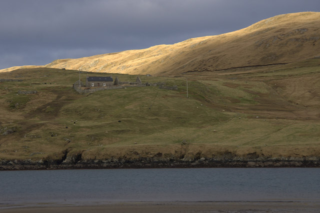
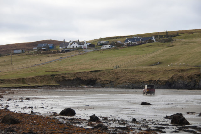
Sandy Point is a prominent coastal feature located in the Shetland Islands, an archipelago in Scotland. It is a headland that extends into the North Sea, forming a distinct point along the rugged coastline. Sandy Point is situated on the southern tip of the mainland Shetland, near the village of Bigton.

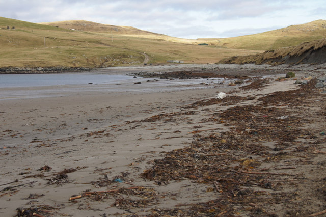
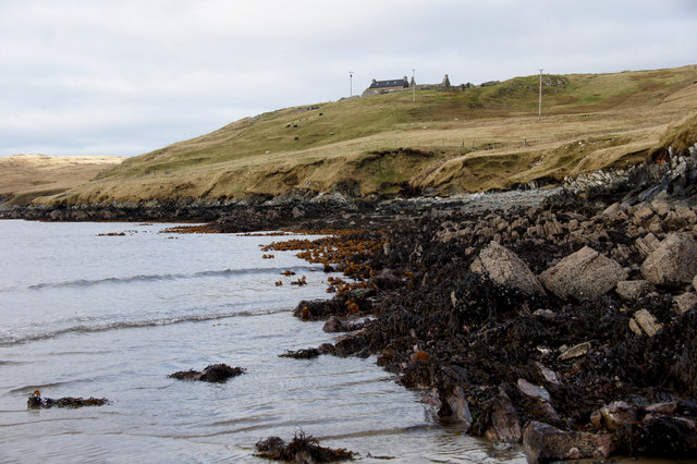
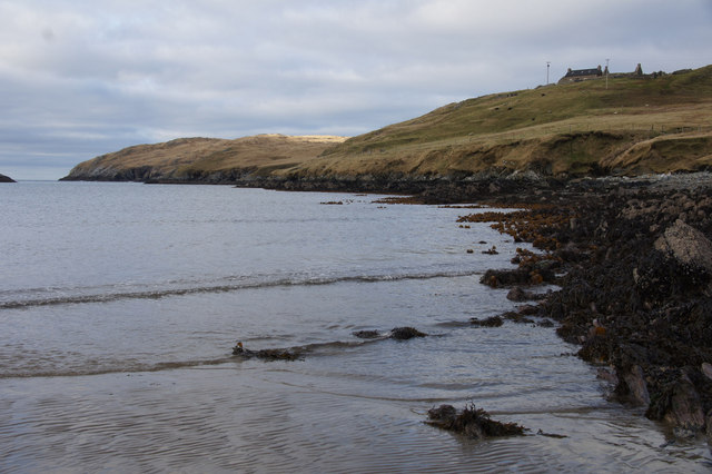
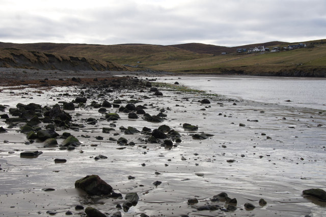
As its name suggests, Sandy Point is characterized by its sandy beaches, which contrast with the surrounding rocky cliffs and grassy dunes. The sandy shores attract locals and tourists alike, offering a peaceful and picturesque spot for sunbathing, picnicking, and beachcombing. The fine sand is often soft underfoot and provides an ideal surface for beach games and long walks along the shore.

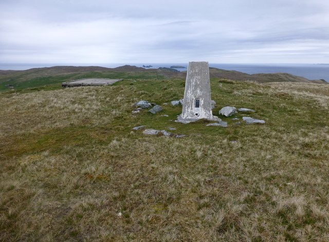
The headland of Sandy Point offers breathtaking views of the North Sea, with its dramatic cliffs providing a vantage point to observe the vast expanse of ocean and the distant horizon. The area is also known for its abundant birdlife, making it a popular spot for birdwatching. Visitors may catch glimpses of seabirds such as puffins, guillemots, and razorbills, as well as the occasional seal or dolphin swimming offshore.

The surrounding landscape of Sandy Point is characterized by undulating grassy dunes, heather-covered moorland, and patches of wildflowers, creating a visually stunning backdrop to the sandy beaches. The area is well-maintained, with paths and trails allowing visitors to explore the headland and enjoy the natural beauty of the surroundings.

Overall, Sandy Point is a captivating coastal feature that offers a mix of sandy beaches, stunning views, and diverse wildlife. It is a must-visit destination for nature lovers and those seeking a peaceful retreat along the Shetland coastline.

If you have any feedback on the listing, please let us know in the comments section below.
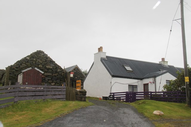
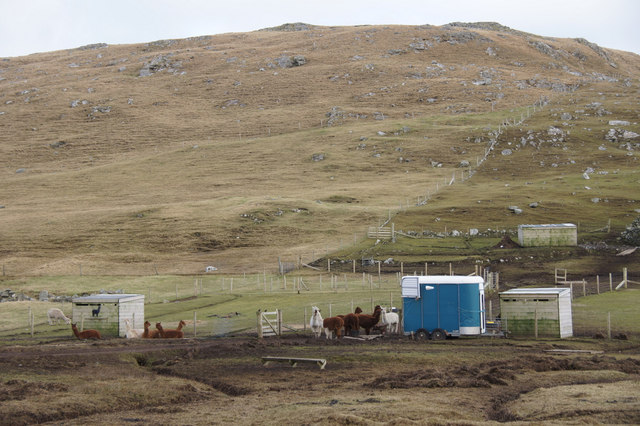
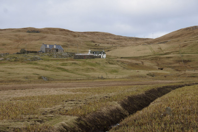
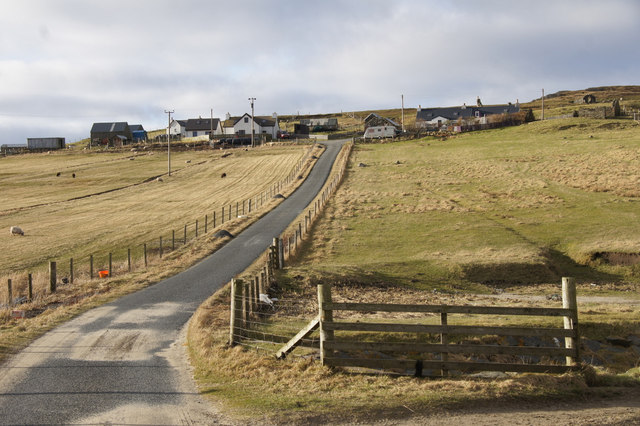
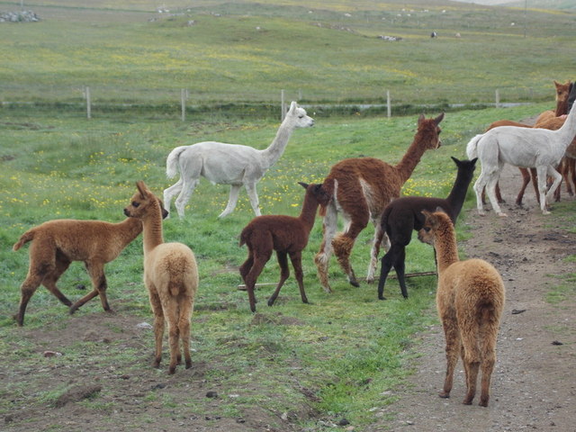
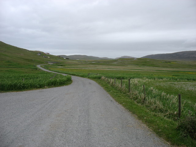
Sandy Point Images

Images are sourced within 2km of 60.594585/-1.3394118 or Grid Reference HU3690. Thanks to Geograph Open Source API. All images are credited.

Sand Voe Sand Voe is an inlet at the north of the Northmavine area of Mainland, Shetland.
This view is of the sandy / shingly beach at the southern end of the voe near to the eponymously named settlement of Sandvoe (see <a href="https://www.geograph.org.uk/photo/2713084">HU3690 : Sandvoe settlement</a>)
Sand Voe
Sand Voe is an inlet at the north of the Northmavine area of Mainland, Shetland. This view is of the sandy / shingly beach at the southern end of the voe near to the eponymously named settlement of Sandvoe (see HU3690 : Sandvoe settlement)
Sandvoe settlement The few houses that make up the settlement of Sandvoe at the north of the Northmavine area of Mainland, Shetland as seen from its little beach on the voe (see <a href="https://www.geograph.org.uk/photo/2713080">HU3690 : Sand Voe</a>), with the burn seen nearest the camera about to flow into the sea.
Sandvoe settlement
The few houses that make up the settlement of Sandvoe at the north of the Northmavine area of Mainland, Shetland as seen from its little beach on the voe (see HU3690 : Sand Voe), with the burn seen nearest the camera about to flow into the sea.
A lost plane There was an explanation of how this plane got half way up the hill but it was so wet that I didn't read it.
A lost plane
There was an explanation of how this plane got half way up the hill but it was so wet that I didn't read it.
Traditional Haystacks Some good old fashioned haystacks at Isbister
Traditional Haystacks
Some good old fashioned haystacks at Isbister
The end of the road The end of the road at Sandvoe
The end of the road
The end of the road at Sandvoe
Alpacas, Isbister, North Roe
Irisbeds, Isbister, North Roe
Sandvoe, North Roe
Sandvoe, North Roe
Beach at the head of Sand Voe, North Roe
Benigarth, beside Sand Voe, North Roe The slopes of the hill of Lanchestoo beyond. The house gained some fame as the residence of Simon King during the filming of Simon King's Shetland. It is only accessible by vehicle by driving along the beach.
Benigarth, beside Sand Voe, North Roe
The slopes of the hill of Lanchestoo beyond. The house gained some fame as the residence of Simon King during the filming of Simon King's Shetland. It is only accessible by vehicle by driving along the beach.
Benigarth, beside Sand Voe, North Roe From the beach on a low tide.
Benigarth, beside Sand Voe, North Roe
From the beach on a low tide.
East shore of Sand Voe, North Roe Looking towards Orrwick Taing.
East shore of Sand Voe, North Roe
Looking towards Orrwick Taing.
Beach at the head of Sand Voe, North Roe Not it's sandiest aspect.
Beach at the head of Sand Voe, North Roe
Not it's sandiest aspect.
Land Rover on the beach at Sand Voe, North Roe The crofter has just been to feed sheep on the far end of the beach.
Land Rover on the beach at Sand Voe, North Roe
The crofter has just been to feed sheep on the far end of the beach.
Lanchestoo Trig First top today after navigating past some Shetland Ponies with Tricky Speirs.

Name: Lanchestoo
Hill number: 4919
Height: 130m / 427ft
Area: 22: Shetland Islands
Class: Hu
Grid ref: HU 37516 91596
Summit feature: trig point: OS measurement
Drop: 113m
Col: 17m  HU371902
Lanchestoo Trig
First top today after navigating past some Shetland Ponies with Tricky Speirs. Name: Lanchestoo Hill number: 4919 Height: 130m / 427ft Area: 22: Shetland Islands Class: Hu Grid ref: HU 37516 91596 Summit feature: trig point: OS measurement Drop: 113m Col: 17m HU371902
End Of The A970 Isbister is the end of the A970 and where we parked for our walk to Lanchestoo trig point.
End Of The A970
Isbister is the end of the A970 and where we parked for our walk to Lanchestoo trig point.
North Roe: alpacas The food tub has just been rattled and the alpacas respond as expected, making a bee-line for their owner. This is the only group of alpacas in Shetland; they have been here for four years, having been born in Hazelbury Bryan in Dorset. Some of the youngest in the picture are only a fortnight old.
North Roe: alpacas
The food tub has just been rattled and the alpacas respond as expected, making a bee-line for their owner. This is the only group of alpacas in Shetland; they have been here for four years, having been born in Hazelbury Bryan in Dorset. Some of the youngest in the picture are only a fortnight old.
The end of the road The A970 just comes to a dead stop here at Isbister. Looking south, for the first ten or a dozen miles it is "single track with passing places", but there is so little traffic that it is hardly a problem. After that, and all the way to Sumburgh <a href="https://www.geograph.org.uk/gridref/HU4009">HU4009</a>, 80km away, it is a splendid road, upgraded (like other main routes in the Shetland Islands) when the oil money was at its peak.

It is, of course, possible to walk further north for nearly 5 kilometres, to the Point of Fethaland (though I did not have time to do this). Only two inhabited islands, Yell and Unst, get even further north and into Myriad HP.
The end of the road
The A970 just comes to a dead stop here at Isbister. Looking south, for the first ten or a dozen miles it is "single track with passing places", but there is so little traffic that it is hardly a problem. After that, and all the way to Sumburgh HU4009, 80km away, it is a splendid road, upgraded (like other main routes in the Shetland Islands) when the oil money was at its peak. It is, of course, possible to walk further north for nearly 5 kilometres, to the Point of Fethaland (though I did not have time to do this). Only two inhabited islands, Yell and Unst, get even further north and into Myriad HP.
Show me another place!

Sandy Point is located at Grid Ref: HU3690 (Lat: 60.594585, Lng: -1.3394118)

Unitary Authority: Shetland Islands

Police Authority: Highlands and Islands

What 3 Words

///wove.furnish.shoving. Near Ulsta, Shetland Islands

Related Wikis

North Roe

North Roe is a village, and protected area at the northern tip in the large Northmavine peninsula of the Mainland of Shetland, Scotland. It is a small...

Fethaland

Fethaland or Fedeland (pronounced [ˈfeɪdələnd]) is an abandoned settlement at the extreme north end of Mainland, Shetland. It was the site of the largest...

Muckle Holm, Yell Sound

Muckle Holm is a small island in Shetland. It is in Yell Sound, near the Northmavine. It is 23 metres (75 ft) at its highest point. There is a lighthouse...

Yell Sound

Yell Sound is the strait running between Yell and Mainland, Shetland, Scotland. It is the boundary between the Mainland and the North Isles and it contains...

Nearby Amenities

Located within 500m of 60.594585,-1.3394118
Passing Place
Lat/Long: 60.5960955/-1.3349938
Passing Place
Lat/Long: 60.5944643/-1.3340572
Turning Circle
Lat/Long: 60.5926867/-1.343011
Noexit: yes
Lat/Long: 60.5927203/-1.3430043
Power: pole
Lat/Long: 60.5910914/-1.3337365
Power: pole
Lat/Long: 60.5917328/-1.333141
Power: pole
Lat/Long: 60.5920133/-1.332905
Power: pole
Lat/Long: 60.5925032/-1.3324517
Power: pole
Lat/Long: 60.5930972/-1.3318884
Power: pole
Lat/Long: 60.5937069/-1.3313493
Power: pole
Lat/Long: 60.5942364/-1.3308772
Power: pole
Lat/Long: 60.5947249/-1.3303998
Power: pole
Lat/Long: 60.5974697/-1.3363431
Flugarth
Place: hamlet
Lat/Long: 60.5973311/-1.3357839
Power: pole
Lat/Long: 60.5980043/-1.3370874
Power: pole
Lat/Long: 60.5984019/-1.3376453
Power: pole
Lat/Long: 60.5986984/-1.3380621
Power: pole
Lat/Long: 60.5989762/-1.3390424
Power: pole
Lat/Long: 60.5971851/-1.3359592
Power: pole
Lat/Long: 60.5969546/-1.3353048
Power: pole
Lat/Long: 60.5963054/-1.3334862
Power: pole
Lat/Long: 60.5966922/-1.3345779
Power: pole
Lat/Long: 60.595912/-1.3323798
Power: pole
Lat/Long: 60.5954583/-1.3311031
Power: pole
Lat/Long: 60.5958172/-1.3353263
Power: pole
Lat/Long: 60.596577/-1.3353088
Power: pole
Lat/Long: 60.5962077/-1.3353157
Passing Place
Lat/Long: 60.5932552/-1.3330042
The data included in this document is from www.openstreetmap.org. The data is made available under ODbL.

Have you been to Sandy Point?

Leave your review of Sandy Point below (or comments, questions and feedback).