Baldcar Head

Landscape Feature in Yorkshire Harrogate

England

Baldcar Head

The view over to the North York Moors Looking NEE from just within the square at MR: SE11017704 towards the North York Moors several miles in the distance.
The view over to the North York Moors Credit: Andy Beecroft

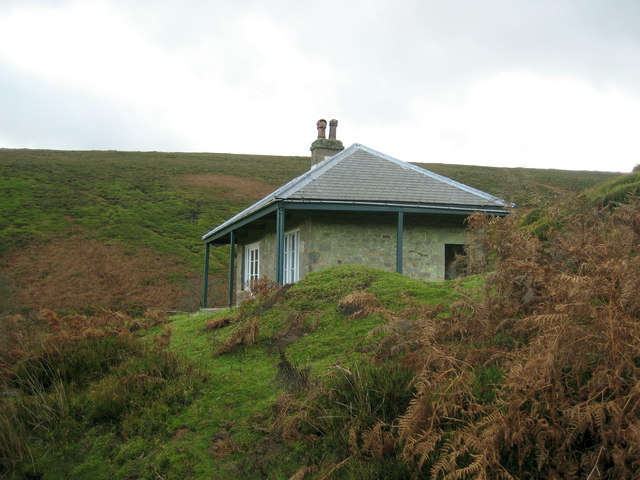
Baldcar Head is a prominent landscape feature located in the county of Yorkshire, England. Situated in the Pennine Hills, it is a high moorland plateau that stands at an elevation of approximately 1,978 feet (603 meters) above sea level. The site is known for its distinctive flat top, which is devoid of any vegetation, giving it the appearance of being "bald."

The landscape surrounding Baldcar Head is characterized by its rugged and wild beauty. It is primarily composed of heather moorland, with patches of grasses and scattered boulders dotting the terrain. The area is often subject to harsh weather conditions, including strong winds and frequent rain, which have contributed to the erosion of the exposed peat soils.

Baldcar Head offers breathtaking panoramic views of the surrounding countryside, with its elevated position providing vistas across the rolling hills, valleys, and distant peaks of the Pennines. On clear days, it is possible to see as far as the Yorkshire Dales and even the Lake District.

The site is a haven for wildlife, with various species of birds, including the red grouse and curlew, making their home in the moorland. The plateau also supports a variety of plant life, including bilberry, cotton grass, and heather, which paint the landscape with vibrant colors during the summer months.

Baldcar Head attracts outdoor enthusiasts, hikers, and nature lovers who come to explore the surrounding area and enjoy the tranquility of this remote and unspoiled location. It is a place where visitors can experience the raw beauty of the Yorkshire countryside while being immersed in its rich natural history.

If you have any feedback on the listing, please let us know in the comments section below.

Baldcar Head Images

Images are sourced within 2km of 54.207642/-1.8073851 or Grid Reference SE1279. Thanks to Geograph Open Source API. All images are credited.

The view over to the North York Moors Looking NEE from just within the square at MR: SE11017704 towards the North York Moors several miles in the distance.
The view over to the North York Moors
Looking NEE from just within the square at MR: SE11017704 towards the North York Moors several miles in the distance.
Shooting House, Swinton Estate Was in use when I passed here.  A variety of official looking notices have been erected to prevent the public walking here - not really acceptable as this is now all open access, I saw some of these signs have been torn down
Shooting House, Swinton Estate
Was in use when I passed here. A variety of official looking notices have been erected to prevent the public walking here - not really acceptable as this is now all open access, I saw some of these signs have been torn down
Track beside infant River Burn These are the upper reaches of the River Burn, whose waters eventually empty into the Ure.  This track, probably for shooters, gives easy walking beside the watercourse
Track beside infant River Burn
These are the upper reaches of the River Burn, whose waters eventually empty into the Ure. This track, probably for shooters, gives easy walking beside the watercourse
Spruce Gill Beck Moorland stream that flows beneath Gollinglith Ridge, before entering the River Burn
Spruce Gill Beck
Moorland stream that flows beneath Gollinglith Ridge, before entering the River Burn
Hambleton Litch Long straight track over moorland near Gollinglith
Hambleton Litch
Long straight track over moorland near Gollinglith
Bridge over Thorny Grane Gill Track gives access to the Shooting Lodge and beyond.  This just before Thorny Grane Gill enters the River Burn
Bridge over Thorny Grane Gill
Track gives access to the Shooting Lodge and beyond. This just before Thorny Grane Gill enters the River Burn
Weathered Rocks Wind has eroded these rocks into peculiar shapes high above the chasm that contains Spruce Gill Beck
Weathered Rocks
Wind has eroded these rocks into peculiar shapes high above the chasm that contains Spruce Gill Beck
Track near Towler Hill This track has wended its way off Masham Moor, over Gollinglith and Hambleton Litch to finally reach this point, just before it meets the lane near the Leeds Pals Memorial
Track near Towler Hill
This track has wended its way off Masham Moor, over Gollinglith and Hambleton Litch to finally reach this point, just before it meets the lane near the Leeds Pals Memorial
Old guidepost on Pott Ridge This old guidepost stands by a junction of ancient trackways across the moors.  Possibly on an old packhorse route associated with Fountains, Jervaulx or Byland Abbeys, all of which owned land in the area.
Old guidepost on Pott Ridge
This old guidepost stands by a junction of ancient trackways across the moors. Possibly on an old packhorse route associated with Fountains, Jervaulx or Byland Abbeys, all of which owned land in the area.
Upper Spruce Gill Beck This boggy watercourse is the upper reaches of the Spruce Gill Beck and the skyline is Brown Ridge. The terrain is almost featureless grouse moor which makes for very difficult walking country.
Upper Spruce Gill Beck
This boggy watercourse is the upper reaches of the Spruce Gill Beck and the skyline is Brown Ridge. The terrain is almost featureless grouse moor which makes for very difficult walking country.
Sourmire Moor Looking out over the wonderfully named Sourmire Moor from the northeast slopes of Brown Ridge. This grouse moorland is mainly heather, bilberry and marsh grass.
Sourmire Moor
Looking out over the wonderfully named Sourmire Moor from the northeast slopes of Brown Ridge. This grouse moorland is mainly heather, bilberry and marsh grass.
Watercourse near Gipsey Wham This watercourse flows from an area of moorland marsh known at Gipsey Hole to join Grimes Gill, passing through grouse moor as shown in this photo. This area is particularly poorly drained and the watercourse often spreads out to form very boggy areas.
Watercourse near Gipsey Wham
This watercourse flows from an area of moorland marsh known at Gipsey Hole to join Grimes Gill, passing through grouse moor as shown in this photo. This area is particularly poorly drained and the watercourse often spreads out to form very boggy areas.
Grimes Gill Grimes Gill viewed from the track. The area is surrounded by prime grouse moorland and the tracks are made so that vehicular access to the moors can be gained by paying guests.
Grimes Gill
Grimes Gill viewed from the track. The area is surrounded by prime grouse moorland and the tracks are made so that vehicular access to the moors can be gained by paying guests.
Farmhouse above Grimes Gill Looking across Grimes Gill towards a farmhouse from the rough moorland track.
Farmhouse above Grimes Gill
Looking across Grimes Gill towards a farmhouse from the rough moorland track.
Grimes Gill This photo is of the upper reaches of Grimes Gill, set in an upland area of grouse moor. The vegetation is mainly heather, bilberry and bracken. Notice how the vegetation differs from one side of the gill to the other, bracken favouring the south facing slopes.
Grimes Gill
This photo is of the upper reaches of Grimes Gill, set in an upland area of grouse moor. The vegetation is mainly heather, bilberry and bracken. Notice how the vegetation differs from one side of the gill to the other, bracken favouring the south facing slopes.
Grimes Gill Footbridge Hidden in the valley, not marked on OS mapping and little used.
Grimes Gill Footbridge
Hidden in the valley, not marked on OS mapping and little used.
Stone Stile Rear of High Sourmire Farm (Derelict)
Stone Stile
Rear of High Sourmire Farm (Derelict)
Track to the shooting house The easiest way into the narrow valley beyond High House Farm is by the shooting track on the south side. The bridleway on the north bank is very difficult going through thick heather and bracken. The shooting house is on the Swinton Estate which owns a large area of grouse moor hereabouts.
Track to the shooting house
The easiest way into the narrow valley beyond High House Farm is by the shooting track on the south side. The bridleway on the north bank is very difficult going through thick heather and bracken. The shooting house is on the Swinton Estate which owns a large area of grouse moor hereabouts.
Show me another place!

Baldcar Head is located at Grid Ref: SE1279 (Lat: 54.207642, Lng: -1.8073851)

Division: North Riding

Administrative County: North Yorkshire

District: Harrogate

Police Authority: North Yorkshire

What 3 Words

///wreck.hugs.legroom. Near Masham, North Yorkshire

Nearby Locations

Baldcar Head

Related Wikis

Colsterdale

Colsterdale is the valley of the River Burn, a tributary of the River Ure, in the Yorkshire Dales in North Yorkshire, England. It gives its name to a hamlet...

Roundhill Reservoir

Roundhill Reservoir is situated near Leighton Reservoir in North Yorkshire, England. It was constructed by Harrogate Corporation early in the 20th century...

Gollinglith Foot

Gollinglith Foot (GOWN-li FOOT), historically also spelt Gownley Foot, is a hamlet in the civil parish of Healey in the Harrogate district of North Yorkshire...

Leighton Reservoir

Leighton Reservoir is a reservoir which drains via the River Burn to the River Ure in North Yorkshire, England. It neighbours Roundhill Reservoir and is...

Leighton, North Yorkshire

Leighton is a hamlet in the civil parish of Healey in the Harrogate district of North Yorkshire, England. It is near Leighton Reservoir that provides for...

Nidderdale Caves

The Nidderdale Caves are a series of caves in Upper Nidderdale in North Yorkshire, England. There are two cave systems and most of the caves are in some...

Skipton and Ripon (UK Parliament constituency)

Skipton and Ripon is a constituency in North Yorkshire represented in the House of Commons of the UK Parliament since 2010 by Julian Smith, a Conservative...

Healey, North Yorkshire

Healey is a small village and civil parish in the Harrogate district of North Yorkshire, England. It is situated in the valley of the River Burn, to the...

Nearby Amenities

Located within 500m of 54.207642,-1.8073851
Baldcar Head
Natural: peak
Source: NPE
Lat/Long: 54.2089287/-1.8011277
The data included in this document is from www.openstreetmap.org. The data is made available under ODbL.

Have you been to Baldcar Head?

Leave your review of Baldcar Head below (or comments, questions and feedback).