Bental Head
Landscape Feature in Yorkshire Harrogate
England
Bental Head

Bental Head is a prominent landscape feature located in the Yorkshire Dales National Park, in the county of Yorkshire, England. It is situated near the village of Kettlewell and stands at an elevation of approximately 704 meters (2,310 feet) above sea level.
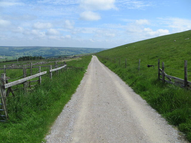
This natural landmark is characterized by its distinctive shape and rocky outcrop, which can be seen from miles around. Bental Head offers magnificent panoramic views of the surrounding countryside, including the stunning Wharfedale and Littondale valleys, as well as the rolling hills and moorlands of the national park.
The area around Bental Head is known for its diverse flora and fauna, with an abundance of heather, grasses, and wildflowers covering the hillsides. The rocky terrain provides a habitat for various bird species, including peregrine falcons, buzzards, and kestrels, which can often be spotted soaring above the cliffs.
Bental Head is a popular destination for hikers and nature enthusiasts, offering a range of walking trails and footpaths that allow visitors to explore its rugged beauty. The ascent to the summit can be challenging, particularly in adverse weather conditions, but the breathtaking views at the top make it well worth the effort.
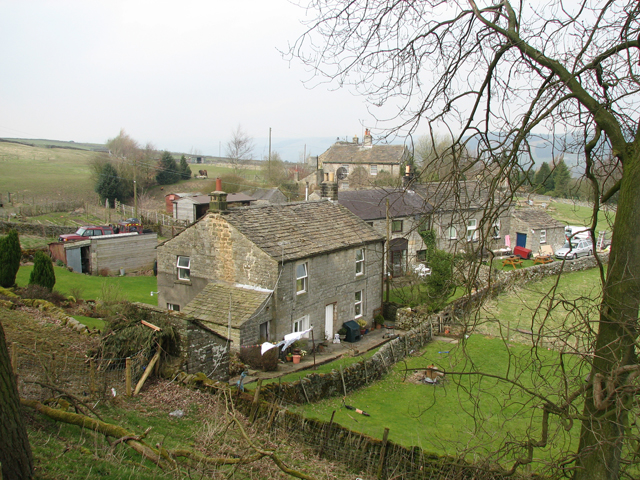
The area surrounding Bental Head is rich in history and heritage, with evidence of ancient settlements and farming practices dating back thousands of years. The landscape is dotted with dry stone walls and remains of old mine workings, serving as a reminder of the region's industrial past.
Overall, Bental Head is a remarkable landscape feature that showcases the natural beauty and cultural significance of the Yorkshire Dales, attracting visitors from far and wide to explore its scenic vistas and immerse themselves in the stunning surroundings.
If you have any feedback on the listing, please let us know in the comments section below.
Bental Head Images
Images are sourced within 2km of 54.086326/-1.8169812 or Grid Reference SE1265. Thanks to Geograph Open Source API. All images are credited.


Bental Head is located at Grid Ref: SE1265 (Lat: 54.086326, Lng: -1.8169812)
Division: West Riding
Administrative County: North Yorkshire
District: Harrogate
Police Authority: North Yorkshire
What 3 Words
///stencil.relatives.hologram. Near Pateley Bridge, North Yorkshire
Nearby Locations
Related Wikis

Greenhow
Greenhow is a village in North Yorkshire, England, often referred to as Greenhow Hill. The term how derives from the Old Norse word haugr meaning a hill...
Heathfield, North Yorkshire
Heathfield is a hamlet in the civil parish of Stonebeck Down in upper Nidderdale, in North Yorkshire, England. It lies on a broad terrace on the west...
Nidderdale High School
Nidderdale High School is a coeducational secondary school located in Pateley Bridge, North Yorkshire, England. The school is named after Nidderdale, one...
Wath-in-Nidderdale railway station
Wath-in-Nidderdale railway station, was one of two intermediate stations on the Nidd Valley Light Railway, in Wath-in-Nidderdale, Yorkshire, England. The...

Gouthwaite Reservoir
Gouthwaite Reservoir is in Nidderdale, North Yorkshire, England. It is one of many reservoirs in the area, others include Roundhill Reservoir and Angram...
Wath-in-Nidderdale
Wath, sometimes known as Wath-in-Nidderdale to distinguish it from other places named Wath, is a village in the Harrogate district of North Yorkshire,...

Pateley Bridge
Pateley Bridge (known locally as Pateley) is a market town in Nidderdale in the county and district of North Yorkshire, England. Historically part of the...
Pateley Bridge railway station (Nidd Valley Light Railway)
Pateley Bridge railway station (NVLR) was a railway station serving the southern terminus of the Nidd Valley Light Railway, in Pateley Bridge, North Yorkshire...
Nearby Amenities
Located within 500m of 54.086326,-1.8169812Have you been to Bental Head?
Leave your review of Bental Head below (or comments, questions and feedback).