Swinhope Burn Head

Landscape Feature in Durham

England

Swinhope Burn Head

Quarry working at Church Bowers The disused quarry at Church Bowers is on the south-western slope of Fendrith Hill. The workings were shallow and appear to have been made into the rock layer as a series of separate bays, this being one of them.
The distant peak at the centre of the image beyond the valley of the River Tees, is Meldon Hill.
Quarry working at Church Bowers Credit: Trevor Littlewood

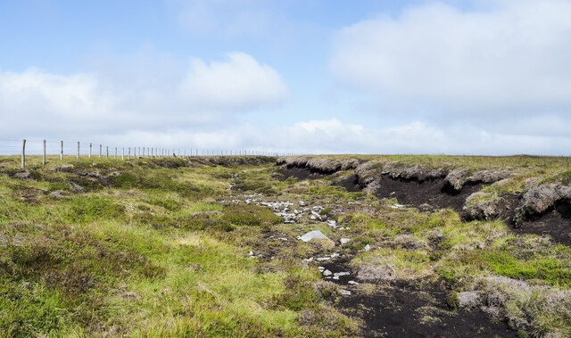
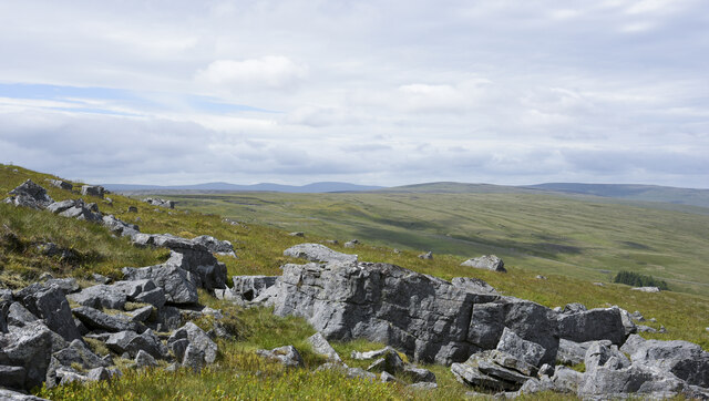
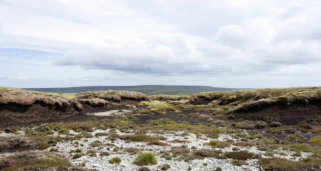
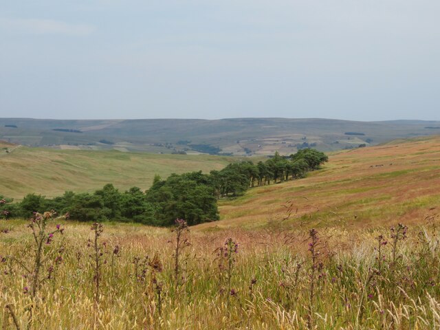
Swinhope Burn Head is a prominent landscape feature located in the county of Durham, England. It is situated near the village of Wolsingham, within the North Pennines Area of Outstanding Natural Beauty. This breathtaking landscape feature consists of a picturesque waterfall cascading down a steep gorge, surrounded by lush greenery and towering cliffs.

The waterfall itself is formed by Swinhope Burn, a small stream that flows through the area. As the water descends over the rocks, it creates a mesmerizing display of rushing water and mist, creating a tranquil and serene atmosphere. The height of the waterfall varies depending on the season and recent rainfall, but it can reach an impressive height of approximately 20 meters during periods of heavy precipitation.

The surrounding cliffs and rocky outcrops provide a dramatic backdrop to the waterfall, adding to its allure. The area is rich in flora and fauna, with numerous plant species, including mosses and ferns, thriving in the damp and shady environment created by the waterfall. The site is also home to a variety of bird species, making it a popular spot for birdwatching enthusiasts.

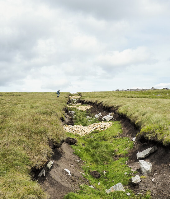
Access to Swinhope Burn Head is relatively easy, with a well-maintained footpath leading visitors to an overlook point that offers stunning views of the waterfall and the surrounding landscape. The site attracts both locals and tourists alike, who come to admire the beauty of this natural wonder and enjoy the tranquility it provides.

In conclusion, Swinhope Burn Head is a captivating landscape feature in Durham, offering visitors a chance to immerse themselves in the beauty of nature and experience the power and serenity of a picturesque waterfall.

If you have any feedback on the listing, please let us know in the comments section below.

Swinhope Burn Head Images

Images are sourced within 2km of 54.698033/-2.1871831 or Grid Reference NY8833. Thanks to Geograph Open Source API. All images are credited.
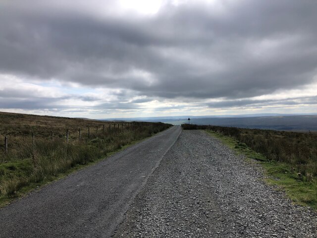
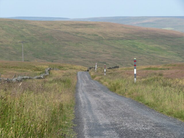
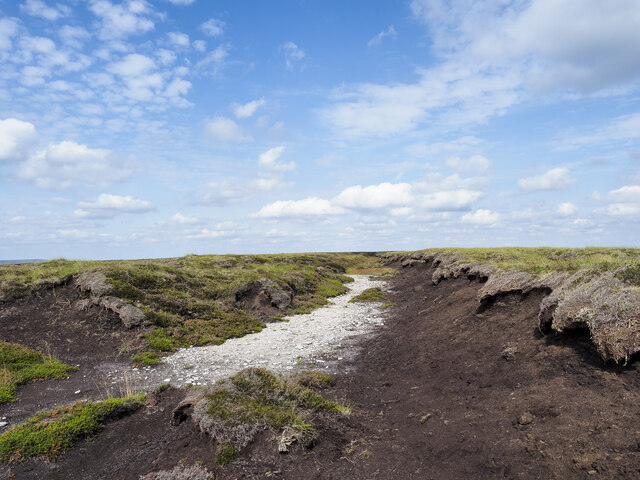
Quarry working at Church Bowers The disused quarry at Church Bowers is on the south-western slope of Fendrith Hill. The workings were shallow and appear to have been made into the rock layer as a series of separate bays, this being one of them.
The distant peak at the centre of the image beyond the valley of the River Tees, is Meldon Hill.
Quarry working at Church Bowers
The disused quarry at Church Bowers is on the south-western slope of Fendrith Hill. The workings were shallow and appear to have been made into the rock layer as a series of separate bays, this being one of them. The distant peak at the centre of the image beyond the valley of the River Tees, is Meldon Hill.
Erosion defences among peat haggs and banks The fence line and peaty groove lie to the north of Fendrith Hill. The purpose of the erosion defences appears to be to restrict the flow of water over the bare peat surfaces in wet weather. There are small rock piles but the main defence and probably the most effective are lengthy rolls of woven tubes filled with what appears to be animal hair. They're put in place and then staked down using wooden pegs and rope. Presumably all materials are biodegradable meaning that once their purpose has been served, they'll decompose.
All of the defences are to the west of the fence / watershed and they extend, (probably not continuously), to the north on Chapel Fell.
The peat of the groove in front of the fence although at a shallow gradient is surely prone to water erosion, but is doubly at risk as it's a hill walkers' route for folk connecting the two, two-thousand foot hills already mentioned!
Erosion defences among peat haggs and banks
The fence line and peaty groove lie to the north of Fendrith Hill. The purpose of the erosion defences appears to be to restrict the flow of water over the bare peat surfaces in wet weather. There are small rock piles but the main defence and probably the most effective are lengthy rolls of woven tubes filled with what appears to be animal hair. They're put in place and then staked down using wooden pegs and rope. Presumably all materials are biodegradable meaning that once their purpose has been served, they'll decompose. All of the defences are to the west of the fence / watershed and they extend, (probably not continuously), to the north on Chapel Fell. The peat of the groove in front of the fence although at a shallow gradient is surely prone to water erosion, but is doubly at risk as it's a hill walkers' route for folk connecting the two, two-thousand foot hills already mentioned!
Moorland south of summit of Chapel Fell A fence and groove on Chapel Fell heading north towards the summit area. The vegetation and peat here at the edge of Harthope Moss appears to be stable whereas to the south there's a significant problem with erosion. To an extent, it's being addressed - <a title="https://www.geograph.org.uk/photo/6951989" href="https://www.geograph.org.uk/photo/6951989">Link</a> .
Moorland south of summit of Chapel Fell
A fence and groove on Chapel Fell heading north towards the summit area. The vegetation and peat here at the edge of Harthope Moss appears to be stable whereas to the south there's a significant problem with erosion. To an extent, it's being addressed - Link .
Activity at Harthope Bank Quarry In terms of cutting new rock the quarry has been inactive for many years but at least occasionally some work does go on there. On this visit, crushed rock was being loaded by a digger into a dumper truck.
(Can the quarry be described as disused?)
Activity at Harthope Bank Quarry
In terms of cutting new rock the quarry has been inactive for many years but at least occasionally some work does go on there. On this visit, crushed rock was being loaded by a digger into a dumper truck. (Can the quarry be described as disused?)
Minor Road at Swinhope Head The road begins a long descent into the Upper Tees Valley from here.
Minor Road at Swinhope Head
The road begins a long descent into the Upper Tees Valley from here.
View from Swinhope Head towards Dora's Seat
Pine trees in Swin Hope Swin Hope is a tributary valley of the River Wear; it's seen here looking downhill towards the parent valley.
Pine trees in Swin Hope
Swin Hope is a tributary valley of the River Wear; it's seen here looking downhill towards the parent valley.
The stone men on Church Bowers Church Bowers is a prominent outcrop of a gritstone which weathers grey, and has been extensively quarried along its outcrop, over a length of about a quarter mile from here to the northwest. These prominent stone men form a very obvious landmark for anyone heading up the track from Forest in Teesdale and mark the southeastern end of the worked area. The grit only outcrops over a limited area before intergrading into softer sandstones which don't form a landscape feature. There's a further outcrop, more intensively quarried, a kilometre further to the northwest. In other areas at this horizon, there's a thin limestone known as the Lower Felltop Limestone, and both the grit and the limestones are often topped by a thin coal seam. The middle cairn seems to be getting a bit decrepit but the outer two are holding up well. To the right of right hand cairn, you can see a small building which is adjacent to the track. Whilst small, it is very sturdily built, but shows no obvious signs of having had a roof. I surmise that this was used as a store for explosives - such buildings tend to be built with strong walls but weak roofing, so that any accidental detonation blows the roof away with little of the blast going towards people working nearby at ground level.
The stone men on Church Bowers
Church Bowers is a prominent outcrop of a gritstone which weathers grey, and has been extensively quarried along its outcrop, over a length of about a quarter mile from here to the northwest. These prominent stone men form a very obvious landmark for anyone heading up the track from Forest in Teesdale and mark the southeastern end of the worked area. The grit only outcrops over a limited area before intergrading into softer sandstones which don't form a landscape feature. There's a further outcrop, more intensively quarried, a kilometre further to the northwest. In other areas at this horizon, there's a thin limestone known as the Lower Felltop Limestone, and both the grit and the limestones are often topped by a thin coal seam. The middle cairn seems to be getting a bit decrepit but the outer two are holding up well. To the right of right hand cairn, you can see a small building which is adjacent to the track. Whilst small, it is very sturdily built, but shows no obvious signs of having had a roof. I surmise that this was used as a store for explosives - such buildings tend to be built with strong walls but weak roofing, so that any accidental detonation blows the roof away with little of the blast going towards people working nearby at ground level.
The stone men on Church Bowers Church Bowers is a prominent outcrop of a gritstone which weathers grey, and has been extensively quarried along its outcrop, over a length of about a quarter mile from here to the northwest. These prominent stone men form a very obvious landmark for anyone heading up the track from Forest in Teesdale and mark the southeastern end of the worked area. The grit only outcrops over a limited area before intergrading into softer sandstones which don't form a landscape feature. There's a further outcrop, more intensively quarried, a kilometre further to the northwest. This particular rock doesn't seem to have a name (at least not at the time that BGS sheet 25, Alston, was last updated). In other areas at this horizon, there's a thin limestone known as the Lower Felltop Limestone, and both the grit and the limestones are often topped by a thin coal seam. The middle cairn seems to be getting a bit decrepit but the outer two are holding up well.
The stone men on Church Bowers
Church Bowers is a prominent outcrop of a gritstone which weathers grey, and has been extensively quarried along its outcrop, over a length of about a quarter mile from here to the northwest. These prominent stone men form a very obvious landmark for anyone heading up the track from Forest in Teesdale and mark the southeastern end of the worked area. The grit only outcrops over a limited area before intergrading into softer sandstones which don't form a landscape feature. There's a further outcrop, more intensively quarried, a kilometre further to the northwest. This particular rock doesn't seem to have a name (at least not at the time that BGS sheet 25, Alston, was last updated). In other areas at this horizon, there's a thin limestone known as the Lower Felltop Limestone, and both the grit and the limestones are often topped by a thin coal seam. The middle cairn seems to be getting a bit decrepit but the outer two are holding up well.
Track to Church Bowers The track starts at Forest in Teesdale and ascends pretty directly towards the prominent landmark formed by three stone men at the souwtheastern end of an outcrop of gritstone that has been extensively quarried. In its lower reaches it is a public footpath, then has a brief spell as a byway (connected via other byway to the public road from Ettersgill to the east) before ceasing to be marked as a right of way at all at the point where it crosses into what has more recently become CROW Access Land. There are signs of recent vehicular use, either a small tractor or a chunky quad bike, but this seems likely to be associated with the use of the moor for grouse shooting rather than for a continuation of quarrying of the gritstone.
Track to Church Bowers
The track starts at Forest in Teesdale and ascends pretty directly towards the prominent landmark formed by three stone men at the souwtheastern end of an outcrop of gritstone that has been extensively quarried. In its lower reaches it is a public footpath, then has a brief spell as a byway (connected via other byway to the public road from Ettersgill to the east) before ceasing to be marked as a right of way at all at the point where it crosses into what has more recently become CROW Access Land. There are signs of recent vehicular use, either a small tractor or a chunky quad bike, but this seems likely to be associated with the use of the moor for grouse shooting rather than for a continuation of quarrying of the gritstone.
Moor west of Church Bowers The cairn (marked as "Currick" on the OS map) seems to mark a small area where the bedrock is close to the surface, but has not been exploited for quarrying. The BGS sheet 25 for Alston makes it appear that the outcrop there is not of the gritstone that has been quarried, but a sandstone a little lower in the sequence, and possibly not as useful for building. Although there are no grouse butts in evidence, it is apparent that the moor is managed for grouse, from the tell tale chunks of white pvc pipe sticking up at intervals, marking the location of grit trays set out to drug the little blighters into submission for shooting (essentially, the medicated grit is to reduce the load of parasites so that the moor can carry well in excess of a natural level of game).
Moor west of Church Bowers
The cairn (marked as "Currick" on the OS map) seems to mark a small area where the bedrock is close to the surface, but has not been exploited for quarrying. The BGS sheet 25 for Alston makes it appear that the outcrop there is not of the gritstone that has been quarried, but a sandstone a little lower in the sequence, and possibly not as useful for building. Although there are no grouse butts in evidence, it is apparent that the moor is managed for grouse, from the tell tale chunks of white pvc pipe sticking up at intervals, marking the location of grit trays set out to drug the little blighters into submission for shooting (essentially, the medicated grit is to reduce the load of parasites so that the moor can carry well in excess of a natural level of game).
Rock outcrop on north side of Chapel Fell The northern side of Chapel Fell is very largely grassy but there are scattered rocks and in places more significant outcrops such as the broken band here.
The three, far-distant hills on the horizon, left of centre, are the Dun Fells and Cross Fell. Right of centre, and nearer are High Field and Burnhope Seat.
Rock outcrop on north side of Chapel Fell
The northern side of Chapel Fell is very largely grassy but there are scattered rocks and in places more significant outcrops such as the broken band here. The three, far-distant hills on the horizon, left of centre, are the Dun Fells and Cross Fell. Right of centre, and nearer are High Field and Burnhope Seat.
Bare ground and peat banks close to summit of Chapel Fell The summit area of Chapel Fell is an extensive area of peat banks with bare peat exposures and some shattered, scattered rocks. The actual summit location is impossible to judge by observation and various positions have been considered over time. But from 09/02/2021 the authoritative 'Database of British and Irish Hills' has accepted, based on a LIDAR survey, that the best estimate for the summit should be at NY 87577 34605. That position is on a peat bank just out of view in the image, to the right of and slightly behind the camera.
In the distance is the moorland hill, Westernhope Moor.
Bare ground and peat banks close to summit of Chapel Fell
The summit area of Chapel Fell is an extensive area of peat banks with bare peat exposures and some shattered, scattered rocks. The actual summit location is impossible to judge by observation and various positions have been considered over time. But from 09/02/2021 the authoritative 'Database of British and Irish Hills' has accepted, based on a LIDAR survey, that the best estimate for the summit should be at NY 87577 34605. That position is on a peat bank just out of view in the image, to the right of and slightly behind the camera. In the distance is the moorland hill, Westernhope Moor.
Piles of stone in stream groove The stream groove is on the south side of Fendrith Hill in Teesdale. The small stone piles are recent additions to the landscape and there are many more of them in other places on the hill, for example - <a title="https://www.geograph.org.uk/photo/6951989" href="https://www.geograph.org.uk/photo/6951989">Link</a> . The stones have been placed to reduce erosion and are there not so much to prevent water flow but to slow it; slowing the rate of water drainage has the added benefit of reducing the rate at which run off enters the river system.
An aerial view of the area shows that there are 'grips' - artificially cut drainage channels on the moorland above which were aligned to carry their waters into this stream groove to promote drainage to 'improve' the land. In an attempt to reduce erosion and to re-water the moorland those grips have been blocked in recent years.
The stones will have been brought to the site from the nearby, disused quarry at Harthope Bank.
Piles of stone in stream groove
The stream groove is on the south side of Fendrith Hill in Teesdale. The small stone piles are recent additions to the landscape and there are many more of them in other places on the hill, for example - Link . The stones have been placed to reduce erosion and are there not so much to prevent water flow but to slow it; slowing the rate of water drainage has the added benefit of reducing the rate at which run off enters the river system. An aerial view of the area shows that there are 'grips' - artificially cut drainage channels on the moorland above which were aligned to carry their waters into this stream groove to promote drainage to 'improve' the land. In an attempt to reduce erosion and to re-water the moorland those grips have been blocked in recent years. The stones will have been brought to the site from the nearby, disused quarry at Harthope Bank.
Road summit at Swinhope Head [2] Quite a contrast to the last time I took a photograph here [22/03/18] as the temperature on that occasion was only a little above freezing, but on this occasion it was 33°C, even at 2000ft. Taken on a day of record breaking temperatures across Britain. Not much point in coming up here to keep cool.
Road summit at Swinhope Head [2]
Quite a contrast to the last time I took a photograph here [22/03/18] as the temperature on that occasion was only a little above freezing, but on this occasion it was 33°C, even at 2000ft. Taken on a day of record breaking temperatures across Britain. Not much point in coming up here to keep cool.
The start of a long descent The minor road from Newbiggin to Westgate begins a long descent here from the 2000ft contour to below 1000ft in Weardale.
The start of a long descent
The minor road from Newbiggin to Westgate begins a long descent here from the 2000ft contour to below 1000ft in Weardale.
Swinhope Plantation First edition OS maps of the 1850's show an extensive area of trees around the upper reaches of the Swinhope Burn. This view shows the eastern edge of the wooded area with plenty of Scots pine in evidence. If the old OS map is accurate, then the wooded area is in decline as there are areas now without trees, but the question is, why was this area planted in the first place?
Swinhope Plantation
First edition OS maps of the 1850's show an extensive area of trees around the upper reaches of the Swinhope Burn. This view shows the eastern edge of the wooded area with plenty of Scots pine in evidence. If the old OS map is accurate, then the wooded area is in decline as there are areas now without trees, but the question is, why was this area planted in the first place?
Groove at summit area of Chapel Fell The groove, (surely one artificially created), is seen looking north passing the currently accepted summit location of the hill; it's on a peat bank a few metres ahead to the right. The 703 m. spot height shown on OS Explorer map OL31, is on the groove's left side and a little further on.
(The actual summit location is impossible to judge by observation on the ground and various positions have been considered over time. But from 09/02/2021 the authoritative 'Database of British and Irish Hills' has accepted, based on a LIDAR survey, that the best estimate for the summit should be at NY 87577 34605.)
Groove at summit area of Chapel Fell
The groove, (surely one artificially created), is seen looking north passing the currently accepted summit location of the hill; it's on a peat bank a few metres ahead to the right. The 703 m. spot height shown on OS Explorer map OL31, is on the groove's left side and a little further on. (The actual summit location is impossible to judge by observation on the ground and various positions have been considered over time. But from 09/02/2021 the authoritative 'Database of British and Irish Hills' has accepted, based on a LIDAR survey, that the best estimate for the summit should be at NY 87577 34605.)
Show me another place!

Swinhope Burn Head is located at Grid Ref: NY8833 (Lat: 54.698033, Lng: -2.1871831)

Unitary Authority: County Durham

Police Authority: Durham

What 3 Words

///slime.conducted.heartless. Near Newbiggin, Co. Durham

Related Wikis

Harthope Moss

Harthope Moss, also known as Chapel Fell (elevation 627 m; 2,057 ft) is a mountain pass in the English Pennines. The pass divides Weardale to the north...

Forest and Frith

Forest and Frith is a civil parish in the County Durham unitary authority, in the ceremonial county of Durham, England. In the 2011 census it had a population...

Langdon Beck

Langdon Beck is a village in County Durham, England. It is situated in upper Teesdale, between Forest-in-Teesdale and Harwood, halfway between Penrith...

Ettersgill

Ettersgill is a village in County Durham, England. It is situated at the top of Teesdale, on the north side of the Tees between Newbiggin and Forest-in...

Nearby Amenities

Located within 500m of 54.698033,-2.1871831
Fendrith Hill
Ele: 696.4
Image: https://www.geograph.org.uk/photo/1655984
Man Made: survey_point
Natural: peak
Ref: NY86S013
Source: npe
Tpuk Ref: TP3138
Website: https://trigpointing.uk/trig/3138
Wikidata: Q24643197
Lat/Long: 54.6949134/-2.1923364
The data included in this document is from www.openstreetmap.org. The data is made available under ODbL.

Have you been to Swinhope Burn Head?

Leave your review of Swinhope Burn Head below (or comments, questions and feedback).